Contributory members are able to log private notes and comments about each site
Sites Anne T has logged. View this log as a table or view the most recent logs from everyone
Cavers Cross
Trip No.93 Entry No.5 Date Added: 31st Aug 2018
Site Type: Ancient Cross
Country: Scotland (Scottish Borders)
Visited: Yes on 29th Aug 2018. My rating: Condition 2 Ambience 4 Access 5
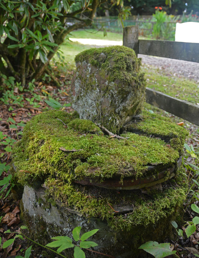
Cavers Cross submitted by Anne T on 31st Aug 2018. A view looking across the cross to the north, towards the small 'cross roads' in the centre of the hamlet of Cavers. The base is round but in pieces which have been stacked on top of each other, held together in places by old metal staples.
(View photo, vote or add a comment)
Log Text: Cavers Cross, near Hawick: From the motte, we drove round to Cavers – a very nicely kept estate, with well kept verges and few places to park along the straight, narrow road by the houses. In the end, we pulled right up to the fence at the largish entrance to a field gate at NT 54235 15805, intending to run back to the car if anyone thought we were in the way.
Walking south west towards the houses (I didn’t even recognise the Auld Kirk, as its been converted into a house with large driveway), we couldn’t see anything resembling a cross. There was a lady who was painting her fence and her large dog, who barked at us and sniffed my hands. I asked her if she knew of the remains of the cross, and she said, “Yes, but it’s only small”. She showed us where it was ‘hiding’ – behind a fence and shrubs in deep shade, then behind its own wooden fence, now much broken. She gave us permission to go into the garden of the holiday cottage as there was no-one there at the time of our visit. Whilst the Canmore record mentions the base of the cross (with the metal bands much visible), nothing is mentioned about the shaft it currently holds. This is of red sandstone and shaped, although much moss-covered.
Moving a small bit of stone near the join of the shaft and the base, there is evidence of a straight cut for part of the socket hole. We didn’t’ see any dowel holes, as the surface was moss and twig covered, but then the report that mentions this is dated 1933!
Midshiels Standing Stone
Trip No.93 Entry No.6 Date Added: 31st Aug 2018
Site Type: Standing Stone (Menhir)
Country: Scotland (Scottish Borders)
Visited: Yes on 29th Aug 2018. My rating: Condition 3 Ambience 4 Access 4
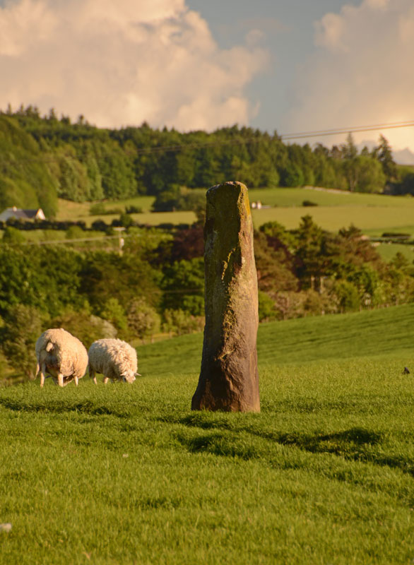
Midshiels Standing Stone submitted by Anne T on 4th Jun 2017. This is the nearest we could get to the standing stone on the evening of our visit. The field was full of quietly grazing sheep but many lively, curious young bullocks. The minute we started to open the gate, they were racing towards us.
(View photo, vote or add a comment)
Log Text: Midshiels Standing Stone, near Hawick: At our last visit, we were put off from entering the field because of a very large bull and his ladies. The bull stood guard near the stone, and any approach made him stand tall, with splayed legs, looking menacingly at us – I contented myself with taking photos from near the gate in the field.
At this visit we parked near the entrance to Midshiels farm, at NT 53459 17603, where we made sure we weren’t blocking the entrance into field. Immediately opposite, at NT 53461 17624 is a metal gate into the field, with the top of the stone just visible.
Husband, Andrew, opened the gate and was in the field, and I was just about to follow when a loud voice behind me stopped me going an further. There was a large, but friendly, farmer and his lad in a very large pickup truck. “There are bullocks in that field – if they see you, they’ll go for you. Drive into the next field and go up to the tunnel – you can turn round there. You can see the stone from there.” I thanked him for the ‘heads up’.
Andrew moved the car, but rather than drive the car up to the tunnel, the ground was a bit too uneven to risk the bottom of the car, so we left it at the edge of the field at NT 53518 17745 and walked to the gate near the tunnel at NT 53388 17830. From here, it looked as if all the cattle were at the far end of the field, with many of them lying down, although the hump in the middle of the field made it difficult to really see. We decided to take the chance and walk to the stone, as we could have got back to the gate quickly.
This stone was glorious in the sunshine, with a most peculiar small ‘hook’ to the top. I tried to capture the shadow in the strong sunshine.
Whitcastle Sike
Trip No.93 Entry No.9 Date Added: 31st Aug 2018
Site Type: Ancient Village or Settlement
Country: Scotland (Scottish Borders)
Visited: Yes on 29th Aug 2018. My rating: Condition 2 Ambience 3 Access 4

Whitcastle Sike submitted by Anne T on 31st Aug 2018. This panoramic view is the only way I could capture the form of this settlement, and is a stitch of three photos. Here I'm standing on a small bank which rises out of the tributary of Newmill Burn which runs to the western side of the settlement, forming a pool of water. The land to the north and west is marshy, and it looks as if the land has been built up around these sides to form a raised enclosure. Parts of the settlement have been quarried out. At the left hand side of the hill above is t...
(View photo, vote or add a comment)
Log Text: Whitcastle Sike Settlement: The OS map shows a group of settlements and hillforts which can be found to the east north east of Broxholme Easter Loch, and today in a pretty remote spot down a gated road. We parked at NT 43929 11939, at the wide entrance to a farm track/field entrance and walked to the gate into the field opposite.
On the map, it looked like these settlements would be pretty easy to pick out. Unfortunately, on the ground, the land had been heavily quarried and tall grass and bracken made picking out the land shapes a little tricky. We managed to identify this settlement by its location next to the stream. Whilst it had been heavily quarried, walking around its outline made it easier to identify.
To the west of this settlement is a very pretty burn which trickles past, forming pools in several areas. To the west and north, the ground around the settlement is boggy, but the area of the settlement is a metre or so above the water and dry; it looks as if the edges of the oval enclosure has been deliberately built up to form a protective kerb.
Monk's Well (Upsettlington)
Trip No.95 Entry No.2 Date Added: 9th Sep 2018
Site Type: Holy Well or Sacred Spring
Country: Scotland (Scottish Borders)
Visited: Yes on 6th Sep 2018. My rating: Condition 2 Ambience 3 Access 4
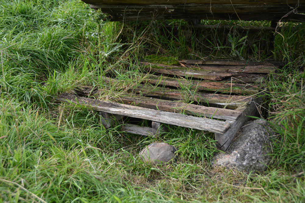
Monk's Well (Upsettlington) submitted by Anne T on 9th Sep 2018. Lifting up the larger pallet, there is a smaller, partly rotten wooden pallet which hides more ?dressed stone pieces and what looks like a manhole cover. Being partly sunk into the ground, it was not possible to lift this up for further investigation to confirm it was Monk's Well or not.
(View photo, vote or add a comment)
Log Text: Monk's Well, Upsetllington: From St Cuthbert's Church in Norham with its Saxon pillar, we went to Norham Castle (well worth looking round, and free of charge). This was the start of quite a treat - three holy wells in two adjacent fields!
From the castle, we crossed the bridge over the River Tweed, going from England to Scotland, following the B6470 to a left hand turn, by a Victorian water fountain by the side of the crossroads. This turning led to Upsettlington, which seems to have been renamed Ladykirk at some point (all the signs and house names read ‘Ladykirk’ Lodge, etc).
At the cross roads between the houses, at the entrance to the main house, we turned left towards Black Row, the Smithy and East Lodge, parking by the phone box. We let ourselves into the field (gate to the left of the phone box), only to find there were four horses galloping from the far side of the field towards us, and a fence between us and the well. We decided to drive back along the road towards the B6470, where there was another gate into a stock-free field. This field also contained two of the wells and gave access through a gate into the field with Nun’s Well.
There was a large pallet at the point where the grid reference for this well was. Lifting the pallet, a smaller pallet, half buried in the mud beneath, with a man-hole cover underneath. Some 20m to the south east there was a modern man hole cover, demarked from the rest of the field by three stakes placed in a triangle, with a pipe leading down the slope. Which of these is the real well, we weren’t sure. There were a few possibly dressed stones peeping above the turf near the pallet.
Having photographed both possible well sites, it looked as if the ‘staked site’ had possibly been the site for a drinking trough, but there had been so much ground disturbance it was difficult to tell.
St Mary's Well (Upsettlington)
Trip No.95 Entry No.3 Date Added: 9th Sep 2018
Site Type: Holy Well or Sacred Spring
Country: Scotland (Scottish Borders)
Visited: Yes on 6th Sep 2018. My rating: Condition 3 Ambience 3 Access 4
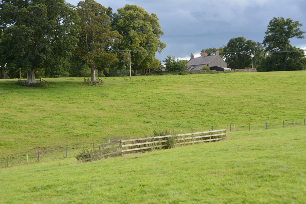
St Mary's Well (Upsettlington) submitted by Anne T on 9th Sep 2018. St Mary's Well from just uphill to its north east, heading for the gate into the next field, where Nun's Well can be found.
(View photo, vote or add a comment)
Log Text: St Mary's Well, Upsettlington: From Monk’s Well, and in the same field, we walked east-north-east towards this fenced off area of the field. To our left hand side, raised some 0.5m+ above ground level, and seemingly in a perfect circle, was a funny wooded area; closer inspection revealed it was being used as a large, tree-covered feeding station for pheasants/grouse? There was no record on Canmore of this being a cairn or the site of a hillfort.
St Mary’s Well, with its inscription barely legible on the top, reminded me very much of the well houses in Durham City. The structure was very overgrown, although underneath the name of the well, there was still the remains of a metal pipe leading into the well trough below (the latter was hidden by vicious nettles).
The latest visit report recorded by Canmore in 1971 says the well is now dry, but the inscription is still intact.
From here, we walked northwards, uphill, to a gate into the next field which contained Nun’s Well.
Nun's Well (Upsettlington)
Trip No.95 Entry No.4 Date Added: 9th Sep 2018
Site Type: Holy Well or Sacred Spring
Country: Scotland (Scottish Borders)
Visited: Yes on 6th Sep 2018. My rating: Condition 3 Ambience 4 Access 4
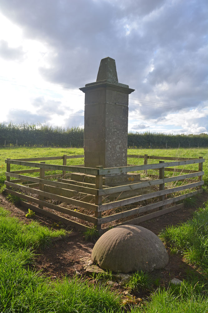
Nun's Well (Upsettlington) submitted by Anne T on 9th Sep 2018. Nun's Well from the south east. The well itself is the feature captured by the fluted, domed stone bowl.
(View photo, vote or add a comment)
Log Text: Nun's Well, Upsettlington: From St. Mary's Well, walking up the hill to the gate which leasds into the next field, we walked back down hill towards a steam. The well monument can be seen between two large trees, just before a small burn leading westwards into the RiverTweed. The trees on the western bank of the river hid the view of the water, but what a magnificent spot.
I didn’t realise until we got home and brought up the Canmore record that the actual well is hidden by the stone dome, which is outside the monument enclosure.
The monument seems to be built on much older steps, which are held together with a large number of iron staples. These aren’t mentioned in the Canmore record.
Wellbraes
Trip No.101 Entry No.1 Date Added: 30th Sep 2018
Site Type: Holy Well or Sacred Spring
Country: Scotland (Scottish Borders)
Visited: Yes on 29th Sep 2018. My rating: Condition 3 Ambience 2 Access 4
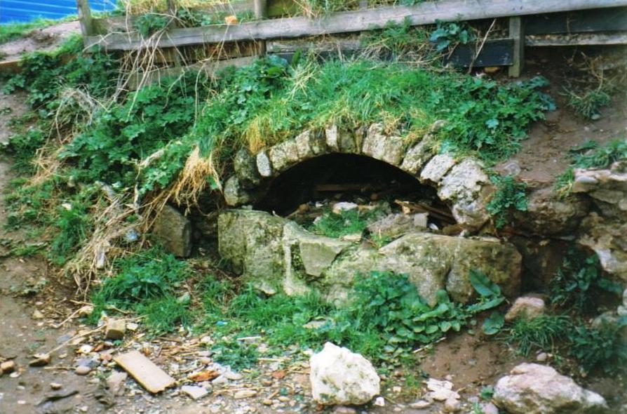
wellbraes submitted by mafenty on 19th Aug 2006. Well from which Wellbraes, Eyemouth derives its name (hidden since 1974 behind the swimming pool) picture taken at that time. Age uncertain ... allegedly "Roman".
grid ref NT944645
(View photo, vote or add a comment)
Log Text: Eyemouth Leisure Centre Well, Wellbraes: This well can only be accessed through the Leisure Centre. Having walked round the Leisure Centre and surrounding buildings, I had to ask at the reception desk, and show a photo of the well. The receptionist didn’t know but one of the personal trainers did, and let us through the fire exit door in the gym; there is a gate at the western end of the centre which leads through into a small garden area; alternatively there is the fire exit through the back of the small gym which leads into the same area.
We could barely recognise the well at first as it was so overgrown with nettles and weeds. Our eyes eventually spotted the arch of stones through the mass of weeds and we trod down a few of the large nettles and dock leaves to take a closer look. The well chamber goes back at least 2m, if not further; whilst there is a wall at the back, this doesn’t seem to be connected to the arched concrete covering over the well basin. We needed better torches to see the back wall of the well, which was partly obscured by a large pile of rubble (bricks and stone) at the back of the chamber.
We could hear water flowing through the well chamber, although there was only a puddle in the bottom. At the left hand side of the well was a very rusty water pipe, but this was dry. Investigating further, we found the water flowing into a low concrete construction at the back of the lip of the well; from there, the water came out of the well chamber through a small rectangular hole and disappeared into a small drain.
With the amount of rubbish around, I didn’t check the quality and taste of the water.
St. Helen's on the Lea (Old Cambus)
Trip No.100 Entry No.2 Date Added: 30th Sep 2018
Site Type: Sculptured Stone
Country: Scotland (Scottish Borders)
Visited: Yes on 29th Sep 2018. My rating: Condition 2 Ambience 4 Access 4
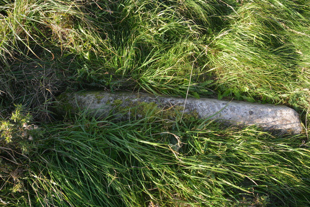
St. Helen's on the Lea (Old Cambus) submitted by Anne T on 30th Sep 2018. The almost complete hogback stone, to be found at the southern side of the eastern gable wall of the church. Canmore 59948 describes some decoration on the hogback, but there was nothing we could see. The stone was almost buried in knee high grass that covered the site.
(View photo, vote or add a comment)
Log Text: Hogback at the ruins of St Helen's Chapel, Old Cambus: We found the first hogback easily – at the northern side of the east gable wall, but the second one we hunted for but were unable to find. The cross incised slab we searched for ages, even matching up the angles of the stone to the masonry behind on the Canmore images, but drew a blank. The site was knee deep in grass, with tumbles of stone underneath, so it could have been anywhere. A strimmer would have helped! Similarly with the fragment of hogback on the southern side of the chancel. We found many tumbled stones in the grass, but even looking closely for the tegulations, we didn’t locate it, which was disappointing.
The information board which sits near the junction of the road to the quarry to the footpath to the chapel and Siccar point reads:
“Proceed from here, through the kissing-gate, past the ruin of St Helen’s Chapel and along the top of the steep sea-braes to Siccar Point, arguably the most important geological site in the world. In 1788 it gave James Hutton final proof of his revolutionary claim that the Earth is eons old He based his claim on painstaking observation of rocks and soil over a period of some 30 years. / James Hutton (1726-1797) farmed locally near Reston and was a self-taught geologist. Having already published his theory, he was on a mission to establish the evidence. Before discovering the proof at Siccar Point, by boat with his friends Sir James Hall and John Playfair, Hutton knew what he was looing for and had an idea of where to find it. He sent Sir James, a local landowner from Dunglass and also a geologist, to review the area before embarking on their boat trip below the braes. Sir James may have done this by observing that the stone used to construct field boundaries in the vicinity was (and still is) a combination of rock from above and below the uncomfority (red sandstone and greywacke). / Hutton’s theory released science and philosophy from limitations of the biblical age of the earth (6,000 years old). Though bitterly disputed at the time, it is now accepted as a fundamental of science. James Hutton also expounded with authority of theories as diverse as the nature of light and methods of education, and was a significant agricultural innovator and improver.”
Just before reaching the ruins of St Helen’s, someone has carved an old tree trunk into an L-shape with a toilet seat on top! Note: the gate to the field was locked, and we had to climb over the rather tall gate.
Cockburnspath Cross
Trip No.101 Entry No.3 Date Added: 2nd Oct 2018
Site Type: Ancient Cross
Country: Scotland (Scottish Borders)
Visited: Yes on 29th Sep 2018. My rating: Condition 3 Ambience 3 Access 5
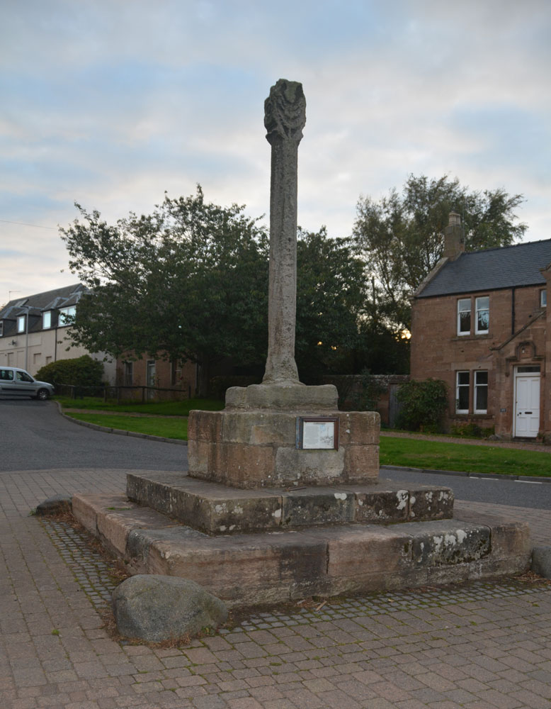
Cockburnspath Cross submitted by Anne T on 2nd Oct 2018. The cross, looking south west down Hoprigg Street.
(View photo, vote or add a comment)
Log Text: Cockburnspath Mercat Cross: Before coming to Cockburnspath, we'd visited the really beautiful Cove, with its smuggler's caves. We'd had to park in the village and follow the single track road running along the top of the cliffs to an old mine tunnel which formed a fun, but very dark, shortcut through to the cove. The bedding planes in the rocks here were fantastic - no wonder James Hutton found the solution to his unconformities only a few miles down the coast. The harbour looks like it might have come straight off an 18th century film set, and there was also a sea arch with a large, round hole in it. Brilliant.
By the time we got to Cockburnspath, only a few miles away, the light was starting to fade rapidly. Parking outside the post office (to avoid the car starring in more of my photographs!), I started to photograph the cross, only to find omeone had left a half eaten pack of McDonalds chips on the base of the stone; we ended up moving these and throwing them away in a nearby bin (yeuk). We also had a look at the churchyard, which had old grave stones, but at this time of night, couldn’t get in. The church had particularly heavy stone slabs used to roof it. We later found the same at Dunglass.
The notice on the side of the cross reads: “Cockburnspath. This Cross was erected in 1503 by King James IV of Scotland in celebration of his marriage to Princess Margaret Tudor, to whom he presented the lands of Cockburnspath as a dowry. The Princess was the sister of King Henry VIII of England and this union of the Scots Thistle and the Tudor Rose was to mark the start of a new and lasting peace, only shattered ten years later by the Battle of Flodden in 1513. / The Cross was repaired with the help of the Regional Council, but mostly by the loyal generosity of the people of this village.”
After seeing this cross, we hopped over the border to East Lothian to see Dunglass Collegiate Church, where we arrived to find a wedding in full swing, and needed torches to look round the inside of this ruined church. Definitely not a chance of getting to see the standing stones nearby at this time of the evening.
Duns Mercat Cross
Trip No.105 Entry No.1 Date Added: 4th Nov 2018
Site Type: Ancient Cross
Country: Scotland (Scottish Borders)
Visited: Yes on 27th Oct 2018. My rating: Condition 3 Ambience 3 Access 5
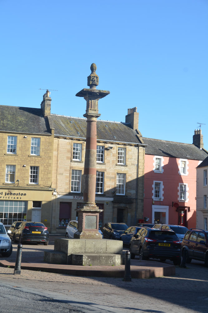
Duns Mercat Cross submitted by Anne T on 4th Nov 2018. The current market cross, moved to its present location in 1897.
(View photo, vote or add a comment)
Log Text: Duns Mercat Cross: Having set off after a snow storm this morning, we stopped off in Duns just after 12 noon for coffee and a scone.
We went to the café we went to when we were here last (some 3-4 years ago), only to find the café open but no-one in, despite many cars in the town. Parking just round the corner from the market square, I realised that there was a market cross which I don’t think I’d photographed before. Whilst the base was ‘modern’ the top appears old.
The café had changed hands, reverting to the original owner, who admitted to being 76 years old and having run a gallery in Harrogate. “We don’t do lunches” we were told. By this time we were cold and hungry so opted for hot scones and tea. A great selection of very reasonably priced antiques to browse round, too, although the only thing I would really have liked to buy wasn't for sale!
The plaque on the cross base reads: “The Mercat Cross of Duns originally stood on the site of the present town hall and was removed when it was rebuilt in 1820. It was re-erected by Andrew Smith Esqr. of Whitchester AD 1897.”
Crosshall Cross
Trip No.123 Entry No.1 Date Added: 2nd Apr 2019
Site Type: Ancient Cross
Country: Scotland (Scottish Borders)
Visited: Yes on 31st Mar 2019. My rating: Condition 3 Ambience 4 Access 4
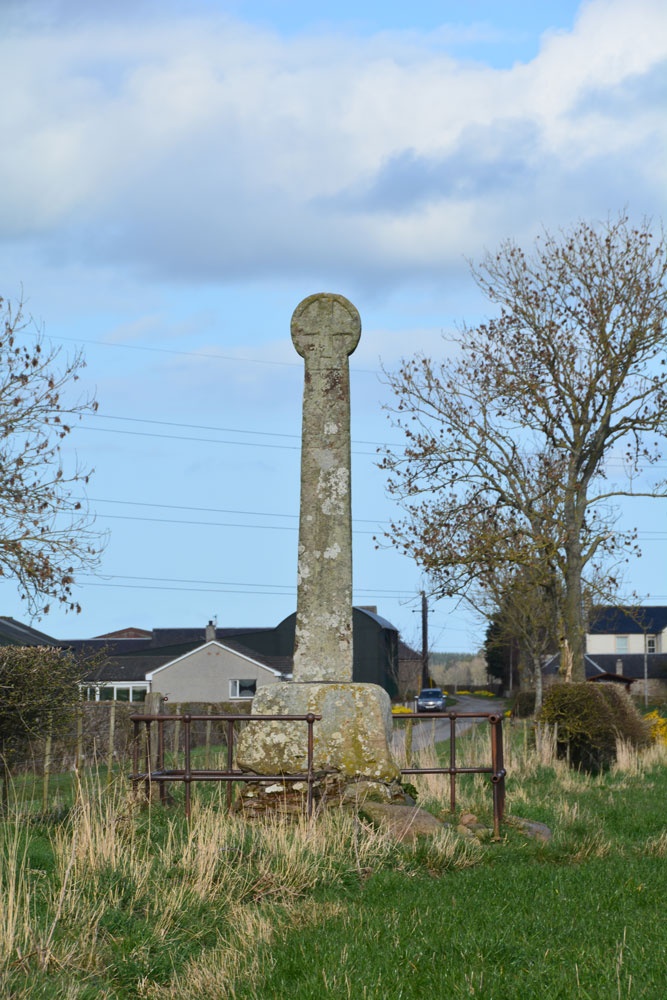
Crosshall Cross submitted by Anne T on 2nd Apr 2019. The western side of the cross, as seen from inside the field. This face has "has a Latin cross with pointed ends to its arms, surmounted by shield", although the carvings are worn and difficult to see, with the cross easier to see than the shield.
(View photo, vote or add a comment)
Log Text: Crosshall Cross: Details of this cross had printed out along with some details of Kelso Abbey, which we visited beforehand. Having found it was not far from Kelso, we decided to take the short drive to see it, and it was well worth it.
This was a little further out of Kelso than we originally thought, but it was a pleasant drive. Whilst the cross was 'protected' by an old iron railing, with the remains of an old signpost next to it, the fence was a taut wire/barbed wire fence with no 'give' to squeeze through, so we walked down the lane, away from the farm to the gate into the field. The ‘gate’ into the field with the cross was right at the cross roads, so we climbed over and walked back down the field of pasture to take a closer look.
The low, very bright, sun, made it difficult to photograph its eastern side with its man and its hound (we thought it was a lamb), but it was well worth seeing this cross, with its Latin crosses, shields, incised man with his hound, and a Crusader sword.
Hier Well (Benrig)
Trip No.158 Entry No.1 Date Added: 2nd Mar 2020
Site Type: Holy Well or Sacred Spring
Country: Scotland (Scottish Borders)
Visited: Yes on 27th Feb 2020. My rating: Condition 2 Ambience 4 Access 4
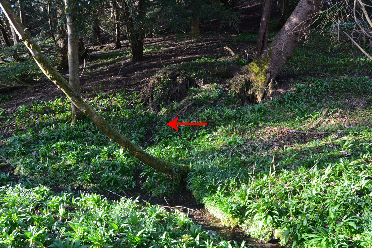
Hier Well (Benrig) submitted by Anne T on 2nd Mar 2020. The red arrow shows where the spring which feeds Hier Well emerges from the base of a wooded slope, just underneath the roots of an uprooted tree. There is a fair trickle of water emerging from the bank.
(View photo, vote or add a comment)
Log Text: Hier Well, Benrigg/Maxton: We first tried to get here by following St Cuthbert’s Way from the cemetery/old chapel ruins at Benrig, but there was a steep drop down to the river below on one side, and the path was muddy and slippery. Andrew said a set of steps down to the Crystal Well were too steep for me to cope with (although later, from below, they looked OK), so we tried again from the church by Glebe House (more details below).
We found the source of the spring, as described at the foot of a wooded slope, but no sign of the structure photographed by Cope, even though we walked alongside the stream to the wooden bridge looking.
A beautiful woodland location, and very peaceful. On the far side of the ford, another well (Well-brae) was marked on the OS map, but after heavy rain in the area, the ford was too deep to cross at this point, without wellies, which we didn't have.
Crystal Well (Benrig)
Trip No.158 Entry No.2 Date Added: 2nd Mar 2020
Site Type: Holy Well or Sacred Spring
Country: Scotland (Scottish Borders)
Visited: Yes on 27th Feb 2020. My rating: Condition 3 Ambience 4 Access 4

Crystal Well (Benrig) submitted by Anne T on 2nd Mar 2020. The spring/well grotto from its southern side. It is a very attractive feature. Whilst the spring must have older origins, the surrounding structure is 19th century.
(View photo, vote or add a comment)
Log Text: Crystal Well and Mule Gang, Benrig: We retraced our steps along the road from Hier Well almost to the wooden bridge, then turned north and followed a track through the woodland between a bank on our left hand side and the River Tweed on our right.
What looked like lime kilns came into view, although this turned out to be the very interesting Mule Gang and pump house. The gate into the Crystal Well was open, and I straddled the small stream of water emerging from it to photograph the well basin and chamber behind. The water appeared to gush straight out of gravel at the back of the well chamber.
A really beautiful location, and I’m surprised there weren’t more walkers and visitors around here.
Tamlane's Well (Carterhaugh)
Trip No.158 Entry No.4 Date Added: 5th Mar 2020
Site Type: Holy Well or Sacred Spring
Country: Scotland (Scottish Borders)
Visited: Yes on 27th Feb 2020. My rating: Condition 3 Ambience 4 Access 5
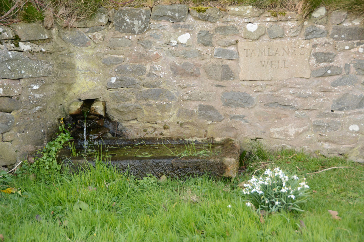
Tamlane's Well (Carterhaugh) submitted by Anne T on 5th Mar 2020. Getting closer to the well trough. The water must drain from the stone trough into a modern drain, about a metre in front of the current structure, then through a pipe under the road into a small stream/field drain in the field to the south.
(View photo, vote or add a comment)
Log Text: Tamlane's Well, Carterhaugh: A delightful spot, next to the single track B7039, parts of which aren’t terribly well defined (and we ended up in a very large farmyard, having taken a wrong turn!). The well is located right by the road, in a small grassy area just to the south of a large set of the Carterhaugh farm buildings/barns, although separated it by a dry stone wall. Whilst the original well was some 2.5m behind the wall, and is now filled in, the well is now presented in a nice way, presumably to allow visitors to access the well, which was really good of the farmers.
There was a steady flow of water into a trough which then drained into a modern manhole about a metre to the south of the well trough.
Caulks Well (Selkirk)
Trip No.158 Entry No.3 Date Added: 5th Mar 2020
Site Type: Holy Well or Sacred Spring
Country: Scotland (Scottish Borders)
Visited: Yes on 27th Feb 2020. My rating: Condition 3 Ambience 4 Access 4
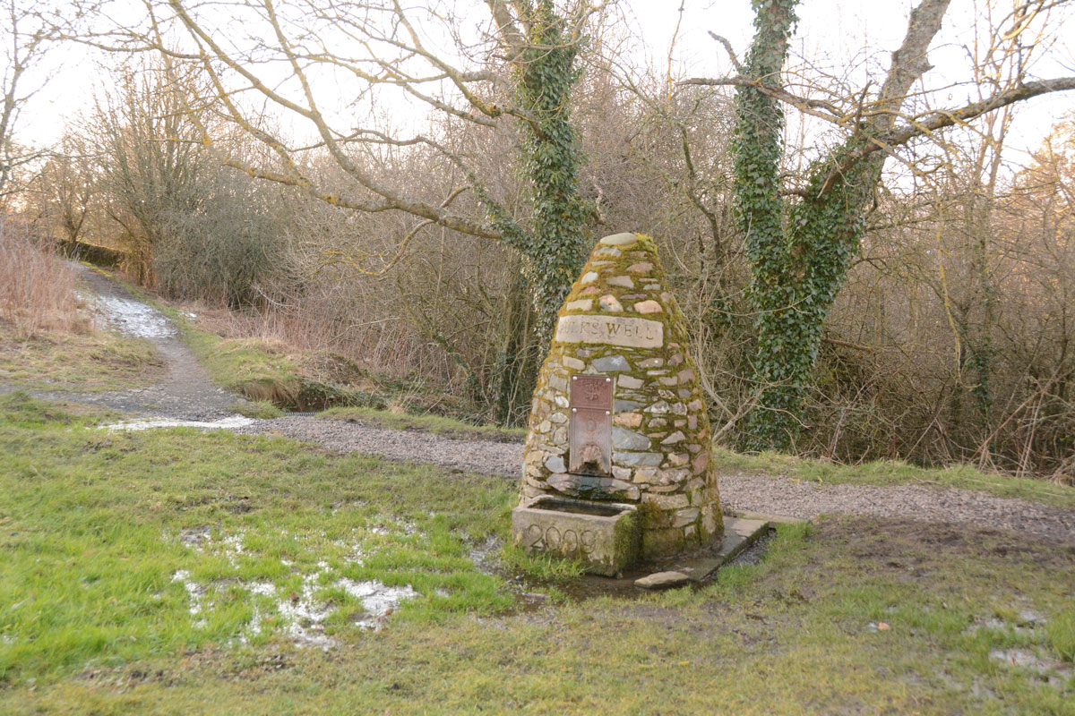
Caulks Well (Selkirk) submitted by Anne T on 5th Mar 2020. Standing just to the east of the well, at the bottom of one of the mounds on the golf course. There was so much water at the time of our visit that the whole area around the well was almost ankle deep in water. It was not obvious from standing by the well how the water arrives at this location, but standing where we parked at NT 47845 27908, just across the A699, there are a series of hills behind from which the water must run down to the well.
(View photo, vote or add a comment)
Log Text: Caulks Well, Selkirk Hill: No mention on Canmore.
We parked in a small layby at NT 47734 27869, which had been largely used for dumping road repair materials, then crossed to the northern side of the A699 and walked up (North East) to the Borders Abbey Way, and followed the track some 150 metres (part of the path were icy) to the well.
Right at the edge of the Golf Course, there is such a plentiful stream of water that there are three sources of the spring in the same small area: (1) at the base of the signpost; (2) at the well house itself, and (3) in a pool which emerges just to the south of the well house. The water tumbles down to the stream below.
Source: https://blackbob.org.uk/pdf/Trail1-SelkirkHill.pdf
Turn left, and follow the track until the Borders Abbeys Way signpost (12), turn left again, to follow the Way back to the A699. You pass the Hill Shelter (13), and a picnic bench (14), then Caulks Well (15), a drinking fountain. The water from here is so good to drink that a former Provost (who shall remain nameless!) used to bring a bottle to take water from it to have with his whisky; and an Italian woman, who met and married a soldier from Selkirk at the end of WW2, coming to live in the town, would drink nothing else."
Randolphfield Stones
Trip No.108 Entry No.1 Date Added: 8th Nov 2018
Site Type: Standing Stones
Country: Scotland (Stirling)
Visited: Yes on 30th Oct 2018. My rating: Condition 3 Ambience 3 Access 4
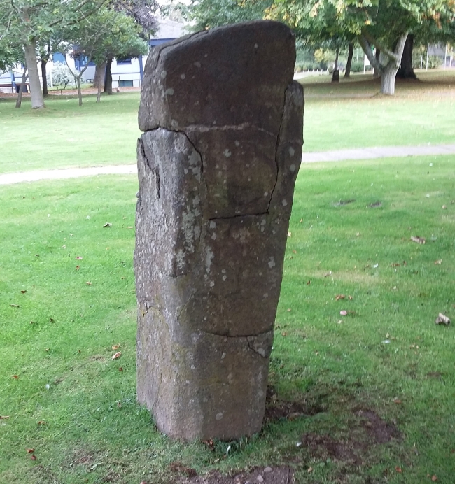
Randolphfield Stones submitted by rogerkread on 16th Oct 2015. The larger stone, showing evidence of destruction and subsequent repair.
(View photo, vote or add a comment)
Log Text: Randolphfield Stones, Sterling: This visit felt really strange, as the stones were literally in front of the police station, and I wondered if I’d get a tap on the shoulder and the memory card from my camera confiscated! No one seemed to turn a hair, though I took a number of photographs of both stones.
Coneypark Nursery (Cambusbarron)
Trip No.108 Entry No.6 Date Added: 10th Nov 2018
Site Type: Cairn
Country: Scotland (Stirling)
Visited: Yes on 31st Oct 2018. My rating: Condition 2 Ambience 3 Access 5
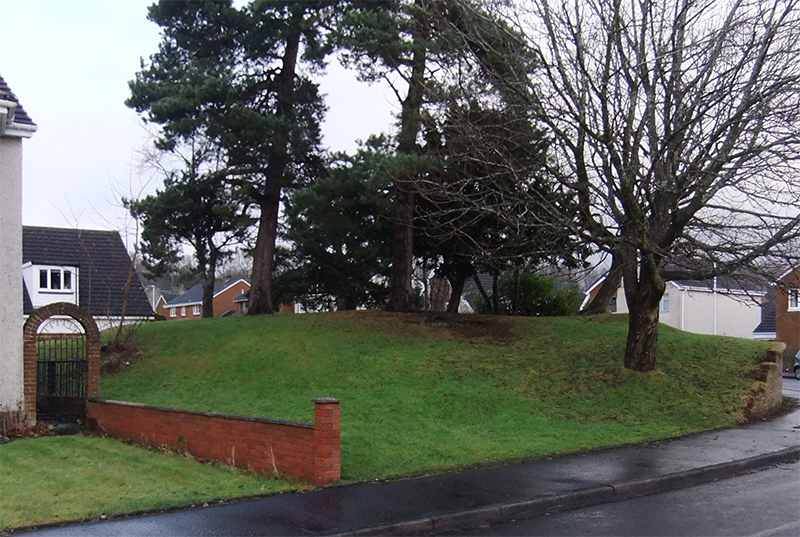
Coneypark Nursery (Cambusbarron) submitted by peigimccann on 24th Dec 2017. Coneypark mound photo by David Sibbald
(View photo, vote or add a comment)
Log Text: Coneypark Nursery Cairn: This cairn is right in the middle of a modern housing estate, where it has been left as a corner ‘open space’. The sides of the cairn have been marginally cut away to create the road and the gardens for the houses, but it is possible to walk over the cairn. A few of the residents were arriving home and in their driveways; none of them took (much) notice of me taking photographs and having a walk all around the cairn.
There is nothing much to see here, but it was ‘one to tick off our list’.
Airthrey Stone
Trip No.51 Entry No.1 Date Added: 9th Oct 2017
Site Type: Standing Stone (Menhir)
Country: Scotland (Stirling)
Visited: Yes on 26th Sep 2017. My rating: Condition 4 Ambience 4 Access 3
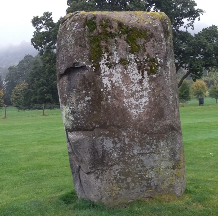
Airthrey Stone submitted by rogerkread on 16th Oct 2015. The Northern face of the Airthrey Stone.
(View photo, vote or add a comment)
Log Text: Airthrey Castle Standing Stone, Stirling University: I have visited the University of Stirling on a number of occasions over the years, visiting an organisation at the Beta Innovation Park, but not known (until I saw them on the Portal) that there were standing stones within the grounds.
We parked at the Wallace Monument, thinking it would be quick half hour walk around Stirling University Campus. Wrong! From the car park, we walked east up Hillfoots Road (the B989) cutting into the Alpha Centre Innovation Park, then walking round the east side of the lake to the University Sports Ground.
As soon as we reached the fence into this area, this huge standing stone stood out. I found the stiles a little too high for my dodgy knees, so it was interesting getting over them!
The surrounding hills, and the view back to the Wallace Monument make this an interesting spot. There were lots of dog walkers and students around, but none seemed to take any notice of the stone – presumably they are all familiar with it. By the time we’d visited Logie Old Church and the Pathfoot Standing Stone, my feet were aching! But no time to relax – Stirling Castle called with a loud, clear voice!
Pathfoot Stone
Trip No.51 Entry No.3 Date Added: 9th Oct 2017
Site Type: Standing Stone (Menhir)
Country: Scotland (Stirling)
Visited: Yes on 26th Sep 2017. My rating: Condition 2 Ambience 3 Access 5
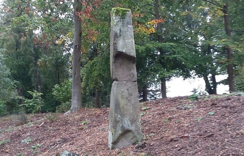
Pathfoot Stone submitted by rogerkread on 14th Oct 2015. Side view.
(View photo, vote or add a comment)
Log Text: Pathfoot Standing Stone, University of Stirling: Walking back across the campus from Logie Old Church, we got caught in a very heavy shower of rain and had to shelter by the student residences at the western side of the campus.
When I caught sight of this, I thought this was a sculpture, not a real standing stone at first. It is at the side of Armitage Road, just north of its’ (busy) junction with Grange Road at the north western side of the campus. We clambered up the wet, slippery slope to take some photos, stared at by the passing students.
By this time, my feet were aching, as we’d spent the best part of 2 hours walking round and round the campus. With Stirling Castle still to come, I welcomed getting back into the car.
Logie Old Kirk (Stirling)
Trip No.51 Entry No.2 Date Added: 9th Oct 2017
Site Type: Early Christian Sculptured Stone
Country: Scotland (Stirling)
Visited: Yes on 26th Sep 2017. My rating: Condition 3 Ambience 4 Access 4
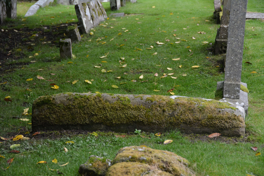
Logie Old Kirk (Stirling) submitted by Anne T on 9th Oct 2017. The hogback as seen from its northern side. Just to its north of this stone is a collection of broken stones, orientated north-south which look like another broken up hogback, but nothing is mentioned by Canmore.
(View photo, vote or add a comment)
Log Text: Hogbacks at Logie Old Kirk, Stirling: To reach the church from the University Halls of Residence, we had to walk through the gardener’s compound/offices. The top two gates around the churchyard were locked; the actual entrance was next to the small stone building to the south of the churchyard, near the stream, with an information board by a small car park, so there is access from the main road.
The churchyard is full of wonderful (morbid!) tombstones. Could have spent the day photographing them. It was also a lovely location with a small stream trickling along the eastern side of the churchyard.
Found one hogback SE of the church, the second is just a lump at the end (by the church) of the 6th row of graves, counting from the stream at the east end of the churchyard. A wonderful location. Really could have spent hours here.
