Contributory members are able to log private notes and comments about each site
Sites Anne T has logged. View this log as a table or view the most recent logs from everyone
Wades Stone (North)
Trip No.159 Entry No.2 Date Added: 6th Mar 2020
Site Type: Standing Stone (Menhir)
Country: England (Yorkshire (North))
Visited: Yes on 4th Mar 2020. My rating: Condition 3 Ambience 3 Access 4
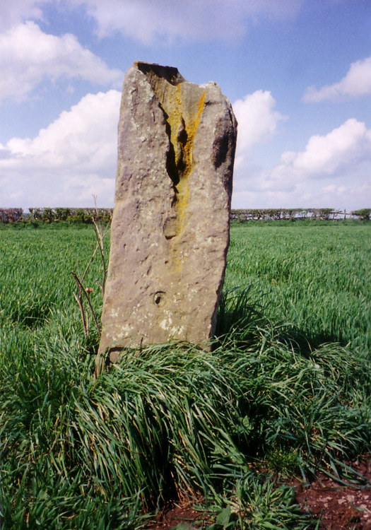
Wades Stone (North) submitted by DavidRaven on 10th May 2005. Showing the large groove on the northern Wade's Stone.
(View photo, vote or add a comment)
Log Text: Wade's Standing Stone (North), Brockrigg: We must have completely forgotten we'd visited this stone before, as neither of us recognised either the road or the lane leading up to the stone. However, we walked up the lane towards the farm, and followed the tractor tyre tracks up to the stone to avoid damaging the seedling plants in the field (the field was planted with small cabbage plants which had recently sprouted). The Pastscape entry says this was originally one of two stones, and we tried to look for possible signs of where the second stone may have stood, but could see nothing.
The deep erosion on the stone was interesting. I looked for the graffiti but only spotted the letters JS on its southern face. The OS map shows this stone to be placed near the Parish boundary line.
Wades Stone (South)
Trip No.159 Entry No.3 Date Added: 6th Mar 2020
Site Type: Standing Stone (Menhir)
Country: England (Yorkshire (North))
Visited: Saw from a distance on 4th Mar 2020
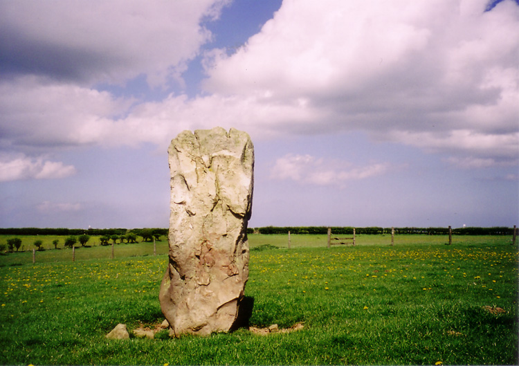
Wades Stone (South) submitted by DavidRaven on 13th May 2005. The southern Wade's Stone, looking north.
(View photo, vote or add a comment)
Log Text: Wades Stone (South): As per our last visit, we were unable to find anyone to ask at the now Council Depot (not the Outdoor Centre as marked on the map), and couldn't see any field access into the field containing the stone, either from the corner of East Barnby Lane and the A171 (at NZ 82845 13203), or off the main road. As there were other sites we were really keen to see, we drove on without making an attempt to see this stone. Shame.
Hinderwell Cross Head
Trip No.159 Entry No.5 Date Added: 7th Mar 2020
Site Type: Ancient Cross
Country: England (Yorkshire (North))
Visited: Yes on 4th Mar 2020. My rating: Condition 2 Ambience 3 Access 4
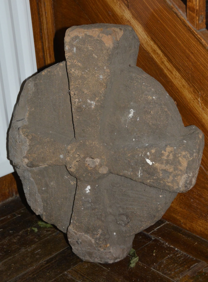
Hinderwell Cross Head submitted by Anne T on 7th Mar 2020. We very carefully moved the flower arrangement next to the stone to photograph it. The mastic repair to the lower arm can be clearly seen on this side.
(View photo, vote or add a comment)
Log Text: The Hinderwell Cross Head, St Hilda's Church: Whilst the church itself is well kept and nicely presented, this cross head is tucked away in the foyer of the church, at the bottom of the stairwell leading to the gallery/organ.
After photographing the well, we wandered up to the church, finding it open. Just inside, to the left hand side of the lobby, next to the stairs ascending to the gallery, was a cross head, which I photographed. Inside was a leaflet describing local heritage, and I found a short section about both Lythe and the Hinderwell Cross in there.
Just outside the south door, about 3m to the south west, is part of either a cross base or a column, which I also photographed.
Guy Points, in his Gazetteer of Anglo Saxon and Viking Sites: Yorkshire, only mentions the well (pages 161/162).
Easington Cross
Trip No.159 Entry No.6 Date Added: 7th Mar 2020
Site Type: Ancient Cross
Country: England (Yorkshire (North))
Visited: Yes on 4th Mar 2020. My rating: Condition 3 Ambience 3 Access 4
Easington Cross submitted by johndhunter on 31st Jan 2020. Easington Cross at NZ 74427 18004 – Closer view, the possible shaft next to the broken medieval base looks like it has a sword carved on it, January 2012.
(View photo, vote or add a comment)
Log Text: Easington Cross Base: The cross base is recorded as HE 1011970 and as Pastscape 1583425. Pastscape 29031 tells us there are "nine Saxon stone fragments [in the basement] at (the) Church of All Saints", although my attempts to contact the vicar by telephone and email have not been successful. I did speak to a gentleman who I thought was the church warden, but he told me "he no longer holds an official position within the church".
As we were passing through the village anyway, we stopped to see the cross base, although the church was well and truly locked.
As well as the cross base, there is also a sundial towards the western end of the churchyard, and a drinking fountain at NZ 74521 18036, at the side of the main Loftus-Whitby Road.
Three Crosses Well (Boulby)
Trip No.159 Entry No.7 Date Added: 7th Mar 2020
Site Type: Holy Well or Sacred Spring
Country: England (Yorkshire (North))
Visited: Yes on 4th Mar 2020. My rating: Condition 3 Ambience 4 Access 4
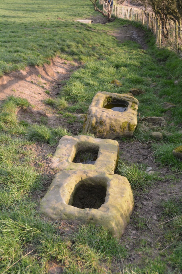
Three Crosses Well (Boulby) submitted by Anne T on 7th Mar 2020. The three cross bases, with the top of the well house just visible down slope.
(View photo, vote or add a comment)
Log Text: Three Crosses Well, Boulby: Parked outside the holiday cottages (there was a large layby just down the road). Originally followed the footpath sign, which took us down a steep bank, but Andrew found a farm track a little further along the south side of the A174, laid through a new area planted with saplings. Despite looking for someone to ask permission from at the farm and the holiday cottages, we were unable to find anyone, so were very carful to stick to the footpath/track.
At the end of this track, three cross bases came into view, and we peered over the fence line to see the well. The well house itself is a little down slope from the cross bases. We were curious as to the connection between the cross bases and the well.
The view of the sea from the cross bases is hidden by a natural small hill/mound. This is a magnificent site, despite the proximity to the potash mine.
St Oswald's Church (Lythe)
Trip No.159 Entry No.1 Date Added: 8th Mar 2020
Site Type: Ancient Cross
Country: England (Yorkshire (North))
Visited: Yes on 4th Mar 2020. My rating: Condition 3 Ambience 5 Access 4
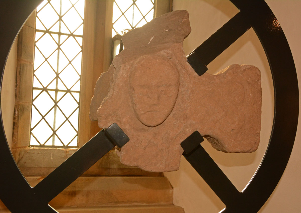
St Oswald's Church (Lythe) submitted by Anne T on 8th Mar 2020. The cross head fragment with its human head in the centre. As displayed in the south window at the west end of the nave.
(View photo, vote or add a comment)
Log Text: St Oswald's Church, Lythe: Our first stop of the day, and one I was very much looking forward to. Parking is available in the small lane to the west of the church (just off the A174 Lythe Lane). A notice put up by the farmer asked cars to park on one side of the lane only, so they had continuous access to their fields behind the church.
I was concerned about if I'd be able to make it down the 'windy stone steps' to the basement, where many of the Anglo Scandinavian and medieval stones were displayed. I needn't have worried, as the steps were modern, and whilst there was no hand-rail, they were easy enough to descend (although I did manage to dislodge small chunks of stone from the south wall as I descended).
We spent an hour and a half here, then needed to move on. I would have liked to have spent another hour (at least) here, with the notes printed from the Corpus of Anglo Saxon Stone Sculpture, and better lighting to take better photos of the stones in the basement.
Easington Cross
Trip No.160 Entry No.2 Date Added: 20th Mar 2020
Site Type: Ancient Cross
Country: England (Yorkshire (North))
Visited: Yes on 19th Mar 2020. My rating: Condition 3 Ambience 3 Access 4
Easington Cross submitted by johndhunter on 31st Jan 2020. Easington Cross at NZ 74427 18004 – Closer view, the possible shaft next to the broken medieval base looks like it has a sword carved on it, January 2012.
(View photo, vote or add a comment)
Log Text: Easington Hogbacks and A-S stone fragments: We had already seen the cross base in the churchyard, but arranged with the Reverend Danny Walker to revisit when the church was open. He was there with a very knowledgeable churchwarden (with his two wonderful dogs) to move some furniture around so they could leave the church open for parishioners and visitors at this current time of crisis.
The churchwarden took us into the tower to see a Norman arch that had been rebuilt on the first floor to preserve it. He also showed us St Hilda’s Cross base, and what he said was part of the cross shaft, but I said I thought was a medieval cross-slab as it clearly had a sword on it in the sunlight.
The vicar had cleared the steps to the basement boiler room, where we were allowed to move the old screens and debris to find any pieces we could. We found all but one of the pieces listed on the Corpus (the other may have been under debris, but with dead birds in the corner, we were reluctant to explore this part of the room). A real treat, and thanks to the vicar for opening the church up for us.
St Anne's Well (Shap)
Date Added: 6th Sep 2022
Site Type: Holy Well or Sacred Spring
Country: England (Cumbria)
Visited: Yes on 12th Jun 2020. My rating: Condition 4 Ambience 4 Access 4
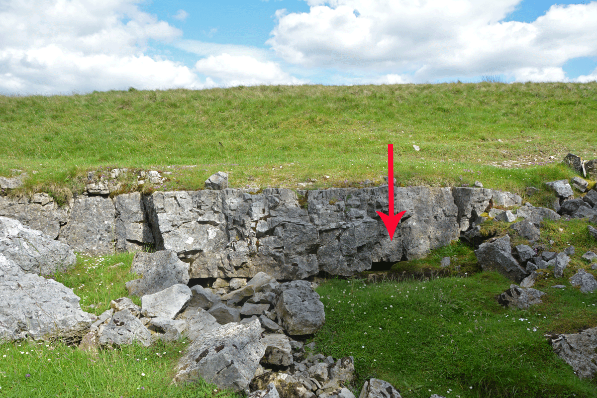
St Anne's Well (Shap) submitted by Anne T on 6th Sep 2022. The water from this well emerges from a small, easily spotted area of limestone pavement, immediately to the east of the small forested area.
(View photo, vote or add a comment)
Log Text: St Anne's Well, Shap: Stopped off for a break on one of very rare essential car journeys during lockdown, when exercise restrictions had been relaxed slightly. A lovely spot, although difficult to park as the long, thin, layby next to the motorway maintenance compound was full with cars of other walkers and dog walkers.
Heading east to walk around the forested areas, the noise of the motorway disappeared, and it was easy to spot the small area of limestone pavement this well is located in.
A very peaceful and lovely spot, although a fair way from any habitation in this era.
Fairy Well (Aikton)
Date Added: 4th Jun 2022
Site Type: Holy Well or Sacred Spring
Country: England (Cumbria)
Visited: Yes on 14th Jun 2020. My rating: Condition 2 Ambience 1 Access 5
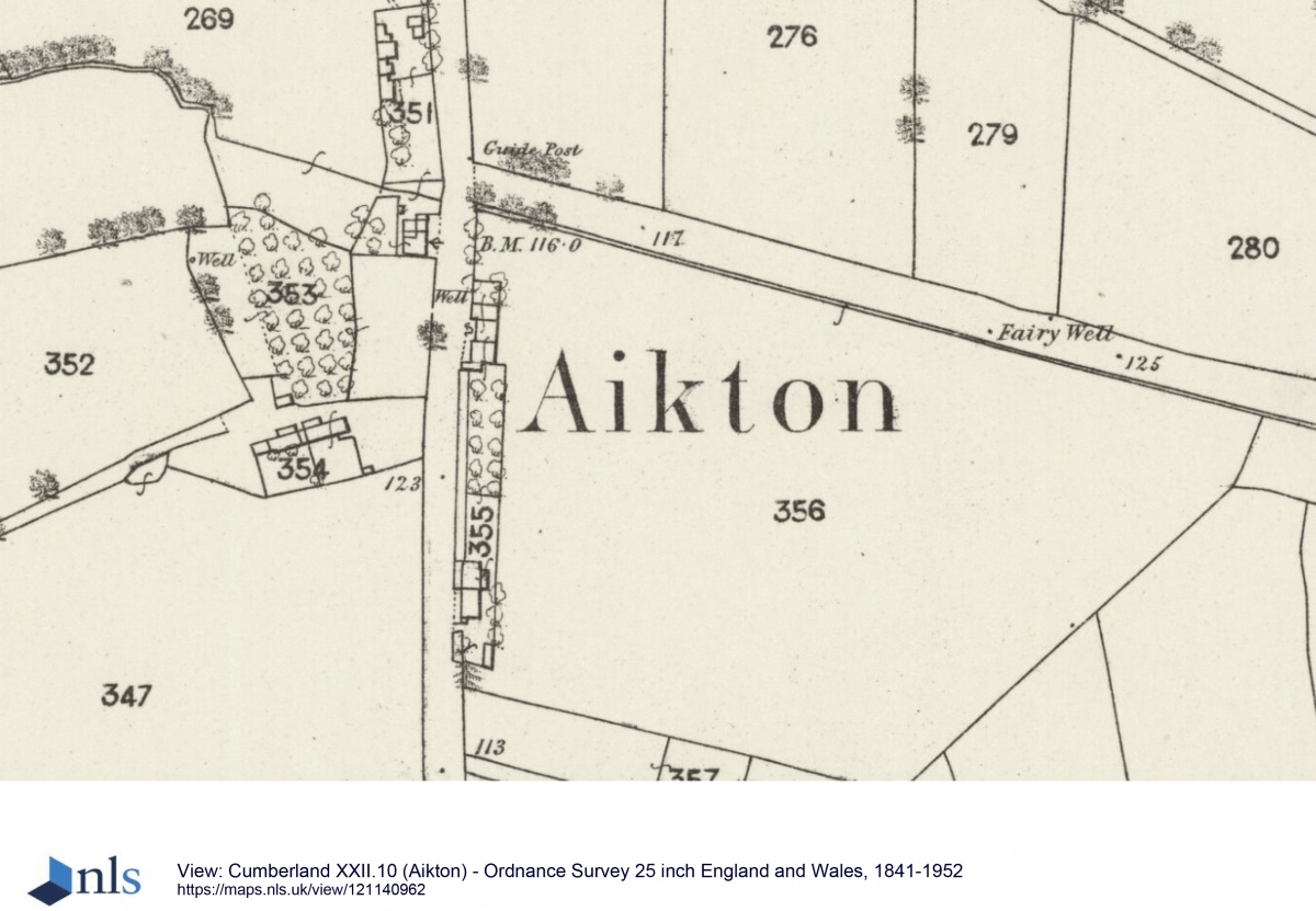
Fairy Well (Aikton) submitted by Anne T on 4th Jun 2022. Courtesy of the National Library of Scotland, this is the 1864 OS map (25 inch), showing the location of Fairy Well. There are two dots shown at this location. On the northern side of the road, there was nothing visible, only vague signs of water emerging from the base of the hedge on the south side. See 1864 OS map 25 inch Aikton.
(View photo, vote or add a comment)
Log Text: Fairy Well (Aikton): just after lockdown rules were relaxed marginally, and it was possible to travel short distances for reasons other than work or exercise, we needed to travel very near to Aikton, so took a short detour to try and find this well. There were plenty of walkers and other cars, but, as defined by lockdown law, no shops open, and no well to find!
Actually, not quite true, as peering down into the ditch, some water was visible bubbling up from the ground, running along a ditch to the south side of the hedge running along the northern edge of the field, but it was very difficult to find.
The gate into the field was open, so we looked along the other side of the hedge - all we could see were huge lumps of stone and concrete, which had been dumped along the ditch-line. Apart from a large lump of stone by the field gate, which looked as if it had simple architectural carving on it.
St Cuthbert's Stone and Well (Waverbridge)
Date Added: 4th Jun 2022
Site Type: Holy Well or Sacred Spring
Country: England (Cumbria)
Visited: Yes on 14th Jun 2020. My rating: Condition 2 Ambience 3 Access 4
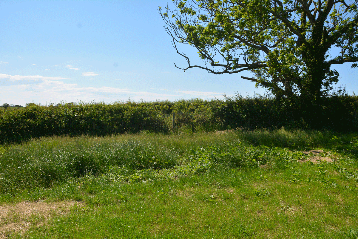
St Cuthbert's Stone and Well (Waverbridge) submitted by Anne T on 4th Jun 2022. Looking at the un-mown section of grass where the site of the well is shown. No water was showing in the field, but there was a pipe under the roots of the tree leading into the drainage ditch at the far side of the tree in the photograph.
(View photo, vote or add a comment)
Log Text: St Cuthbert's Stone & Well: We were making our first (and only for a long time) essential trip out, and passed within 400m of this well, so screeched to a halt at the entrance to the track (Watergate Lonning) at its junction with the B5302 at NY 21277 49139, and took our daily exercise walking down slope towards the well.
There is some sign of the well - in the field as an un-mown area of grass and in the hedge-line under the tree are remnants of a stone structure between the tree roots and along the bank of the ditch. All along the left hand side of the track (eastern side) is a drainage ditch, which we presume took the water from the fields, then when you get to the well, the water from the well joins the ditch. The well was dry at the time of our visit.
The stone was marked on the OS map, but was several fields away, with no gates in sight, so with time pressing, I photographed the well and we set off for our destination. So very odd to be out-and-about after months at home, but lots of other cars on the road, and difficult to rejoin the main road due to the high speed traffic.
Stanger Spa
Date Added: 8th Sep 2022
Site Type: Holy Well or Sacred Spring
Country: England (Cumbria)
Visited: Yes on 14th Jun 2020. My rating: Condition 3 Ambience 4 Access 3

Stanger Spa submitted by DavidRaven on 13th Dec 2005. The roof-less building that houses the Stanger Spa is hidden away in a copse of birch and poplar. The site isn't easy to find, following ill-defined footpaths through pastureland. It's worth the hunt though. A very quiet place, good to spend time there, not doing much.
(View photo, vote or add a comment)
Log Text: Stanger Spa Well, Embleton: The well is approached by a narrow causeway which runs through a boggy area, terminating at the well house. At the time of our visit, the land around the well was very wet, and in places there were deep puddles of water around the edges of the well house.
Whilst there were lots of other walkers in the area, I didn't see anyone else look at the well house.
An interesting spot and well worth visiting.
St Michael's Well (Shawk)
Date Added: 10th Jul 2022
Site Type: Holy Well or Sacred Spring
Country: England (Cumbria)
Visited: Yes on 25th Jun 2020. My rating: Condition 3 Ambience 3 Access 3
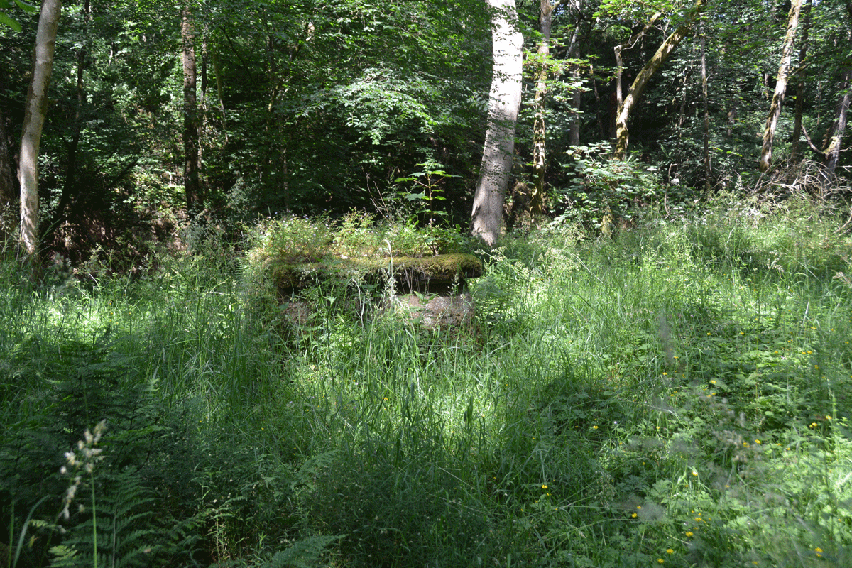
St Michael's Well (Shawk) submitted by Anne T on 10th Jul 2022. Looking back towards the footpath down through the wood (approached from the western side of the woodland).
(View photo, vote or add a comment)
Log Text: St Michael's Well, Shawk: Situated in a very lovely, heavily wooded area, to the east of a stream, Chalk Beck, which has stepping stones over it (these appear to move and be replaced when the stream floods, as there are several sets).
There is no mention on Pastscape or HE, although the HE map search shows a ‘W’ at the location of the well.
To reach the well, we parked on the grass verge at NY 33234 47664, and walked down the (private?) lane leading first south, then largely eastwards, past a number of properties, including the first which is called ‘Farthings’. At NY 33679 47362, the footpath carries on eastwards, through a gate; there is a private road which continues to the south. Our OS map indicated the well was nearer a footpath which started at NY 33653 47097, and which ran largely eastwards, but after 150m or so, it became so overgrown, we turned back.
We proceeded down the marked footpath at NY 33679 47362, where there are now a couple of wooden stables/sheds. There is an old hollow way which runs alongside the western side of the wood here, and we continued along this, through another gate, and followed the path which ran downhill, with a steep gorge to our right hand side. This path winds downhill, eventually coming to some stones laid across the course of Chalk Beck. We gingerly crossed this (wouldn’t like to try when the river is in flood or after it had been raining heavily). The well is immediately to our right hand side, about 20m to the east of the beck, largely hidden by tall grass and bracken.
The well structure is stone, with an opening in the top. The well was about 1/3 full of water, although we didn’t try and sample the water, as someone had thrown in a beer/lager can (a real shame). No visible signs of any ornamentation on the well housing.
The bedding planes on what we thought are red sandstone here were very clear, with a cliff on the western side of the river. Impressive!
Skew Skell Well
Trip No.161 Entry No.5 Date Added: 8th Jun 2021
Site Type: Holy Well or Sacred Spring
Country: England (Yorkshire (North))
Visited: Yes on 31st May 2021. My rating: Condition 2 Access 4
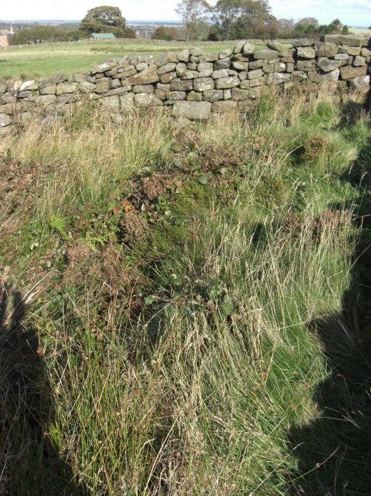
Skew Skell Well submitted by jamesrattue on 23rd Oct 2008. Skew Skell Well at Ilton, photographed 16th October 2008.
(View photo, vote or add a comment)
Log Text: Skew Skell Well, Ilton: We parked at SE 18823 78010, and walked NW down the slope with GPS in hand to find this well. It is in a small, rectangular area (to our right hand side) defined by a the stone walls forming an enclosure open at its south-western side, presumably to accommodate, and allow access to the well and a spring.
The ground was very heavily covered with foliage and nettles. The sound of running water could be clearly heard. Skew Skell Well could be made out by standing in the NE of the enclosure (there was a deep dip, filled with water). The spring appeared to be on the NW edge of the enclosure, with water now appearing to rise just over the stone wall, in the adjacent field. This flow of water could be followed downhill by a line of reeds.
On the opposite side of the road, there was another large pool of water. Other springs rise in the area. Water from Skew Skell Well must be piped under the road and run down the drainage ditch at the other side of the lane.
Billey Keld
Trip No.161 Entry No.6 Date Added: 8th Jun 2021
Site Type: Holy Well or Sacred Spring
Country: England (Yorkshire (West))
Visited: Yes on 31st May 2021. My rating: Condition 3 Ambience 3 Access 4
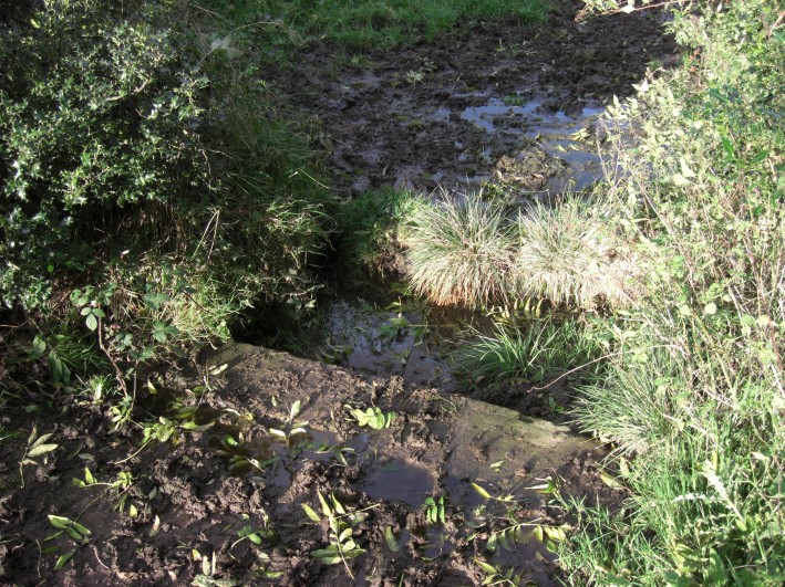
Billey Keld submitted by jamesrattue on 23rd Oct 2008. Billey Keld at Grewelthorpe, photographed 15th October 2008.
(View photo, vote or add a comment)
Log Text: Billey Keld Well, Grewelthorpe: With some very lively bullocks in the field, we decided not to venture into the field through the gate to look at well. However, we managed to see some of the structure from the roadside.
A local lady walking her dog stopped to talk to us and say she remembers visiting the well to collect water when she was a child.
Ings Well (Mickley)
Trip No.161 Entry No.7 Date Added: 9th Jun 2021
Site Type: Holy Well or Sacred Spring
Country: England (Yorkshire (West))
Visited: Yes on 31st May 2021. My rating: Condition 3 Ambience 4 Access 4
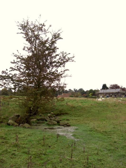
Ings Well (Mickley) submitted by jamesrattue on 23rd Oct 2008. Ings Well at Mickley, photographed 15th October 2008.
(View photo, vote or add a comment)
Log Text: Ings Well & Spring, Mickley (North Yorkshire): Our last stop of the day, and what a pretty site, with an easy walk down the Ripon Rowel Way from Mickley village. Note: there was a very rickety stile to cross as you entered the field at SE 25833 77052 (the top step was like a see-saw, although climbing the gate might have been easier!).
Sited under a lone hawthorn tree to the left hand side of the footpath, water flows freely out of the ground and spreads out into the field.
At SE 25954 77141 a large wooden post marks the location of a spring, the waters of which appear to flow south-east to north-west along a drainage channel. I wanted to investigate further, and also walk to another well (marked 'W' on the HE map search) at SE 26090 77149, but the field was far too wet and boggy and I was sinking up to my ankles in water. So wish I'd taken a pair of wellies!
Lady Well (Kirklington)
Trip No.161 Entry No.1 Date Added: 7th Jun 2021
Site Type: Holy Well or Sacred Spring
Country: England (Yorkshire (North))
Visited: Yes on 31st May 2021. My rating: Condition 3 Ambience 4 Access 4
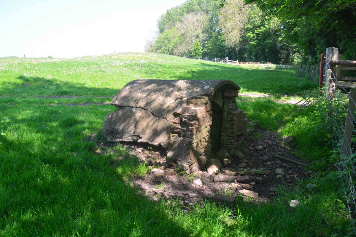
Lady Well (Kirklington) submitted by Anne T on 6th Jun 2021. View of Lady Well, Kirklington, from just to its western side. The remains of building platforms from the now deserted medieval village of Yarnwick lie above, and to the left of, the well house.
(View photo, vote or add a comment)
Log Text: Lady Well (Kirklington): our first site, in our first day out for 15 months. What a delightful location, although a shame the well house itself is crumbling and full of rubbish.
With the site of the deserted medieval village of Yarnwick in the same field, and to the north of, the well, it was a delight to be back in the countryside again
I stopped to photograph a second, now capped well, presumably the well supplying the farmhouse, at SE 31634 81303.
St Michael's Well (Well)
Trip No.161 Entry No.3 Date Added: 7th Jun 2021
Site Type: Holy Well or Sacred Spring
Country: England (Yorkshire (North))
Visited: Yes on 31st May 2021. My rating: Condition 3 Ambience 4 Access 5
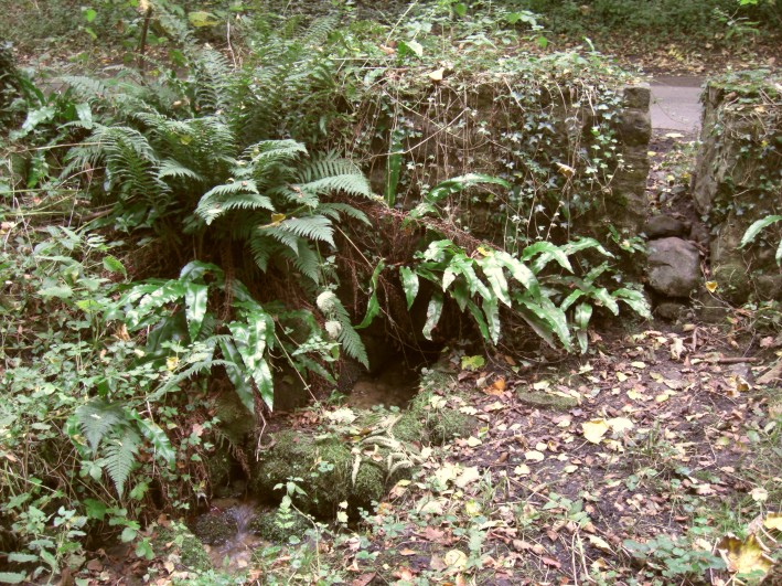
St Michael's Well (Well) submitted by jamesrattue on 20th Oct 2008. St Michael's Well, Well, North Yorkshire, photographed October 2008.
(View photo, vote or add a comment)
Log Text: St Michael's Well, Well: Our third stop of the day, driving west out of Well village, up a shady, pretty single track road with trees on either side. With little/no traffic on this road, we pulled into the passing place/small layby immediately opposite the well. At first, I didn't think anything was here, but behind the stone wall and wooden fence to the northern side of the road, there was the very distinct sound of running water.
Behind the small stone wall are some steps which lead down to the well itself, through which copious amounts of very clear water are running. This water then leads into a small stream which runs into Well Beck.
We didn't realise until later that the actual source of the water was from the southern side of the road, which also has a stone wall structure, fronted by what is now a muddy patch (once the well pool?). The water looks as if it originally emerged from by a large tree now growing in the wall. This area of ground has been heavily churned by cattle and the small gap/stile in the wall at this point has been wired off.
A very lovely spot, well worth the visit.
St Michael's Church (Well)
Trip No.161 Entry No.2 Date Added: 7th Jun 2021
Site Type: Ancient Cross
Country: England (Yorkshire (North))
Visited: Yes on 31st May 2021. My rating: Condition 3 Ambience 4 Access 4
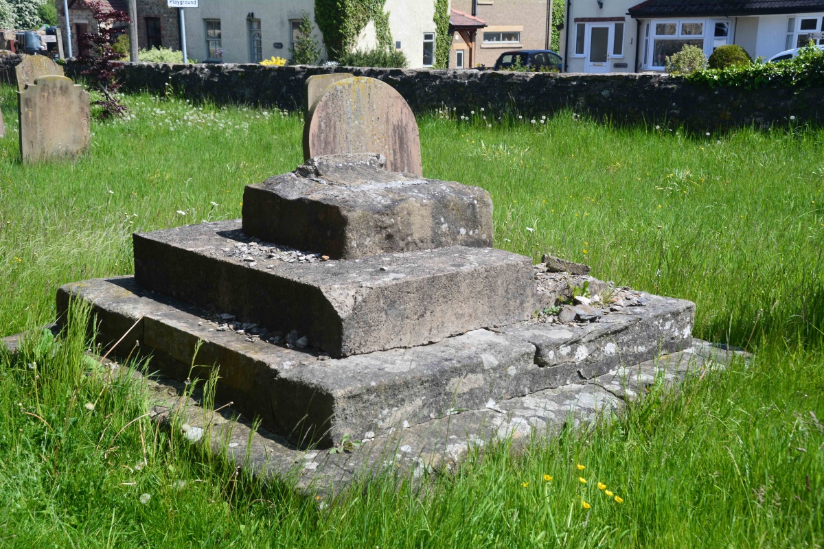
St Michael's Church (Well) submitted by Anne T on 7th Jun 2021. The cross base from the external south wall of the nave, looking eastwards down Church Street.
(View photo, vote or add a comment)
Log Text: Cross Base, St Michael's Church, Well: Our second stop of the day, arriving in glorious sunshine. Parking is available immediately outside the lych gate, and along Church Street. The HE record led me expect a 3m tall cross shaft, but this had been broken off, with no sign of it lying anywhere close to the cross base.
Understandably, the church remains locked to visitors due to pandemic restrictions, but we wandered round the outside of the church, photographing the few medieval grave slabs built into the fabric of the old building, and the sundial (very, very worn) over the south porch door.
The lower part of the tower is clearly early - 12th century in date at the bottom, the western side containing a very old wooden door which looks like it leads up to the belfry. I would be very interested to go back, as the church contains part of a Roman mosaic found locally, along with some interesting tombs and effigies
Berry Well
Trip No.161 Entry No.4 Date Added: 8th Jun 2021
Site Type: Holy Well or Sacred Spring
Country: England (Yorkshire (West))
Visited: Yes on 31st May 2021. My rating: Condition 3

Berry Well submitted by jamesrattue on 23rd Oct 2008. Berry Well at Swinton, photographed 18th October 2008.
(View photo, vote or add a comment)
Log Text: Berry Well, Swinton Park Hotel: After St Michael's Well in Well, we stopped off in Masham for refreshments, stopping to photograph the water troughs/Renton Well in Masham before setting off to find Berry Well.
We parked at SE 21443 79735, just to the south of the hotel lodge gates. As I stepped out of the car, I immediately noticed the trough.
The area of grass verge up to the well from the hotel gates has been recently strimmed. The sound of running water can be clearly heard. The well basin is well under the current ground level, and largely hidden by the weed trimmings. The water is piped under the road, although there is no indication that we could find of where the water goes to.
There is a pond on the other side of the wall, which feeds the well. There is a small, lively, very clear stream which wends its way down a very gentle slope in the grounds of the Swinton Park Hotel. (The gates of the hotel were open, so we popped in and followed the wall along).
There is another section of trough on the hotel side of the wall.
Entry Well (Ovington)
Trip No.162 Entry No.1 Date Added: 9th Jun 2021
Site Type: Holy Well or Sacred Spring
Country: England (Northumberland)
Visited: Yes on 6th Jun 2021. My rating: Condition 3 Ambience 4 Access 4
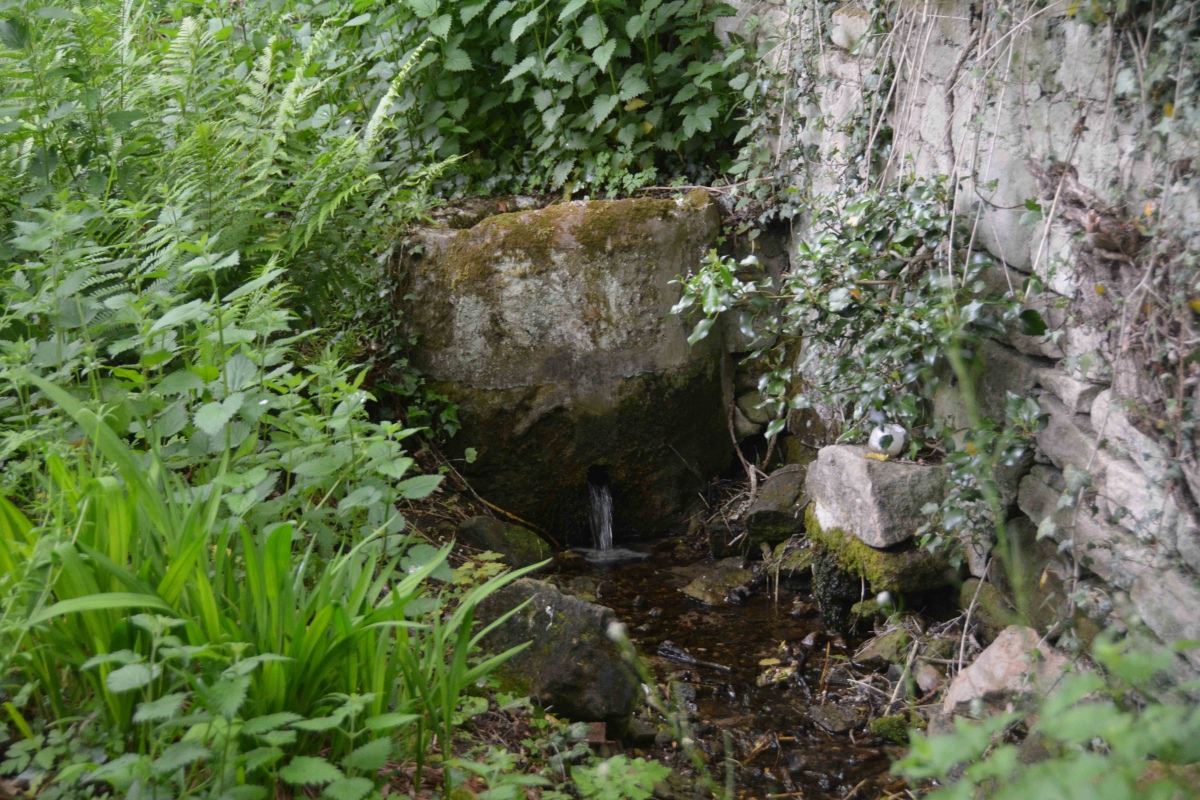
Entry Well (Ovington) submitted by Anne T on 9th Jun 2021. People still visit Entry Well, as there is an overgrown path a few metres to its eastern side. This leads down to the small stream taking water from the well.
(View photo, vote or add a comment)
Log Text: Entry Well, Ovington: A pleasant walk on a warm, sunny Sunday evening, trying to destress before the builders arrive next door tomorrow. Not expecting to find anything at this site, we were surprised by the remaining, and still visible structure here. Not been able to find out anything much about this well, apart from the fact it forms the western boundary of the parish of Ovington. Have appealed for further information until I can get hold of some local history books/journals.
