Contributory members are able to log private notes and comments about each site
Sites Anne T has logged. View this log as a table or view the most recent logs from everyone
Hollin Stump Cairn
Trip No.6 Entry No.4 Date Added: 2nd Oct 2016
Site Type: Cairn
Country: England (Cumbria)
Visited: Yes on 11th Sep 2016. My rating: Condition 3 Ambience 4 Access 3
Hollin Stump Cairn submitted by HeronEye on 14th Mar 2014. Looking East to Hollin Stump cairn from the footpath to Gaythorne Plain ring cairn.
(View photo, vote or add a comment)
Log Text: Hollin Stump Cairn, Gaythorp Plain, Cumbria: From St Helen's Well at Great Asby, we headed south south west, following the single track road to ASby Winderwath Common, were the metalled carriageway turned west across Gaythorne Plain. We parked by the cattle grid on opposite Linglow Hill, where a dog walker had taken up much of the dry parking area and was waiting for his 2 lively terriers to wear themselves out tearing across the grass.
We hadn’t spotted a gateway into the field containing Hollin Stump Cairn from the road, so followed the bridlepath south. There was a gate into the field about a quarter mile from the road, but there was a herd of large cows (and a bull) surrounding the cairn, so we only go to view this from a distance.
We carried along the bridlwway to find the Gaythorn Plain Ring Cairn/Stone Row (not sure we found it, need to process the photos). The latter was visit 7/5 (not yet logged).
Lowhouse
Trip No.9 Entry No.6 Date Added: 15th Feb 2017
Site Type: Stone Circle
Country: England (Cumbria)
Visited: Yes on 12th Feb 2017. My rating: Condition 3 Ambience 3 Access 4
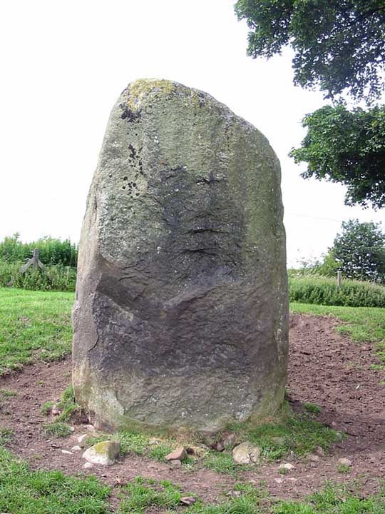
Lowhouse submitted by stu on 16th Jul 2004. Kitchenhill Bridge Stone (Lowhouse?), NY4961 3434.
Standing by the West Coast Mainline, this is a massive stone at least 3m tall. Not marked on the O.S maps.
(View photo, vote or add a comment)
Log Text: Lowhouse/Holme Head/Kitchenhill Standing Stone, Penrith, Cumbria: From Newbeggin, heading back up the M6, leaving at junction 41, turning right onto the B5305 and taking the first exit off the roundabout, we headed up the minor road signposted to Calthwaite. Where the road divides at Kitchenhill Farm, we turned right, heading over the railway line, then immediately over the small bridge over the River Petterill. At grid reference NY 49802 34135 there is a left hand turn on the bend, leading down to a small area of land by the river, used by the farmer for storing hay. There is room here for one car to park at the entrance. We walked back the short distance over the bridge over the river and went to look over the gate into the field. At first, in the gathering dusk, we couldn’t see anything, but then at the far end of the field, sheltered by a large tree, we spotted this huge grey stone.
The field is guarded by a barbed wire topped gate. I don’t like trespassing, but there was nothing in the field, so we let ourselves gingerly in and followed the tractor trail over the grass to the stone. It is huge. I spotted what seemed like other smaller (grey) stones in the base of the red sandstone wall to the right-hand side of the field. Getting closer to the stone, it sits on (what was) a lovely spot (pre railway line), overlooking the gently meandering river below.
Andrew was keen to try and get sight of two other stones in the area (and another I’d spotted travelling south on the M6 on the way down), so we drove to Plumpton, slightly further north, stopping near Plumpton Wall Farm to peer over the fields, but could see nothing. We retraced our route and headed off towards Calthwaite, stopping at the entrance to Hallrigg to peer eastwards over the fields. With the sleet hammering in our faces, Andrew got the binoculars out and spotted a stone next to Calgarth Plantation at grid reference NY 48253 37527. Looking on UK Grid Reference Finder, I couldn’t see any sign of it, although this is an old map on the Modern Antiquarian web site which would be worth investigating.
Skirsgill Standing Stone
Trip No.9 Entry No.1 Date Added: 13th Feb 2017
Site Type: Standing Stone (Menhir)
Country: England (Cumbria)
Visited: Yes on 12th Feb 2017. My rating: Condition 2 Ambience 3 Access 5
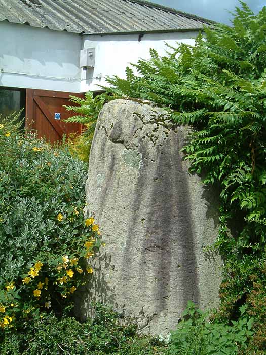
Skirsgill Standing Stone submitted by stu on 16th Jul 2004. NY5098 2874.
On the Skirsgill industrial estate near Penrith. Stone stands at the rear of the Liliput Lane factory.
(View photo, vote or add a comment)
Log Text: Skirsgill Standing Stone, Penrith: Situated in Skirsgill Business Park, just to the west of the southern part of Penrith, we’ve tried visiting this stone before, but never found it.
From Penrith, heading west across the M6 on the A66 towards Ullswater, take the very first turn into the Skirsgill Industrial Estate (easy to drive past, as it has a very short feeder lane into it). Follow the one way system into the industrial estate (note the intriguing thatched building to your left) and continue straight ahead between the two sets of industrial units. After several hundred metres, you will see a dead end with a gate leading into the field, an CrossFit Cumbria to your left. Parking can be difficult during the week, but plenty of spaces during the weekend. Walk along the dead end road towards the field, with the CrossFit building to your left. The standing stone can be found immediately at the end of this building. Was the building built to accommodate the stone, or has the stone been relocated to form part of its garden?
The face of the stone nearest to the building appears to have been quarried in more recent times, as the face is ‘squared off’. There is some modern grafitti on it.
Not the best of locations, but certainly intriguing! Could only find the Historic England listing – nothing in Pastscape.
Mossthorn Long Cairn 2
Trip No.9 Entry No.3 Date Added: 13th Feb 2017
Site Type: Cairn
Country: England (Cumbria)
Visited: Yes on 12th Feb 2017. My rating: Condition 3 Ambience 3 Access 5
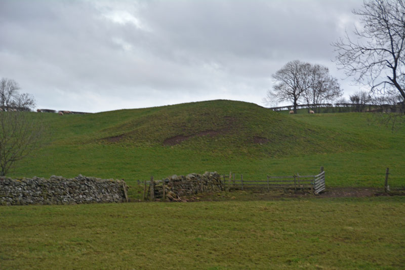
Mossthorn Long Cairn 2 submitted by Anne T on 13th Feb 2017. The long cairn at grid reference NY 48289 30440, taken from the layby outside The Wreays on the minor road from the A66 to Greystoke.
(View photo, vote or add a comment)
Log Text: Long Cairns near Mossthorn Farm, near Sewborwens Standing Stones: From Sewborwens Standing Stone(s), we drove westwards along this minor road, through the roadworks currently there, and parked in the layby outside The Wreay. The first long cairn is visible in the field immediately opposite.
Crossing the road to photograph this site, the wind chill must have been -5 degrees C, with the occasional flake of sleet. The roadworks had churned up the grass, so I waded through almost ankle deep mud to the stone wall and got a closer photograph.
We didn’t realise there was a second cairn at grid reference NY 48258 30606 until I checked on the Historic England site.
Given we want to come back and track the standing stones in Newbeggin Village at some point, I’m going to write to the farm to ask permission to walk the fields to see both long cairns at closer quarters.
Sewborrans Stone
Trip No.9 Entry No.2 Date Added: 14th Feb 2017
Site Type: Standing Stone (Menhir)
Country: England (Cumbria)
Visited: Yes on 12th Feb 2017. My rating: Condition 3 Ambience 3 Access 4
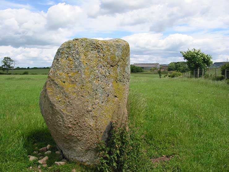
Sewborrans Stone submitted by stu on 16th Jul 2004. NY4884 2999.
1.5m high stone. Visible from the road.
(View photo, vote or add a comment)
Log Text: Sewborwens Standing Stone (and outliers), Penrith, Cumbria: From the Skirsgill Standing Stone, we made our way back on the A66, heading westwards (you can only turn left onto this dual carriageway). Turning round at the next roundabout, heading back to Penrith, we took the first left hand turn down the mnor road leading past the golf driving range and Greystoke Pillar (18th century monument to the 11th Duke of Norfolk). About 1.5 kms down this road from the A66, there is a barn on the right hand side of the road with a small (muddy) layby next to it. There is a gate into the main field to the east of the barn and the standing stone is visible next to the first fence line to the east.
There was nothing in the field, so we kept to its edge to look at the stone. Before reaching the stone, I spotted two more smaller stones in the hedge line, which looked like part of a row or avenue leading to the stone.
Having photographed the stone, I spotted more large stones against the wire fence. This modern fence has been put on top of what looked like an old (medieval?) stone wall line. There were at least three large boulders, two looking like they had been shaped and with flat bottoms, which had been moved against the old wall to clear the field.
An email to Cumbria County Council provided the information: "there are 2 smaller stones which may be related to the larger stone, beside the hedgerow bordering the B5288 and about 120 metres bearing 280 degrees from the major stone. The southernmost stone is c1.08 metres and the northermost stone is c0.75 metres.” They also added that notes from 1973 tell us: “Thompson records the ‘remnants of a stone sepulchural ring at Sewborrans”, but he doesn’t know what the original source was.
Newbeggin Wells
Trip No.9 Entry No.5 Date Added: 15th Feb 2017
Site Type: Holy Well or Sacred Spring
Country: England (Cumbria)
Visited: Yes on 12th Feb 2017. My rating: Condition 3 Ambience 3 Access 5
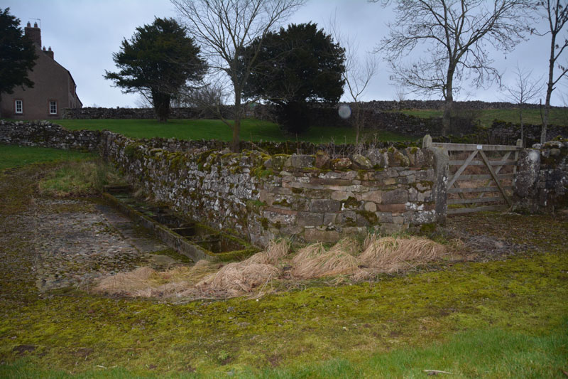
Newbeggin Wells submitted by Anne T on 14th Feb 2017. The Prospect Well, which is located on the village green in the middle of Newbeggin. The main well chamber is located behind the stone wall, with troughs set against the exterior wall. There was a fair flow of water into the troughs at the time of the visit. The water didn't taste of any particular mineral.
(View photo, vote or add a comment)
Log Text: Newbeggin Wells, near Sewborwens Standing Stone: We went originally to try and trace the standing stones, one of which stood in the wall of Rosemary House (we found Rosemary Cottage but not the house) and another which stood in the field behind.
Parking at the side of the road near Rosemary Cottage, opposite Sunbeam Well, we braved the sleet. It was getting to be dusk and cold, and light conditions were really weird. We walked the hundred or so yards between the two wells, then set off in seach of Holme Head standing stone, before it got dark.
I have since emailed the clerk of Dacre Parish Council to try to find out the location of the above stone, and to seek the landowners’ name, so we can visit.
Wikipedia, and Dacre Parish Council, record that Newbeggin is an ancient village, built on the Putnam Fault, which provides a line of springs running through the village. Neolithic burials have been found on nearby Flusco Pike and there are a number of barrows and cairns and other standing stones in close proximity.
Gilsland Spa Sulphur Spring
Trip No.146 Entry No.2 Date Added: 28th Aug 2019
Site Type: Holy Well or Sacred Spring
Country: England (Cumbria)
Visited: Couldn't find on 27th Aug 2019
Log Text: Gilsland Spa Sulphur Spring: We tried to find this well from both sides of the river. Continuing west along the river walk for about 20m, we found the path had been washed away, and not even husband-cum-mountain-goat Andrew felt comfortable walking this section of the river (he said it would have been easier to walk in the river).
We did cross the footbridge and made our way along the side of the river to within what should have been 'sighting distance' of the well, but the banks were too heavily wooded to see. Shame, as I really wanted to find this well-in-a-grotto. May return and have a second look from the Irthing Gorge walk path.
Wetheral Village Cross
Trip No.146 Entry No.3 Date Added: 29th Aug 2019
Site Type: Ancient Cross
Country: England (Cumbria)
Visited: Yes on 27th Aug 2019. My rating: Condition 3 Ambience 4 Access 4

Wetheral Village Cross submitted by Anne T on 29th Aug 2019. Standing just to the south east of the cross, looking north west towards the main part of the village, over the B6263 Steele's Bank. The cross head appears far older than the 'modern' shaft and steps.
(View photo, vote or add a comment)
Log Text: Wetheral Village Cross: a very pretty village. The steps and shaft of this cross are relatively modern, erected sometime between 1838 to 1844. The head of the cross is much weathered and appears older than the rest of the cross, although neither Pastscape nor Historic England mention this.
The cross is less than 150m to the west of the church and the River Eden. At the church, there is the remains of an Anglo Saxon cross shaft.
Greystoke Village Cross
Trip No.146 Entry No.7 Date Added: 30th Aug 2019
Site Type: Ancient Cross
Country: England (Cumbria)
Visited: Yes on 27th Aug 2019. My rating: Condition 3 Ambience 4 Access 5
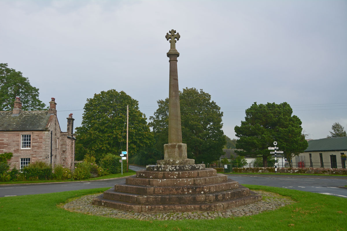
Greystoke Village Cross submitted by Anne T on 30th Aug 2019. Looking eastwards across the village green and the cross, along the B5288 which goes to Click Em and Pallethill.
(View photo, vote or add a comment)
Log Text: Greystoke Village Cross: We've been to this area before, on the hunt for the possible Newbeggin Stone Rows, but never driven into this very pretty little village. We left this until the last stop of the day (just before the rain started to hurl down), after having seen the Eyekeld Well, the village Church and the Sanctuary Stone.
There are parts of the original medieval cross built into this largely 'modern' structure. Whilst Pastscape and HE say the socket stone is original, it looked like the top three steps were original (the new socket stone had chamfered and shaped corners and was a much brighter/less weathered stone than the rest).
Sanctuary Stone (Greystoke)
Trip No.146 Entry No.6 Date Added: 30th Aug 2019
Site Type: Early Christian Sculptured Stone
Country: England (Cumbria)
Visited: Yes on 27th Aug 2019. My rating: Condition 2 Ambience 3 Access 5
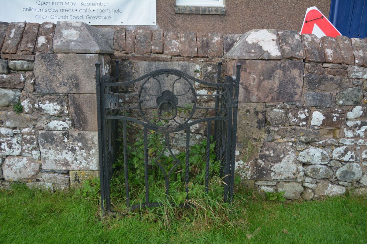
Sanctuary Stone (Greystoke) submitted by Anne T on 29th Aug 2019. Nothing could be seen of the actual sanctuary stone, which lies virtually flat to the ground within in a concrete base. It used to lie some 10 feet south of its current position. With a very busy heated, outdoor swimming pool, I didn't dare lean over and pull the nettles away (perhaps I should have asked permission at the swimming pool).
(View photo, vote or add a comment)
Log Text: Greystoke Sanctuary Stone: We didn't know this stone was here until I read the church guide book as we walked around the church. There is also a plaque stone somewhere, but we'd almost run out of time today. This stone was disappointing, as it wasn't visible underneath a dense covering of nettles and weeds. I'm now kicking myself for not asking at the swimming pool reception a few metres away if it was possible to pull a few of these away to take a closer look. There was a photograph of the cleared enclosure on the Old Cumbria Gazetteer.
Winderwath Stone Circle
Trip No.13 Entry No.4 Date Added: 28th Mar 2017
Site Type: Stone Circle
Country: England (Cumbria)
Visited: Yes on 25th Mar 2017. My rating: Condition 3 Ambience 4 Access 5
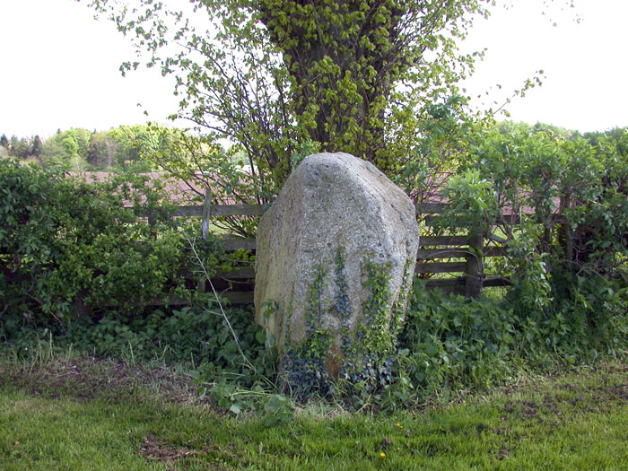
Winderwath Stone Circle submitted by nicoladidsbury on 11th May 2005. Winderwath standing stone This stone stands by the lane leading to Winderwath, and its magnificent gardens.
(View photo, vote or add a comment)
Log Text: Winderwath Stone Circle, Penrith: After our 'stone hunt' around Newbeggin and Newton Reigny, by this time it was gone 5pm and there was no hope of getting to Haweswater to look at the standing stones on Four Stones Hill before dark, so we set off to Winderwath. The Visit Cumbria website says in its entry for Winderwath Gardens: "There used to be a stone circle in the field adjacent to the lane that leads down to Winderwath, which was destroyed. Its stones were thrown into the River Eden nearby, except two – one stone remains standing by the lane, and a further stone lies behind the hedge, at the edge of the field." Note: this site is not included on the list of stone circles @ Photographer’s Resource and I could find no other reference to it on the web.
Sited on the minor road to Winderwath Gardens, it was interesting to find this tiny little turn off the A66 east. From Penrith, go passed the entrance to Centre Parks on the opposite side of the road and take the first road to your left, signposted to Culgaith. Following this little road which takes you past Woodside, Low Woodside and Winderwath Farm before taking a left to Winderwath Gardens, we’ve never seen so many rabbits scuttling about across the road and in the fields.
These stones are on the right hand side of the road as you drive down towards the gardens, about half way down the drive. This is again in a lovely valley, but being in an estate, it looks as if the ground has been heavily improved and levelled.
After having found the first stone, which seemed to have a couple of worn single cup marks in 2 of the faces (quite distinctive from the weathering patterns on the top of the stone), we peered over the hedge to find the second stone. It appears the tree in the fenceline is sitting on top of a few other smaller stones. The second, larger stone can hardly be seen from the driveway, so we found a gate in the top end of the field and quickly ran down to take a look. If someone had been around, we would have asked nicely.
Newbeggin Stone Row
Trip No.14 Entry No.2 Date Added: 28th Apr 2017
Site Type: Stone Row / Alignment
Country: England (Cumbria)
Visited: Yes on 25th Mar 2017. My rating: Condition 2 Ambience 3 Access 4
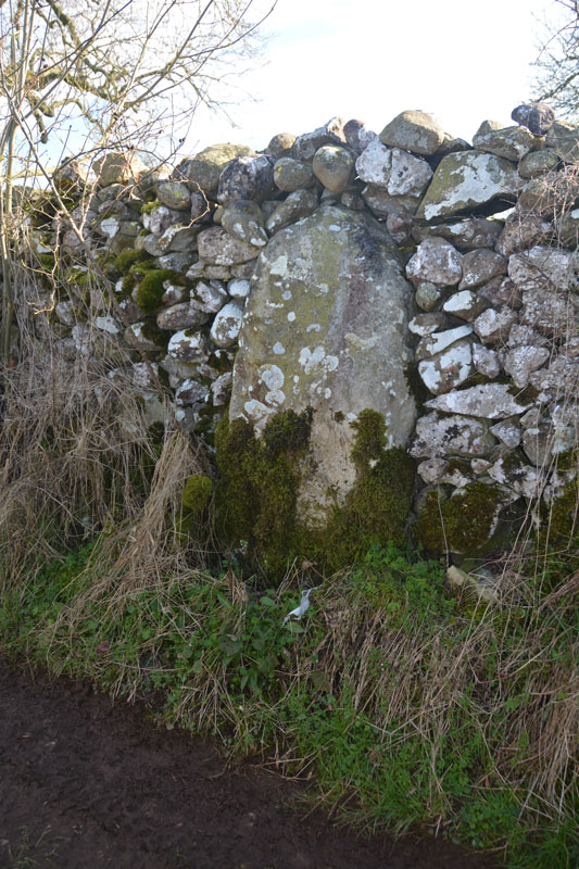
Newbeggin Stone Row (Possible) submitted by Anne T on 28th Mar 2017. This stone is built into a stone wall on a footpath which follows the Carlsike Burn, around Hoghouse Hill to Newbeggin. Located at NY 48058 29531. Note: 3rd April 2017. The Lead Officer for the Historic Environment and Commons says "This is slightly more interesting. I would not like to guess at when this might have been erected."
(View photo, vote or add a comment)
Log Text: Newbiggin Stone Row, Near Penrith: Following our first visit to try and find the standing stones mentioned on the village website, but drawn a blank, we did find 2 of the 4 wells, and recorded these in photographs. An email to the Parish Council, who'd featured one of these stones on their website, resulted in us being put in touch with Dr. Alan J Rich, the local historian. He was enormously helpful and emailed me across a map of 5 of the stones to be found around the immediate bounds of the village.
Also intrigued by The document “The Prehistoric Remains on Moordivock, near Ullswater” by M. Waistell Taylor MD, FSA, dated 1885 on page 342 and 343 talks about “remnants of former alignments of megaliths may still be made out elsewhere, in various localities in the district around Penrith, a few appearing as Standing Stones, and some partially sunk, or walled into the breast of fences. For instance in the direction from the S end of the village of Newton Reigny, by Mossthorn, on over Pallet Hill to Newbiggin; also from Sewborrens over the Riggs Farm to Newbiggin some few exist, and I have seen old people who remembered the removal of many of these stones at the beginning of the century. These lines may have been in connection with the barrows and stone circles, of which the dilapidated remains and half buried relics are frequent over this locality.”
Taking advantage of the sunny, spring weather, and armed with Dr. Rich's maps and book, we headed back to Newbiggin for a wander around the lanes and pathways in and around this long, linear village. In total we saw a total of 10 possible standing stones, and I've emailed details to the County Historical Officer to see if these can be verified as such, as they are not mentioned on the OS map. Curiously, plotting the grid references on UK Grid Finder, apart from the stone near Bell Mount, there is an alignment running north-east from Newbiggin towards Newton Reigny.
Shapbeck Plantation
Trip No.15 Entry No.1 Date Added: 3rd Apr 2017
Site Type: Stone Circle
Country: England (Cumbria)
Visited: Yes on 2nd Apr 2017. My rating: Condition 3 Ambience 4 Access 4
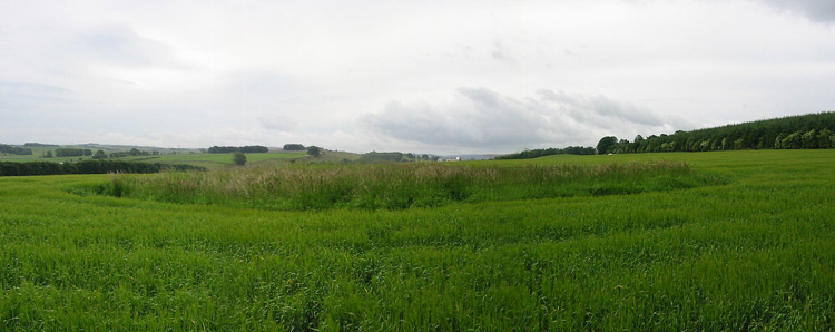
Shapbeck Plantation submitted by stu on 16th Jul 2004. NY552 188.
General view of the overgrown stone circle.
(View photo, vote or add a comment)
Log Text: Shapbeck Plantation Stone Circle: Our first stop of the day, whizzing off the M6 southbound at Eamont Bridge and travelling on the A6 through Clifton & Hackthorpe to Shapbeck Gate. There, a side road leads to a bridge across the River Leith, but there was no parking to be had. We turned back northwards up the A6 and parked in a layby some ¼ mile north of the footpath leading up to Shapbeck Plantation. We took our lives in our hands walking back to the footpath, with cars and motorbikes travelling fast along the road, and the verge was lumpy and bumpy and difficult to walk along.
Finally reaching the footpath, almost opposite the road leading to Southfield and Stonygill Bridge, we turned west over the fields towards Shapbeck Plantation, I was glad I had worn my wellies, as the gates into the fields were deep in muddy water. Careful of the stock in the first field, we crossed through the gate into a second field, where the footpath vanished – it had been ploughed out. Following the dry stone wall line up the hill towards the plantation, it was only when we had almost reached the top of the field that a fenced off area to the northern side of the field came into view.
Walking towards this, it was clear the farmer had been using this area as a dump for old metal items and other stones, although an inner and outer circle were clearly visible. It looked as if the circle had been built on a slight mound, with a ditch around the outside. At this time of year, there wasn't much vegetation, so it was possible to see lots of the stones.
Without the plantation, there would have been views 360 degrees around the site. Even today, this area was busy, busy, busy, with the A6, M6 and West Coast railway all intersecting and intermingling in the valley below. Walking across the fields, many of the smaller stones poking out of the earth had a very distinctly green tinge.
Definitely worth braving the traffic to visit this site.
Four Stones Hill Standing Stones
Trip No.15 Entry No.3 Date Added: 3rd Apr 2017
Site Type: Standing Stones
Country: England (Cumbria)
Visited: Couldn't find on 2nd Apr 2017. My rating: Access 3
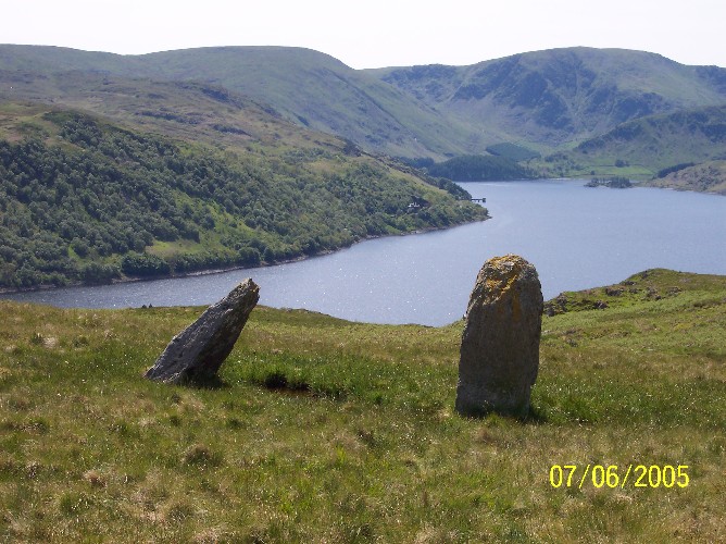
Four Stones Hill Standing Stones submitted by donstobbart on 11th Jun 2005. I have to agree with Nicoladidsbury that I did not feel any ambience when I visited this site. But I did get a great view of the lake!
(View photo, vote or add a comment)
Log Text: Four Stones Hill, Haweswater: Ashamed to say I was defeated by the large stiles with big drops and missing steps. Was so looking forward to going to see this site and from Google Earth, it seemed possible for me to walk this route. Did look for gates in the fields to avoid the stiles, but up by Lower Drybarrows, couldn't find any entry/exits; the one there was said very clearly "no public right of way". Perhaps I should have ignored those and tramped through the fields anyway, but it would have left me feeling guilty. Will try again. Note to self: parking was very difficult up by Winder Hill. Needed to wedge the car in besides a stone wall to leave ready access to the fields.
Bell Mount
Trip No.14 Entry No.1 Date Added: 3rd Apr 2017
Site Type: Natural Stone / Erratic / Other Natural Feature
Country: England (Cumbria)
Visited: Yes on 25th Mar 2017. My rating: Condition 2 Ambience 3 Access 5
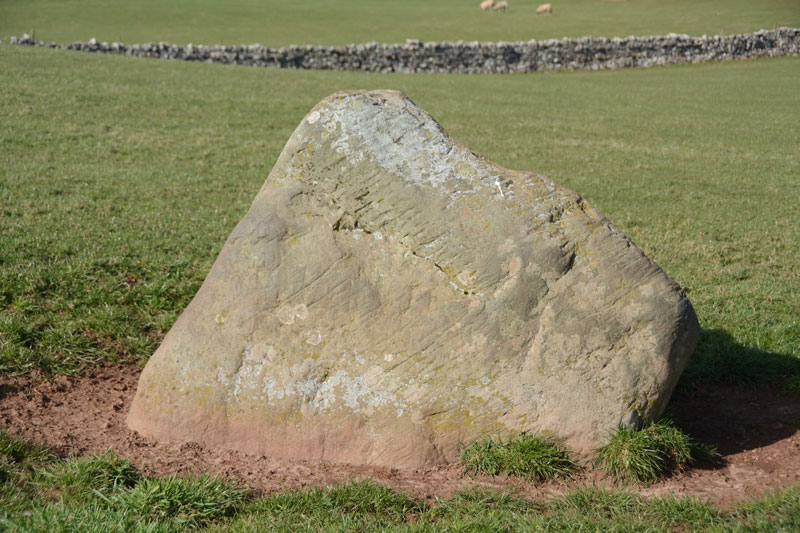
Bell Mount submitted by Anne T on 3rd Apr 2017. This stone sits almost on the brow of the hill. There are striations on its surface (plough or glacial?) indicating it has lain prone at some point in its history. There is slight evidence it is set within a depression.
(View photo, vote or add a comment)
Log Text: Bell Mount Erratic (or standing stone?): Saw this very briefly on our first visit to Newbeggin, but whizzed by in the car and didn't stop. This time, we parked by the open gate to the field. There being no stock, we took the chance to walk up the grassy slope to see this stone. Whilst it's not marked on the OS map (neither is the Sewborwens stone not far away), it showed distinct striations on one of the surfaces indicating it had lain prone at some point and been stood up. My geology isn't good enough to tell it the marks were as a result of glaciation or the plough, although the stone seemed to be set into a slight depression which was even all round, and didn't look like stock had been rubbing around it. Note to self: need to check geology of the area.
Pocklington's Druid Stone
Trip No.155 Entry No.3 Date Added: 15th Jan 2020
Site Type: Modern Stone Circle etc
Country: England (Cumbria)
Visited: Yes on 12th Jan 2020. My rating: Condition 4 Ambience 4 Access 4
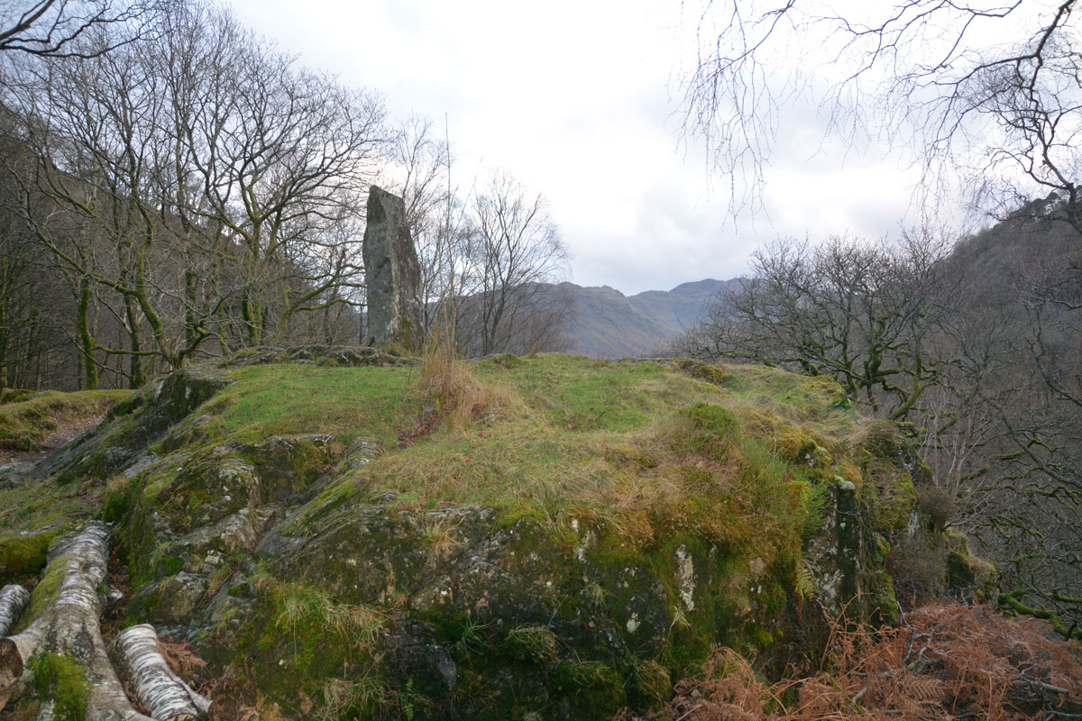
Pocklington's Druid Stone submitted by Anne T on 15th Jan 2020. Pocklington's Druid Stone, a relatively modern megalith, having been erected here in around 1778, stands on top of a rocky outcrop just to the south of the Bowder Stone. This view looks south, with the B5289 and the River Derwent below.
(View photo, vote or add a comment)
Log Text: Pockington's Druid Stone at the Bowder Stone: A short distance from the Bowder Stone, almost hidden from sight by a small cottage, this 'modern' monolith stands on top of a rocky outcrop high above the road below. At first, I thought it might be a memorial, as there appeared to be writing on the stone. Getting closer, the 'writing' was just striations on the stone.
Moor Divock Cairn
Date Added: 18th May 2022
Site Type: Cairn
Country: England (Cumbria)
Visited: Yes on 14th May 2022. My rating: Condition 2 Ambience 3 Access 4
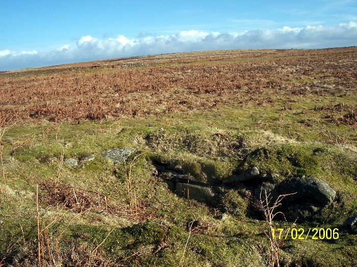
Moor Divock Cairn submitted by donstobbart on 24th Jul 2006. Along the side of the cairn, with a good view of the straight edge that can be seen in the interior of the carn.
(View photo, vote or add a comment)
Log Text: Moor Divock Cairn - Query: We, too, found this feature, just to the right hand side of the main bridleway/footpath leading towards White Raise Cairn. I photographed it, just in case it was documented on what used to be Pastscape, or Historic England. Some 70m to the north west of Moor Divock 3/Askham Fell Cairn and Stone Row, we debated long and hard as to whether this is part of an old quarry, a shooting butt, or part of a robbed cairn (we know Canon Greenwell carried out extensive excavations around here in the 1880s).
Hallrigg Standing Stone
Trip No.175 Entry No.1 Date Added: 28th May 2022
Site Type: Standing Stone (Menhir)
Country: England (Cumbria)
Visited: Saw from a distance on 28th May 2022. My rating: Condition 3 Ambience 3 Access 1
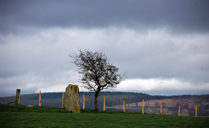
Hallrigg Standing Stone submitted by nicoladidsbury on 9th Apr 2007. Hallrigg Standing Stone - rediscovered standing stone, 2 miles north of Lowhouse Standing Stone, 5 miles north of Penrith. It appears to be red sandstone, approx 1.5m tall
(View photo, vote or add a comment)
Log Text: Hallrigg Standing Stone, Plumpton: The nearest we could get was the very back (staff only area) of the Pot Place Car Park, and we asked permission to take this photograph from the member of staff working in this area.
We did try numerous other ways to get closer to the standing stone, but couldn't even find a track and/or gate to walk across the fields, or who to ask permission off.
Photo taken with a tripod and 50-300mm zoom lens at maximum zoom, but even this didn't give an excellent photo, given the haze in the atmosphere.
Hyssop Holme Well (Carlisle)
Trip No.176 Entry No.1 Date Added: 6th Jun 2022
Site Type: Holy Well or Sacred Spring
Country: England (Cumbria)
Visited: Yes on 4th Jun 2022. My rating: Condition 4 Ambience 3 Access 4
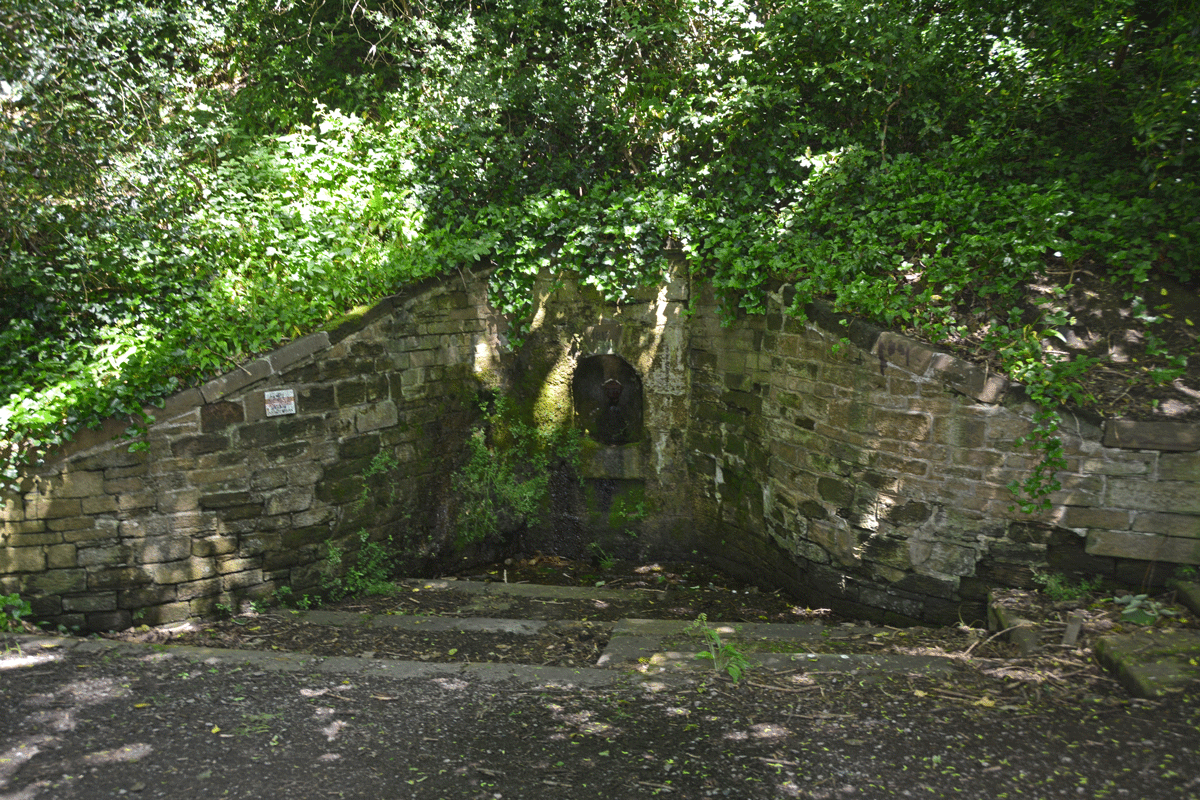
Hyssop Holme Well (Carlisle) submitted by Anne T on 5th Jun 2022. The well was in deep shade at the time of our visit. A slow, steady trickle of water emerged from the pipe at the back of the well, trickling down the moss into the small well basin, then out to modern drains to a small pond/water feature.
(View photo, vote or add a comment)
Log Text: Hyssop Holme Well (Carlisle): A very pleasant, short walk down slope to this well house, the sound of wood on willow from the nearby Cricket Ground accompanying our steps. Am trying to trace the Antiquarian history books which mention this site, as I'm trying to ascertain if the well predates the 1817 date on the keystone, and why the water was regarded as a spa in days gone by, and what properties the water had.
Finglandrigg Spa Well (Chalybeate)
Trip No.176 Entry No.2 Date Added: 6th Jun 2022
Site Type: Holy Well or Sacred Spring
Country: England (Cumbria)
Visited: Yes on 4th Jun 2022. My rating: Condition 2 Ambience 3 Access 3
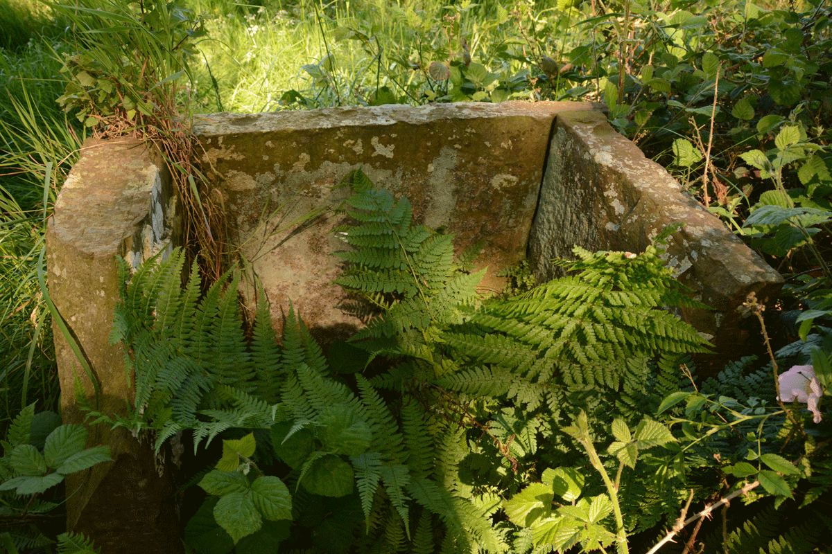
Finglandrigg Spa Well (Chalybeate) submitted by Anne T on 5th Jun 2022. There's nothing left of the information board shown on old photographs of this well. See Heritage and History for photographs taken in 2009.
(View photo, vote or add a comment)
Log Text: Finglandrigg Spa Well: A very pleasant walk through this nature reserve, although the well is not where the published map says it is. In the end, we walked round and round, then tried to find a spot with a phone signal so we could find a rough grid reference, which we acquired from the Old Cumbria Gazetteer. Some 50m from the published path, down a grassy 'lane'. Ruined, but ticked this one off the list. Am trying to trace what properties this water had, and added the nearby Toddel Well to my list of places to visit in the near future.
