Contributory members are able to log private notes and comments about each site
Sites Andy B has logged. View this log as a table or view the most recent logs from everyone
National Museum of Ireland
Date Added: 4th Apr 2012
Site Type: Museum
Country: Ireland (Republic of) (Co. Dublin)
Visited: Yes on 23rd Feb 2011
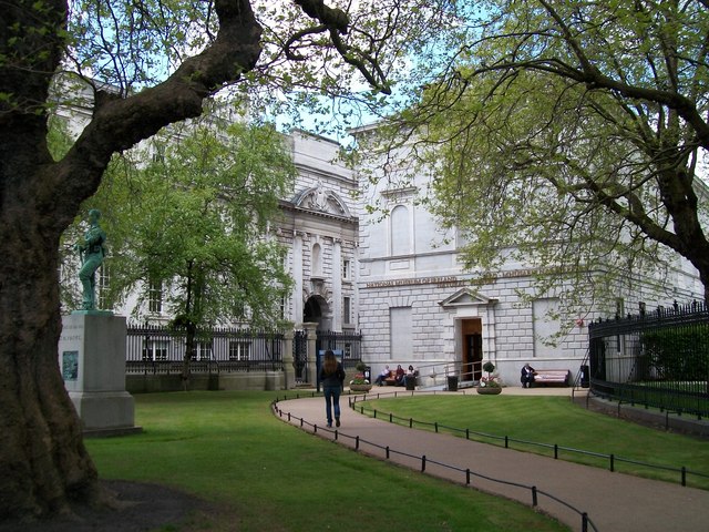
National Museum of Ireland submitted by Creative Commons on 23rd Feb 2011. The Natural History Galleries of the National Museum of Ireland in Upper Merrion Street
Copyright Eric Jones and licensed for reuse under the Creative Commons Licence.
(View photo, vote or add a comment)
Log Text: None
Teteles de Santo Nombre
Date Added: 4th Apr 2012
Site Type: Ancient Village or Settlement
Country: Mexico (Puebla)
Visited: Yes on 26th Feb 2011
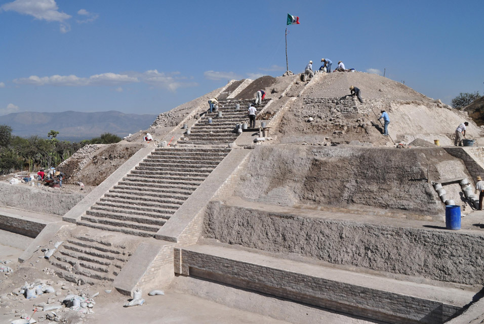
Santo Nombre submitted by Andy B on 26th Feb 2011. Consolidation works at the Pyramid of the Snails. Photo copyright: DMC INAH (M. Tapia.)
(View photo, vote or add a comment)
Log Text: None
Pen-y-Crug Hillfort
Date Added: 4th Apr 2012
Site Type: Hillfort
Country: Wales (Powys)
Visited: Yes on 27th Feb 2011
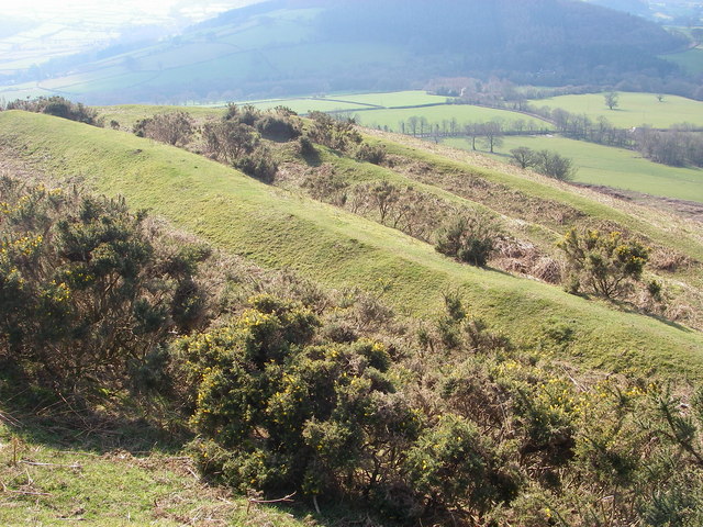
Pen-y-Crug Hillfort submitted by Creative Commons on 27th Feb 2011. The impressive Iron Age hillfort at Pen-y-crug just west of Brecon provides commanding views over the surrounding countryside. It was defended by multiple banks and ditches as seen here.
Copyright Alan Bowring and licensed for reuse under the Creative Commons Licence.
(View photo, vote or add a comment)
Log Text: None
Slwch Camp
Date Added: 4th Apr 2012
Site Type: Hillfort
Country: Wales (Powys)
Visited: Yes on 27th Feb 2011
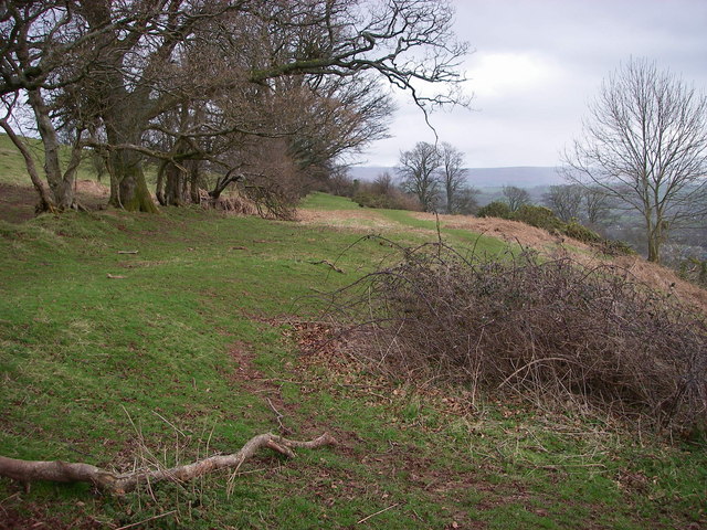
Slwch Camp submitted by Andy B on 27th Feb 2011. Slwch Tump
This level bench in the hillside is the southern edge of the hillfort which sits above and immediately east of Brecon/Aberhonddu. It is one of three hillforts which surround the town. Slwch Tump and nearby Pen-y-crug are accessible by public rights of way.
Copyright Alan Bowring and licensed for reuse under the Creative Commons Licence.
(View photo, vote or add a comment)
Log Text: None
Clochafarmore
Date Added: 4th Apr 2012
Site Type: Standing Stone (Menhir)
Country: Ireland (Republic of) (Co. Louth)
Visited: Yes on 5th Mar 2011
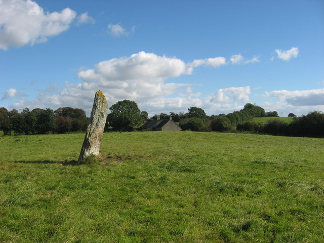
Clochafarmore submitted by Andy B on 5th Mar 2011. Standing stone at Rathiddy
'Cloch an Fhir Mhoir', the stone of the big man, stands 2.9m high and is associated with the death of Cú Chulainn.
Copyright Kieran Campbell and licensed for reuse under the Creative Commons Licence
(View photo, vote or add a comment)
Log Text: None
Ringmoor Down Stone Row
Date Added: 4th Apr 2012
Site Type: Multiple Stone Rows / Avenue
Country: England (Devon)
Visited: Yes on 5th Mar 2011
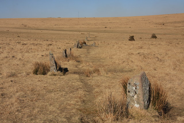
Ringmoor Down Stone Row submitted by Creative Commons on 5th Mar 2011. Ringmoor Down Stone Row
This row was apparently subject to an ill advised restoration in 1909 and as a result little is known as to its original length or format.
Copyright Guy Wareham and licensed for reuse under the Creative Commons Licence.
(View photo, vote or add a comment)
Log Text: None
Wigford Down 1
Date Added: 4th Apr 2012
Site Type: Stone Circle
Country: England (Devon)
Visited: Yes on 5th Mar 2011
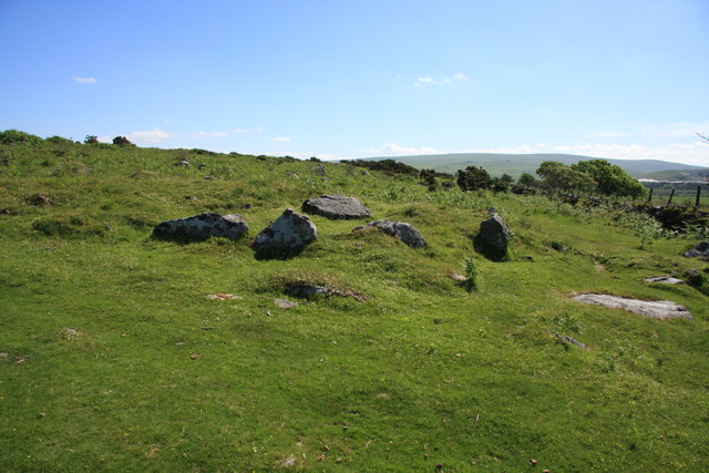
Wigford Down 1 submitted by Andy B on 5th Mar 2011. Cairn and Cist. at SX 544 644. On the edge of Wigford Down, about a third of the retaining stone circle still exists and the chamber has all four sides with a displaced capstone.
Copyright Guy Wareham and licensed for reuse under the Creative Commons Licence.
(View photo, vote or add a comment)
Log Text: None
Green Hill - Stall Moor
Date Added: 4th Apr 2012
Site Type: Stone Row / Alignment
Country: England (Devon)
Visited: Yes on 5th Mar 2011
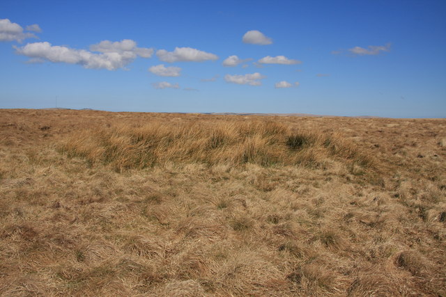
Green Hill - Stall Moor submitted by Andy B on 5th Mar 2011. The cairn on Green Hill
Viewed from the south-east the vegetation obscures all the stones.
Copyright Guy Wareham and licensed for reuse under this Creative Commons Licence.
(View photo, vote or add a comment)
Log Text: None
Western White Barrow
Date Added: 4th Apr 2012
Site Type: Cairn
Country: England (Devon)
Visited: Yes on 5th Mar 2011
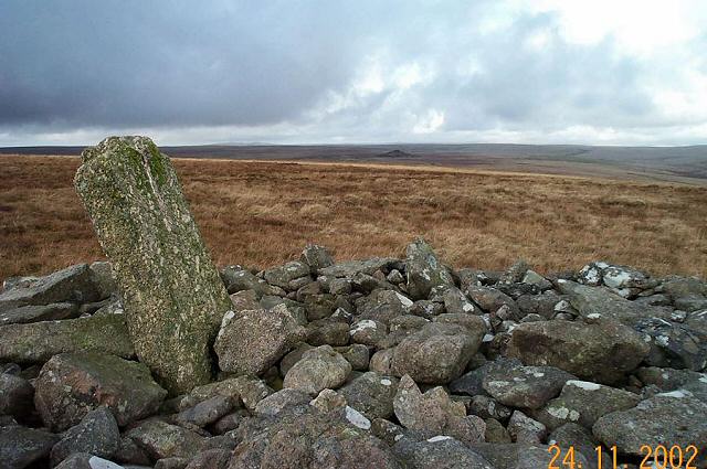
Western White Barrow submitted by Andy B on 5th Mar 2011. Petre's Cross - South Dartmoor
The shaft of Petre's cross at Western Whitebarrow. The tip of Red Lake is in the background. The rocks are part of a crude shelter built into the ancient barrow by 19th century peat workers. This is a very exposed place and in bad weather would be a grim place to stay.
Copyright Richard Knights and licensed for reuse under this Creative Commons Licence.
(View photo, vote or add a comment)
Log Text: None
Chankillo Fortress
Date Added: 4th Apr 2012
Site Type: Ancient Temple
Country: Peru
Visited: Yes on 6th Mar 2011
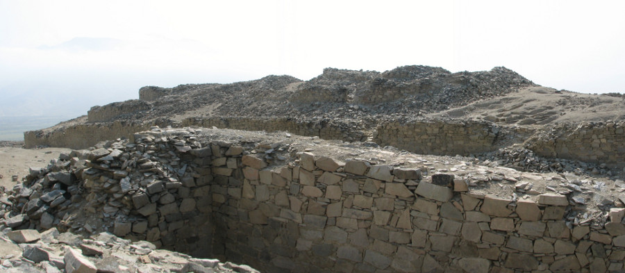
Chankillo Fortress submitted by Andy B on 6th Mar 2011. Chankillo Fortress in Peru
(View photo, vote or add a comment)
Log Text: None
Roman Ridge (Rotherham)
Date Added: 4th Apr 2012
Site Type: Misc. Earthwork
Country: England (Yorkshire (South))
Visited: Yes on 9th Mar 2011

Roman Ridge (Rotherham) submitted by Andy B on 9th Mar 2011. Yvonne Luke from English Heritage, and Richard Fulbook the landowner in Swinton Woods. They are standing on top of a ramp constructed by mountain bikers with soil dug from the 2,500 year old Roman Ridge, pictured behind.
Image © English Heritage
(View photo, vote or add a comment)
Log Text: None
Suisgill Broch
Date Added: 4th Apr 2012
Site Type: Broch or Nuraghe
Country: Scotland (Sutherland)
Visited: Yes on 12th Mar 2011

Suisgill Broch submitted by Creative Commons on 12th Mar 2011. Ruins of a broch with the modern Corbuie beyond, across the river.
Copyright Richard Webb and licensed for reuse under the Creative Commons Licence.
(View photo, vote or add a comment)
Log Text: None
Kilearnan Broch
Date Added: 4th Apr 2012
Site Type: Broch or Nuraghe
Country: Scotland (Sutherland)
Visited: Yes on 12th Mar 2011
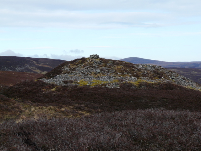
Kilearnan Broch submitted by Andy B on 12th Mar 2011. Remains of a broch near Killearnan
Copyright sylvia duckworth and licensed for reuse under the Creative Commons Licence.
(View photo, vote or add a comment)
Log Text: None
Bail of A' Chairn
Date Added: 4th Apr 2012
Site Type: Broch or Nuraghe
Country: Scotland (Caithness)
Visited: Yes on 12th Mar 2011
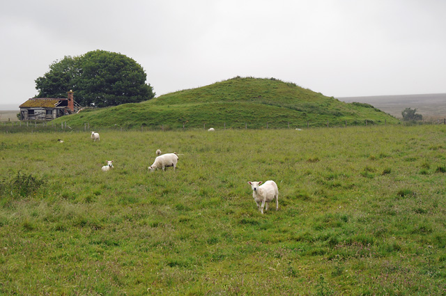
Bail of A' Chairn submitted by Creative Commons on 12th Mar 2011. Bail a' Chairn Broch
Copyright Peter Gamble and licensed for reuse under this Creative Commons Licence.
(View photo, vote or add a comment)
Log Text: None
Bouilag
Date Added: 4th Apr 2012
Site Type: Stone Circle
Country: Scotland (Caithness)
Visited: Yes on 12th Mar 2011
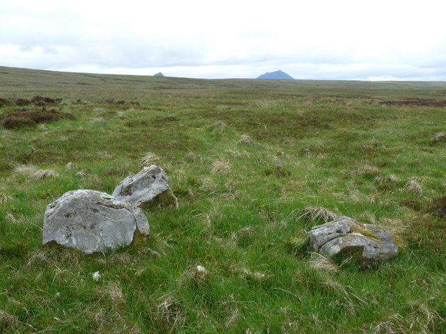
Bouilag submitted by Andy B on 12th Mar 2011. Four poster stone circle near Achnaclyth
Only three stones remain. They are 0.5 to 0.6m high and are aligned NW-SE.
On the horizon the tip of Maiden Pap can just be seen along with Morven.
Copyright Claire Pegrum and licensed for reuse under the Creative Commons Licence.
(View photo, vote or add a comment)
Log Text: None
Tiantulloch
Date Added: 4th Apr 2012
Site Type: Broch or Nuraghe
Country: Scotland (Caithness)
Visited: Yes on 12th Mar 2011
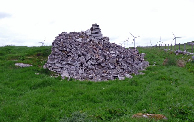
Tiantulloch submitted by Creative Commons on 12th Mar 2011. Broch, Houstry
This broch lies approximately 200m to the west of the one marked on OS maps.
Copyright Claire Pegrum and licensed for reuse under the Creative Commons Licence.
(View photo, vote or add a comment)
Log Text: None
Scorriclet
Date Added: 4th Apr 2012
Site Type: Broch or Nuraghe
Country: Scotland (Caithness)
Visited: Yes on 12th Mar 2011
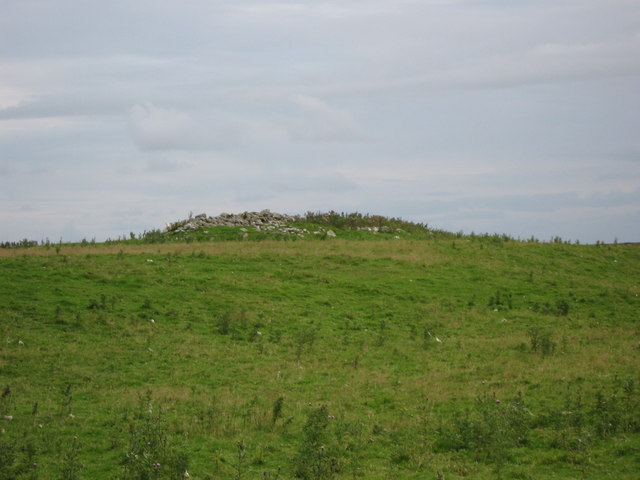
Scorriclet submitted by Creative Commons on 12th Mar 2011. Scorriclet 'Pict's house site' (Broch)
A mound, approximately 24.0m long, 10.0m wide and 2.0m high, locally called a Pict's house site but according to the Royal Commission on the Ancient and Historical Monuments of Scotland (RCAHMS), most likely the remains of an Iron Age Broch.
Copyright Paul Simonite and licensed for reuse under this Creative Commons Licence.
(View photo, vote or add a comment)
Log Text: None
Knock Stone Circle
Date Added: 4th Apr 2012
Site Type: Modern Stone Circle etc
Country: Scotland (West Lothian)
Visited: Yes on 12th Mar 2011
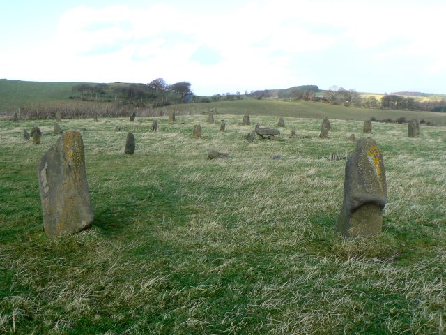
Knock Stone Circle submitted by Andy B on 12th Mar 2011. The stones themselves are ancient, and with their lichen-covered appearance seem to have been here in this archaeology-rich countryside since time immemorial. But appearances are deceptive. These two concentric cicles of standing stones (comprising 50 massive stones in all, with one horizontal stone supported on three vertical ones at the centre of the circles) were erected here, not by neolithic ancestors of ours, but as recently as 1998 by the son of a local farmer who built it as a 50th birth...
(View photo, vote or add a comment)
Log Text: None
Chanctonbury Ring
Date Added: 4th Apr 2012
Site Type: Hillfort
Country: England (West Sussex)
Visited: Yes on 19th Mar 2011
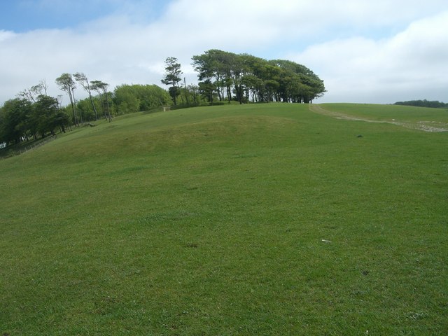
Chanctonbury Ring submitted by Creative Commons on 19th Mar 2011. Chanctonbury Hill Tumulus TQ 1373 1202
Looking East to Chanctonbury Ring, shows the most prominent Tumulus and to the right, the South Downs Way.
The 'Whaleback' nature of the ridge is clearly shown.
The trees of the ring were planted in the 'ring' of the hill fort by Charles Goring in the C18; devastated in the storm of 1987 they are now being replanted.
Copyright Peter Cox and licensed for reuse under the Creative Commons Licence.
(View photo, vote or add a comment)
Log Text: None
Chanctonbury Hill Cross Dyke
Date Added: 4th Apr 2012
Site Type: Misc. Earthwork
Country: England (West Sussex)
Visited: Yes on 19th Mar 2011
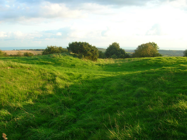
Chanctonbury Hill Cross Dyke submitted by Andy B on 19th Mar 2011. Cross Dyke, Chanctonbury Hill
A ditch possibly associated with the Iron Age fort nearby. Viewed where the South Downs Way crosses it.
Copyright Simon Carey and licensed for reuse under the Creative Commons Licence.
(View photo, vote or add a comment)
Log Text: None
