Contributory members are able to log private notes and comments about each site
Sites 4clydesdale7 has logged. View this log as a table or view the most recent logs from everyone
Haresfield Beacon and Ring
Date Added: 24th Jun 2011
Site Type: Hillfort
Country: England (Gloucestershire)
Visited: Yes on 23rd Jun 2011. My rating: Condition 4 Ambience 4 Access 3
Haresfield Beacon and Ring submitted by 4clydesdale7 on 24th Jun 2011. From the same spot looking NNW over the inside of the Fort
(View photo, vote or add a comment)
Log Text: Well worth a visit on a clear weekday - superb views
Crippet's Barrow
Date Added: 24th Jun 2011
Site Type: Chambered Tomb
Country: England (Gloucestershire)
Visited: Yes on 23rd Jun 2011. My rating: Condition 3 Ambience 5 Access 4
Crippet's Barrow submitted by Celia_Haddon on 3rd Nov 2004. CRIPPETS OR SHURDINGTON BARROW, COBERLEY. SO 9342 1737
A surprisingly high long barrow made into a landscape feature by Scots pines planted on it in l890, just off a footpath. Planting up barrow protects from the plough, even tree roots destroy the barrow features. The area is still called Barrow piece. At the east end, which was excavated before l779, a flat stone is all that is visible now. In “Archeological Handbook of the county of Gloucester” of 1883 G.B. Witts wrotethat the early exc...
(View photo, vote or add a comment)
Log Text: This could be my favourite - quite easy to get to -
Juniper Hill
Date Added: 25th Jun 2011
Site Type: Misc. Earthwork
Country: England (Gloucestershire)
Visited: Yes on 25th Jun 2011. My rating: Condition 3 Ambience 4 Access 3
Juniper Hill submitted by 4clydesdale7 on 25th Jun 2011. From the N down E side.
(View photo, vote or add a comment)
Log Text: These Cross Dykes are quite interesting - particularly figuring out why they were positioned where they are now found - where does this one protect - probably from attack from up the small combe to the West but where in the East?
Westwood (Gloucestershire)
Date Added: 25th Jun 2011
Site Type: Chambered Tomb
Country: England (Gloucestershire)
Visited: Yes on 25th Jun 2011. My rating: Condition 2 Ambience 4 Access 3
Westwood (Gloucestershire) submitted by 4clydesdale7 on 25th Jun 2011. Probably the best view from SSW.
(View photo, vote or add a comment)
Log Text: Nice setting - loads of damage to Barrow - covered in brambles
Money Tump
Date Added: 25th Jun 2011
Site Type: Round Barrow(s)
Country: England (Gloucestershire)
Visited: Yes on 25th Jun 2011. My rating: Condition 2 Ambience 3 Access 4
Money Tump submitted by 4clydesdale7 on 25th Jun 2011. The tump itself from the E - as you can see it's not in a brilliant condition.
(View photo, vote or add a comment)
Log Text: Easy to find and to get to - should be another bowl barrow in next field - but no sign
Dyrham and Hinton
Date Added: 1st Jul 2011
Site Type: Chambered Tomb
Country: England (Gloucestershire)
Visited: Yes on 30th Jun 2011. My rating: Condition -1 Ambience 2 Access 5
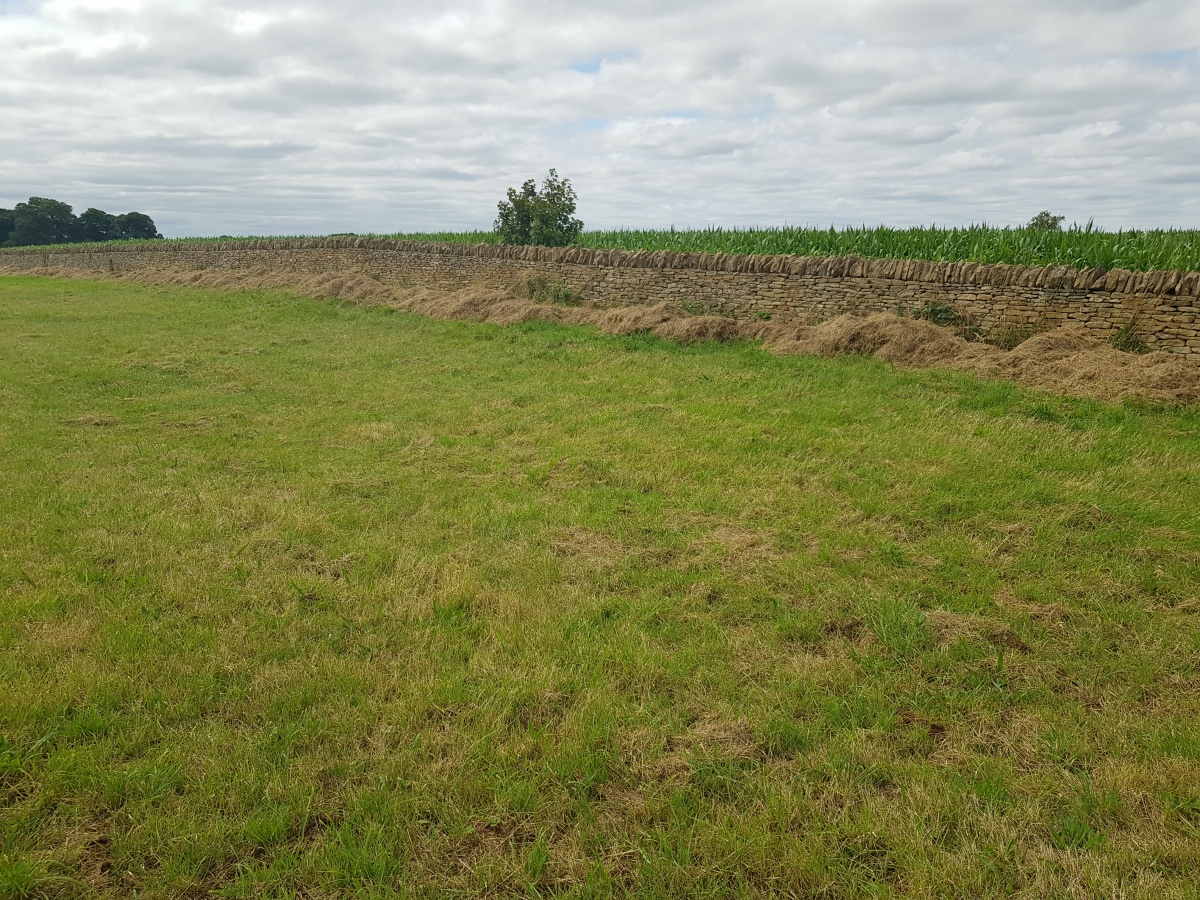
Dyrham and Hinton submitted by dooclay on 11th Aug 2024. Another slight swelling in the right, foreground could also be remnants?
(View photo, vote or add a comment)
Log Text: Easy to locate where it should be but absolutely no evidence of site remaining (seems now to be ploughed out) but Hillfort just down the road (to the West) quite intriguing
Dyrham Camp
Date Added: 1st Jul 2011
Site Type: Hillfort
Country: England (Gloucestershire)
Visited: Yes on 30th Jun 2011. My rating: Condition 3 Ambience 3 Access 4
Dyrham Camp submitted by Thorgrim on 22nd Aug 2003. Dyrham Camp, otherwise known as Hinton Hillfort, is best seen from high land in Dyrham Park (National Trust) Dating from the Iron Age, it was the likely site of the Battle of Dyrham in 577 AD when the Anglo-Saxon Chronicle tells us that the invading Saxons under "Cuthwine and Ceawlin fought against the Britons and slew three kings, Coinmail, Condidan and Farimail at the place which is called Dyrham; and they captured three cities, Gloucester, Cirencester and Bath"
(View photo, vote or add a comment)
Log Text: Limited visit to part of fort to NW of road - whetted my appetite for a return for more detailed inspection
Tormarton 1
Date Added: 1st Jul 2011
Site Type: Long Barrow
Country: England (Gloucestershire)
Visited: Yes on 30th Jun 2011. My rating: Ambience 3 Access 4
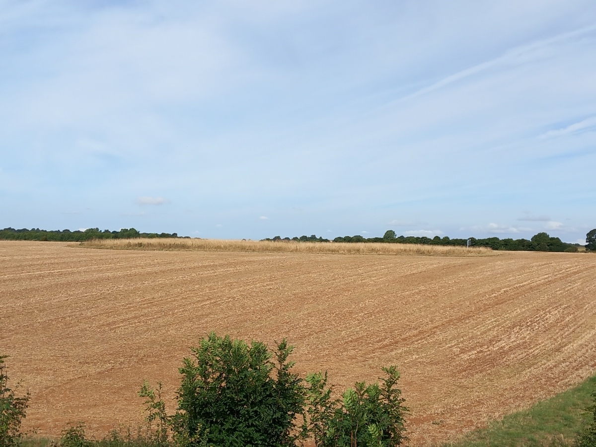
Tormarton 1 submitted by dooclay on 28th Aug 2022. unploughed (currently) area in which the barrow is located - from the road
(View photo, vote or add a comment)
Log Text: Summer visit no marks in crop to confirm position - relied on OS Explorer which also showed accurately Fox Covert a site 'just across the road'
Fox Covert NW
Date Added: 1st Jul 2011
Site Type: Chambered Tomb
Country: England (Wiltshire)
Visited: Yes on 30th Jun 2011. My rating: Condition 3 Ambience 3 Access 4
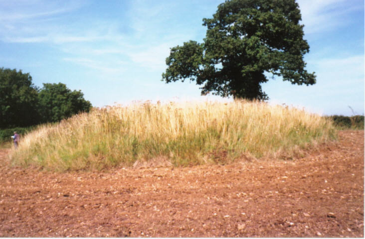
Fox Covert NW submitted by hamish on 9th Feb 2004. ST781779. Tormarton. Chambered Tomb.
I don't know if you mean this one, but the ref. is very close. There is a ploughed out tumulus just east of this. I couldn't see anything across the road, so I presume this is it. I was here on a warm late summer day with swallows and loads of insects after my sweat. It is a great site. It is also just through the farm gate.
(View photo, vote or add a comment)
Log Text: As to be expected on Summer visit site heavily overgrown - pity about the electricity pylons to the S
Giant's Caves
Date Added: 1st Jul 2011
Site Type: Chambered Cairn
Country: England (Wiltshire)
Visited: Yes on 30th Jun 2011. My rating: Condition 3 Ambience 4 Access 4
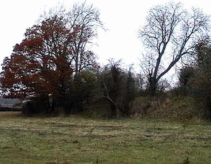
Giant's Caves submitted by Thorgrim on 13th Nov 2003. A beautiful long barrow at ST 820830 near Luckington. In the grounds of Badminton Park, but clearly visible from the lane.
(View photo, vote or add a comment)
Log Text: The approach from Badminton Village springs a beautiful surprise as you meet the T-junction (with footpath/track going to S) shown on the map even more so in summer on a late sunny evening - lots to investigate with many stones around and on the Cairn - probably a veritable 'treasure chest' on careful examination
Parkwood Farm
Date Added: 1st Jul 2011
Site Type: Round Barrow(s)
Country: England (Gloucestershire)
Visited: Yes on 30th Jun 2011. My rating: Condition 2 Ambience 4 Access 4
Parkwood Farm submitted by 4clydesdale7 on 1st Jul 2011. Photo shows site from ESE in lay-by by Stud entrance - Quite tidily kept - some nice older sites in vicinity - the odd good hostelry too
(View photo, vote or add a comment)
Log Text: This came as a surprise when approaching Leighterton from the S late on a sunny summer's evening
West Littleton Down
Date Added: 1st Jul 2011
Site Type: Round Barrow(s)
Country: England (Gloucestershire)
Visited: Yes on 30th Jun 2011. My rating: Ambience 4 Access 2
West Littleton Down submitted by 4clydesdale7 on 1st Jul 2011. Site from NNW
(View photo, vote or add a comment)
Log Text: Just arrived at the wrong time - haymaking in progress meant it was inconvenient to walk to site - but that walk is not short nor is it along footpaths so permission needed
Nan Tow's Tump
Date Added: 1st Jul 2011
Site Type: Round Barrow(s)
Country: England (Gloucestershire)
Visited: Yes on 30th Jun 2011. My rating: Condition 3 Ambience 4 Access 4
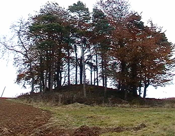
Nan Tow's Tump submitted by Thorgrim on 11th Nov 2003. One of the largest round barrows in Gloucestershire. Nan Tow was a local witch who was buried standing upright in the barrow. It is very dramatic and easy to see from the A46, but there is no convenient place to leave the car. Best bet is to drive down the narrow lane opposite, park where you can and walk back.
(View photo, vote or add a comment)
Log Text: Must return in winter - first visit in height of summer - site heavily overgrown
Whitefield's Tump
Date Added: 1st Jul 2011
Site Type: Long Barrow
Country: England (Gloucestershire)
Visited: Yes on 28th Jun 2011. My rating: Condition 2 Ambience 3 Access 4
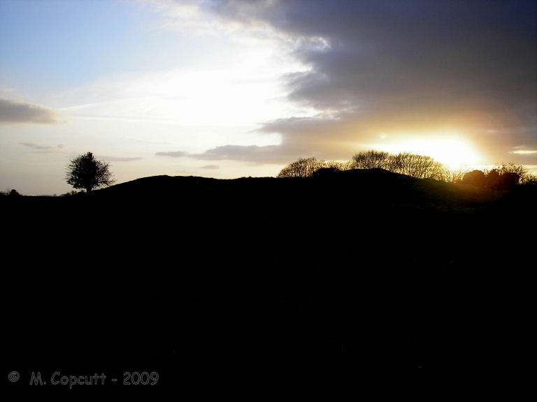
Whitefield's Tump submitted by thecaptain on 9th May 2009. Whitefield's Tump is a largely shapeless remains of a Long Barrow on the northwestern part of Minchinhampton Common.
(View photo, vote or add a comment)
Log Text: Passed by, by many a golfer day in day out (especially in summer) and probably not recognised by the for what it is (no - not an unraked overgrown golf bunker with lots of divot holes!) but a Long Barrow -
Brackenbury Ditches
Date Added: 2nd Jul 2011
Site Type: Promontory Fort / Cliff Castle
Country: England (Gloucestershire)
Visited: Yes on 2nd Jul 2011. My rating: Condition 3 Ambience 4 Access 2
Brackenbury Ditches submitted by 4clydesdale7 on 2nd Jul 2011. Walking up the NW side
(View photo, vote or add a comment)
Log Text: One hell of a climb but well worth it
Damery Camp
Date Added: 3rd Jul 2011
Site Type: Hillfort
Country: England (Gloucestershire)
Visited: Yes on 2nd Jul 2011. My rating: Condition 3 Ambience 4 Access 3
Damery Camp submitted by 4clydesdale7 on 2nd Jul 2011. On approach from NE
(View photo, vote or add a comment)
Log Text: Friendly resident most helpful - I rather liked this site - there was lots of atmosphere
The Toots (Oldbury)
Date Added: 4th Jul 2011
Site Type: Hillfort
Country: England (Gloucestershire)
Visited: Yes on 4th Jul 2011. My rating: Condition 2 Ambience 3 Access 4
The Toots (Oldbury) submitted by 4clydesdale7 on 4th Jul 2011. The best evidence of the Fort - the NNE rampart looking SE
(View photo, vote or add a comment)
Log Text: Lots of evidence but Oldbury Village expansion over many many years has encroached on the Fort making it difficult to get a full picture.
St Arilda's, Oldbury-on-Severn
Date Added: 4th Jul 2011
Site Type: Artificial Mound
Country: England (Gloucestershire)
Visited: Yes on 4th Jul 2011. My rating: Condition 4 Ambience 4 Access 4
St Arilda's, Oldbury-on-Severn submitted by hamish on 1st Apr 2007. St Arilda's Church on the South Gloucestershire levels. The rise it is built on is described as a Tumulus.
(View photo, vote or add a comment)
Log Text: This is in a beautiful spot - no wonder the villagers fought to save it
Oldbury-on-Severn Submerged Forest
Date Added: 4th Jul 2011
Site Type: Natural Stone / Erratic / Other Natural Feature
Country: England (Gloucestershire)
Visited: Yes on 4th Jul 2011. My rating: Access 1
Oldbury-on-Severn Submerged Forest submitted by 4clydesdale7 on 4th Jul 2011. As I stated like Atlantis risng
(View photo, vote or add a comment)
Log Text: It rose like Atlantis from beneath the waves - no chance of getting near it - high security and (every 12 1/2hrs) tides too!
Camp Hill (Rockhampton)
Date Added: 4th Jul 2011
Site Type: Hillfort
Country: England (Gloucestershire)
Visited: Yes on 4th Jul 2011. My rating: Condition 4 Ambience 5 Access 2
Camp Hill (Rockhampton) submitted by 4clydesdale7 on 4th Jul 2011. Halfway along the N side you may meet me under MY tree - I will insist that you look over your shoulder - bivallate etc clearly visible - two deep ditches too
(View photo, vote or add a comment)
Log Text: This site is fabulous - say no more
