


<< Our Photo Pages >> Brent Pelham - Natural Stone / Erratic / Other Natural Feature in England in Hertfordshire
Submitted by Thorgrim on Sunday, 05 March 2006 Page Views: 7555
Natural PlacesSite Name: Brent PelhamCountry: England
NOTE: This site is 4.1 km away from the location you searched for.
County: Hertfordshire Type: Natural Stone / Erratic / Other Natural Feature
Nearest Town: Buntingford Nearest Village: Brent Pelham
Map Ref: TL433307
Latitude: 51.956329N Longitude: 0.083995E
Condition:
| 5 | Perfect |
| 4 | Almost Perfect |
| 3 | Reasonable but with some damage |
| 2 | Ruined but still recognisable as an ancient site |
| 1 | Pretty much destroyed, possibly visible as crop marks |
| 0 | No data. |
| -1 | Completely destroyed |
| 5 | Superb |
| 4 | Good |
| 3 | Ordinary |
| 2 | Not Good |
| 1 | Awful |
| 0 | No data. |
| 5 | Can be driven to, probably with disabled access |
| 4 | Short walk on a footpath |
| 3 | Requiring a bit more of a walk |
| 2 | A long walk |
| 1 | In the middle of nowhere, a nightmare to find |
| 0 | No data. |
| 5 | co-ordinates taken by GPS or official recorded co-ordinates |
| 4 | co-ordinates scaled from a detailed map |
| 3 | co-ordinates scaled from a bad map |
| 2 | co-ordinates of the nearest village |
| 1 | co-ordinates of the nearest town |
| 0 | no data |
Internal Links:
External Links:
")
Massive puddingstone boulder used as war memorial base. Cluster of smaller puddingstones also on site. Are they marker stones or just natural erratics?
You may be viewing yesterday's version of this page. To see the most up to date information please register for a free account.
")
")
")
Do not use the above information on other web sites or publications without permission of the contributor.
Nearby Images from Geograph Britain and Ireland:
©2013(licence)
©2023(licence)
©2007(licence)
©2006(licence)
©2005(licence)
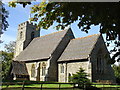
The above images may not be of the site on this page, they are loaded from Geograph.
Please Submit an Image of this site or go out and take one for us!
Click here to see more info for this site
Nearby sites
Key: Red: member's photo, Blue: 3rd party photo, Yellow: other image, Green: no photo - please go there and take one, Grey: site destroyed
Download sites to:
KML (Google Earth)
GPX (GPS waypoints)
CSV (Garmin/Navman)
CSV (Excel)
To unlock full downloads you need to sign up as a Contributory Member. Otherwise downloads are limited to 50 sites.
Turn off the page maps and other distractions
Nearby sites listing. In the following links * = Image available
2.3km NW 323° Anstey Cursus Cursus (TL41863249)
4.0km ENE 74° Clavering Castle* Misc. Earthwork (TL471319)
5.0km S 171° Patmore Heath* Marker Stone (TL44262581)
5.6km NW 313° Barkway Golf Club hoard Ancient Mine, Quarry or other Industry (TL3908434456)
6.4km NE 55° Arkesden Puddingstones* Natural Stone / Erratic / Other Natural Feature (TL485345)
8.2km ENE 73° Wicken Bonhunt Puddingstone* Natural Stone / Erratic / Other Natural Feature (TL511334)
8.6km N 11° Chrishall hoard Ancient Mine, Quarry or other Industry (TL4465339161)
9.2km ENE 74° Newport Puddingstone* Natural Stone / Erratic / Other Natural Feature (TL521335)
9.3km S 188° Caley Wood Misc. Earthwork (TL422215)
9.3km SSW 209° Standon Puddingstone* Standing Stone (Menhir) (TL390224)
9.5km WNW 286° Sandon Cursus Cursus (TL3409733124)
9.6km ENE 66° Leper Stone* Standing Stone (Menhir) (TL520349)
9.8km ESE 113° Ugley Green Puddingstone* Natural Stone / Erratic / Other Natural Feature (TL5242327126)
10.0km E 83° Widdington Puddingstone* Natural Stone / Erratic / Other Natural Feature (TL532322)
10.2km NNW 328° Whiteley Hill Barrow Cemetery Barrow Cemetery (TL3760739122)
10.2km NNW 328° Whiteley Hill Springfield style enclosure Ancient Village or Settlement (TL3760739122)
10.2km NW 321° Reed Round Barrows Round Barrow(s) (TL36613844)
10.3km ENE 58° Mutlow Hill Round Barrow(s) (TL5193236381)
10.8km SE 139° Birchanger* Early Christian Sculptured Stone (TL507228)
11.1km SSE 151° Glasscock Stone* Natural Stone / Erratic / Other Natural Feature (TL4894821169)
11.1km NE 49° Ring Hill (Essex) Hillfort (TL515382)
11.6km W 265° Cottered Stones* Natural Stone / Erratic / Other Natural Feature (TL318293)
11.8km NNW 337° Five Hill Barrow Cemetery (TL3836341431)
11.9km WNW 300° Orwellbury Holy Well or Sacred Spring (TL3279836387)
11.9km E 79° Debden Pudding Stone* Natural Stone / Erratic / Other Natural Feature (TL550333)
View more nearby sites and additional images


 We would like to know more about this location. Please feel free to add a brief description and any relevant information in your own language.
 Wir möchten mehr über diese Stätte erfahren. Bitte zögern Sie nicht, eine kurze Beschreibung und relevante Informationen in Deutsch hinzuzufügen.
 Nous aimerions en savoir encore un peu sur les lieux. S'il vous plaît n'hesitez pas à ajouter une courte description et tous les renseignements pertinents dans votre propre langue.
 Quisieramos informarnos un poco más de las lugares. No dude en añadir una breve descripción y otros datos relevantes en su propio idioma.