<< Our Photo Pages >> The Dod - Ancient Village or Settlement in Scotland in Scottish Borders
Submitted by Anne T on Monday, 05 June 2017 Page Views: 2075
Multi-periodSite Name: The DodCountry: Scotland County: Scottish Borders Type: Ancient Village or Settlement
Nearest Town: Hawick Nearest Village: Priesthaugh
Map Ref: NT47260600
Latitude: 55.345186N Longitude: 2.833157W
Condition:
| 5 | Perfect |
| 4 | Almost Perfect |
| 3 | Reasonable but with some damage |
| 2 | Ruined but still recognisable as an ancient site |
| 1 | Pretty much destroyed, possibly visible as crop marks |
| 0 | No data. |
| -1 | Completely destroyed |
| 5 | Superb |
| 4 | Good |
| 3 | Ordinary |
| 2 | Not Good |
| 1 | Awful |
| 0 | No data. |
| 5 | Can be driven to, probably with disabled access |
| 4 | Short walk on a footpath |
| 3 | Requiring a bit more of a walk |
| 2 | A long walk |
| 1 | In the middle of nowhere, a nightmare to find |
| 0 | No data. |
| 5 | co-ordinates taken by GPS or official recorded co-ordinates |
| 4 | co-ordinates scaled from a detailed map |
| 3 | co-ordinates scaled from a bad map |
| 2 | co-ordinates of the nearest village |
| 1 | co-ordinates of the nearest town |
| 0 | no data |
Internal Links:
External Links:
I have visited· I would like to visit
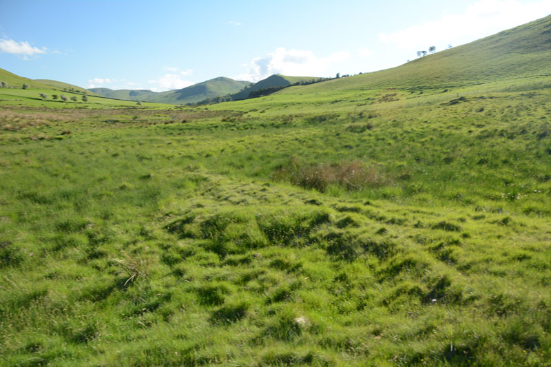
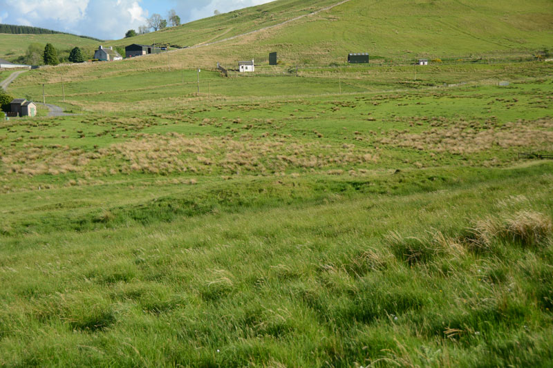
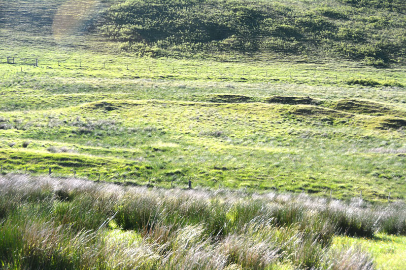
Anne T visited on 3rd Jun 2017 - their rating: Cond: 2 Amb: 4 Access: 5 The Dod, near Bugh Hill Stone Circle and Hillfort: It was amazing what could be seen of this site from the slope just below Burgh Hill Stone Circle. Looking at the plan on Canmore, it is cut in two by the syke by the farm to it's south, but what remains, looking at the settlement from the road, are deep ditches and reasonably high banks.
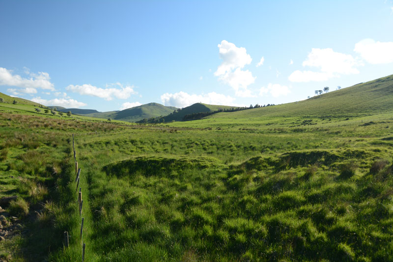
The area is boggy, but the settlement can be reached by entering the field at its north-eastern end, walking westwards along the fence line next to the gate, then cutting across the field at the far end. For those not keen on boggy ground, a lot can be seen from the road.
Thankfully (after Burgh Hill Hillfort) The Dod was not windy! The sun was very strong at the time of our arrival here, and I struggled to avoid flare even using a polaroid and UV filters together. Was really pleased to have seen this site, but with so many other settlements and hill forts in the area, how to fit them all in? We decided to call it a day, calling in at Midshiels Standing Stone and Cairn on the way back home.
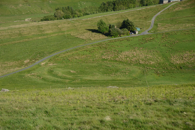
Walking just down the slope from Burgh Hill Stone Circle and looking towards the south east, the outline of this settlement springs out of the fields below. It is largely oval, occupies level ground in what is now pasture and is divided into two by an in-named syke. The northern part of the site is more easily discerned than the part of the settlement to the south of the syke.
The Dod is described in Canmore ID 54060, which says this is: "the fragmentary remains of (this) sub-oval earthwork occupy a non-defensive position, overlooked by Burgh Hill on the NE and facing level ground on the other three sides, in rough pasture at a height of 700 ft OD." Canmore describes the sub-oval enclosure as being 115 ft by 55 ft internally, with all banks being formed of upcast material from the ditches.
In 1979, an inspection reported that the site "is under threat of destruction by the land-owner and the site is being currently excavated by the Scottish Development Department." No further details are given, but the site still remains much as described by Canmore almost 40 years later.
You may be viewing yesterday's version of this page. To see the most up to date information please register for a free account.
Do not use the above information on other web sites or publications without permission of the contributor.
Click here to see more info for this site
Nearby sites
Key: Red: member's photo, Blue: 3rd party photo, Yellow: other image, Green: no photo - please go there and take one, Grey: site destroyed
Download sites to:
KML (Google Earth)
GPX (GPS waypoints)
CSV (Garmin/Navman)
CSV (Excel)
To unlock full downloads you need to sign up as a Contributory Member. Otherwise downloads are limited to 50 sites.
Turn off the page maps and other distractions
Nearby sites listing. In the following links * = Image available
346m NW 313° Burgh Hill Stone Circle* Stone Circle (NT47010624)
476m WNW 289° Burgh Hill Hillfort* Hillfort (NT46810616)
3.1km NNE 12° Ca Knowe (Hawick)* Cairn (NT4793409075)
3.7km NNE 12° Lord's Tree (Hawick)* Cairn (NT48090957)
6.5km ENE 74° Stonedge Stone Circle (NT536077)
6.9km NNW 331° Whitcastle Sike* Ancient Village or Settlement (NT44011207)
7.2km NNW 333° Whitcastle Hill* Hillfort (NT44101245)
8.5km NNE 18° Hawick Mote* Misc. Earthwork (NT4994314073)
8.8km NNW 336° Borthwick Mains Class I Pictish Symbol Stone (NT4372814111)
9.8km SSE 152° Ninestanes Rig* Stone Circle (NY51809731)
10.3km SSE 161° The Buck Stone (Buckstone Rig)* Standing Stone (Menhir) (NY50509622)
11.2km WSW 238° Wrangway Burn* Rock Art (NT377001)
11.3km ENE 57° Hawthornside Farm (Bonchester Bridge)* Holy Well or Sacred Spring (NT5678612089)
11.8km NE 34° Cavers Cross* Ancient Cross (NT54071564)
13.2km NNE 27° Midshiels Cairn* Cairn (NT53311770)
13.2km NNE 27° Midshiels Standing Stone* Standing Stone (Menhir) (NT53391774)
13.3km SE 124° Caddrounburn Calvert* Ancient Village or Settlement (NY58199836)
14.4km NE 48° Rubers Law* Hillfort (NT58031557)
15.5km WNW 302° Black Rig Standing Stone (Menhir) (NT34151437)
16.4km SW 215° Grey Wether Meikledale Standing Stone (Menhir) (NY3761692734)
16.4km SSE 166° Old Castleton (Newcastleton)* Misc. Earthwork (NY50978997)
16.5km ENE 78° Southdean Law* Hillfort (NT63500938)
16.6km SSE 166° Castleton (Newcastleton)* Ancient Cross (NY51108983)
17.1km NE 45° Bedrule Sculptured Stone (NT59501793)
17.3km ESE 108° The Kielder Stone* Natural Stone / Erratic / Other Natural Feature (NT63690050)
View more nearby sites and additional images


 We would like to know more about this location. Please feel free to add a brief description and any relevant information in your own language.
 Wir möchten mehr über diese Stätte erfahren. Bitte zögern Sie nicht, eine kurze Beschreibung und relevante Informationen in Deutsch hinzuzufügen.
 Nous aimerions en savoir encore un peu sur les lieux. S'il vous plaît n'hesitez pas à ajouter une courte description et tous les renseignements pertinents dans votre propre langue.
 Quisieramos informarnos un poco más de las lugares. No dude en añadir una breve descripción y otros datos relevantes en su propio idioma.