

<< Text Pages >> Dallcharn - Broch or Nuraghe in Scotland in Sutherland
Submitted by SolarMegalith on Sunday, 27 March 2011 Page Views: 4527
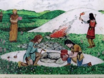
Iron Age and Later PrehistorySite Name: DallcharnCountry: Scotland
NOTE: This site is 2.9 km away from the location you searched for.
County: Sutherland Type: Broch or Nuraghe
Map Ref: NC62105875
Latitude: 58.495054N Longitude: 4.367652W
Condition:
| 5 | Perfect |
| 4 | Almost Perfect |
| 3 | Reasonable but with some damage |
| 2 | Ruined but still recognisable as an ancient site |
| 1 | Pretty much destroyed, possibly visible as crop marks |
| 0 | No data. |
| -1 | Completely destroyed |
| 5 | Superb |
| 4 | Good |
| 3 | Ordinary |
| 2 | Not Good |
| 1 | Awful |
| 0 | No data. |
| 5 | Can be driven to, probably with disabled access |
| 4 | Short walk on a footpath |
| 3 | Requiring a bit more of a walk |
| 2 | A long walk |
| 1 | In the middle of nowhere, a nightmare to find |
| 0 | No data. |
| 5 | co-ordinates taken by GPS or official recorded co-ordinates |
| 4 | co-ordinates scaled from a detailed map |
| 3 | co-ordinates scaled from a bad map |
| 2 | co-ordinates of the nearest village |
| 1 | co-ordinates of the nearest town |
| 0 | no data |
Internal Links:
External Links:
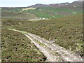
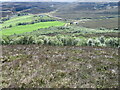
Broch in Sutherland
Remains of a broch preserved as a mound of 20 m diameter and height of 2 m.
Read More at ScotlandsPlaces.
You may be viewing yesterday's version of this page. To see the most up to date information please register for a free account.
Do not use the above information on other web sites or publications without permission of the contributor.
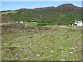
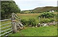
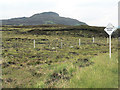
Nearby Images from Geograph Britain and Ireland:
©2009(licence)
©2022(licence)
©2007(licence)
©2021(licence)
©2021(licence)
The above images may not be of the site on this page, they are loaded from Geograph.
Please Submit an Image of this site or go out and take one for us!
Click here to see more info for this site
Nearby sites
Key: Red: member's photo, Blue: 3rd party photo, Yellow: other image, Green: no photo - please go there and take one, Grey: site destroyed
Download sites to:
KML (Google Earth)
GPX (GPS waypoints)
CSV (Garmin/Navman)
CSV (Excel)
To unlock full downloads you need to sign up as a Contributory Member. Otherwise downloads are limited to 50 sites.
Turn off the page maps and other distractions
Nearby sites listing. In the following links * = Image available
2.3km NNW 343° Scullomie Broch or Nuraghe (NC615610)
4.0km E 88° Borgie Stone Rows* Multiple Stone Rows / Avenue (NC66135874)
5.5km E 82° Borgie Souterrain* Souterrain (Fogou, Earth House) (NC67625929)
6.4km ENE 59° Torrisdail Broch or Nuraghe (NC67736185)
7.1km ENE 66° Dun Riaskidh* Chambered Cairn (NC68766140)
7.7km NW 311° West Strathan* Broch or Nuraghe (NC56456401)
7.8km NW 311° West Strathan Carving (Melness) Rock Art (NC5642864084)
7.9km ENE 72° Baile Mhargaite* Broch or Nuraghe (NC6973560973)
8.0km SW 218° Grianan Cup and Ring marked Stone Rock Art (NC56935262)
8.1km ENE 70° Baile Mhargaite Enclosure 1 Ancient Village or Settlement (NC6984361228)
8.1km ENE 71° Baile Mhargaite Cist 1* Cist (NC6990861102)
8.4km SW 222° Kinloch Lodge Carved Stone Sculptured Stone (NC5620952749)
8.4km SW 222° Kinloch Cup marked Stone* Rock Art (NC5619952707)
8.9km SW 228° Dun Mhaigh* Broch or Nuraghe (NC55225303)
9.2km ENE 74° Cai Dun Broch or Nuraghe (NC7161)
9.3km E 84° Achcoillenaborgie Broch or Nuraghe (NC71395942)
9.4km SW 227° Kinloch Chambered Cairn Chambered Cairn (NC54975262)
9.4km E 86° Coille na Borgie* Chambered Cairn (NC7154359000)
9.9km ENE 67° Farr Stone* Class II Pictish Symbol Stone (NC71436225)
10.2km E 96° Skelpick Stone Rows Multiple Stone Rows / Avenue (NC722574)
10.3km E 95° Allt an Duin (Skelpick)* Broch or Nuraghe (NC72355752)
10.3km E 99° Skelpick Chambered Cairn 1* Chambered Cairn (NC72255672)
10.3km ESE 101° Skelpick Chambered Cairn 2 Chambered Cairn (NC72175635)
10.4km E 95° Allt a' Chaisteil* Stone Circle (NC72515756)
10.7km ENE 62° Clerkhill Broch or Nuraghe (NC71756338)
View more nearby sites and additional images


 We would like to know more about this location. Please feel free to add a brief description and any relevant information in your own language.
 Wir möchten mehr über diese Stätte erfahren. Bitte zögern Sie nicht, eine kurze Beschreibung und relevante Informationen in Deutsch hinzuzufügen.
 Nous aimerions en savoir encore un peu sur les lieux. S'il vous plaît n'hesitez pas à ajouter une courte description et tous les renseignements pertinents dans votre propre langue.
 Quisieramos informarnos un poco más de las lugares. No dude en añadir una breve descripción y otros datos relevantes en su propio idioma.