<< Our Photo Pages >> Knockrome east - Standing Stone (Menhir) in Scotland in Isle of Jura
Submitted by Anonymous on Tuesday, 01 October 2002 Page Views: 4675
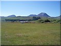
Neolithic and Bronze AgeSite Name: Knockrome eastCountry: Scotland County: Isle of Jura Type: Standing Stone (Menhir)
Map Ref: NR55037148 Landranger Map Number: 61
Latitude: 55.874014N Longitude: 5.917689W
Condition:
| 5 | Perfect |
| 4 | Almost Perfect |
| 3 | Reasonable but with some damage |
| 2 | Ruined but still recognisable as an ancient site |
| 1 | Pretty much destroyed, possibly visible as crop marks |
| 0 | No data. |
| -1 | Completely destroyed |
| 5 | Superb |
| 4 | Good |
| 3 | Ordinary |
| 2 | Not Good |
| 1 | Awful |
| 0 | No data. |
| 5 | Can be driven to, probably with disabled access |
| 4 | Short walk on a footpath |
| 3 | Requiring a bit more of a walk |
| 2 | A long walk |
| 1 | In the middle of nowhere, a nightmare to find |
| 0 | No data. |
| 5 | co-ordinates taken by GPS or official recorded co-ordinates |
| 4 | co-ordinates scaled from a detailed map |
| 3 | co-ordinates scaled from a bad map |
| 2 | co-ordinates of the nearest village |
| 1 | co-ordinates of the nearest town |
| 0 | no data |
Internal Links:
External Links:
")
Canmore site no. 38270.
You may be viewing yesterday's version of this page. To see the most up to date information please register for a free account.
Do not use the above information on other web sites or publications without permission of the contributor.
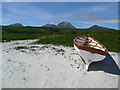
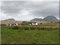
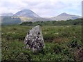
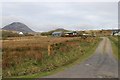
Nearby Images from Geograph Britain and Ireland:
©2014(licence)
©2018(licence)
©2008(licence)
©2019(licence)
©2010(licence)
The above images may not be of the site on this page, they are loaded from Geograph.
Please Submit an Image of this site or go out and take one for us!
Click here to see more info for this site
Nearby sites
Key: Red: member's photo, Blue: 3rd party photo, Yellow: other image, Green: no photo - please go there and take one, Grey: site destroyed
Download sites to:
KML (Google Earth)
GPX (GPS waypoints)
CSV (Garmin/Navman)
CSV (Excel)
To unlock full downloads you need to sign up as a Contributory Member. Otherwise downloads are limited to 50 sites.
![]()
Turn off the page maps and other distractions
Nearby sites listing. In the following links * = Image available
193m WSW 255° Knockrome West* Standing Stone (Menhir) (NR54847144)
1.0km ENE 73° Ardfernal* Natural Stone / Erratic / Other Natural Feature (NR5600971718)
6.2km SSW 214° Carragh a'Ghlinne* Stone Row / Alignment (NR5128566490)
7.4km SSW 202° Sannaig* Stone Row / Alignment (NR51846480)
8.8km SSW 206° Strone Farm* Standing Stones (NR50786375)
9.5km SSW 205° Cladh Chlainn Iain* Chambered Cairn (NR50476315)
10.9km SW 229° Camas An Staca* Standing Stone (Menhir) (NR46416479)
12.2km NNE 24° Tarbert (Jura)* Standing Stone (Menhir) (NR6062782298)
14.5km WSW 250° Scanistle Standing Stone (Menhir) (NR41086724)
15.7km ENE 73° Kilmory Knap* Sculptured Stone (NR703752)
16.0km WSW 256° Finlaggan* Standing Stone (Menhir) (NR3927668559)
16.3km ESE 103° Cretshengan* Standing Stone (Menhir) (NR70726689)
16.4km E 99° Dun Cragach Stone Fort or Dun (NR71086805)
16.4km WSW 240° Mullach Dubh* Standing Stone (Menhir) (NR40366412)
16.5km WSW 243° Knocklearoch* Standing Stones (NR3989164860)
17.4km ESE 111° Kilberry* Sculptured Stone (NR709643)
18.9km SSW 203° Ardtalla Standing Stone (Menhir) (NR46575456)
19.0km WSW 255° Baile Tarbhach Standing Stone (Menhir) (NR36366762)
20.3km W 262° Clach an Tiompain Standing Stone (Menhir) (NR34756977)
20.4km WSW 257° Beinn Cham Standing Stones (NR349679)
20.5km SSW 202° Trudernish* Standing Stone (Menhir) (NR46295290)
20.6km SE 144° Cnoc nan Gobhar Stone* Standing Stone (Menhir) (NR6607454042)
20.7km ENE 72° St Columba's Cave* Cave or Rock Shelter (NR751767)
20.8km ENE 60° Dun Rostan Stone Fort or Dun (NR73628097)
21.1km SSE 147° Kinerarach (Gigha)* Standing Stone (Menhir) (NR6568453210)
View more nearby sites and additional images


 We would like to know more about this location. Please feel free to add a brief description and any relevant information in your own language.
 Wir möchten mehr über diese Stätte erfahren. Bitte zögern Sie nicht, eine kurze Beschreibung und relevante Informationen in Deutsch hinzuzufügen.
 Nous aimerions en savoir encore un peu sur les lieux. S'il vous plaît n'hesitez pas à ajouter une courte description et tous les renseignements pertinents dans votre propre langue.
 Quisieramos informarnos un poco más de las lugares. No dude en añadir una breve descripción y otros datos relevantes en su propio idioma.