 with our Megalithic Portal iPhone app")

<< Our Photo Pages >> Salt Knowe - Round Barrow(s) in Scotland in Orkney
Submitted by howar on Thursday, 03 June 2004 Page Views: 7979
Neolithic and Bronze AgeSite Name: Salt KnoweCountry: Scotland County: Orkney Type: Round Barrow(s)
Nearest Town: Finstown Nearest Village: Stenness
Map Ref: HY293133 Landranger Map Number: 6
Latitude: 59.000931N Longitude: 3.232364W
Condition:
| 5 | Perfect |
| 4 | Almost Perfect |
| 3 | Reasonable but with some damage |
| 2 | Ruined but still recognisable as an ancient site |
| 1 | Pretty much destroyed, possibly visible as crop marks |
| 0 | No data. |
| -1 | Completely destroyed |
| 5 | Superb |
| 4 | Good |
| 3 | Ordinary |
| 2 | Not Good |
| 1 | Awful |
| 0 | No data. |
| 5 | Can be driven to, probably with disabled access |
| 4 | Short walk on a footpath |
| 3 | Requiring a bit more of a walk |
| 2 | A long walk |
| 1 | In the middle of nowhere, a nightmare to find |
| 0 | No data. |
| 5 | co-ordinates taken by GPS or official recorded co-ordinates |
| 4 | co-ordinates scaled from a detailed map |
| 3 | co-ordinates scaled from a bad map |
| 2 | co-ordinates of the nearest village |
| 1 | co-ordinates of the nearest town |
| 0 | no data |
Internal Links:
External Links:
I have visited· I would like to visit
RockHugger visited on 23rd Sep 2016 - their rating: Cond: 4 Amb: 5 Access: 4
Orcinus SandyG DrewParsons NickyD Redfun have visited here
")
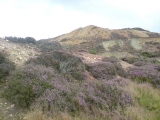
Behind the Ring of Brodgar in the RH corner of the field there is a cist-like structure at the top of this mound, though all I could locate on my visit was the turf-covered edge of a long horizontal slab at the side facing the loch. During an excavation nine pieces of silver 'ring-money' were found.
You may be viewing yesterday's version of this page. To see the most up to date information please register for a free account.
")
")
")
")
")
")
")
")
")
")
")
Do not use the above information on other web sites or publications without permission of the contributor.
Click here to see more info for this site
Nearby sites
Key: Red: member's photo, Blue: 3rd party photo, Yellow: other image, Green: no photo - please go there and take one, Grey: site destroyed
Download sites to:
KML (Google Earth)
GPX (GPS waypoints)
CSV (Garmin/Navman)
CSV (Excel)
To unlock full downloads you need to sign up as a Contributory Member. Otherwise downloads are limited to 50 sites.
Turn off the page maps and other distractions
Nearby sites listing. In the following links * = Image available
111m E 99° South Knowe* Artificial Mound (HY29411328)
158m ENE 70° Ring of Brodgar* Stone Circle (HY29451335)
282m NE 44° Plumcake Mound* Round Barrow(s) (HY295135)
312m ENE 72° Fresh Knowe* Long Barrow (HY29601339)
333m E 86° Comet Stone (Orkney)* Standing Stone (Menhir) (HY2963413318)
344m SSE 156° Fairy Well (Stenness)* Holy Well or Sacred Spring (HY2943212982)
367m S 174° Possible large stone circle in Loch of Stenness Stone Circle (HY2933112934)
564m NW 314° Wasbister Disc Barrow* Round Barrow(s) (HY289137)
564m NW 314° Dyke o'Sean* Ancient Village or Settlement (HY289137)
587m NW 324° Wasbister Burnt Mound* Artificial Mound (HY28961378)
720m NW 325° Bookan Cairns* Cairn (HY289139)
828m NW 323° Wasbister Cairn* Cairn (HY28811397)
848m NNW 332° Bookan Stones* Standing Stones (HY28921406)
982m ESE 113° Brodgar Farm Chambered Tomb Chambered Tomb (HY302129)
1.0km ESE 110° Ness of Brodgar* Ancient Village or Settlement (HY3024312941)
1.1km NW 318° Bookan* Chambered Tomb (HY286141)
1.1km ESE 116° Brodgar Farm Standing Stones* Standing Stones (HY303128)
1.2km ESE 113° Lochview Mound* Cairn (HY304128)
1.2km NW 324° The Brecks* Cairn (HY286143)
1.4km ESE 117° Watch Stone (Orkney)* Standing Stone (Menhir) (HY30551264)
1.5km NW 315° Skae Frue* Round Barrow(s) (HY28241440)
1.6km NW 319° Ring of Bookan* Henge (HY283145)
1.6km ESE 119° Stenness* Stone Circle (HY30671252)
1.6km ESE 111° Barnhouse Settlement* Ancient Village or Settlement (HY30761270)
1.9km SSW 211° Unstan* Chambered Cairn (HY28291172)
View more nearby sites and additional images


 We would like to know more about this location. Please feel free to add a brief description and any relevant information in your own language.
 Wir möchten mehr über diese Stätte erfahren. Bitte zögern Sie nicht, eine kurze Beschreibung und relevante Informationen in Deutsch hinzuzufügen.
 Nous aimerions en savoir encore un peu sur les lieux. S'il vous plaît n'hesitez pas à ajouter une courte description et tous les renseignements pertinents dans votre propre langue.
 Quisieramos informarnos un poco más de las lugares. No dude en añadir una breve descripción y otros datos relevantes en su propio idioma.