


<< Text Pages >> Brodgar Farm Chambered Tomb - Chambered Tomb in Scotland in Orkney
Submitted by Andy B on Thursday, 07 September 2006 Page Views: 5565
Neolithic and Bronze AgeSite Name: Brodgar Farm Chambered TombCountry: Scotland County: Orkney Type: Chambered Tomb
Map Ref: HY302129
Latitude: 58.997487N Longitude: 3.216575W
Condition:
| 5 | Perfect |
| 4 | Almost Perfect |
| 3 | Reasonable but with some damage |
| 2 | Ruined but still recognisable as an ancient site |
| 1 | Pretty much destroyed, possibly visible as crop marks |
| 0 | No data. |
| -1 | Completely destroyed |
| 5 | Superb |
| 4 | Good |
| 3 | Ordinary |
| 2 | Not Good |
| 1 | Awful |
| 0 | No data. |
| 5 | Can be driven to, probably with disabled access |
| 4 | Short walk on a footpath |
| 3 | Requiring a bit more of a walk |
| 2 | A long walk |
| 1 | In the middle of nowhere, a nightmare to find |
| 0 | No data. |
| 5 | co-ordinates taken by GPS or official recorded co-ordinates |
| 4 | co-ordinates scaled from a detailed map |
| 3 | co-ordinates scaled from a bad map |
| 2 | co-ordinates of the nearest village |
| 1 | co-ordinates of the nearest town |
| 0 | no data |
Internal Links:
External Links:
Possible Chambered Tomb in Orkney. Investigating earlier geophysics scans of a field between Lochview and Brodgar Farm, a trench has revealed the remains of what may be a chambered tomb. And if it is, it could be the "missing link" between the two styles of Stone Age cairn found in Orkney.
As another season’s work draws to a close, the Stenness side of the Ness of Brodgar continues to throw up archaeological surprises – including two pieces of iconic Neolithic art.
More, with photos: Orkneyjar
IMPORTANT NOTE: Grid reference given is an approximation of the location of this site
You may be viewing yesterday's version of this page. To see the most up to date information please register for a free account.
Do not use the above information on other web sites or publications without permission of the contributor.
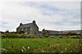
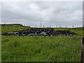
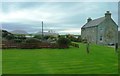
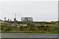
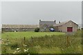
Nearby Images from Geograph Britain and Ireland:
©2024(licence)
©2023(licence)
©2016(licence)
©2024(licence)
©2024(licence)
The above images may not be of the site on this page, they are loaded from Geograph.
Please Submit an Image of this site or go out and take one for us!
Click here to see more info for this site
Nearby sites
Key: Red: member's photo, Blue: 3rd party photo, Yellow: other image, Green: no photo - please go there and take one, Grey: site destroyed
Download sites to:
KML (Google Earth)
GPX (GPS waypoints)
CSV (Garmin/Navman)
CSV (Excel)
To unlock full downloads you need to sign up as a Contributory Member. Otherwise downloads are limited to 50 sites.
Turn off the page maps and other distractions
Nearby sites listing. In the following links * = Image available
59m NE 45° Ness of Brodgar* Ancient Village or Settlement (HY3024312941)
141m SE 134° Brodgar Farm Standing Stones* Standing Stones (HY303128)
223m ESE 116° Lochview Mound* Cairn (HY304128)
435m SE 126° Watch Stone (Orkney)* Standing Stone (Menhir) (HY30551264)
593m ESE 109° Barnhouse Settlement* Ancient Village or Settlement (HY30761270)
603m SE 128° Stenness* Stone Circle (HY30671252)
702m NW 305° Comet Stone (Orkney)* Standing Stone (Menhir) (HY2963413318)
770m W 275° Fairy Well (Stenness)* Holy Well or Sacred Spring (HY2943212982)
773m NW 308° Fresh Knowe* Long Barrow (HY29601339)
867m W 271° Possible large stone circle in Loch of Stenness Stone Circle (HY2933112934)
872m WNW 300° Ring of Brodgar* Stone Circle (HY29451335)
874m WNW 295° South Knowe* Artificial Mound (HY29411328)
920m NW 310° Plumcake Mound* Round Barrow(s) (HY295135)
982m WNW 293° Salt Knowe* Round Barrow(s) (HY293133)
1.2km S 177° Standing Stones Hotel* Chambered Cairn (HY30251165)
1.3km ESE 123° Barnhouse Stone* Standing Stone (Menhir) (HY31271217)
1.5km NW 304° Wasbister Burnt Mound* Artificial Mound (HY28961378)
1.5km WNW 301° Wasbister Disc Barrow* Round Barrow(s) (HY289137)
1.5km WNW 301° Dyke o'Sean* Ancient Village or Settlement (HY289137)
1.5km NNE 31° Campston (Grimeston)* Broch or Nuraghe (HY310142)
1.5km NNE 31° Grimston Broch* Broch or Nuraghe (HY310142)
1.6km E 94° Maes Howe* Chambered Cairn (HY31821277)
1.6km NW 307° Bookan Cairns* Cairn (HY289139)
1.6km NE 49° Vola* Round Barrow(s) (HY31471395)
1.7km NW 311° Bookan Stones* Standing Stones (HY28921406)
View more nearby sites and additional images


 We would like to know more about this location. Please feel free to add a brief description and any relevant information in your own language.
 Wir möchten mehr über diese Stätte erfahren. Bitte zögern Sie nicht, eine kurze Beschreibung und relevante Informationen in Deutsch hinzuzufügen.
 Nous aimerions en savoir encore un peu sur les lieux. S'il vous plaît n'hesitez pas à ajouter une courte description et tous les renseignements pertinents dans votre propre langue.
 Quisieramos informarnos un poco más de las lugares. No dude en añadir una breve descripción y otros datos relevantes en su propio idioma.