

<< Our Photo Pages >> Castel Cilan - Round Barrow(s) in Wales in Gwynedd
Submitted by vicky on Tuesday, 12 August 2003 Page Views: 8092
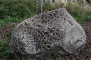
Neolithic and Bronze AgeSite Name: Castel CilanCountry: Wales County: Gwynedd Type: Round Barrow(s)
Nearest Village: Cilan Uchaf
Map Ref: SH294248 Landranger Map Number: 123
Latitude: 52.793721N Longitude: 4.531626W
Condition:
| 5 | Perfect |
| 4 | Almost Perfect |
| 3 | Reasonable but with some damage |
| 2 | Ruined but still recognisable as an ancient site |
| 1 | Pretty much destroyed, possibly visible as crop marks |
| 0 | No data. |
| -1 | Completely destroyed |
| 5 | Superb |
| 4 | Good |
| 3 | Ordinary |
| 2 | Not Good |
| 1 | Awful |
| 0 | No data. |
| 5 | Can be driven to, probably with disabled access |
| 4 | Short walk on a footpath |
| 3 | Requiring a bit more of a walk |
| 2 | A long walk |
| 1 | In the middle of nowhere, a nightmare to find |
| 0 | No data. |
| 5 | co-ordinates taken by GPS or official recorded co-ordinates |
| 4 | co-ordinates scaled from a detailed map |
| 3 | co-ordinates scaled from a bad map |
| 2 | co-ordinates of the nearest village |
| 1 | co-ordinates of the nearest town |
| 0 | no data |
Internal Links:
External Links:
I have visited· I would like to visit
SolarMegalith would like to visit
")
Have you visited this site? Please add a comment below.
You may be viewing yesterday's version of this page. To see the most up to date information please register for a free account.
Do not use the above information on other web sites or publications without permission of the contributor.
Nearby Images from Geograph Britain and Ireland:
©2010(licence)
©2014(licence)
©2023(licence)
©2010(licence)
©2010(licence)
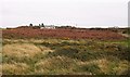
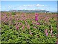
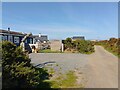
The above images may not be of the site on this page, they are loaded from Geograph.
Please Submit an Image of this site or go out and take one for us!
Click here to see more info for this site
Nearby sites
Key: Red: member's photo, Blue: 3rd party photo, Yellow: other image, Green: no photo - please go there and take one, Grey: site destroyed
Download sites to:
KML (Google Earth)
GPX (GPS waypoints)
CSV (Garmin/Navman)
CSV (Excel)
To unlock full downloads you need to sign up as a Contributory Member. Otherwise downloads are limited to 50 sites.
Turn off the page maps and other distractions
Nearby sites listing. In the following links * = Image available
994m E 95° Pared Mawr Promontory Fort / Cliff Castle (SH30392468)
1.4km SSE 153° Llech-y-Doll* Burial Chamber or Dolmen (SH300235)
1.9km N 3° Castell Hillfort (Llanengan)* Hillfort (SH29562665)
2.2km N 358° St Engan’s Church (Llanengan)* Ancient Temple (SH29412703)
2.3km N 355° Ffynnon Engan* Holy Well or Sacred Spring (SH29302707)
3.5km N 6° Pen-Y-Gaer (Llanengan) Hillfort (SH29862824)
4.1km N 2° St Cian's Church (Llangian)* Early Christian Sculptured Stone (SH297289)
5.5km NNE 27° The Warren, Abersoch, Submerged Forest and Peat Exposures Natural Stone / Erratic / Other Natural Feature (SH3207729590)
6.2km NNE 12° Ffynnon Fyw Holy Well or Sacred Spring (SH30913087)
6.3km N 5° Mynydd Mynytho Hut Circle Ancient Village or Settlement (SH30183105)
6.3km N 5° Foel Gron* Hillfort (SH30143108)
6.4km N 7° Ffynnon Arian Holy Well or Sacred Spring (SH30413113)
6.6km NW 319° Gelliwig Ancient Palace (SH252299)
6.8km WNW 290° Tuhwnt-I'r-Mynyd Cairn (SH23062731)
6.9km WNW 303° Tan-Y-Muriau* Chambered Cairn (SH23772877)
7.0km NW 310° Ffynnon Saint (Rhiw)* Holy Well or Sacred Spring (SH24202947)
7.0km NW 310° Tyn-y-parc Holy Well* Holy Well or Sacred Spring (SH242295)
7.0km NNE 24° Mynydd Tir-y-Cwmwd* Chambered Tomb (SH32513110)
7.0km WNW 296° Bronheulog* Burial Chamber or Dolmen (SH23192812)
7.0km WNW 299° Ffynnon Aelrhiw* Holy Well or Sacred Spring (SH23382847)
7.1km WNW 290° Mynydd y Graig* Hillfort (SH228274)
7.3km WNW 297° Rhiw fort* Ancient Village or Settlement (SH23002831)
7.4km WNW 291° Capel Tan-Y-Foel* Standing Stone (Menhir) (SH22612767)
7.5km N 353° Pandy Standing Stone* Standing Stone (Menhir) (SH28783229)
7.7km NW 305° Mynydd Rhiw South* Cairn (SH23242949)
View more nearby sites and additional images

")
 We would like to know more about this location. Please feel free to add a brief description and any relevant information in your own language.
 Wir möchten mehr über diese Stätte erfahren. Bitte zögern Sie nicht, eine kurze Beschreibung und relevante Informationen in Deutsch hinzuzufügen.
 Nous aimerions en savoir encore un peu sur les lieux. S'il vous plaît n'hesitez pas à ajouter une courte description et tous les renseignements pertinents dans votre propre langue.
 Quisieramos informarnos un poco más de las lugares. No dude en añadir una breve descripción y otros datos relevantes en su propio idioma.