<< Text Pages >> Newton Stone Circle - Stone Circle in Scotland in Aberdeenshire
Submitted by golux on Monday, 15 July 2002 Page Views: 5395
Neolithic and Bronze AgeSite Name: Newton Stone Circle Alternative Name: Blue Butts, Newton FarmCountry: Scotland County: Aberdeenshire Type: Stone Circle
Nearest Town: Aberdeen Nearest Village: Auchleven
Map Ref: NJ63512503 Landranger Map Number: 37
Latitude: 57.314368N Longitude: 2.607428W
Condition:
| 5 | Perfect |
| 4 | Almost Perfect |
| 3 | Reasonable but with some damage |
| 2 | Ruined but still recognisable as an ancient site |
| 1 | Pretty much destroyed, possibly visible as crop marks |
| 0 | No data. |
| -1 | Completely destroyed |
| 5 | Superb |
| 4 | Good |
| 3 | Ordinary |
| 2 | Not Good |
| 1 | Awful |
| 0 | No data. |
| 5 | Can be driven to, probably with disabled access |
| 4 | Short walk on a footpath |
| 3 | Requiring a bit more of a walk |
| 2 | A long walk |
| 1 | In the middle of nowhere, a nightmare to find |
| 0 | No data. |
| 5 | co-ordinates taken by GPS or official recorded co-ordinates |
| 4 | co-ordinates scaled from a detailed map |
| 3 | co-ordinates scaled from a bad map |
| 2 | co-ordinates of the nearest village |
| 1 | co-ordinates of the nearest town |
| 0 | no data |
Internal Links:
External Links:
"About AD 1835 a stone circle comprising 7 or 8 stones was removed. Underneath one of the stones a cist was found containing a few bones and some black earth." Name Book 1867 (per RCAHMS).
You may be viewing yesterday's version of this page. To see the most up to date information please register for a free account.
Do not use the above information on other web sites or publications without permission of the contributor.
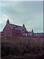
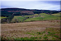
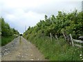
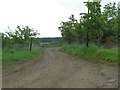
Nearby Images from Geograph Britain and Ireland:
©2007(licence)
©2023(licence)
©2008(licence)
©2008(licence)
©2008(licence)
The above images may not be of the site on this page, they are loaded from Geograph.
Please Submit an Image of this site or go out and take one for us!
Click here to see more info for this site
Nearby sites
Key: Red: member's photo, Blue: 3rd party photo, Yellow: other image, Green: no photo - please go there and take one, Grey: site destroyed
Download sites to:
KML (Google Earth)
GPX (GPS waypoints)
CSV (Garmin/Navman)
CSV (Excel)
To unlock full downloads you need to sign up as a Contributory Member. Otherwise downloads are limited to 50 sites.
![]()
Turn off the page maps and other distractions
Nearby sites listing. In the following links * = Image available
787m NNW 344° Broomend Stone Circle Stone Circle (NJ63302579)
836m NW 305° Westside Stone Circle Stone Circle (NJ62832552)
1.5km ESE 110° Tillymuick Ancient Village or Settlement (NJ649245)
2.8km NW 324° Wantonwells* Stone Circle (NJ619273)
3.0km NE 54° Hatton Of Ardoyne* Stone Circle (NJ65982676)
3.2km ENE 64° Westerton of Petmathen* Standing Stone (Menhir) (NJ664264)
3.2km WSW 255° Loanend* Stone Circle (NJ604242)
3.2km E 83° Berry Hill Enclosure* Ancient Village or Settlement (NJ6672225370)
3.4km SW 214° Druidstone (Brackla)* Stone Circle (NJ6152922206)
3.4km E 80° Archaeolink* Museum (NJ6691625613)
3.9km NW 325° Dunnideer Fort* Vitrified Fort (NJ613282)
4.1km NW 305° Hill of Christ's Kirk* Hillfort (NJ60182742)
4.2km E 80° The Gowk Stane* Standing Stone (Menhir) (NJ67652570)
4.3km NW 322° Dunnideer Circle* Stone Circle (NJ60862844)
4.3km W 276° Braehead Circle* Stone Circle (NJ592255)
4.4km NNW 344° Inschfield* Stone Circle (NJ623293)
4.4km NNE 26° South Lediken* Cairn (NJ655290)
4.6km WSW 257° Leslie Stone Circle (NJ590240)
5.0km NW 317° Stonehead* Stone Circle (NJ601287)
5.3km NE 56° Old Rayne* Stone Circle (NJ67982798)
5.4km ESE 119° Mither Tap* Hillfort (NJ682224)
5.4km NNE 30° Newton House* Class I Pictish Symbol Stone (NJ6623929732)
5.5km E 90° Mill Of Carden Stone Circle (NJ690250)
5.5km SSW 198° Cothiemuir Wood* Stone Circle (NJ61711980)
5.6km W 271° Johnston, The Ringing Stone* Standing Stone (Menhir) (NJ57902517)
View more nearby sites and additional images


 We would like to know more about this location. Please feel free to add a brief description and any relevant information in your own language.
 Wir möchten mehr über diese Stätte erfahren. Bitte zögern Sie nicht, eine kurze Beschreibung und relevante Informationen in Deutsch hinzuzufügen.
 Nous aimerions en savoir encore un peu sur les lieux. S'il vous plaît n'hesitez pas à ajouter une courte description et tous les renseignements pertinents dans votre propre langue.
 Quisieramos informarnos un poco más de las lugares. No dude en añadir una breve descripción y otros datos relevantes en su propio idioma.