

<< Our Photo Pages >> Kilry - Standing Stone (Menhir) in Scotland in Angus
Submitted by vicky on Sunday, 09 March 2003 Page Views: 11314
Neolithic and Bronze AgeSite Name: KilryCountry: Scotland County: Angus Type: Standing Stone (Menhir)
Map Ref: NO24325449 Landranger Map Number: 53
Latitude: 56.676017N Longitude: 3.236705W
Condition:
| 5 | Perfect |
| 4 | Almost Perfect |
| 3 | Reasonable but with some damage |
| 2 | Ruined but still recognisable as an ancient site |
| 1 | Pretty much destroyed, possibly visible as crop marks |
| 0 | No data. |
| -1 | Completely destroyed |
| 5 | Superb |
| 4 | Good |
| 3 | Ordinary |
| 2 | Not Good |
| 1 | Awful |
| 0 | No data. |
| 5 | Can be driven to, probably with disabled access |
| 4 | Short walk on a footpath |
| 3 | Requiring a bit more of a walk |
| 2 | A long walk |
| 1 | In the middle of nowhere, a nightmare to find |
| 0 | No data. |
| 5 | co-ordinates taken by GPS or official recorded co-ordinates |
| 4 | co-ordinates scaled from a detailed map |
| 3 | co-ordinates scaled from a bad map |
| 2 | co-ordinates of the nearest village |
| 1 | co-ordinates of the nearest town |
| 0 | no data |
Internal Links:
External Links:
I have visited· I would like to visit
MAIGO has visited here
")
Have you visited this site? Please add a comment below.
You may be viewing yesterday's version of this page. To see the most up to date information please register for a free account.
")
")
Do not use the above information on other web sites or publications without permission of the contributor.
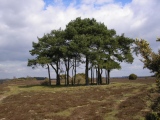
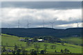
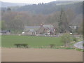
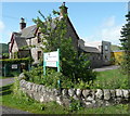
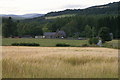
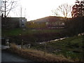
Nearby Images from Geograph Britain and Ireland:
©2009(licence)
©2017(licence)
©2010(licence)
©2009(licence)
©2007(licence)
The above images may not be of the site on this page, they are loaded from Geograph.
Please Submit an Image of this site or go out and take one for us!
Click here to see more info for this site
Nearby sites
Key: Red: member's photo, Blue: 3rd party photo, Yellow: other image, Green: no photo - please go there and take one, Grey: site destroyed
Download sites to:
KML (Google Earth)
GPX (GPS waypoints)
CSV (Garmin/Navman)
CSV (Excel)
To unlock full downloads you need to sign up as a Contributory Member. Otherwise downloads are limited to 50 sites.
Turn off the page maps and other distractions
Nearby sites listing. In the following links * = Image available
1.4km ESE 109° Formal (Bridge of Craigisla) Standing Stone (Menhir) (NO2561854024)
3.0km S 186° Shealwalls* Stone Circle (NO23965150)
3.0km S 186° Shealwalls Enclosure (Alyth) Ancient Village or Settlement (NO2392251484)
3.7km ENE 57° Pitmudie* Stone Row / Alignment (NO2744956473)
4.6km SSE 155° Barry Hillfort Hillfort (NO262503)
4.6km WSW 251° Alyth Burn Hut Circles Ancient Village or Settlement (NO199531)
5.0km ENE 63° Strone Hill Stone Circle (NO288567)
5.3km SE 135° Shanzie Standing Stone (Menhir) (NO280507)
5.3km SE 135° Drumderrach* Standing Stones (NO280507)
5.7km WSW 237° Parkneuk* Stone Circle (NO195515)
5.7km S 179° Alyth* Class II Pictish Symbol Stone (NO24324878)
5.7km SW 233° Heatheryhaugh (Bendochy) Rock Art (NO1963951153)
5.8km SSE 167° Pitcrocknie* Standing Stone (Menhir) (NO2554648860)
5.8km WSW 237° Tullymurdoch* Stone Circle (NO194514)
5.8km W 274° Drumderg 1 (Tullymurdoch) Rock Art (NO18525497)
5.8km ENE 75° Brankam Hill NW Stone Circle (NO300559)
5.8km ENE 75° Brankam Hill SE Stone Circle (NO300559)
6.2km SE 130° Bruceton* Class I Pictish Symbol Stone (NO290504)
6.4km SSE 151° Balloch Mill Cairn (NO27384885)
6.7km NE 54° Auldallan* Standing Stones (NO298583)
7.3km SW 232° Horse Stone, Hill of Drimmie* Standing Stone (Menhir) (NO18535007)
7.3km SW 232° Woodside, Hill of Drimmie* Stone Circle (NO1848750054)
7.4km SW 217° Broad Moss Stone Circle (NO197487)
7.4km E 92° Meikle Kenny A* Stone Circle (NO31765415)
7.4km SE 127° Philpie Stones* Standing Stone (Menhir) (NO302499)
View more nearby sites and additional images


 We would like to know more about this location. Please feel free to add a brief description and any relevant information in your own language.
 Wir möchten mehr über diese Stätte erfahren. Bitte zögern Sie nicht, eine kurze Beschreibung und relevante Informationen in Deutsch hinzuzufügen.
 Nous aimerions en savoir encore un peu sur les lieux. S'il vous plaît n'hesitez pas à ajouter une courte description et tous les renseignements pertinents dans votre propre langue.
 Quisieramos informarnos un poco más de las lugares. No dude en añadir una breve descripción y otros datos relevantes en su propio idioma.