<< Our Photo Pages >> Sa Coveccada Dolmen - Burial Chamber or Dolmen in Italy in Sardinia (Sardegna)
Submitted by AlexHunger on Saturday, 25 March 2006 Page Views: 13209
Neolithic and Bronze AgeSite Name: Sa Coveccada DolmenCountry: Italy Region: Sardinia (Sardegna) Type: Burial Chamber or Dolmen
Nearest Town: Nuoro Nearest Village: Mores
Latitude: 40.508240N Longitude: 8.866700E
Condition:
| 5 | Perfect |
| 4 | Almost Perfect |
| 3 | Reasonable but with some damage |
| 2 | Ruined but still recognisable as an ancient site |
| 1 | Pretty much destroyed, possibly visible as crop marks |
| 0 | No data. |
| -1 | Completely destroyed |
| 5 | Superb |
| 4 | Good |
| 3 | Ordinary |
| 2 | Not Good |
| 1 | Awful |
| 0 | No data. |
| 5 | Can be driven to, probably with disabled access |
| 4 | Short walk on a footpath |
| 3 | Requiring a bit more of a walk |
| 2 | A long walk |
| 1 | In the middle of nowhere, a nightmare to find |
| 0 | No data. |
| 5 | co-ordinates taken by GPS or official recorded co-ordinates |
| 4 | co-ordinates scaled from a detailed map |
| 3 | co-ordinates scaled from a bad map |
| 2 | co-ordinates of the nearest village |
| 1 | co-ordinates of the nearest town |
| 0 | no data |
Internal Links:
External Links:
I have visited· I would like to visit
rrmoser would like to visit
DrewParsons has visited here
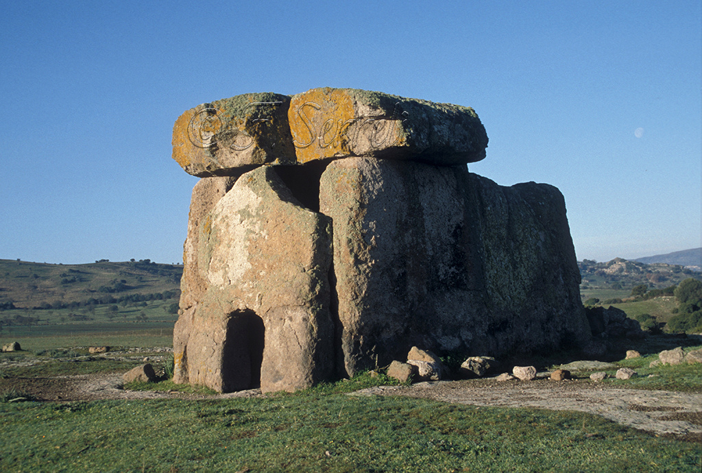
A very complete 3.0 metres high and 5 metres long dolmen with a "soul hole" facing south east, but with missing rear wall. There is a menhir nearby. 283 meters altitude.
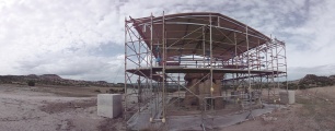
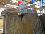
Additional information submitted by Drew Parsons October 2010: This is the largest dolmen in Sardinia. It is thought to date back to the end of the third millenium BC and is constructed from volcanic trachyte rock. It comprises a rectangular chamber bounded by three giant orthostats and a capstone which weighs 25 tons. There is a small aperture in the front orthostat and a small niche to the side at the front where it is thought that offerings to the dead may have been placed. The site is quite remote and yet accessible by car. From Mores village drive east on the SS128bis and turn south after 1.4 kilometres. 6 kilometres down this road turn right (south) at the sign for the site and follow this sometimes badly potholed lane for a further 3 kilometres to a farm entrance on the right with the site signposted. Drive north down past this farm to reach the site sign and car park. Walk the last 200 metres through a gate and down to the site. In October 2010 the site was undergoing much needed restoration as the capstone had split and was in danger of collapse.
Note: Exact GPS position from handheld GPS device.
You may be viewing yesterday's version of this page. To see the most up to date information please register for a free account.


Do not use the above information on other web sites or publications without permission of the contributor.
Click here to see more info for this site
Nearby sites
Click here to view sites on an interactive map of the areaKey: Red: member's photo, Blue: 3rd party photo, Yellow: other image, Green: no photo - please go there and take one, Grey: site destroyed
Download sites to:
KML (Google Earth)
GPX (GPS waypoints)
CSV (Garmin/Navman)
CSV (Excel)
To unlock full downloads you need to sign up as a Contributory Member. Otherwise downloads are limited to 50 sites.
Turn off the page maps and other distractions
Nearby sites listing. In the following links * = Image available
3.7km SW 228° Su Crastu Coveccadu Dolmen Burial Chamber or Dolmen
3.9km NE 53° Funtana 'e Baule Fonte Sacra Holy Well or Sacred Spring
4.1km NNE 30° Partulesi Domus de Janas* Rock Cut Tomb
6.1km SW 234° Padru Nuraghe* Broch or Nuraghe
7.2km WNW 283° Corona Moltana Domus de Janas* Rock Cut Tomb
7.3km WNW 290° Sorroi Domus de Janas* Rock Cut Tomb
7.3km WSW 252° Longu Nuraghe (Torralba)* Broch or Nuraghe
7.4km WSW 254° Culzu Nuraghe* Broch or Nuraghe
7.6km WSW 251° Fraigas Nuraghe* Broch or Nuraghe
7.6km WNW 290° Cultu Nuraghe (Bonnanaro)* Broch or Nuraghe
8.3km WSW 249° Oes Nuraghe* Broch or Nuraghe
8.5km WSW 253° Santu Antine Nuraghe* Broch or Nuraghe
8.5km W 274° Torralba Museum* Museum
8.5km WSW 254° Santu Antine Villaggio Nuragico* Ancient Village or Settlement
8.7km WNW 283° Elies Nuraghe Broch or Nuraghe
8.9km SW 226° Campu de Olta Nuraghe Broch or Nuraghe
9.3km WSW 249° Mura Coloras Nuraghe* Broch or Nuraghe
9.6km S 190° Sant Andria Priu Domus de Janas* Rock Cut Tomb
9.7km S 190° Sant' Andrea Priu* Rock Cut Tomb
10.5km SSW 206° Su Lumarzu Fonte Nuragica* Holy Well or Sacred Spring
10.9km SSE 148° Nuraghe Sa Reggia* Broch or Nuraghe
11.0km W 274° Sa Tanca Noa Nuraghe* Broch or Nuraghe
11.2km SW 219° Ena Leperes Nuraghe Broch or Nuraghe
11.2km WNW 282° Mura 'e Sai Insediamento Nuragico* Ancient Village or Settlement
11.3km WNW 281° Mura 'e Sai Protonuraghe* Broch or Nuraghe
View more nearby sites and additional images


 We would like to know more about this location. Please feel free to add a brief description and any relevant information in your own language.
 Wir möchten mehr über diese Stätte erfahren. Bitte zögern Sie nicht, eine kurze Beschreibung und relevante Informationen in Deutsch hinzuzufügen.
 Nous aimerions en savoir encore un peu sur les lieux. S'il vous plaît n'hesitez pas à ajouter une courte description et tous les renseignements pertinents dans votre propre langue.
 Quisieramos informarnos un poco más de las lugares. No dude en añadir una breve descripción y otros datos relevantes en su propio idioma.