

<< Text Pages >> Salverguettes 2 statue-menhir - Sculptured Stone in France in Midi:Tarn (81)
Submitted by TheCaptain on Saturday, 16 April 2005 Page Views: 1994
Multi-periodSite Name: Salverguettes 2 statue-menhirCountry: France Département: Midi:Tarn (81) Type: Sculptured Stone
Nearest Town: Mazamet Nearest Village: Salvergues
Latitude: 43.637000N Longitude: 2.902000E
Condition:
| 5 | Perfect |
| 4 | Almost Perfect |
| 3 | Reasonable but with some damage |
| 2 | Ruined but still recognisable as an ancient site |
| 1 | Pretty much destroyed, possibly visible as crop marks |
| 0 | No data. |
| -1 | Completely destroyed |
| 5 | Superb |
| 4 | Good |
| 3 | Ordinary |
| 2 | Not Good |
| 1 | Awful |
| 0 | No data. |
| 5 | Can be driven to, probably with disabled access |
| 4 | Short walk on a footpath |
| 3 | Requiring a bit more of a walk |
| 2 | A long walk |
| 1 | In the middle of nowhere, a nightmare to find |
| 0 | No data. |
| 5 | co-ordinates taken by GPS or official recorded co-ordinates |
| 4 | co-ordinates scaled from a detailed map |
| 3 | co-ordinates scaled from a bad map |
| 2 | co-ordinates of the nearest village |
| 1 | co-ordinates of the nearest town |
| 0 | no data |
Be the first person to rate this site - see the 'Contribute!' box in the right hand menu.
Internal Links:
External Links:
A second statue-menhir was found in the community of Cambon et Salvergues, which is nowadays shown in the Museum called MUSEE DU BITERROIS, in Béziers.
Thanks to lafemmedepierre for this information
Musée du Biterrois
You may be viewing yesterday's version of this page. To see the most up to date information please register for a free account.
Do not use the above information on other web sites or publications without permission of the contributor.
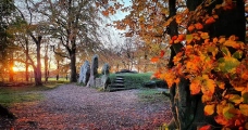
Nearby Images from Flickr
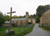

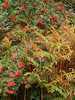
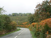

The above images may not be of the site on this page, but were taken nearby. They are loaded from Flickr so please click on them for image credits.
Click here to see more info for this site
Nearby sites
Click here to view sites on an interactive map of the areaKey: Red: member's photo, Blue: 3rd party photo, Yellow: other image, Green: no photo - please go there and take one, Grey: site destroyed
Download sites to:
KML (Google Earth)
GPX (GPS waypoints)
CSV (Garmin/Navman)
CSV (Excel)
To unlock full downloads you need to sign up as a Contributory Member. Otherwise downloads are limited to 50 sites.
Turn off the page maps and other distractions
Nearby sites listing. In the following links * = Image available
172m ENE 61° Salverguettes statue menhir* Sculptured Stone
4.2km NW 311° Col-des-Saints statue-menhir* Sculptured Stone
5.7km W 276° La Landette statue menhir* Sculptured Stone
5.8km N 358° Menhir des Parrots* Standing Stone (Menhir)
6.2km NNW 336° Montaigut menhir* Standing Stone (Menhir)
6.2km NW 309° Dolmen de Castelsec* Burial Chamber or Dolmen
6.6km NW 324° Favarels statue-menhir* Sculptured Stone
6.6km NW 324° Dévès-de-Félines statue menhir Sculptured Stone
6.6km NW 325° Murat-sur-Vèbre Centre d'Interprétation* Museum
6.7km NW 310° Candoubre menhir* Standing Stone (Menhir)
6.7km NW 309° Menhir de Candoubre 2* Standing Stone (Menhir)
7.0km NW 318° Dolmen de Lagarde* Burial Chamber or Dolmen
7.2km NW 310° Pré-de-Roi Menhir* Standing Stone (Menhir)
7.5km S 190° Dolmen du Débès Burial Chamber or Dolmen
7.7km S 188° Dolmen du Ròc-des-Gòrbs Burial Chamber or Dolmen
7.9km NW 305° Paumérou menhir* Standing Stone (Menhir)
8.0km WNW 295° Croix-de-Condomines menhir* Standing Stone (Menhir)
8.9km NW 323° Plos statue menhir 1 Sculptured Stone
8.9km W 266° Triby-Fabié statue-menhir* Sculptured Stone
9.0km WSW 247° Statue menhir des Fontanelles* Sculptured Stone
9.1km WSW 248° Statue menhir de La Pomarède* Sculptured Stone
9.3km NW 307° Lubio-Ferrières statue-menhir* Sculptured Stone
9.6km WSW 240° Statue menhir de Picarel* Sculptured Stone
9.8km W 272° Naujac statue menhir* Sculptured Stone
9.9km NNW 329° Plos statue menhir 2* Sculptured Stone
View more nearby sites and additional images


 We would like to know more about this location. Please feel free to add a brief description and any relevant information in your own language.
 Wir möchten mehr über diese Stätte erfahren. Bitte zögern Sie nicht, eine kurze Beschreibung und relevante Informationen in Deutsch hinzuzufügen.
 Nous aimerions en savoir encore un peu sur les lieux. S'il vous plaît n'hesitez pas à ajouter une courte description et tous les renseignements pertinents dans votre propre langue.
 Quisieramos informarnos un poco más de las lugares. No dude en añadir una breve descripción y otros datos relevantes en su propio idioma.