 with our Megalithic Portal iPhone app")


<< Our Photo Pages >> Naujac statue menhir - Sculptured Stone in France in Midi:Tarn (81)
Submitted by Aska on Saturday, 23 October 2010 Page Views: 2583
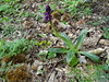
Multi-periodSite Name: Naujac statue menhirCountry: France Département: Midi:Tarn (81) Type: Sculptured Stone
Nearest Town: Lacaune Nearest Village: Naujac
Latitude: 43.639810N Longitude: 2.780490E
Condition:
| 5 | Perfect |
| 4 | Almost Perfect |
| 3 | Reasonable but with some damage |
| 2 | Ruined but still recognisable as an ancient site |
| 1 | Pretty much destroyed, possibly visible as crop marks |
| 0 | No data. |
| -1 | Completely destroyed |
| 5 | Superb |
| 4 | Good |
| 3 | Ordinary |
| 2 | Not Good |
| 1 | Awful |
| 0 | No data. |
| 5 | Can be driven to, probably with disabled access |
| 4 | Short walk on a footpath |
| 3 | Requiring a bit more of a walk |
| 2 | A long walk |
| 1 | In the middle of nowhere, a nightmare to find |
| 0 | No data. |
| 5 | co-ordinates taken by GPS or official recorded co-ordinates |
| 4 | co-ordinates scaled from a detailed map |
| 3 | co-ordinates scaled from a bad map |
| 2 | co-ordinates of the nearest village |
| 1 | co-ordinates of the nearest town |
| 0 | no data |
Internal Links:
External Links:
I have visited· I would like to visit
regina has visited here
")
You may be viewing yesterday's version of this page. To see the most up to date information please register for a free account.
")
")
Do not use the above information on other web sites or publications without permission of the contributor.
Nearby Images from Flickr

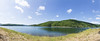
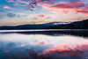
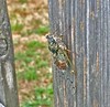
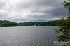
The above images may not be of the site on this page, but were taken nearby. They are loaded from Flickr so please click on them for image credits.
Click here to see more info for this site
Nearby sites
Click here to view sites on an interactive map of the areaKey: Red: member's photo, Blue: 3rd party photo, Yellow: other image, Green: no photo - please go there and take one, Grey: site destroyed
Download sites to:
KML (Google Earth)
GPX (GPS waypoints)
CSV (Garmin/Navman)
CSV (Excel)
To unlock full downloads you need to sign up as a Contributory Member. Otherwise downloads are limited to 50 sites.
Turn off the page maps and other distractions
Nearby sites listing. In the following links * = Image available
1.0km NNW 348° Barraque-des-Fourniols statue-menhir* Sculptured Stone
1.1km NNW 346° Trédos menhir* Standing Stone (Menhir)
1.1km NNW 346° Menhir de la Serre de Nages* Standing Stone (Menhir)
1.1km NNW 345° Rieu-Montagné museum* Museum
1.1km NNW 348° Griffoulou menhir Standing Stone (Menhir)
1.2km NNW 335° Rouvière statue-menhir Sculptured Stone
1.3km SE 134° Triby-Fabié statue-menhir* Sculptured Stone
2.0km S 190° Dolmen de la Frajure* Burial Chamber or Dolmen
2.3km WNW 300° Rouiregros statue menhir* Sculptured Stone
3.2km N 359° Carrieres menhir* Standing Stone (Menhir)
3.2km SW 218° Gravures du Roc del Bosc Rock Art
3.8km N 357° Lou Prat statue menhir* Sculptured Stone
3.8km S 185° Statue menhir de Cambayssy* Sculptured Stone
3.9km N 359° Nages menhir* Standing Stone (Menhir)
4.0km NE 39° Croix-de-Condomines menhir* Standing Stone (Menhir)
4.0km SSE 159° Statue menhir de La Pomarède* Sculptured Stone
4.1km SSE 158° Statue menhir des Fontanelles* Sculptured Stone
4.1km E 86° La Landette statue menhir* Sculptured Stone
5.3km SW 215° Col-de-la-Bole menhir* Sculptured Stone
5.3km SSE 163° Statue menhir de Picarel* Sculptured Stone
5.3km NE 38° Paumérou menhir* Standing Stone (Menhir)
5.7km NNW 327° statue-menhir du Pic du Montalet Sculptured Stone
5.7km NNE 24° Lubio-Ferrières statue-menhir* Sculptured Stone
6.0km NE 49° Menhir de Candoubre 2* Standing Stone (Menhir)
6.0km NE 44° Pré-de-Roi Menhir* Standing Stone (Menhir)
View more nearby sites and additional images


 We would like to know more about this location. Please feel free to add a brief description and any relevant information in your own language.
 Wir möchten mehr über diese Stätte erfahren. Bitte zögern Sie nicht, eine kurze Beschreibung und relevante Informationen in Deutsch hinzuzufügen.
 Nous aimerions en savoir encore un peu sur les lieux. S'il vous plaît n'hesitez pas à ajouter une courte description et tous les renseignements pertinents dans votre propre langue.
 Quisieramos informarnos un poco más de las lugares. No dude en añadir una breve descripción y otros datos relevantes en su propio idioma.