

<< Our Photo Pages >> Steinkiste Criewen - Cist in Germany in Brandenburg, Berlin
Submitted by Boeddel on Friday, 12 April 2024 Page Views: 40
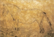
Neolithic and Bronze AgeSite Name: Steinkiste CriewenCountry: Germany Land: Brandenburg, Berlin Type: Cist
Nearest Town: Schwedt Nearest Village: Criewen
Latitude: 53.013205N Longitude: 14.224789E
Condition:
| 5 | Perfect |
| 4 | Almost Perfect |
| 3 | Reasonable but with some damage |
| 2 | Ruined but still recognisable as an ancient site |
| 1 | Pretty much destroyed, possibly visible as crop marks |
| 0 | No data. |
| -1 | Completely destroyed |
| 5 | Superb |
| 4 | Good |
| 3 | Ordinary |
| 2 | Not Good |
| 1 | Awful |
| 0 | No data. |
| 5 | Can be driven to, probably with disabled access |
| 4 | Short walk on a footpath |
| 3 | Requiring a bit more of a walk |
| 2 | A long walk |
| 1 | In the middle of nowhere, a nightmare to find |
| 0 | No data. |
| 5 | co-ordinates taken by GPS or official recorded co-ordinates |
| 4 | co-ordinates scaled from a detailed map |
| 3 | co-ordinates scaled from a bad map |
| 2 | co-ordinates of the nearest village |
| 1 | co-ordinates of the nearest town |
| 0 | no data |
Internal Links:
External Links:
I have visited· I would like to visit
Boeddel visited on 12th Apr 2024 - their rating: Cond: 3
")
_NOTE: The cist is not open to the public and can only be visited with the permission of the residents_
You may be viewing yesterday's version of this page. To see the most up to date information please register for a free account.
")
")
")
")
Do not use the above information on other web sites or publications without permission of the contributor.
Nearby Images from Flickr
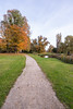
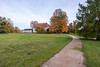
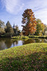
The above images may not be of the site on this page, but were taken nearby. They are loaded from Flickr so please click on them for image credits.
Click here to see more info for this site
Nearby sites
Click here to view sites on an interactive map of the areaKey: Red: member's photo, Blue: 3rd party photo, Yellow: other image, Green: no photo - please go there and take one, Grey: site destroyed
Download sites to:
KML (Google Earth)
GPX (GPS waypoints)
CSV (Garmin/Navman)
CSV (Excel)
To unlock full downloads you need to sign up as a Contributory Member. Otherwise downloads are limited to 50 sites.
Turn off the page maps and other distractions
Nearby sites listing. In the following links * = Image available
175m SW 231° Besucherzentrum des Nationalparks in Criewen* Museum
463m WNW 287° Großer Stein von Criewen* Rock Art
1.3km WSW 238° Gräberfeld Criewen* Cist
1.7km WSW 244° Rillenstein Criewen* Carving
2.0km WSW 244° Schälchenstein Criewen* Rock Art
2.9km NW 323° Briesensee Hügelgrab* Round Barrow(s)
6.3km NE 41° Stadtmuseum Schwedt* Museum
7.2km WNW 295° Grosssteingrab Felchow I Chambered Tomb
8.0km WSW 245° Rillenstein Stolpe* Sculptured Stone
8.1km WSW 244° Slawenburg Stolpe* Ancient Village or Settlement
10.1km NNW 344° Hügelgräber Heinersdorf bei Schwedt* Barrow Cemetery
10.7km SW 227° Stolzenhagen Burgwall* Promontory Fort / Cliff Castle
11.6km SW 232° Hügelgrab Stolzenhagen 40445* Round Barrow(s)
12.3km SW 226° Hügelgrab Stolzenhagen 40444* Round Barrow(s)
12.4km SW 215° Betstein Lunow* Early Christian Sculptured Stone
13.6km SW 229° Findling aus Bornholmer Granit* Natural Stone / Erratic / Other Natural Feature
13.6km WSW 248° Rillenstein Neukünkendorf* Sculptured Stone
14.0km WNW 294° Muerow Steingrab* Burial Chamber or Dolmen
14.8km W 272° Museum Angermünde* Museum
14.9km W 274° SteinZeit der Moderne* Modern Stone Circle etc
15.3km SW 222° Grenzstein Lüdersdorf* Burial Chamber or Dolmen
17.0km S 172° Steinkeller Burial Chamber or Dolmen
17.1km SW 232° Näpfchenstein im Parsteinsee* Rock Art
17.7km SW 229° Schälchenstein Krebssee* Rock Art
17.9km SW 222° Grosser Stein Neuendorf* Natural Stone / Erratic / Other Natural Feature
View more nearby sites and additional images


 We would like to know more about this location. Please feel free to add a brief description and any relevant information in your own language.
 Wir möchten mehr über diese Stätte erfahren. Bitte zögern Sie nicht, eine kurze Beschreibung und relevante Informationen in Deutsch hinzuzufügen.
 Nous aimerions en savoir encore un peu sur les lieux. S'il vous plaît n'hesitez pas à ajouter une courte description et tous les renseignements pertinents dans votre propre langue.
 Quisieramos informarnos un poco más de las lugares. No dude en añadir una breve descripción y otros datos relevantes en su propio idioma.