
, Aubrey Burl")
<< Our Photo Pages >> Slawenburg Rugard - Hillfort in Germany in Mecklenburg-Western Pomerania
Submitted by Boeddel on Monday, 01 April 2024 Page Views: 920
Early Medieval (Dark Age)Site Name: Slawenburg Rugard Alternative Name: RujanenburgCountry: Germany Land: Mecklenburg-Western Pomerania Type: Hillfort
Nearest Town: Bergen auf Rügen
Latitude: 54.421574N Longitude: 13.444444E
Condition:
| 5 | Perfect |
| 4 | Almost Perfect |
| 3 | Reasonable but with some damage |
| 2 | Ruined but still recognisable as an ancient site |
| 1 | Pretty much destroyed, possibly visible as crop marks |
| 0 | No data. |
| -1 | Completely destroyed |
| 5 | Superb |
| 4 | Good |
| 3 | Ordinary |
| 2 | Not Good |
| 1 | Awful |
| 0 | No data. |
| 5 | Can be driven to, probably with disabled access |
| 4 | Short walk on a footpath |
| 3 | Requiring a bit more of a walk |
| 2 | A long walk |
| 1 | In the middle of nowhere, a nightmare to find |
| 0 | No data. |
| 5 | co-ordinates taken by GPS or official recorded co-ordinates |
| 4 | co-ordinates scaled from a detailed map |
| 3 | co-ordinates scaled from a bad map |
| 2 | co-ordinates of the nearest village |
| 1 | co-ordinates of the nearest town |
| 0 | no data |
Internal Links:
External Links:
I have visited· I would like to visit
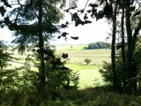
Boeddel visited on 30th Mar 2024 - their rating: Cond: 3 Amb: 4 Access: 4 Before I went to the harbor to go to Bornholm, I finally had to visit this hillfort.
")
The complex has a pointed oval floor plan and consists of a plateau-like, slightly square main castle and a slightly lower one outer bailey. The two-part castle is surrounded by an outer wall that is still 5 to 10 m high. The entire outside of the castle wall was surrounded by a wide and dry moat. Unfortunately, it is not possible to trace when the first castle complex was built on the "Rugard". Multi-part Slavic hillforts on the mainland of Mecklenburg-Western Pomerania were more of an early Slavic phenomenon in the late 8th to 9th centuries.
During the Danish conquest of Rügen in the summer of 1168, the still heathen Jaromar I resided. in the “Rugard” hillfort. After the surrender, he accepted Christianity and founded the first Christian church in 1180 instead of today's St. Mary's Church. Jaromar I died around 1218 and was probably buried in the area of the church he founded. The so-called “Jaromarstein” can still be found in the west facade of St. Mary’s Church today. It is believed that this is the tombstone of Jaromir I.
The last slavic, but christian, reside in the "Rugard" hillfort was Wizlaw III, who died childless in 1325. Shortly after his death, the hillfort was probably finally abandoned.
On the 100th birthday of the writer and historian "Ernst-Moritz-Arndt", who was born on Rügen, it was decided in 1869 to build a lookout tower in his memory on the Rugard. In 1877 the tower was finally completed. During GDR times (1970) a new restaurant was built on the main castle area.
Info from the website Slawenburgen
You may be viewing yesterday's version of this page. To see the most up to date information please register for a free account.
")
")
")
")
")
")
")
")
")
")
")
Do not use the above information on other web sites or publications without permission of the contributor.
Click here to see more info for this site
Nearby sites
Click here to view sites on an interactive map of the areaKey: Red: member's photo, Blue: 3rd party photo, Yellow: other image, Green: no photo - please go there and take one, Grey: site destroyed
Download sites to:
KML (Google Earth)
GPX (GPS waypoints)
CSV (Garmin/Navman)
CSV (Excel)
To unlock full downloads you need to sign up as a Contributory Member. Otherwise downloads are limited to 50 sites.
Turn off the page maps and other distractions
Nearby sites listing. In the following links * = Image available
943m WSW 239° Bildstein Marienkirche* Carving
1.7km E 96° Dumsevitz Grabhügel Round Barrow(s)
2.0km NE 47° Buschvitz Grabhuegelgruppe Barrow Cemetery
2.3km SSE 150° Kaiseritz Huegelgrab Round Barrow(s)
3.9km NNW 327° Dramwitz Grabhügel 2 Round Barrow(s)
3.9km NNW 331° Dramwitz Grabhügel 1 Round Barrow(s)
4.2km NNW 334° Dramwitz Grabhügel 3* Round Barrow(s)
4.2km SE 127° Silvitz Steingrab* Chambered Tomb
4.5km N 1° Tempelberg Grabhuegel (Rügen)* Round Barrow(s)
4.8km SSE 163° Neklade Steingrab 1* Chambered Tomb
4.8km S 177° Neklade Steingrab 2 Chambered Tomb
4.9km SSE 164° Pastitz Steingrab 1* Long Barrow
5.0km SSE 164° Pastitz Steingrab 2* Burial Chamber or Dolmen
5.3km NW 321° Patzig Grabhügel 2* Round Barrow(s)
5.4km NW 321° Patzig Grabhügel 1* Round Barrow(s)
5.5km N 7° Augustenhof Grabhuegelfeld* Barrow Cemetery
5.8km NNW 343° Gnies Grabhuegel 1* Round Barrow(s)
6.0km N 350° Gnies Grabhuegel 2* Round Barrow(s)
6.9km NNW 326° Woorke Grabhügel 7* Round Barrow(s)
6.9km NNW 328° Woorke Grabhügel 12* Round Barrow(s)
6.9km NW 325° Woorke Grabhügel 2* Round Barrow(s)
7.0km NNW 328° Woorke Grabhügel 11* Round Barrow(s)
7.0km NNW 326° Woorke Grabhügel 5* Round Barrow(s)
7.0km NW 325° Woorke Grabhügel 3* Round Barrow(s)
7.0km NW 324° Woorke Grabhügel 1* Round Barrow(s)
View more nearby sites and additional images


 We would like to know more about this location. Please feel free to add a brief description and any relevant information in your own language.
 Wir möchten mehr über diese Stätte erfahren. Bitte zögern Sie nicht, eine kurze Beschreibung und relevante Informationen in Deutsch hinzuzufügen.
 Nous aimerions en savoir encore un peu sur les lieux. S'il vous plaît n'hesitez pas à ajouter une courte description et tous les renseignements pertinents dans votre propre langue.
 Quisieramos informarnos un poco más de las lugares. No dude en añadir una breve descripción y otros datos relevantes en su propio idioma.