<< Our Photo Pages >> The Garris - Ancient Village or Settlement in England in Yorkshire (North)
Submitted by Reddon on Friday, 03 March 2023 Page Views: 451
Early Medieval (Dark Age)Site Name: The GarrisCountry: England County: Yorkshire (North) Type: Ancient Village or Settlement
Nearest Village: Gargrave
Map Ref: SD9306153776
Latitude: 53.979995N Longitude: 2.107294W
Condition:
| 5 | Perfect |
| 4 | Almost Perfect |
| 3 | Reasonable but with some damage |
| 2 | Ruined but still recognisable as an ancient site |
| 1 | Pretty much destroyed, possibly visible as crop marks |
| 0 | No data. |
| -1 | Completely destroyed |
| 5 | Superb |
| 4 | Good |
| 3 | Ordinary |
| 2 | Not Good |
| 1 | Awful |
| 0 | No data. |
| 5 | Can be driven to, probably with disabled access |
| 4 | Short walk on a footpath |
| 3 | Requiring a bit more of a walk |
| 2 | A long walk |
| 1 | In the middle of nowhere, a nightmare to find |
| 0 | No data. |
| 5 | co-ordinates taken by GPS or official recorded co-ordinates |
| 4 | co-ordinates scaled from a detailed map |
| 3 | co-ordinates scaled from a bad map |
| 2 | co-ordinates of the nearest village |
| 1 | co-ordinates of the nearest town |
| 0 | no data |
Internal Links:
External Links:
")
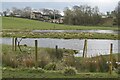
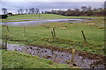
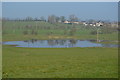
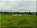
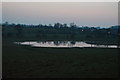
The Pennine Way walk skirts the northern boundary. Preliminary investigations using magnetometry indicates the presence of structures on the central "island" together with defensive palisades, possibly of timber.
You may be viewing yesterday's version of this page. To see the most up to date information please register for a free account.
")
Do not use the above information on other web sites or publications without permission of the contributor.
Nearby Images from Geograph Britain and Ireland:
©2024(licence)
©2012(licence)
©2016(licence)
©2021(licence)
©2016(licence)
The above images may not be of the site on this page, they are loaded from Geograph.
Please Submit an Image of this site or go out and take one for us!
Click here to see more info for this site
Nearby sites
Key: Red: member's photo, Blue: 3rd party photo, Yellow: other image, Green: no photo - please go there and take one, Grey: site destroyed
Download sites to:
KML (Google Earth)
GPX (GPS waypoints)
CSV (Garmin/Navman)
CSV (Excel)
To unlock full downloads you need to sign up as a Contributory Member. Otherwise downloads are limited to 50 sites.
Turn off the page maps and other distractions
Nearby sites listing. In the following links * = Image available
193m NE 46° St Andrew (Gargrave)* Ancient Cross (SD93205391)
326m NNE 18° Roman Ford (Gargrave)* Ancient Trackway (SD9316354086)
940m ESE 106° Kirk Sink (Gargrave) Ancient Village or Settlement (SD9396753517)
3.0km SE 142° Broughton Circle Stone Circle (SD9490551404)
3.2km N 1° St Helen's Well (Eshton)* Holy Well or Sacred Spring (SD9309656992)
3.5km E 80° Skyrakes West (Stirton) Rock Art (SD965544)
3.8km ENE 58° Rough Haw (Flasby) Hillfort (SD963558)
3.8km SW 216° St Peter (East Marton)* Ancient Cross (SD9080750694)
4.4km NW 324° Lower Colgarth Hill Tumulus* Round Barrow(s) (SD9048157360)
4.7km WNW 287° Steeling Hill Enclosure Ancient Village or Settlement (SD8859255148)
5.1km NE 52° Scale House (Rylstone) Cairn (SD9708856870)
5.4km SSE 168° Standrise Earth Circle (Carleton in Craven) Misc. Earthwork (SD94194847)
5.5km ENE 62° Nettlehole Ridge* Stone Circle (SD97945634)
6.1km S 181° Hare Hill ring cairn* Cairn (SD9295347697)
6.1km ENE 67° Fairies Chest (Embsay Moor)* Natural Stone / Erratic / Other Natural Feature (SD9869656105)
6.2km SSW 207° Church Well (Thornton-in-Craven)* Holy Well or Sacred Spring (SD902483)
6.2km SSW 208° Church Well (Thornton-in-Craven)* Holy Well or Sacred Spring (SD901483)
6.3km ESE 109° Craven Museum* Museum (SD9902451734)
6.4km W 267° Cobers Laithe Camp (Nappa)* Misc. Earthwork (SD86695340)
6.5km NE 39° St Peter's Church (Rylstone) Ancient Cross (SD972588)
7.3km ESE 116° Great Wood Laithe (19) Rock Art (SD9962050551)
7.4km ESE 117° Horse Close Hill (Skipton) Ancient Village or Settlement (SD9965350468)
7.5km ESE 123° Low Snaygill Stone (Skipton) Rock Art (SD9939949729)
7.5km ESE 121° High Laithe Stone (17) Rock Art (SD9951649914)
8.2km S 188° Bleara Moor Cairnfield (Earby) Cairn (SD919457)
View more nearby sites and additional images


 We would like to know more about this location. Please feel free to add a brief description and any relevant information in your own language.
 Wir möchten mehr über diese Stätte erfahren. Bitte zögern Sie nicht, eine kurze Beschreibung und relevante Informationen in Deutsch hinzuzufügen.
 Nous aimerions en savoir encore un peu sur les lieux. S'il vous plaît n'hesitez pas à ajouter une courte description et tous les renseignements pertinents dans votre propre langue.
 Quisieramos informarnos un poco más de las lugares. No dude en añadir una breve descripción y otros datos relevantes en su propio idioma.