

<< Text Pages >> High Laithe Stone (17) - Rock Art in England in Yorkshire (North)
Submitted by Anne T on Monday, 13 November 2017 Page Views: 1130
Rock ArtSite Name: High Laithe Stone (17) Alternative Name: Boughey & Vickerman (17); Hedges (SK2)Country: England County: Yorkshire (North) Type: Rock Art
Nearest Town: Skipton Nearest Village: Low Snaygill
Map Ref: SD9951649914
Latitude: 53.945332N Longitude: 2.008861W
Condition:
| 5 | Perfect |
| 4 | Almost Perfect |
| 3 | Reasonable but with some damage |
| 2 | Ruined but still recognisable as an ancient site |
| 1 | Pretty much destroyed, possibly visible as crop marks |
| 0 | No data. |
| -1 | Completely destroyed |
| 5 | Superb |
| 4 | Good |
| 3 | Ordinary |
| 2 | Not Good |
| 1 | Awful |
| 0 | No data. |
| 5 | Can be driven to, probably with disabled access |
| 4 | Short walk on a footpath |
| 3 | Requiring a bit more of a walk |
| 2 | A long walk |
| 1 | In the middle of nowhere, a nightmare to find |
| 0 | No data. |
| 5 | co-ordinates taken by GPS or official recorded co-ordinates |
| 4 | co-ordinates scaled from a detailed map |
| 3 | co-ordinates scaled from a bad map |
| 2 | co-ordinates of the nearest village |
| 1 | co-ordinates of the nearest town |
| 0 | no data |
Be the first person to rate this site - see the 'Contribute!' box in the right hand menu.
Internal Links:
External Links:
Rock Art in Yorkshire (North)
This cup and ring stone, built into a stone wall, is featured on The Northern Antiquarian (TNA) - see their entry for the High Laithe Stone, Skipton, North Yorkshire. TNA give directions for finding the stone together with a photograph and a brief archaeology & history.
TNA tells us: "First described by Messrs Hartley and Radley in the Yorkshire Archaeological Register of 1968, this small “standing stone”, less than three-feet tall, has a distinct cup-and-double- ring carved onto its upright north-facing edge. The outline of the carving is visible even in bad light, though you might wanna rest and gaze for a minute or two for yourself and the lighting to adjust if it’s a grey day. There’s another cup-marking below the bottom right of the double-ring, with another ‘possible’ just above ground-level."
The stone is also recorded as Pastscape Monument No. 46255, which has two entries, the first saying: "A limestone block found in 1968 set in the base of a gritstone field wall at Skipton, has a cup marking with three concentric rings." A second entry corrects this to: "Limestone rock with large shallow cup surrounded by two uneven shallow rings. One oval cup. Found in 1968." Pastscape also makes reference to a second nearby rock at SE 99404975. "Large grit rock with eleven cups, circle of nine very small cups and grooves. Situated on grassy bank above Suay Gill."
This cup and ring marked stone is also scheduled - see Historic England List ID 1014981, which adds: "This is not the rock's original position, but it is not thought to have been moved far. The carving consists of three cups, one of which has one complete ring and a part ring."
Note: Have you visited this site? Do you have any photographs or information to add?
You may be viewing yesterday's version of this page. To see the most up to date information please register for a free account.
Do not use the above information on other web sites or publications without permission of the contributor.
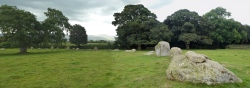
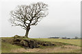
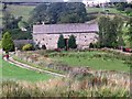
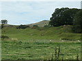
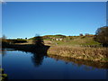
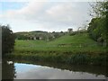
Nearby Images from Geograph Britain and Ireland:
©2017(licence)
©2011(licence)
©2020(licence)
©2010(licence)
©2022(licence)
The above images may not be of the site on this page, they are loaded from Geograph.
Please Submit an Image of this site or go out and take one for us!
Click here to see more info for this site
Nearby sites
Key: Red: member's photo, Blue: 3rd party photo, Yellow: other image, Green: no photo - please go there and take one, Grey: site destroyed
Download sites to:
KML (Google Earth)
GPX (GPS waypoints)
CSV (Garmin/Navman)
CSV (Excel)
To unlock full downloads you need to sign up as a Contributory Member. Otherwise downloads are limited to 50 sites.
Turn off the page maps and other distractions
Nearby sites listing. In the following links * = Image available
219m SSW 212° Low Snaygill Stone (Skipton) Rock Art (SD9939949729)
570m NNE 14° Horse Close Hill (Skipton) Ancient Village or Settlement (SD9965350468)
645m N 9° Great Wood Laithe (19) Rock Art (SD9962050551)
1.9km NNW 345° Craven Museum* Museum (SD9902451734)
2.4km SSE 161° Hamblethorpe (Low Bradley)* Standing Stones (SE0030347622)
2.7km SSE 151° Black Hill Ring Cairn* Ring Cairn (SE00814756)
2.7km SSE 149° Bradley Long Cairn* Chambered Cairn (SE0091047573)
2.7km SSE 150° Black Hill Round Cairn* Round Cairn (SE0087347529)
3.0km SSE 158° Farnhill Moor (Kildwick)* Rock Art (SE00644710)
4.3km SSW 212° Babyhouse Lane (Cononley) Ancient Village or Settlement (SD97194627)
4.3km SSE 158° St Andrew, Kildwick, West Yorkshire* Ancient Cross (SE0114445893)
4.6km NE 44° St Helen's Well (Draughton) Holy Well or Sacred Spring (SE02705324)
4.8km WNW 288° Broughton Circle Stone Circle (SD9490551404)
5.1km E 90° Counter Hill (31) Rock Art (SE0463049950)
5.1km NE 37° Eastby 01 (Low Lane) Rock Art (SE026540)
5.4km NW 326° Skyrakes West (Stirton) Rock Art (SD965544)
5.4km NE 38° Eastby 02 (Bark Lane) Rock Art (SE02835421)
5.5km E 94° High Marchup (Silsden) Cairn (SE0501249489)
5.5km WSW 255° Standrise Earth Circle (Carleton in Craven) Misc. Earthwork (SD94194847)
5.6km E 88° Counter Hill (Addingham) Misc. Earthwork (SE051501)
5.8km SSE 152° Nanny's Grave (Steeton) Cairn (SE022448)
6.0km E 88° Round Dykes* Ancient Village or Settlement (SE0551850121)
6.2km N 352° Fairies Chest (Embsay Moor)* Natural Stone / Erratic / Other Natural Feature (SD9869656105)
6.3km E 89° Low Moor (W Yorks)* Round Barrow(s) (SE0581750001)
6.4km SE 132° Silsden round barrow Round Barrow(s) (SE0426345622)
View more nearby sites and additional images


 We would like to know more about this location. Please feel free to add a brief description and any relevant information in your own language.
 Wir möchten mehr über diese Stätte erfahren. Bitte zögern Sie nicht, eine kurze Beschreibung und relevante Informationen in Deutsch hinzuzufügen.
 Nous aimerions en savoir encore un peu sur les lieux. S'il vous plaît n'hesitez pas à ajouter une courte description et tous les renseignements pertinents dans votre propre langue.
 Quisieramos informarnos un poco más de las lugares. No dude en añadir una breve descripción y otros datos relevantes en su propio idioma.