


<< Our Photo Pages >> Dun Edinbane - Broch or Nuraghe in Scotland in Isle of Skye
Submitted by markj99 on Sunday, 11 October 2020 Page Views: 746
Iron Age and Later PrehistorySite Name: Dun Edinbane Alternative Name: Dun EdinbainCountry: Scotland County: Isle of Skye Type: Broch or Nuraghe
Nearest Town: Dunvegan Nearest Village: Edinbane
Map Ref: NG35355092
Latitude: 57.471061N Longitude: 6.415798W
Condition:
| 5 | Perfect |
| 4 | Almost Perfect |
| 3 | Reasonable but with some damage |
| 2 | Ruined but still recognisable as an ancient site |
| 1 | Pretty much destroyed, possibly visible as crop marks |
| 0 | No data. |
| -1 | Completely destroyed |
| 5 | Superb |
| 4 | Good |
| 3 | Ordinary |
| 2 | Not Good |
| 1 | Awful |
| 0 | No data. |
| 5 | Can be driven to, probably with disabled access |
| 4 | Short walk on a footpath |
| 3 | Requiring a bit more of a walk |
| 2 | A long walk |
| 1 | In the middle of nowhere, a nightmare to find |
| 0 | No data. |
| 5 | co-ordinates taken by GPS or official recorded co-ordinates |
| 4 | co-ordinates scaled from a detailed map |
| 3 | co-ordinates scaled from a bad map |
| 2 | co-ordinates of the nearest village |
| 1 | co-ordinates of the nearest town |
| 0 | no data |
Internal Links:
External Links:
")
Dun Edinbane is a ruined broch perched above Edinbane, a village 14 miles NW of Portree by the A850. It is around 20 yards across with a jumble of stones 2 yards high in the centre. The outer wall is deliniated by an incomplete circle of large stones. There are extensive views all round from Dun Edinbane, however its elevated position was probably chosen for defensive purposes.
Canmore ID 11145, which names the broch as Dun Edinbain, has extensive details of the site.
You may be viewing yesterday's version of this page. To see the most up to date information please register for a free account.
")
")
Do not use the above information on other web sites or publications without permission of the contributor.
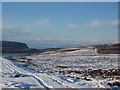
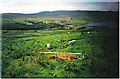
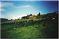
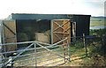
Nearby Images from Geograph Britain and Ireland:
©2010(licence)

©2008(licence)
©2006(licence)
©2006(licence)
©2006(licence)
The above images may not be of the site on this page, they are loaded from Geograph.
Please Submit an Image of this site or go out and take one for us!
Click here to see more info for this site
Nearby sites
Key: Red: member's photo, Blue: 3rd party photo, Yellow: other image, Green: no photo - please go there and take one, Grey: site destroyed
Download sites to:
KML (Google Earth)
GPX (GPS waypoints)
CSV (Garmin/Navman)
CSV (Excel)
To unlock full downloads you need to sign up as a Contributory Member. Otherwise downloads are limited to 50 sites.
Turn off the page maps and other distractions
Nearby sites listing. In the following links * = Image available
2.6km NE 47° Dun Suladale* Broch or Nuraghe (NG374526)
2.7km N 351° Dun Flashader* Broch or Nuraghe (NG351536)
3.5km NNE 31° Creagan Soillier* Stone Fort or Dun (NG37315378)
4.9km N 352° Dun na h-Airde* Stone Fort or Dun (NG350558)
5.8km ENE 78° Dun Cruinn* Stone Fort or Dun (NG411518)
5.8km ENE 78° Standing stones below Dun Cruinn* Standing Stones (NG411518)
6.1km NE 34° Unnamed dun at Kingsburgh* Stone Fort or Dun (NG391558)
6.3km ENE 72° Eyre Alignment* Stone Row / Alignment (NG4143252510)
6.5km ESE 110° Dun Sgalair* Stone Fort or Dun (NG41354826)
6.6km E 83° Carn Liath (Kensaleyre)* Chambered Cairn (NG420513)
6.7km NE 53° Dun Adhamh* Stone Fort or Dun (NG410546)
6.9km NNE 21° Dun Santavaig* Stone Fort or Dun (NG382572)
6.9km ESE 107° St Columba's Chapel (Skeabost) Early Christian Sculptured Stone (NG41824850)
7.0km ESE 101° Tote, Skye* Class I Pictish Symbol Stone (NG421491)
7.1km ENE 65° Dun Eyre* Stone Fort or Dun (NG420535)
7.2km E 88° Kensaleyre N Cairn* Cairn (NG42555064)
7.2km E 88° Kensalyre Stone* Standing Stone (Menhir) (NG426507)
7.2km E 89° Kensaleyre S Cairn* Cairn (NG42605059)
8.3km W 279° Temple of Anaitis (Waternish) Stone Circle (NG27255273)
8.3km S 179° Dun Arkaig* Broch or Nuraghe (NG350426)
8.5km NNE 12° Dun Maraig* Stone Fort or Dun (NG377591)
8.8km SW 215° Vatten* Cairn (NG2983843987)
9.3km NNE 18° Snizort Stone Setting* Stone Circle (NG38755962)
9.5km SSW 204° Dun Abhuinn Bhaile Mheadhonaich* Stone Fort or Dun (NG309425)
10.2km SSW 209° Dun Feorlig* Broch or Nuraghe (NG299423)
View more nearby sites and additional images


 We would like to know more about this location. Please feel free to add a brief description and any relevant information in your own language.
 Wir möchten mehr über diese Stätte erfahren. Bitte zögern Sie nicht, eine kurze Beschreibung und relevante Informationen in Deutsch hinzuzufügen.
 Nous aimerions en savoir encore un peu sur les lieux. S'il vous plaît n'hesitez pas à ajouter une courte description et tous les renseignements pertinents dans votre propre langue.
 Quisieramos informarnos un poco más de las lugares. No dude en añadir una breve descripción y otros datos relevantes en su propio idioma.