

, Aubrey Burl")
<< Our Photo Pages >> Single Hut Circle East of Braich Y Gornel - Ancient Village or Settlement in Wales in Gwynedd
Submitted by TAlanJones on Tuesday, 01 September 2020 Page Views: 546
Multi-periodSite Name: Single Hut Circle East of Braich Y GornelCountry: Wales County: Gwynedd Type: Ancient Village or Settlement
Nearest Town: Porthmadog
Map Ref: SH554446
Latitude: 52.979183N Longitude: 4.155148W
Condition:
| 5 | Perfect |
| 4 | Almost Perfect |
| 3 | Reasonable but with some damage |
| 2 | Ruined but still recognisable as an ancient site |
| 1 | Pretty much destroyed, possibly visible as crop marks |
| 0 | No data. |
| -1 | Completely destroyed |
| 5 | Superb |
| 4 | Good |
| 3 | Ordinary |
| 2 | Not Good |
| 1 | Awful |
| 0 | No data. |
| 5 | Can be driven to, probably with disabled access |
| 4 | Short walk on a footpath |
| 3 | Requiring a bit more of a walk |
| 2 | A long walk |
| 1 | In the middle of nowhere, a nightmare to find |
| 0 | No data. |
| 5 | co-ordinates taken by GPS or official recorded co-ordinates |
| 4 | co-ordinates scaled from a detailed map |
| 3 | co-ordinates scaled from a bad map |
| 2 | co-ordinates of the nearest village |
| 1 | co-ordinates of the nearest town |
| 0 | no data |
Internal Links:
External Links:
I have visited· I would like to visit
TAlanJones has visited here
")
A large hut circle to the east of Braich Y Gornel. The walls of the hut are impressive, 1.5m thick in places. The interior diameter of the hut is 7m. The entrance faces to the south. The walls are raised to a height of 0.6m. This is an area rich in hut circles and settlements.
You may be viewing yesterday's version of this page. To see the most up to date information please register for a free account.
")
")
")
")
Do not use the above information on other web sites or publications without permission of the contributor.
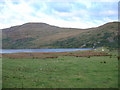
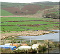
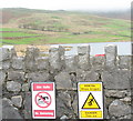
Nearby Images from Geograph Britain and Ireland:
©2005(licence)
©2006(licence)
©2006(licence)
©2006(licence)
©2006(licence)
The above images may not be of the site on this page, they are loaded from Geograph.
Please Submit an Image of this site or go out and take one for us!
Click here to see more info for this site
Nearby sites
Key: Red: member's photo, Blue: 3rd party photo, Yellow: other image, Green: no photo - please go there and take one, Grey: site destroyed
Download sites to:
KML (Google Earth)
GPX (GPS waypoints)
CSV (Garmin/Navman)
CSV (Excel)
To unlock full downloads you need to sign up as a Contributory Member. Otherwise downloads are limited to 50 sites.
Turn off the page maps and other distractions
Nearby sites listing. In the following links * = Image available
65m N 354° Cwm Ystradllyn Cairn 3* Cairn (SH5539544665)
65m NNW 346° Cwm Ystradllyn Cairn 2* Cairn (SH5538644664)
93m S 189° Cwm Ystradllyn Standing Stones* Standing Stones (SH5538344508)
160m W 266° Cwm Ystradllyn Hut Circle Settlement* Ancient Village or Settlement (SH5524044595)
173m W 259° Cwm Ystradllyn Ring Cairn* Ring Cairn (SH5522944572)
223m WNW 295° Braich Y Gornel Settlement* Ancient Village or Settlement (SH552447)
223m WSW 242° Hut Circles South of Braich Y Gornel* Ancient Village or Settlement (SH552445)
299m N 356° Cwm Ystradllyn Cairn 1* Cairn (SH5538744899)
446m WNW 295° Hut Circles at Braich Y Gornel * Ancient Village or Settlement (SH550448)
485m NNW 333° Braich y Gornel Summit Stone Feature* Natural Stone / Erratic / Other Natural Feature (SH5519445040)
486m NW 324° Braich y Gornel cairn* Cairn (SH5512845004)
537m WSW 246° Settlement North East of Traian* Ancient Village or Settlement (SH549444)
576m WSW 247° Cairn North East of Traian* Cairn (SH5486344387)
693m N 354° Cist North of Braich y Gornel* Cist (SH5535045292)
698m W 268° Hut Circle near Cae Bach* Ancient Village or Settlement (SH547446)
704m W 281° Cairn Cemetery west of Braich y Gornel* Barrow Cemetery (SH5471144756)
726m WNW 284° Cae Bach Settlement* Ancient Village or Settlement (SH547448)
761m NNE 21° Hut Circle Settlement West of Treforys deserted quarry village* Ancient Village or Settlement (SH557453)
763m WNW 282° Cairn West of Braich y Gornel* Cairn (SH5465744785)
764m N 1° Braich Y Gornel Enclosure* Ancient Village or Settlement (SH5543745364)
822m ENE 74° Hut Circle Settlement East of Cefn Bifor* Ancient Village or Settlement (SH562448)
832m N 353° Cist SW of Moel Hebog* Cist (SH5532445429)
842m NNE 17° Plas Llyn Settlement* Ancient Village or Settlement (SH5566945399)
878m W 281° Caerfadog Uchaf Settlement* Ancient Village or Settlement (SH5454044790)
889m WNW 283° Caerfadog Uchaf Cairn* Cairn (SH5453744824)
View more nearby sites and additional images


 We would like to know more about this location. Please feel free to add a brief description and any relevant information in your own language.
 Wir möchten mehr über diese Stätte erfahren. Bitte zögern Sie nicht, eine kurze Beschreibung und relevante Informationen in Deutsch hinzuzufügen.
 Nous aimerions en savoir encore un peu sur les lieux. S'il vous plaît n'hesitez pas à ajouter une courte description et tous les renseignements pertinents dans votre propre langue.
 Quisieramos informarnos un poco más de las lugares. No dude en añadir una breve descripción y otros datos relevantes en su propio idioma.