

<< Our Photo Pages >> Llyn Tan Y Graig Cairn - Cairn in Wales in Gwynedd
Submitted by TAlanJones on Thursday, 13 August 2020 Page Views: 913
Neolithic and Bronze AgeSite Name: Llyn Tan Y Graig CairnCountry: Wales County: Gwynedd Type: Cairn
Nearest Town: Dolgellau Nearest Village: Llanelltyd
Map Ref: SH708202
Latitude: 52.763902N Longitude: 3.916237W
Condition:
| 5 | Perfect |
| 4 | Almost Perfect |
| 3 | Reasonable but with some damage |
| 2 | Ruined but still recognisable as an ancient site |
| 1 | Pretty much destroyed, possibly visible as crop marks |
| 0 | No data. |
| -1 | Completely destroyed |
| 5 | Superb |
| 4 | Good |
| 3 | Ordinary |
| 2 | Not Good |
| 1 | Awful |
| 0 | No data. |
| 5 | Can be driven to, probably with disabled access |
| 4 | Short walk on a footpath |
| 3 | Requiring a bit more of a walk |
| 2 | A long walk |
| 1 | In the middle of nowhere, a nightmare to find |
| 0 | No data. |
| 5 | co-ordinates taken by GPS or official recorded co-ordinates |
| 4 | co-ordinates scaled from a detailed map |
| 3 | co-ordinates scaled from a bad map |
| 2 | co-ordinates of the nearest village |
| 1 | co-ordinates of the nearest town |
| 0 | no data |
Internal Links:
External Links:
I have visited· I would like to visit
TAlanJones has visited here
")
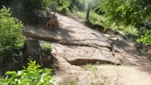
One of two cairns in the area that are difficult to get to. Within a conifer forest that's very overgrown. Positioned on a terrace on a S facing steep hillside this is an interesting site. The cairn is overgrown with moss and punctuated by conifers whose trunks have shifted the larger stones, and whose roots have grown over the underlying stones. I have surveyed the site to determine where the stones lie and it appears that the central area is raised to about 0.8m. The site is not circular (if indeed it ever was) it appears more like an avenue leading to the central raised area from the E and W and measuring about 6m from both directions, i.e. 12m in length? Taking pics was difficult due to the trees and the humidity corrupted several shots taken with my tablet.
You may be viewing yesterday's version of this page. To see the most up to date information please register for a free account.
")
")
")
Do not use the above information on other web sites or publications without permission of the contributor.
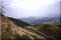
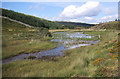
Nearby Images from Geograph Britain and Ireland:
©2021(licence)
©2008(licence)
©2021(licence)
©2007(licence)
©2006(licence)
The above images may not be of the site on this page, they are loaded from Geograph.
Please Submit an Image of this site or go out and take one for us!
Click here to see more info for this site
Nearby sites
Key: Red: member's photo, Blue: 3rd party photo, Yellow: other image, Green: no photo - please go there and take one, Grey: site destroyed
Download sites to:
KML (Google Earth)
GPX (GPS waypoints)
CSV (Garmin/Navman)
CSV (Excel)
To unlock full downloads you need to sign up as a Contributory Member. Otherwise downloads are limited to 50 sites.
Turn off the page maps and other distractions
Nearby sites listing. In the following links * = Image available
100m N 358° Cairn South of Mynydd Maes Mawr* Cairn (SH708203)
199m E 88° Tan Y Graig Cairn* Round Cairn (SH710202)
1.1km SE 126° Kenric's Stone (Llanelltyd)* Early Christian Sculptured Stone (SH717195)
1.7km SE 129° Pentre Farm Barrow* Round Barrow(s) (SH721191)
2.1km ESE 111° Coed Pen Y Bryn Defended Settlement* Hillfort (SH727194)
2.2km NNE 32° Cefn Coch Cairn and Cist* Cairn (SH720220)
2.5km E 84° Foel Faner* Hillfort (SH733204)
2.7km NE 34° Tyddyn Bach Stone* Standing Stone (Menhir) (SH7241022420)
2.8km SSE 148° Pandy'r Odyn Well* Holy Well or Sacred Spring (SH722178)
2.8km NNE 21° Dolmelynllyn Estate Hut Circle* Ancient Village or Settlement (SH7187022823)
2.9km SE 141° Dolgellau* Modern Stone Circle etc (SH72581792)
3.0km NNE 21° Dolmelynllyn Estate Platform House* Ancient Village or Settlement (SH7197223010)
3.2km SE 144° Ffynnon Fair (Dolgellau)* Holy Well or Sacred Spring (SH72601755)
3.5km NE 38° Carreg Coed Y Brenin* Modern Stone Circle etc (SH730229)
3.6km NNE 20° Berth Llwyd Hut Circle* Ancient Village or Settlement (SH7210023550)
3.6km SSW 198° Waen Fechan Cairn 3* Cairn (SH696168)
3.7km NNE 19° Berth Llwyd Enclosure* Ancient Village or Settlement (SH7210023670)
3.7km SSW 192° Waen Fechan Cairn 4* Cairn (SH699166)
3.7km NNE 18° Berth Llwyd Cairn Cemetery* Barrow Cemetery (SH7206023700)
3.7km SSW 197° Waen Fechan cairn 1* Cairn (SH69621666)
3.8km SSW 195° Waen Fechan cairn 2* Cairn (SH69731660)
3.9km E 83° Caer Isaf Moel-Offrwm* Hillfort (SH747206)
4.0km SSW 197° Cairn North of Craig Y Castell.* Round Cairn (SH695164)
4.1km SSW 196° Craig Y Castell Stone Feature* Modern Stone Circle etc (SH696163)
4.1km ENE 63° Tyddyn Bach Round Barrow* Round Barrow(s) (SH74572196)
View more nearby sites and additional images


 We would like to know more about this location. Please feel free to add a brief description and any relevant information in your own language.
 Wir möchten mehr über diese Stätte erfahren. Bitte zögern Sie nicht, eine kurze Beschreibung und relevante Informationen in Deutsch hinzuzufügen.
 Nous aimerions en savoir encore un peu sur les lieux. S'il vous plaît n'hesitez pas à ajouter une courte description et tous les renseignements pertinents dans votre propre langue.
 Quisieramos informarnos un poco más de las lugares. No dude en añadir una breve descripción y otros datos relevantes en su propio idioma.