

<< Our Photo Pages >> Gochang 6th Course Dolmens - Burial Chamber or Dolmen in South Korea
Submitted by Aska on Friday, 12 April 2019 Page Views: 907
Neolithic and Bronze AgeSite Name: Gochang 6th Course Dolmens Alternative Name: 고찬고인돌유 적6제코스Country: South Korea Type: Burial Chamber or Dolmen
Nearest Town: Gochang 고창 高敞 Nearest Village: Dosan-ri 도산리
Latitude: 35.436910N Longitude: 126.656340E
Condition:
| 5 | Perfect |
| 4 | Almost Perfect |
| 3 | Reasonable but with some damage |
| 2 | Ruined but still recognisable as an ancient site |
| 1 | Pretty much destroyed, possibly visible as crop marks |
| 0 | No data. |
| -1 | Completely destroyed |
| 5 | Superb |
| 4 | Good |
| 3 | Ordinary |
| 2 | Not Good |
| 1 | Awful |
| 0 | No data. |
| 5 | Can be driven to, probably with disabled access |
| 4 | Short walk on a footpath |
| 3 | Requiring a bit more of a walk |
| 2 | A long walk |
| 1 | In the middle of nowhere, a nightmare to find |
| 0 | No data. |
| 5 | co-ordinates taken by GPS or official recorded co-ordinates |
| 4 | co-ordinates scaled from a detailed map |
| 3 | co-ordinates scaled from a bad map |
| 2 | co-ordinates of the nearest village |
| 1 | co-ordinates of the nearest town |
| 0 | no data |
Internal Links:
External Links:
")
You may be viewing yesterday's version of this page. To see the most up to date information please register for a free account.
")
Do not use the above information on other web sites or publications without permission of the contributor.
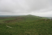
Nearby Images from Flickr
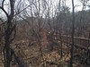
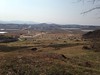

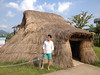
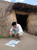
The above images may not be of the site on this page, but were taken nearby. They are loaded from Flickr so please click on them for image credits.
Click here to see more info for this site
Nearby sites
Click here to view sites on an interactive map of the areaKey: Red: member's photo, Blue: 3rd party photo, Yellow: other image, Green: no photo - please go there and take one, Grey: site destroyed
Download sites to:
KML (Google Earth)
GPX (GPS waypoints)
CSV (Garmin/Navman)
CSV (Excel)
To unlock full downloads you need to sign up as a Contributory Member. Otherwise downloads are limited to 50 sites.
Turn off the page maps and other distractions
Nearby sites listing. In the following links * = Image available
650m NW 325° Gochang goindol-yujeok* Burial Chamber or Dolmen
1.4km N 351° Gochang 2nd Course Dolmens* Burial Chamber or Dolmen
1.4km WNW 299° Mugisuk Dolmen* Burial Chamber or Dolmen
1.5km N 358° Gochang 1st Course Dolmens* Burial Chamber or Dolmen
1.6km NNW 335° Gochang 3rd Course Dolmens* Burial Chamber or Dolmen
1.6km NNW 328° Gochang 4th Course Dolmens* Natural Stone / Erratic / Other Natural Feature
1.7km NW 306° Gochang 5th Course Dolmen* Burial Chamber or Dolmen
1.9km NNE 28° Song-arm-ri menhir* Standing Stone (Menhir)
3.7km N 357° Ungok-ri Dolmen* Burial Chamber or Dolmen
4.0km E 96° Gochangeup Castle* Hillfort
5.0km ESE 117° Pavilion Dolmen* Burial Chamber or Dolmen
5.1km ESE 119° Hodong Village dolmen 1* Burial Chamber or Dolmen
6.7km E 98° Walarm-ri Menhir 1* Standing Stone (Menhir)
6.9km E 95° Walarm-ri Dolmen 1* Burial Chamber or Dolmen
7.0km WSW 251° Gochang Dolmens* Burial Chamber or Dolmen
7.4km NNW 344° Yongsan-ri Dolmen* Burial Chamber or Dolmen
7.9km WNW 286° Pyeongji-ri dolmen 2 Burial Chamber or Dolmen
8.1km S 190° Panjeong-ri Dolemen Burial Chamber or Dolmen
8.8km WNW 285° Pyeongji-ri dolmen 3* Burial Chamber or Dolmen
9.1km SSW 191° Amchi-ri Dolmen Burial Chamber or Dolmen
9.9km WNW 284° Pyeongji-ri dolmen 4* Burial Chamber or Dolmen
10.0km WNW 284° Pyeongji-ri dolmen* Burial Chamber or Dolmen
10.0km SSW 192° Musong-ri Dolmen* Burial Chamber or Dolmen
11.3km WNW 287° Ansan-Ri Dolmen* Burial Chamber or Dolmen
12.6km NW 304° Docheon-ri Dolmen* Burial Chamber or Dolmen
View more nearby sites and additional images


 We would like to know more about this location. Please feel free to add a brief description and any relevant information in your own language.
 Wir möchten mehr über diese Stätte erfahren. Bitte zögern Sie nicht, eine kurze Beschreibung und relevante Informationen in Deutsch hinzuzufügen.
 Nous aimerions en savoir encore un peu sur les lieux. S'il vous plaît n'hesitez pas à ajouter une courte description et tous les renseignements pertinents dans votre propre langue.
 Quisieramos informarnos un poco más de las lugares. No dude en añadir una breve descripción y otros datos relevantes en su propio idioma.