

<< Our Photo Pages >> Tumulus Pas de Pertus 3 - Round Barrow(s) in France in Languedoc:Hérault (34)
Submitted by LaDragonne on Saturday, 25 August 2018 Page Views: 783
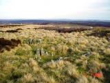
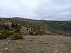
Neolithic and Bronze AgeSite Name: Tumulus Pas de Pertus 3Country: France Département: Languedoc:Hérault (34) Type: Round Barrow(s)
Nearest Town: LODÈVE Nearest Village: Sorbs
Latitude: 43.872180N Longitude: 3.419700E
Condition:
| 5 | Perfect |
| 4 | Almost Perfect |
| 3 | Reasonable but with some damage |
| 2 | Ruined but still recognisable as an ancient site |
| 1 | Pretty much destroyed, possibly visible as crop marks |
| 0 | No data. |
| -1 | Completely destroyed |
| 5 | Superb |
| 4 | Good |
| 3 | Ordinary |
| 2 | Not Good |
| 1 | Awful |
| 0 | No data. |
| 5 | Can be driven to, probably with disabled access |
| 4 | Short walk on a footpath |
| 3 | Requiring a bit more of a walk |
| 2 | A long walk |
| 1 | In the middle of nowhere, a nightmare to find |
| 0 | No data. |
| 5 | co-ordinates taken by GPS or official recorded co-ordinates |
| 4 | co-ordinates scaled from a detailed map |
| 3 | co-ordinates scaled from a bad map |
| 2 | co-ordinates of the nearest village |
| 1 | co-ordinates of the nearest town |
| 0 | no data |
Internal Links:
External Links:
")
You may be viewing yesterday's version of this page. To see the most up to date information please register for a free account.
")
Do not use the above information on other web sites or publications without permission of the contributor.
Nearby Images from Flickr
The above images may not be of the site on this page, but were taken nearby. They are loaded from Flickr so please click on them for image credits.
Click here to see more info for this site
Nearby sites
Click here to view sites on an interactive map of the areaKey: Red: member's photo, Blue: 3rd party photo, Yellow: other image, Green: no photo - please go there and take one, Grey: site destroyed
Download sites to:
KML (Google Earth)
GPX (GPS waypoints)
CSV (Garmin/Navman)
CSV (Excel)
To unlock full downloads you need to sign up as a Contributory Member. Otherwise downloads are limited to 50 sites.
Turn off the page maps and other distractions
Nearby sites listing. In the following links * = Image available
21m ENE 74° Tumulus Pas de Pertus 5 Round Barrow(s)
25m ENE 58° Tumulus Pas de Pertus 4* Round Barrow(s)
28m SSE 160° Tumulus Pas de Pertus 2* Round Barrow(s)
45m SSE 164° Menhir du Pas de Pertus* Standing Stone (Menhir)
56m SSE 166° Tumulus Pas de Pertus 1* Round Barrow(s)
198m ESE 102° Menhir Pas de Pertus 4* Standing Stone (Menhir)
346m ENE 70° Menhir Pas de Pertus 2* Standing Stone (Menhir)
392m ENE 72° Menhir Pas de Pertus 1* Standing Stone (Menhir)
423m ENE 76° Menhir Pas de Pertus 3* Standing Stone (Menhir)
583m NNW 339° Dolmen de Latude 2* Burial Chamber or Dolmen
613m NNW 341° Menhir de Latude 2a* Standing Stone (Menhir)
643m ESE 122° Menhir des Gamboules* Standing Stone (Menhir)
648m NNW 338° Menhir de Latude 2* Standing Stone (Menhir)
877m NE 51° Menhir de l'Espérelle 2* Standing Stone (Menhir)
890m ENE 62° Menhir de l'Espérelle 3* Standing Stone (Menhir)
944m NNW 340° Menhir de Latude 1* Standing Stones
971m S 181° Menhir 4 Gamboules* Standing Stone (Menhir)
1.0km ENE 65° Menhir de l'Espérelle 4* Standing Stone (Menhir)
1.0km NNE 16° Dolmen de Latude 1* Burial Chamber or Dolmen
1.0km NW 310° Menhir de Latude 5* Standing Stone (Menhir)
1.1km NNE 16° Menhir de l'Espérelle 1* Standing Stone (Menhir)
1.3km WNW 296° Dolmen de Latude 6* Burial Chamber or Dolmen
1.3km ENE 70° Menhir des Baumes 3* Standing Stone (Menhir)
1.3km S 181° Groupe de Menhirs Gamboules* Standing Stones
1.4km SE 140° Menhirs du Caylaret* Standing Stones
View more nearby sites and additional images


 We would like to know more about this location. Please feel free to add a brief description and any relevant information in your own language.
 Wir möchten mehr über diese Stätte erfahren. Bitte zögern Sie nicht, eine kurze Beschreibung und relevante Informationen in Deutsch hinzuzufügen.
 Nous aimerions en savoir encore un peu sur les lieux. S'il vous plaît n'hesitez pas à ajouter une courte description et tous les renseignements pertinents dans votre propre langue.
 Quisieramos informarnos un poco más de las lugares. No dude en añadir una breve descripción y otros datos relevantes en su propio idioma.