


<< Our Photo Pages >> Cranshaw Thorn Hill 05 - Rock Art in England in Yorkshire (West)
Submitted by Anne T on Monday, 29 January 2018 Page Views: 734
Rock ArtSite Name: Cranshaw Thorn Hill 05 Alternative Name: ERA-2555; Boughey & Vickerman (271); SAM 25382Country: England County: Yorkshire (West) Type: Rock Art
Nearest Town: Ilkley
Map Ref: SE1232846312
Latitude: 53.912815N Longitude: 1.813812W
Condition:
| 5 | Perfect |
| 4 | Almost Perfect |
| 3 | Reasonable but with some damage |
| 2 | Ruined but still recognisable as an ancient site |
| 1 | Pretty much destroyed, possibly visible as crop marks |
| 0 | No data. |
| -1 | Completely destroyed |
| 5 | Superb |
| 4 | Good |
| 3 | Ordinary |
| 2 | Not Good |
| 1 | Awful |
| 0 | No data. |
| 5 | Can be driven to, probably with disabled access |
| 4 | Short walk on a footpath |
| 3 | Requiring a bit more of a walk |
| 2 | A long walk |
| 1 | In the middle of nowhere, a nightmare to find |
| 0 | No data. |
| 5 | co-ordinates taken by GPS or official recorded co-ordinates |
| 4 | co-ordinates scaled from a detailed map |
| 3 | co-ordinates scaled from a bad map |
| 2 | co-ordinates of the nearest village |
| 1 | co-ordinates of the nearest town |
| 0 | no data |
Be the first person to rate this site - see the 'Contribute!' box in the right hand menu.
Internal Links:
External Links:
I have visited· I would like to visit
AndrewTawn has visited here
")
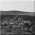
This rock art panel contains 14 cups, grooves and depressions, created making use of natural features. Seven of the cups are clustered in the centre of the panel. One of the cups has been placed on a slightly mounded dome. Two of the 14 cups are linked by a short groove forming a dumbbell. For more information see England's Rock Art entry for ERA-2555 Cranshaw Thorn Hill 05, which includes a description, photographs, a plan of the stone and its motifs, plus photogrammetry.
This rock is also recorded as part of a group of four Bronze Age cup and ring marked stones and a possible prehistoric enclosure - see Pastscape Monument No. 1031136, which gives slightly different dimensions to the rock from the ERA entry, but the carving description is the same.
This rock art panel is located on Open Access land.
Note: Have you seen this rock art panel? Do you have any photographs or information to add?
You may be viewing yesterday's version of this page. To see the most up to date information please register for a free account.
")
Do not use the above information on other web sites or publications without permission of the contributor.
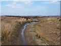
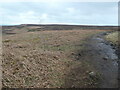
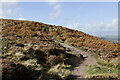
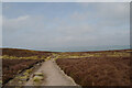
Nearby Images from Geograph Britain and Ireland:
©2013(licence)
©2024(licence)
©2022(licence)
©2023(licence)
©2023(licence)
The above images may not be of the site on this page, they are loaded from Geograph.
Please Submit an Image of this site or go out and take one for us!
Click here to see more info for this site
Nearby sites
Key: Red: member's photo, Blue: 3rd party photo, Yellow: other image, Green: no photo - please go there and take one, Grey: site destroyed
Download sites to:
KML (Google Earth)
GPX (GPS waypoints)
CSV (Garmin/Navman)
CSV (Excel)
To unlock full downloads you need to sign up as a Contributory Member. Otherwise downloads are limited to 50 sites.
Turn off the page maps and other distractions
Nearby sites listing. In the following links * = Image available
44m NNE 30° Cranshaw Thorn Hill 07 Rock Art (SE1235046350)
69m WNW 303° Cranshaw Thorn Hill Rock Art (SE12274635)
83m S 173° Cranshaw Thorn Hill 06* Rock Art (SE1233846230)
89m NW 306° Cranshaw Thorn Hill 04* Rock Art (SE1225646364)
90m WNW 282° Cranshaw Thorn Hill 02 Rock Art (SE1224046330)
90m WNW 292° Cranshaw Thorn Hill 03* Rock Art (SE1224446346)
100m WNW 289° Cranshaw Thorn Hill 01* Rock Art (SE1223346344)
205m NW 325° Ilkley Crags* Rock Art (SE1221046480)
257m E 80° Cranshaw Thorn Hill 08* Rock Art (SE1258246358)
331m ESE 124° Backstone Circle* Stone Circle (SE1260546130)
348m E 95° Backstone Beck 01* Rock Art (SE1267646282)
366m SE 141° Gill Head 01* Rock Art (SE1255846027)
392m E 96° Backstone Beck 03* Rock Art (SE1271946270)
414m E 99° Backstone Beck 04* Rock Art (SE1273846249)
472m NE 54° Backstone Beck 02* Rock Art (SE1270946592)
506m E 97° Backstone Beck 05a Rock Art (SE1283246254)
507m ESE 104° Backstone Beck 05.* Rock Art (SE1282246190)
516m NNE 34° Hangingstones 01* Rock Art (SE1261446742)
516m ESE 114° Backstone Beck Enclosure* Ancient Village or Settlement (SE128461)
524m ESE 106° Backstone Beck 06* Rock Art (SE1283246165)
533m ESE 108° Backstone Beck 07* Rock Art (SE1283646147)
548m NNE 24° Backstone Beck (Cowpasture Road) Rock Art (SE1254946814)
551m WNW 294° White Wells 06* Rock Art (SE1182246533)
557m NE 39° Hangingstone Rock 02 & 03* Rock Art (SE1267846747)
568m WNW 296° White Wells 05* Rock Art (SE1181646562)
View more nearby sites and additional images


 We would like to know more about this location. Please feel free to add a brief description and any relevant information in your own language.
 Wir möchten mehr über diese Stätte erfahren. Bitte zögern Sie nicht, eine kurze Beschreibung und relevante Informationen in Deutsch hinzuzufügen.
 Nous aimerions en savoir encore un peu sur les lieux. S'il vous plaît n'hesitez pas à ajouter une courte description et tous les renseignements pertinents dans votre propre langue.
 Quisieramos informarnos un poco más de las lugares. No dude en añadir una breve descripción y otros datos relevantes en su propio idioma.