<< Text Pages >> Emmott Cross (Colne) - Ancient Cross in England in Lancashire
Submitted by Anne T on Monday, 16 October 2017 Page Views: 1394
Early Medieval (Dark Age)Site Name: Emmott Cross (Colne) Alternative Name: The Touch CrossCountry: England County: Lancashire Type: Ancient Cross
Nearest Town: Burnley Nearest Village: Colne
Map Ref: SD888401
Latitude: 53.857003N Longitude: 2.171759W
Condition:
| 5 | Perfect |
| 4 | Almost Perfect |
| 3 | Reasonable but with some damage |
| 2 | Ruined but still recognisable as an ancient site |
| 1 | Pretty much destroyed, possibly visible as crop marks |
| 0 | No data. |
| -1 | Completely destroyed |
| 5 | Superb |
| 4 | Good |
| 3 | Ordinary |
| 2 | Not Good |
| 1 | Awful |
| 0 | No data. |
| 5 | Can be driven to, probably with disabled access |
| 4 | Short walk on a footpath |
| 3 | Requiring a bit more of a walk |
| 2 | A long walk |
| 1 | In the middle of nowhere, a nightmare to find |
| 0 | No data. |
| 5 | co-ordinates taken by GPS or official recorded co-ordinates |
| 4 | co-ordinates scaled from a detailed map |
| 3 | co-ordinates scaled from a bad map |
| 2 | co-ordinates of the nearest village |
| 1 | co-ordinates of the nearest town |
| 0 | no data |
Be the first person to rate this site - see the 'Contribute!' box in the right hand menu.
Internal Links:
External Links:
I have visited· I would like to visit
AmyBlahBlahBlah would like to visit
The Emmott Cross in Colne stands at the north side of St. Bartholomew's churchyard. Also known as the Touch Cross, this 7ft tall English Gothic style cross was re-erected here in 1967, having been removed from the grounds of Emmott Hall in Laneshawbridge when the old hall was being pulled down.
The Northern Antiquarian (TNA) feature a page on this cross - see their entry for Emmott Cross, Colne, Lancashire, which adds: "The cross had stood for centuries close to the famous Hallown Well, both of which were highly venerated by pilgrims travelling between Whalley Abbey and Yorkshire. It appears that originally the cross had stood at the side of the Stanbury to Haworth road over Herders, close by Emmott."
TNA also says that "The name Touch Cross probably comes about in the sense that pilgrims touched the cross in the hope of a safe pilgrimage, or the name may be something to do with a troop of soldiers who were stationed at the hall in the past. They touched the stone too, but for different reasons – that they would live to fight another day in battle."
Note: Have you visited this site? Do you have any photographs or more information to add?
You may be viewing yesterday's version of this page. To see the most up to date information please register for a free account.
Do not use the above information on other web sites or publications without permission of the contributor.
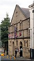
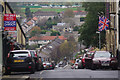
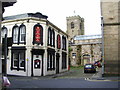
Nearby Images from Geograph Britain and Ireland:
©2015(licence)

©2008(licence)

©2010(licence)
©2015(licence)
©2007(licence)
The above images may not be of the site on this page, they are loaded from Geograph.
Please Submit an Image of this site or go out and take one for us!
Click here to see more info for this site
Nearby sites
Key: Red: member's photo, Blue: 3rd party photo, Yellow: other image, Green: no photo - please go there and take one, Grey: site destroyed
Download sites to:
KML (Google Earth)
GPX (GPS waypoints)
CSV (Garmin/Navman)
CSV (Excel)
To unlock full downloads you need to sign up as a Contributory Member. Otherwise downloads are limited to 50 sites.
Turn off the page maps and other distractions
Nearby sites listing. In the following links * = Image available
447m SSE 153° St. Helen's Well (Waterside, Colne)* Holy Well or Sacred Spring (SD890397)
1.2km NW 313° Alkincoats Cross (Colne) Ancient Cross (SD87894094)
1.7km S 190° Castercliffe* Hillfort (SD8848738395)
1.9km S 186° The Gib Clough Head Stone* Marker Stone (SD886382)
2.2km N 5° Tallers Cross* Ancient Cross (SD890423)
2.3km WSW 245° Swinden Cross (Swinden Clough) Ancient Cross (SD86733916)
2.7km SSE 167° Walton Spire Stone* Standing Stone (Menhir) (SD8939137498)
2.8km SSE 167° Walton Spire Cross* Standing Stone (Menhir) (SD8941637328)
3.0km SSW 192° Catlow Well/Spring* Holy Well or Sacred Spring (SD8818137169)
3.1km NNW 345° The Lark Hill Stone (Whitemoor)* Standing Stone (Menhir) (SD880431)
3.2km S 172° Ring Stones Hill Stone Circle (SD89263693)
3.2km ENE 69° Cold Well (Laneshawbridge)* Holy Well or Sacred Spring (SD91804125)
3.2km SSE 165° Knave Hill (Nelson)* Cairn (SD8963636991)
3.3km WNW 287° Cock Hill Standing Stone* Standing Stone (Menhir) (SD85624110)
3.8km WNW 297° Blacko Cross (Blacko Hill) Ancient Cross (SD85414187)
4.3km WNW 292° Aedmer's Mound (Admergill)* Artificial Mound (SD8482941718)
4.3km S 180° Burwain's Farm Stone Circle (SD888358)
4.4km E 100° Wycoller Cup-marked Stones* Rock Art (SD931393)
4.4km E 98° Lowlands Well (Wycoller) Holy Well or Sacred Spring (SD93173944)
4.4km E 82° Hullown Well* Holy Well or Sacred Spring (SD93204067)
4.8km SSW 206° Finn's Well (Haggate) Holy Well or Sacred Spring (SD86713582)
4.8km SSE 166° Burwain's Camp* Misc. Earthwork (SD900354)
4.8km S 188° Annot Cross (Brierfield) Ancient Cross (SD881353)
4.9km ESE 104° Wycoller Iron Age Bridge (Standing Stone)* Standing Stone (Menhir) (SD93583889)
5.1km SSE 163° Broadbank* Ancient Village or Settlement (SD9023935227)
View more nearby sites and additional images


 We would like to know more about this location. Please feel free to add a brief description and any relevant information in your own language.
 Wir möchten mehr über diese Stätte erfahren. Bitte zögern Sie nicht, eine kurze Beschreibung und relevante Informationen in Deutsch hinzuzufügen.
 Nous aimerions en savoir encore un peu sur les lieux. S'il vous plaît n'hesitez pas à ajouter une courte description et tous les renseignements pertinents dans votre propre langue.
 Quisieramos informarnos un poco más de las lugares. No dude en añadir una breve descripción y otros datos relevantes en su propio idioma.