<< Text Pages >> Nattor Down 5 - Cairn in England in Devon
Submitted by Anne T on Wednesday, 19 October 2016 Page Views: 1222
Neolithic and Bronze AgeSite Name: Nattor Down 5 Alternative Name: Grinsell Peter Tavy 14; Butler Nattor Down 5 (V2 32.2)Country: England County: Devon Type: Cairn
Nearest Town: Tavistock Nearest Village: Willsworthy
Map Ref: SX54098286
Latitude: 50.627133N Longitude: 4.064288W
Condition:
| 5 | Perfect |
| 4 | Almost Perfect |
| 3 | Reasonable but with some damage |
| 2 | Ruined but still recognisable as an ancient site |
| 1 | Pretty much destroyed, possibly visible as crop marks |
| 0 | No data. |
| -1 | Completely destroyed |
| 5 | Superb |
| 4 | Good |
| 3 | Ordinary |
| 2 | Not Good |
| 1 | Awful |
| 0 | No data. |
| 5 | Can be driven to, probably with disabled access |
| 4 | Short walk on a footpath |
| 3 | Requiring a bit more of a walk |
| 2 | A long walk |
| 1 | In the middle of nowhere, a nightmare to find |
| 0 | No data. |
| 5 | co-ordinates taken by GPS or official recorded co-ordinates |
| 4 | co-ordinates scaled from a detailed map |
| 3 | co-ordinates scaled from a bad map |
| 2 | co-ordinates of the nearest village |
| 1 | co-ordinates of the nearest town |
| 0 | no data |
Be the first person to rate this site - see the 'Contribute!' box in the right hand menu.
Internal Links:
External Links:
Cairn and cist in Devon
Information about the Nattor Down 5 Cist comes from Prehistoric Dartmoor Walks (PDW) website.
The PDW web page gives links to further information on Pastscape, Monument Number 440705, which describes this monument as: "a Bronze Age cairn and a cist. The cairn measures 4.9m by 4.2m and is 0.3m high, and incorporates the remains of a cist. It consists of one side slab 1.2m long and one end slab 0.5m long; the visible depth is 0.4m of which 0.1m protrudes above the cairn. A possible cover stone, 1.0m by 0.8m, lies embedded in the south side of the cairn."
This site is also recorded as MDV3223 (Cairn in the Parish of Peter Tavy) on the Devon and Dartmoor HER, and scheduled as part of Historic England List Entry No. 1008711 (An enclosed stone hut circle settlement, three round cairns and a length of reave 650m WSW of Ger Tor).
Note: Have you visited this site? Do you have any photographs, images or further information you can add?
You may be viewing yesterday's version of this page. To see the most up to date information please register for a free account.
Do not use the above information on other web sites or publications without permission of the contributor.
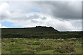
Nearby Images from Geograph Britain and Ireland:

©2010(licence)

©2015(licence)

©2013(licence)

©2015(licence)
©2011(licence)
The above images may not be of the site on this page, they are loaded from Geograph.
Please Submit an Image of this site or go out and take one for us!
Click here to see more info for this site
Nearby sites
Key: Red: member's photo, Blue: 3rd party photo, Yellow: other image, Green: no photo - please go there and take one, Grey: site destroyed
Download sites to:
KML (Google Earth)
GPX (GPS waypoints)
CSV (Garmin/Navman)
CSV (Excel)
To unlock full downloads you need to sign up as a Contributory Member. Otherwise downloads are limited to 50 sites.
Turn off the page maps and other distractions
Nearby sites listing. In the following links * = Image available
763m NE 45° Ger Tor Cairn (SX54658338)
1.2km NNW 331° White Hill North Cairn Field Ring Cairn (SX53528395)
1.4km NNW 343° White Hill North East* Cairn (SX5371384190)
1.4km NW 304° White Hill South* Ring Cairn (SX5294283680)
1.6km SSE 155° Standon Hill Cairn Cairn (SX5473781373)
1.9km W 269° Ring of Bells* Ring Cairn (SX5214082873)
2.0km N 7° Doe Tor* Cist (SX54388485)
3.4km SE 131° Limsboro Cairn (SX5656780550)
3.6km WNW 302° Lydford Anglo Saxon Defences* Misc. Earthwork (SX51088487)
3.7km N 11° Great Links Tor Cairn* Cairn (SX5491686496)
3.9km S 184° Cudlipptown Down Cairn (SX5373278949)
4.1km SSE 165° Langstone Moor stone row* Stone Row / Alignment (SX5502278851)
4.1km SSE 166° Langstone Moor row 2* Stone Row / Alignment (SX54957880)
4.2km SSE 164° Langstone Moor 3 Stone Row / Alignment (SX55107880)
4.2km S 176° White Tor (Peter Tavy)* Ancient Village or Settlement (SX5424078673)
4.2km S 172° Cairns East of White Tor* Cairn (SX5459578695)
4.2km S 170° East of White Tor Cairn 4* Cist (SX5469478690)
4.2km S 171° East of White Tor cairn 3* Cairn (SX5461278668)
4.2km S 172° East of White for cairn 2* Cairn (SX5459278664)
4.2km SSE 166° The Langstone* Standing Stone (Menhir) (SX55027873)
4.3km SSE 149° Cocks Hill West Cairn* Cairn (SX5618579154)
4.4km S 185° Cudliptown Down Enclosed Settlement* Ancient Village or Settlement (SX536785)
4.5km S 176° South of White Tor Cairns* Barrow Cemetery (SX543784)
4.5km SE 141° White Barrow (Cocks Hill) Cairn (SX568793)
4.5km S 179° White Tor Long Cairn* Cairn (SX5401478316)
View more nearby sites and additional images


 We would like to know more about this location. Please feel free to add a brief description and any relevant information in your own language.
 Wir möchten mehr über diese Stätte erfahren. Bitte zögern Sie nicht, eine kurze Beschreibung und relevante Informationen in Deutsch hinzuzufügen.
 Nous aimerions en savoir encore un peu sur les lieux. S'il vous plaît n'hesitez pas à ajouter une courte description et tous les renseignements pertinents dans votre propre langue.
 Quisieramos informarnos un poco más de las lugares. No dude en añadir una breve descripción y otros datos relevantes en su propio idioma.