<< Other Photo Pages >> Cromlech de Lann Pen ar Lan - Stone Circle in France in Bretagne:Finistère (29)
Submitted by holger_rix on Wednesday, 11 May 2016 Page Views: 1692
Neolithic and Bronze AgeSite Name: Cromlech de Lann Pen ar LanCountry: France Département: Bretagne:Finistère (29) Type: Stone Circle
Nearest Town: Brest Nearest Village: Ouessant
Latitude: 48.462670N Longitude: 5.037566W
Condition:
| 5 | Perfect |
| 4 | Almost Perfect |
| 3 | Reasonable but with some damage |
| 2 | Ruined but still recognisable as an ancient site |
| 1 | Pretty much destroyed, possibly visible as crop marks |
| 0 | No data. |
| -1 | Completely destroyed |
| 5 | Superb |
| 4 | Good |
| 3 | Ordinary |
| 2 | Not Good |
| 1 | Awful |
| 0 | No data. |
| 5 | Can be driven to, probably with disabled access |
| 4 | Short walk on a footpath |
| 3 | Requiring a bit more of a walk |
| 2 | A long walk |
| 1 | In the middle of nowhere, a nightmare to find |
| 0 | No data. |
| 5 | co-ordinates taken by GPS or official recorded co-ordinates |
| 4 | co-ordinates scaled from a detailed map |
| 3 | co-ordinates scaled from a bad map |
| 2 | co-ordinates of the nearest village |
| 1 | co-ordinates of the nearest town |
| 0 | no data |
Internal Links:
External Links:
")
Lampaul, Ouessant, Brest, Finistère, Brittany
Source: T4T35.fr
"The stone circle of the peninsula of Pen ar Lan, which has an ovoid shape (a "megalithic egg" made up of 18 blocks of 0.60 m to 1 m high, connected by a slope makes it a small wall stones, drawing an ellipse of 13 m in the east-west by 10 m in its north-south axis), was perhaps a prehistoric astronomical monument; Another assumption made safe megalithic sepulchral. In the center were two menhirs that have disappeared. The site was excavated in 1988 by archaeologists and Jacques Briard Michel Goffic"
Information and Pictures:
t4t35.fr
You may be viewing yesterday's version of this page. To see the most up to date information please register for a free account.
Do not use the above information on other web sites or publications without permission of the contributor.
Nearby Images from Flickr


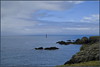

The above images may not be of the site on this page, but were taken nearby. They are loaded from Flickr so please click on them for image credits.
Click here to see more info for this site
Nearby sites
Click here to view sites on an interactive map of the areaKey: Red: member's photo, Blue: 3rd party photo, Yellow: other image, Green: no photo - please go there and take one, Grey: site destroyed
Download sites to:
KML (Google Earth)
GPX (GPS waypoints)
CSV (Garmin/Navman)
CSV (Excel)
To unlock full downloads you need to sign up as a Contributory Member. Otherwise downloads are limited to 50 sites.
Turn off the page maps and other distractions
Nearby sites listing. In the following links * = Image available
15m N 350° Lann Pen ar Lan menhir Standing Stone (Menhir)
529m SW 236° Alignement de Lann Pen ar Lan Stone Row / Alignment
4.1km SSE 151° Dolmens de l'Île-de-Bannec Burial Chamber or Dolmen
6.4km SE 142° Dolmen de l'Île-de-Balanec Burial Chamber or Dolmen
9.0km SE 140° Dolmens de l'Île-Molène Burial Chamber or Dolmen
9.3km SE 133° Dolmen de Ledenez Vian Kemenez Burial Chamber or Dolmen
9.8km SE 143° Menhirs dit Amer Sud Standing Stone (Menhir)
9.8km SE 142° Menhirs du Moulin Sud Standing Stones
12.4km SSE 146° Dolmen de l'Île de Triélin 1 Burial Chamber or Dolmen
12.4km SE 146° Dolmens de l'Île de Triélin 2 Burial Chamber or Dolmen
13.5km SE 131° Tumulus de Lédénez-Vian Burial Chamber or Dolmen
13.6km SE 131° Affleurement à Cupule de l'Île-de-Ledenez-Vian Rock Art
13.6km SE 136° Dolmen et Pierres couchées de Beg ar Groas Burial Chamber or Dolmen
13.7km SE 136° Menhir de Beg ar Groas Standing Stone (Menhir)
13.7km SE 136° Tumulus de Beg ar Groas Burial Chamber or Dolmen
13.8km SE 132° Dolmen de Lédénez-Vraz Burial Chamber or Dolmen
14.2km SE 134° Île de Quéménes megalithic ensemble Standing Stones
18.4km SE 133° Cromlech de l'Île-de-Béniguet Stone Circle
18.5km SE 137° Cairn de l'Île de Béniguet Burial Chamber or Dolmen
18.6km SE 136° Île de Béniguet menhirs Stone Row / Alignment
18.6km E 98° Tumuli de l'ile Ségal* Barrow Cemetery
19.4km E 83° Île Melon Dolmen* Burial Chamber or Dolmen
19.4km E 83° Île Melon menhirs* Standing Stones
19.4km E 83° Île Melon grand menhir* Standing Stone (Menhir)
19.9km ENE 79° Dolmen de Kerizella* Burial Chamber or Dolmen
View more nearby sites and additional images


 We would like to know more about this location. Please feel free to add a brief description and any relevant information in your own language.
 Wir möchten mehr über diese Stätte erfahren. Bitte zögern Sie nicht, eine kurze Beschreibung und relevante Informationen in Deutsch hinzuzufügen.
 Nous aimerions en savoir encore un peu sur les lieux. S'il vous plaît n'hesitez pas à ajouter une courte description et tous les renseignements pertinents dans votre propre langue.
 Quisieramos informarnos un poco más de las lugares. No dude en añadir una breve descripción y otros datos relevantes en su propio idioma.