

<< Text Pages >> Crow Hole - Cave or Rock Shelter in Wales in West Glamorgan
Submitted by vicky on Monday, 23 September 2002 Page Views: 3970
Natural PlacesSite Name: Crow HoleCountry: Wales County: West Glamorgan Type: Cave or Rock Shelter
Nearest Town: Swansea Nearest Village: Southgate
Map Ref: SS558869 Landranger Map Number: 159
Latitude: 51.562490N Longitude: 4.081712W
Condition:
| 5 | Perfect |
| 4 | Almost Perfect |
| 3 | Reasonable but with some damage |
| 2 | Ruined but still recognisable as an ancient site |
| 1 | Pretty much destroyed, possibly visible as crop marks |
| 0 | No data. |
| -1 | Completely destroyed |
| 5 | Superb |
| 4 | Good |
| 3 | Ordinary |
| 2 | Not Good |
| 1 | Awful |
| 0 | No data. |
| 5 | Can be driven to, probably with disabled access |
| 4 | Short walk on a footpath |
| 3 | Requiring a bit more of a walk |
| 2 | A long walk |
| 1 | In the middle of nowhere, a nightmare to find |
| 0 | No data. |
| 5 | co-ordinates taken by GPS or official recorded co-ordinates |
| 4 | co-ordinates scaled from a detailed map |
| 3 | co-ordinates scaled from a bad map |
| 2 | co-ordinates of the nearest village |
| 1 | co-ordinates of the nearest town |
| 0 | no data |
Internal Links:
External Links:
Cave or Rock Shelter in West Glamorgan
Have you visited this site? Please add a comment below.
You may be viewing yesterday's version of this page. To see the most up to date information please register for a free account.
Do not use the above information on other web sites or publications without permission of the contributor.
Nearby Images from Geograph Britain and Ireland:
©2016(licence)
©2016(licence)
©2015(licence)
©2019(licence)
©2021(licence)
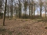
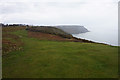
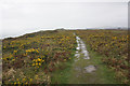
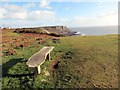
The above images may not be of the site on this page, they are loaded from Geograph.
Please Submit an Image of this site or go out and take one for us!
Click here to see more info for this site
Nearby sites
Key: Red: member's photo, Blue: 3rd party photo, Yellow: other image, Green: no photo - please go there and take one, Grey: site destroyed
Download sites to:
KML (Google Earth)
GPX (GPS waypoints)
CSV (Garmin/Navman)
CSV (Excel)
To unlock full downloads you need to sign up as a Contributory Member. Otherwise downloads are limited to 50 sites.
Turn off the page maps and other distractions
Nearby sites listing. In the following links * = Image available
315m ESE 107° Bacon Hole* Cave or Rock Shelter (SS561868)
315m WSW 250° Minchin Hole Cave or Rock Shelter (SS555868)
946m ESE 107° High Pennard* Hillfort (SS567866)
1.2km WNW 288° Ravencliffe Cave* Cave or Rock Shelter (SS547873)
1.4km NE 49° Bishopston Valley* Hillfort (SS569878)
2.5km NW 308° Pennard Pill Promontory Fort / Cliff Castle (SS53828851)
2.6km NNW 347° Trinity Well, Ilston* Holy Well or Sacred Spring (SS55308946)
2.7km NW 325° Gower Heritage centre* Museum (SS543892)
2.9km WNW 293° Penmaen Burrows* Chambered Tomb (SS53168812)
2.9km WNW 284° Leather's Hole Cave or Rock Shelter (SS530877)
3.1km ENE 76° Caswell Cliff Fort* Hillfort (SS58808756)
3.1km WNW 302° North Hills Lane Barrow Cemetary Barrow Cemetery (SS53248863)
3.1km NE 36° Kittle Hill Cave or Rock Shelter (SS577894)
3.2km ENE 70° Caswell Bay Cave Cave or Rock Shelter (SS589879)
3.5km ENE 64° St Peters's Well* Holy Well or Sacred Spring (SS59048837)
3.6km NW 323° Parc le Breos* Chambered Tomb (SS53738984)
3.7km NW 322° Church Hill Earthwork* Misc. Earthwork (SS53628987)
3.7km NW 325° Cat Hole Cave* Cave or Rock Shelter (SS53779002)
4.1km WNW 283° Crawley Rocks Promontory Fort / Cliff Castle (SS51878796)
4.1km WNW 297° Cefn Bryn Beacon 2 Cairn (SS52238886)
4.1km WNW 297° Cefn Bryn Beacon 1 Cairn (SS52198886)
4.2km NNE 16° Bishopston Burch Cairn (SS571909)
4.2km WNW 296° Cefn Bryn Cairn 1* Cairn (SS52068889)
4.5km WNW 299° Cefn Bryn Ring Cairn Ring Cairn (SS51918922)
4.5km WNW 299° Cefn Bryn Burnt Mound Misc. Earthwork (SS51898922)
View more nearby sites and additional images


 We would like to know more about this location. Please feel free to add a brief description and any relevant information in your own language.
 Wir möchten mehr über diese Stätte erfahren. Bitte zögern Sie nicht, eine kurze Beschreibung und relevante Informationen in Deutsch hinzuzufügen.
 Nous aimerions en savoir encore un peu sur les lieux. S'il vous plaît n'hesitez pas à ajouter une courte description et tous les renseignements pertinents dans votre propre langue.
 Quisieramos informarnos un poco más de las lugares. No dude en añadir una breve descripción y otros datos relevantes en su propio idioma.