


<< Our Photo Pages >> Gower Heritage centre - Museum in Wales in West Glamorgan
Submitted by coldrum on Saturday, 03 September 2011 Page Views: 10408
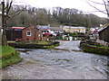
MuseumsSite Name: Gower Heritage centreCountry: Wales County: West Glamorgan Type: Museum
Nearest Village: Parkmill
Map Ref: SS543892
Latitude: 51.582771N Longitude: 4.10429W
Condition:
| 5 | Perfect |
| 4 | Almost Perfect |
| 3 | Reasonable but with some damage |
| 2 | Ruined but still recognisable as an ancient site |
| 1 | Pretty much destroyed, possibly visible as crop marks |
| 0 | No data. |
| -1 | Completely destroyed |
| 5 | Superb |
| 4 | Good |
| 3 | Ordinary |
| 2 | Not Good |
| 1 | Awful |
| 0 | No data. |
| 5 | Can be driven to, probably with disabled access |
| 4 | Short walk on a footpath |
| 3 | Requiring a bit more of a walk |
| 2 | A long walk |
| 1 | In the middle of nowhere, a nightmare to find |
| 0 | No data. |
| 5 | co-ordinates taken by GPS or official recorded co-ordinates |
| 4 | co-ordinates scaled from a detailed map |
| 3 | co-ordinates scaled from a bad map |
| 2 | co-ordinates of the nearest village |
| 1 | co-ordinates of the nearest town |
| 0 | no data |
Internal Links:
External Links:
I have visited· I would like to visit
Geojazz visited on 6th Sep 2021 - their rating: Cond: 5 Amb: 5 Access: 5 Have visited here many times in the past but only logged it today.
Andy B have visited here
")
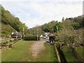
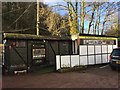
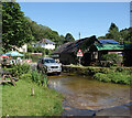
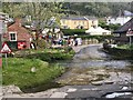
Gower Heritage Centre
Note: (Possibly) oldest cave art in UK, the image of a reindeer, has been vandalized
You may be viewing yesterday's version of this page. To see the most up to date information please register for a free account.
Do not use the above information on other web sites or publications without permission of the contributor.
Nearby Images from Geograph Britain and Ireland:
©2019(licence)
©2017(licence)
©2021(licence)
©2019(licence)
©2014(licence)
The above images may not be of the site on this page, they are loaded from Geograph.
Please Submit an Image of this site or go out and take one for us!
Click here to see more info for this site
Nearby sites
Key: Red: member's photo, Blue: 3rd party photo, Yellow: other image, Green: no photo - please go there and take one, Grey: site destroyed
Download sites to:
KML (Google Earth)
GPX (GPS waypoints)
CSV (Garmin/Navman)
CSV (Excel)
To unlock full downloads you need to sign up as a Contributory Member. Otherwise downloads are limited to 50 sites.
Turn off the page maps and other distractions
Nearby sites listing. In the following links * = Image available
840m SSW 213° Pennard Pill Promontory Fort / Cliff Castle (SS53828851)
856m NW 317° Parc le Breos* Chambered Tomb (SS53738984)
953m NW 313° Church Hill Earthwork* Misc. Earthwork (SS53628987)
975m NW 326° Cat Hole Cave* Cave or Rock Shelter (SS53779002)
1.0km ENE 74° Trinity Well, Ilston* Holy Well or Sacred Spring (SS55308946)
1.2km WSW 240° North Hills Lane Barrow Cemetary Barrow Cemetery (SS53248863)
1.6km SW 225° Penmaen Burrows* Chambered Tomb (SS53168812)
1.9km SSE 166° Ravencliffe Cave* Cave or Rock Shelter (SS547873)
2.0km SW 219° Leather's Hole Cave or Rock Shelter (SS530877)
2.1km NW 323° Tooth Cave* Cave or Rock Shelter (SS531909)
2.1km W 259° Cefn Bryn Beacon 2 Cairn (SS52238886)
2.1km W 259° Cefn Bryn Beacon 1 Cairn (SS52198886)
2.3km W 260° Cefn Bryn Cairn 1* Cairn (SS52068889)
2.4km W 269° Cefn Bryn Ring Cairn Ring Cairn (SS51918922)
2.4km W 269° Cefn Bryn Burnt Mound Misc. Earthwork (SS51898922)
2.4km W 269° Cefn Bryn Burnt Mound 2 Misc. Earthwork (SS51888922)
2.7km SSE 152° Minchin Hole Cave or Rock Shelter (SS555868)
2.7km WSW 241° Crawley Rocks Promontory Fort / Cliff Castle (SS51878796)
2.7km SE 145° Crow Hole Cave or Rock Shelter (SS558869)
2.9km ESE 117° Bishopston Valley* Hillfort (SS569878)
3.0km SE 142° Bacon Hole* Cave or Rock Shelter (SS561868)
3.3km ENE 57° Bishopston Burch Cairn (SS571909)
3.4km W 264° Nicholaston Hall Cairn Cairn (SS50948894)
3.4km E 85° Kittle Hill Cave or Rock Shelter (SS577894)
3.5km SE 136° High Pennard* Hillfort (SS567866)
View more nearby sites and additional images


 We would like to know more about this location. Please feel free to add a brief description and any relevant information in your own language.
 Wir möchten mehr über diese Stätte erfahren. Bitte zögern Sie nicht, eine kurze Beschreibung und relevante Informationen in Deutsch hinzuzufügen.
 Nous aimerions en savoir encore un peu sur les lieux. S'il vous plaît n'hesitez pas à ajouter une courte description et tous les renseignements pertinents dans votre propre langue.
 Quisieramos informarnos un poco más de las lugares. No dude en añadir una breve descripción y otros datos relevantes en su propio idioma.