<< Our Photo Pages >> Ballymeanoch Henge - Henge in Scotland in Argyll
Submitted by caradoc68 on Sunday, 11 December 2011 Page Views: 5250
Neolithic and Bronze AgeSite Name: Ballymeanoch HengeCountry: Scotland County: Argyll Type: Henge
Nearest Town: Lochgilphead Nearest Village: kilmarin
Map Ref: NR83319628
Latitude: 56.109971N Longitude: 5.486583W
Condition:
| 5 | Perfect |
| 4 | Almost Perfect |
| 3 | Reasonable but with some damage |
| 2 | Ruined but still recognisable as an ancient site |
| 1 | Pretty much destroyed, possibly visible as crop marks |
| 0 | No data. |
| -1 | Completely destroyed |
| 5 | Superb |
| 4 | Good |
| 3 | Ordinary |
| 2 | Not Good |
| 1 | Awful |
| 0 | No data. |
| 5 | Can be driven to, probably with disabled access |
| 4 | Short walk on a footpath |
| 3 | Requiring a bit more of a walk |
| 2 | A long walk |
| 1 | In the middle of nowhere, a nightmare to find |
| 0 | No data. |
| 5 | co-ordinates taken by GPS or official recorded co-ordinates |
| 4 | co-ordinates scaled from a detailed map |
| 3 | co-ordinates scaled from a bad map |
| 2 | co-ordinates of the nearest village |
| 1 | co-ordinates of the nearest town |
| 0 | no data |
Internal Links:
External Links:
I have visited· I would like to visit
SandyG visited on 15th Apr 2015 - their rating: Cond: 4 Amb: 5 Access: 4
coin visited on 1st Jan 2014 - their rating: Cond: 2 Amb: 5 Access: 3 Fantastic ambience
SolarMegalith visited on 28th Apr 2013 - their rating: Cond: 3 Amb: 4 Access: 4
Uralsdaughter visited - their rating: Cond: 2 Amb: 4 Access: 3
snakefarmer rrmoser have visited here
Average ratings for this site from all visit loggers: Condition: 2.75 Ambience: 4.5 Access: 3.5
The cairn is surrounded by the ditch of a Class 2 henge, 115' in diameter, 7' - 12' wide with causeways at E and W. The external bank is 138' in diameter, 24' - 28' wide.
M Campbell and M Sandeman 1964; W Greenwell 1868; H A W Burl 1969; J H Craw 1931.
At this site are the remains of a Class 2 henge which consist of a ditch up to 6.0m wide and 0.5m deep enclosing an area 20.0m in diameter. The mutilated causeways are in the N and S. There is a stony outer bank, most obvious on the E side.
Only the larger cist is visible in the interior which, although stony, cannot be confirmed as a cairn because field clearance has been deposited over the whole site.
Resurveyed at 1:2500.
Visited by OS (J P) 21 June 1973.
NR 8332 9627. An earthwork generally as described by the previous authorities. The inner top edge of the bank has a 'kerb' of intermittent, earthfast stones; four of these are particularly large being up to 0.6m by 0.4m.
The interior is completely covered by a cairn, composed of small stone, which rises to a height of 0.6m above the surrounding ground level. In its top, are two cists which are off-centre. The larger of these is complete with capstone whilst the smaller is open. The earthwork is turf-covered and has clear evidence of disturbance, with modern stone clearance infilling parts of the ditch.
It is almost certainly a Class 2 henge with, in the interior, a large cairn which has two apparently secondary cists.
Surveyed at 1/10,000.
Visited by OS (T R G) 19 April 1977.
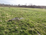
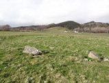
This henge monument is situated in an unploughed part of a field 150 m to the SSW of the standing stones No.199; it comprises an outer bank with internal ditch, broken by entrance-causeways on the N and S, and has two cists within the enclosed area. The henge measures about 40 m in diameter overall, but the bank, at best 0.4 m high, is so denuded that its edge is now uncertain; the flat-bottomed ditch is about 4 m across and at most about 0.4 m in depth.
Two cists were discovered in the course of Greenwell's excavations in 1864, both of them still partly visible.1 The larger and more central cist (1.8 m by 0.8 m and 0.7 m in depth) was constructed with unusually long side-slabs (up to 2.75 m) and is still covered by a massive capstone (2.4 m by 1.4 m and 0.25 m thick). The floor of the cist was formed of carefully laid small rounded pebbles. It had apparently been rifled before Greenwell's excavation, and nothing further was found in it.
In the NE quadrant of the interior three stones remain of a second cist; this was still complete in 1864, comprising four slabs and a cover, and measuring 0.9 m by 0.4 m and 0.5 m in depth. It contained the remains of three inhumation burials, accompanied by a fragmentary Beaker; the pot is now in the British Museum, London.
Visited June 1979
RCAHMS 1988
NR 833 962 and NR89NW 14 (Ballymeanoch standing stones) During April 1995 landscape work was carried out at these sites in order to improve their appearance. This involved the removal of modern clearance stone and the addition of topsoil to cover plough damage on the ground immediately around the monuments. In addition a trench was excavated at the site in order to test the nature of some geophysical anomalies which had been detected in 1993.
Whilst removing the modern clearance stone from around the bases of stones A-D (RCAHMS 1988) nothing of additional archaeological interest was encountered. Amongst the clearance stone aound the bases of Stones E and F (RCAHMS 1988) were two large flat stones; one measured 0.78m by 0.43m and in one of its corners are two possible eroded cup-marks. The other stone measured 0.66m by 0.32m and was thinner and squarer with a dressed appearance. Both stones were left in situ.
When clearance stones were removed from the ditch around the henge on its W side a large flat stone measuring 1.2m by 0.5m was found. It is suspected that this is the missing northern end slab from the central cist in the Henge. Another smaller, flatter, and much squarer stone was also found in this area of the ditch. It measures 0.5m by 0.3m and may have originally come from the satellite cist. Both stones were left in situ.
Geophysical prospection in 1993 had detected a series of linear anomalies on the same alignment as Stones A-D (RCAMS 1988) and running up to meet them at their SE end. A 50m by 1m trench was excavated across these anomolies as there is a good case to suggest that they represent the remains of a prehistoric earthwork avenue. There were no archaeological deposits encountered that might explain the cause of the linear anomalies but a ditch was encountered running N-S. It measured an average of 0.6m across and when sectioned proved to be only an average of 0.11m in depth. No finds were recovered but the W side of this feature contained more stone than the E possibly indicating the presence of packing material for a palisade trench.
Sponsor: Commissioned by Historic Scotland and funded by Kilmartin Glen Project. D Abernethy 1995.
For more information about this henge, and how it relates to the nearby stone row and cairns, see the Stone Rows of Great Britain's entry for the Ballymeanoch Stone Row, which includes a description, photographs of the henge showing its proximity to the row, simplified plans of the row and related monuments (including the henge), plus access information and links to other online sources of information.
You may be viewing yesterday's version of this page. To see the most up to date information please register for a free account.


Do not use the above information on other web sites or publications without permission of the contributor.
Click here to see more info for this site
Nearby sites
Key: Red: member's photo, Blue: 3rd party photo, Yellow: other image, Green: no photo - please go there and take one, Grey: site destroyed
Download sites to:
KML (Google Earth)
GPX (GPS waypoints)
CSV (Garmin/Navman)
CSV (Excel)
To unlock full downloads you need to sign up as a Contributory Member. Otherwise downloads are limited to 50 sites.
Turn off the page maps and other distractions
Nearby sites listing. In the following links * = Image available
120m N 352° Ballymeanoch Rock Art* Rock Art (NR833964)
143m NNE 22° Ballymeanoch Stone Row* Stone Row / Alignment (NR83379641)
171m NNE 27° Ballymeanoch Kerb Cairn* Cairn (NR8339596429)
228m ENE 64° Ballymeanoch Cairn* Cairn (NR83529637)
530m N 357° Dunchraigaig Cairn* Cairn (NR8330796811)
709m NNW 342° Baluachraig Rock Art* Rock Art (NR8312696966)
990m E 92° Ballymeanoch Dun Stone Fort or Dun (NR843962)
1.1km SE 139° Rhudil Cairn (NR840954)
1.1km NW 315° Ri Cruin* Cairn (NR8254897119)
1.1km W 264° Rowanfield Cist* Cist (NR8216096208)
1.1km NW 313° Ri Cruin* Rock Art (NR825971)
1.2km NE 38° Dun Mor, Dunchraigaig Stone Fort or Dun (NR841972)
1.3km WSW 248° Rowanfield Cottage* Standing Stone (Menhir) (NR82059585)
1.4km NNW 337° Nether Largie Stone Row* Stone Row / Alignment (NR8283197610)
1.5km WNW 301° Poltalloch Cist* Cist (NR82049714)
1.5km NNW 337° Nether Largie standing stone* Standing Stone (Menhir) (NR82799773)
1.6km NW 309° Cnoc-an-teallaidh* Cist (NR82129735)
1.7km ESE 115° Baroile* Chambered Cairn (NR8477195498)
1.7km NW 320° Bruach-na-cuirte* Cist (NR82309760)
1.7km NNW 333° Temple Wood S* Stone Circle (NR8263197830)
1.7km NNW 342° Nether Largie South* Chambered Cairn (NR8286097920)
1.7km NNW 335° Temple Wood N* Stone Circle (NR8265997856)
1.9km NNW 347° Nether Largie Lost Cairn* Cairn (NR82979815)
2.0km W 271° Poltalloch House Rock Art* Rock Art (NR813964)
2.0km N 349° Nether Largie Mid* Cairn (NR8303798309)
View more nearby sites and additional images


 We would like to know more about this location. Please feel free to add a brief description and any relevant information in your own language.
 Wir möchten mehr über diese Stätte erfahren. Bitte zögern Sie nicht, eine kurze Beschreibung und relevante Informationen in Deutsch hinzuzufügen.
 Nous aimerions en savoir encore un peu sur les lieux. S'il vous plaît n'hesitez pas à ajouter une courte description et tous les renseignements pertinents dans votre propre langue.
 Quisieramos informarnos un poco más de las lugares. No dude en añadir una breve descripción y otros datos relevantes en su propio idioma.