


<< Text Pages >> Little Hunters Sleets Cairn - Cairn in England in Yorkshire (North)
Submitted by coldrum on Monday, 05 December 2011 Page Views: 2984
Neolithic and Bronze AgeSite Name: Little Hunters Sleets CairnCountry: England County: Yorkshire (North) Type: Cairn
Nearest Village: Starbottom
Map Ref: SD98647576
Latitude: 54.177623N Longitude: 2.022333W
Condition:
| 5 | Perfect |
| 4 | Almost Perfect |
| 3 | Reasonable but with some damage |
| 2 | Ruined but still recognisable as an ancient site |
| 1 | Pretty much destroyed, possibly visible as crop marks |
| 0 | No data. |
| -1 | Completely destroyed |
| 5 | Superb |
| 4 | Good |
| 3 | Ordinary |
| 2 | Not Good |
| 1 | Awful |
| 0 | No data. |
| 5 | Can be driven to, probably with disabled access |
| 4 | Short walk on a footpath |
| 3 | Requiring a bit more of a walk |
| 2 | A long walk |
| 1 | In the middle of nowhere, a nightmare to find |
| 0 | No data. |
| 5 | co-ordinates taken by GPS or official recorded co-ordinates |
| 4 | co-ordinates scaled from a detailed map |
| 3 | co-ordinates scaled from a bad map |
| 2 | co-ordinates of the nearest village |
| 1 | co-ordinates of the nearest town |
| 0 | no data |
Be the first person to rate this site - see the 'Contribute!' box in the right hand menu.
Internal Links:
External Links:
Cairn in Yorkshire (North)
"Situated at SD 9866 7578 in a prominent position on the crest of a hill are the mutilated remains of a round cairn. It is made of turf-covered limestone rubble 1.3m high and probably measured about 11.5m overall diameter. (See enlargement). There is no definite kerb and the centre in intact. A modern wall runs off from the NE side."
Source: Pastscape.
You may be viewing yesterday's version of this page. To see the most up to date information please register for a free account.
")
Do not use the above information on other web sites or publications without permission of the contributor.
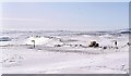
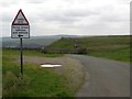
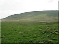
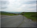
Nearby Images from Geograph Britain and Ireland:
©2008(licence)
©2015(licence)
©2023(licence)
©2009(licence)
©2018(licence)
The above images may not be of the site on this page, they are loaded from Geograph.
Please Submit an Image of this site or go out and take one for us!
Click here to see more info for this site
Nearby sites
Key: Red: member's photo, Blue: 3rd party photo, Yellow: other image, Green: no photo - please go there and take one, Grey: site destroyed
Download sites to:
KML (Google Earth)
GPX (GPS waypoints)
CSV (Garmin/Navman)
CSV (Excel)
To unlock full downloads you need to sign up as a Contributory Member. Otherwise downloads are limited to 50 sites.
Turn off the page maps and other distractions
Nearby sites listing. In the following links * = Image available
567m WSW 244° Tor Dike Ancient Village or Settlement (SD98137551)
7.2km SW 229° Blue Scar (Arncliffe)* Ancient Village or Settlement (SD93237100)
7.5km SSW 207° Douky Bottom Settlement (Arncliffe) Ancient Village or Settlement (SD9520369067)
7.7km SSW 207° Dowkerbottom Cave* Cave or Rock Shelter (SD95176889)
7.7km SSW 207° Douky Bottom Ring (Arncliffe) Ancient Village or Settlement (SD9512668887)
8.5km SSW 204° Kilnsey* Stone Circle (SD951680)
8.6km SSE 162° Green Hill Pasture Stone Circle* Stone Circle (SE013676)
9.4km WNW 293° Yockenthwaite* Ring Cairn (SD8995779376)
9.5km S 175° Lea Green cairn Cairn (SD995663)
9.7km SW 230° Dewbottoms (Arncliffe) Ancient Village or Settlement (SD912695)
9.8km SSE 157° Grassington B* Stone Circle (SE025667)
9.9km SSE 157° Grassington A* Stone Circle (SE025666)
10.5km S 186° Chapel House Wood* Ancient Village or Settlement (SD9750165316)
10.6km SSE 166° Yarnbury Settlement (Grassington) Ancient Village or Settlement (SE012655)
10.6km SSW 198° Lantern Holes (Bordley)* Ancient Village or Settlement (SD95336566)
10.6km S 171° Grassington Settlement Ancient Village or Settlement (SE0027765259)
10.7km SSE 165° Yarnbury Henge* Henge (SE0140665415)
10.7km E 99° St Chad (Middlesmoor)* Ancient Cross (SE09257414)
10.8km S 184° Brazen Gate* Round Cairn (SD9785964995)
10.8km S 173° Cove Hole* Cave or Rock Shelter (SD99896499)
11.1km SSW 198° Hammond Close Stone (Threshfield) Standing Stones (SD9516165209)
11.1km SSW 199° Druid's Altar (Yorkshire)* Stone Circle (SD94946527)
11.2km NNE 23° Burton Moor* Ancient Village or Settlement (SE03118604)
11.3km SSW 197° Hammond Close (Threshfield)* Ancient Village or Settlement (SD95386492)
11.4km S 191° Heights Cave* Cave or Rock Shelter (SD96446460)
View more nearby sites and additional images


 We would like to know more about this location. Please feel free to add a brief description and any relevant information in your own language.
 Wir möchten mehr über diese Stätte erfahren. Bitte zögern Sie nicht, eine kurze Beschreibung und relevante Informationen in Deutsch hinzuzufügen.
 Nous aimerions en savoir encore un peu sur les lieux. S'il vous plaît n'hesitez pas à ajouter une courte description et tous les renseignements pertinents dans votre propre langue.
 Quisieramos informarnos un poco más de las lugares. No dude en añadir una breve descripción y otros datos relevantes en su propio idioma.