<< Text Pages >> Spittal Farm - Broch or Nuraghe in Scotland in Caithness
Submitted by SolarMegalith on Saturday, 12 March 2011 Page Views: 3591
Iron Age and Later PrehistorySite Name: Spittal FarmCountry: Scotland County: Caithness Type: Broch or Nuraghe
Map Ref: ND17565438
Latitude: 58.469844N Longitude: 3.414995W
Condition:
| 5 | Perfect |
| 4 | Almost Perfect |
| 3 | Reasonable but with some damage |
| 2 | Ruined but still recognisable as an ancient site |
| 1 | Pretty much destroyed, possibly visible as crop marks |
| 0 | No data. |
| -1 | Completely destroyed |
| 5 | Superb |
| 4 | Good |
| 3 | Ordinary |
| 2 | Not Good |
| 1 | Awful |
| 0 | No data. |
| 5 | Can be driven to, probably with disabled access |
| 4 | Short walk on a footpath |
| 3 | Requiring a bit more of a walk |
| 2 | A long walk |
| 1 | In the middle of nowhere, a nightmare to find |
| 0 | No data. |
| 5 | co-ordinates taken by GPS or official recorded co-ordinates |
| 4 | co-ordinates scaled from a detailed map |
| 3 | co-ordinates scaled from a bad map |
| 2 | co-ordinates of the nearest village |
| 1 | co-ordinates of the nearest town |
| 0 | no data |
Internal Links:
External Links:
Broch in Caithness
Remains of a broch preserved as a strongly ploughed mound.
Read More at ScotlandsPlaces.
You may be viewing yesterday's version of this page. To see the most up to date information please register for a free account.
Do not use the above information on other web sites or publications without permission of the contributor.
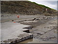
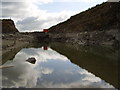
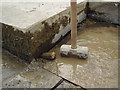
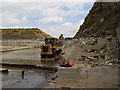
Nearby Images from Geograph Britain and Ireland:
©2006(licence)
©2006(licence)
©2006(licence)
©2006(licence)
©2006(licence)
The above images may not be of the site on this page, they are loaded from Geograph.
Please Submit an Image of this site or go out and take one for us!
Click here to see more info for this site
Nearby sites
Key: Red: member's photo, Blue: 3rd party photo, Yellow: other image, Green: no photo - please go there and take one, Grey: site destroyed
Download sites to:
KML (Google Earth)
GPX (GPS waypoints)
CSV (Garmin/Navman)
CSV (Excel)
To unlock full downloads you need to sign up as a Contributory Member. Otherwise downloads are limited to 50 sites.
Turn off the page maps and other distractions
Nearby sites listing. In the following links * = Image available
537m WSW 237° Spittal Quarry* Modern Stone Circle etc (ND171541)
1.1km S 176° Knockglass Broch Broch or Nuraghe (ND17615329)
2.9km SSW 194° Achkeepster Broch or Nuraghe (ND16805158)
3.1km WNW 285° Achanarras Hill* Stone Circle (ND14545525)
3.3km ENE 57° Bridge of Dunn Broch Broch or Nuraghe (ND20415613)
3.5km NE 54° Bridge of Dunn Standing Stone* Standing Stone (Menhir) (ND2045156374)
3.6km NE 48° Lower Dunn* Broch or Nuraghe (ND2026656718)
3.8km WNW 288° Achies East* Broch or Nuraghe (ND14005565)
3.8km NE 46° Lower Dunn (2) Broch or Nuraghe (ND2036356940)
4.6km W 279° Achies West* Broch or Nuraghe (ND13055522)
4.7km S 177° Halsary Standing Stone North Standing Stone (Menhir) (ND1774149665)
5.1km E 99° Cairn of Achoy Broch or Nuraghe (ND22605348)
5.1km S 178° Halsary Standing Stone Standing Stone (Menhir) (ND17644923)
5.2km WSW 240° Tulach Buaile A' Chroic* Broch or Nuraghe (ND12995186)
5.2km WSW 243° Tulach An Fhuarain Broch or Nuraghe (ND12875208)
5.3km WSW 242° Tulach Lochain Braiseal Broch or Nuraghe (ND12825203)
5.4km SSW 209° Tormsdale Stone Rows* Multiple Stone Rows / Avenue (ND14834974)
5.4km SW 230° Cairn Na Mairg* Broch or Nuraghe (ND13315103)
5.4km SSW 212° Tulach Beag* Broch or Nuraghe (ND14594980)
5.5km ESE 119° Acharole* Stone Circle (ND22335166)
5.7km SSW 207° Tulach Mor* Broch or Nuraghe (ND14854940)
5.7km ENE 64° Lynegar House, Oslie Cairn* Chambered Cairn (ND22715679)
5.9km ESE 116° Bail of A' Chairn* Broch or Nuraghe (ND22815171)
5.9km NNW 346° Torran Reitheach Cairn (ND1629160143)
5.9km ENE 67° Lynegar House, Grey Cairn* Broch or Nuraghe (ND23045662)
View more nearby sites and additional images


 We would like to know more about this location. Please feel free to add a brief description and any relevant information in your own language.
 Wir möchten mehr über diese Stätte erfahren. Bitte zögern Sie nicht, eine kurze Beschreibung und relevante Informationen in Deutsch hinzuzufügen.
 Nous aimerions en savoir encore un peu sur les lieux. S'il vous plaît n'hesitez pas à ajouter une courte description et tous les renseignements pertinents dans votre propre langue.
 Quisieramos informarnos un poco más de las lugares. No dude en añadir una breve descripción y otros datos relevantes en su propio idioma.