<< Other Photo Pages >> Ha' of Durran - Broch or Nuraghe in Scotland in Caithness
Submitted by SolarMegalith on Friday, 26 November 2010 Page Views: 3270
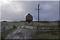
Iron Age and Later PrehistorySite Name: Ha' of DurranCountry: Scotland County: Caithness Type: Broch or Nuraghe
Nearest Town: Wick Nearest Village: Durran
Map Ref: ND19516359
Latitude: 58.552899N Longitude: 3.384832W
Condition:
| 5 | Perfect |
| 4 | Almost Perfect |
| 3 | Reasonable but with some damage |
| 2 | Ruined but still recognisable as an ancient site |
| 1 | Pretty much destroyed, possibly visible as crop marks |
| 0 | No data. |
| -1 | Completely destroyed |
| 5 | Superb |
| 4 | Good |
| 3 | Ordinary |
| 2 | Not Good |
| 1 | Awful |
| 0 | No data. |
| 5 | Can be driven to, probably with disabled access |
| 4 | Short walk on a footpath |
| 3 | Requiring a bit more of a walk |
| 2 | A long walk |
| 1 | In the middle of nowhere, a nightmare to find |
| 0 | No data. |
| 5 | co-ordinates taken by GPS or official recorded co-ordinates |
| 4 | co-ordinates scaled from a detailed map |
| 3 | co-ordinates scaled from a bad map |
| 2 | co-ordinates of the nearest village |
| 1 | co-ordinates of the nearest town |
| 0 | no data |
Internal Links:
External Links:
Broch in Caithness
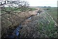
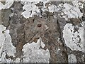
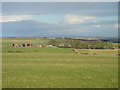
Remains of a broch preserved as a grassy mound of 36 x 28 m dimensions. No traces of the walls are visible.
You may be viewing yesterday's version of this page. To see the most up to date information please register for a free account.
Do not use the above information on other web sites or publications without permission of the contributor.
Andy B has found this location on Google Street View:
Nearby Images from Geograph Britain and Ireland:
©2023(licence)
©2021(licence)
©2005(licence)
©2007(licence)
©2013(licence)
The above images may not be of the site on this page, they are loaded from Geograph.
Please Submit an Image of this site or go out and take one for us!
Click here to see more info for this site
Nearby sites
Key: Red: member's photo, Blue: 3rd party photo, Yellow: other image, Green: no photo - please go there and take one, Grey: site destroyed
Download sites to:
KML (Google Earth)
GPX (GPS waypoints)
CSV (Garmin/Navman)
CSV (Excel)
To unlock full downloads you need to sign up as a Contributory Member. Otherwise downloads are limited to 50 sites.
Turn off the page maps and other distractions
Nearby sites listing. In the following links * = Image available
3.3km SE 124° The Stone Lud* Standing Stone (Menhir) (ND222617)
3.7km ESE 118° Mains of Bowertower Broch or Nuraghe (ND22796179)
3.7km SW 220° Mill of Knockdee* Chambered Cairn (ND17036077)
3.9km NNE 18° Thurdistoft Broch or Nuraghe (ND20786731)
4.0km NW 310° Cairn of Sibmister* Broch or Nuraghe (ND16516622)
4.1km WSW 246° Cnoc na Ciste Chambered Cairn (ND1572161989)
4.2km WSW 253° Cnoc an Tailler Cairn (ND1545462477)
4.5km E 88° Ha' of Bowermadden* Broch or Nuraghe (ND23986369)
4.5km WNW 293° Youkil Hillock* Chambered Cairn (ND15416545)
4.6km WSW 242° Springfield Chambered Cairn Chambered Cairn (ND1533161521)
4.7km SW 222° Torran Reitheach Cairn (ND1629160143)
4.8km WNW 283° Cairnfield (Weydale)* Cairn (ND14876472)
5.0km ESE 118° Halcro Manse* Broch or Nuraghe (ND23896119)
5.2km N 357° Castlehill Broch* Broch or Nuraghe (ND19366876)
5.5km N 351° Craig of Hattel Class I Pictish Symbol Stone (ND18776901)
5.5km W 263° Carsgoe Broch or Nuraghe (ND1463)
5.7km SW 231° Sibster Broch or Nuraghe (ND14996011)
5.8km NNW 335° East Murkle Cairn (ND17216891)
5.9km E 96° Murza Broch or Nuraghe (ND25386290)
6.4km W 276° Tulloch of Shalmstry* Broch or Nuraghe (ND13166443)
6.4km NE 56° Ha' of Greenland Broch or Nuraghe (ND24906709)
6.6km NNE 23° Links of Dunnet Broch or Nuraghe (ND222696)
6.7km S 172° Lower Dunn (2) Broch or Nuraghe (ND2036356940)
6.9km S 173° Lower Dunn* Broch or Nuraghe (ND2026656718)
7.1km NNW 331° West Murkle Cairn (ND16206990)
View more nearby sites and additional images


 We would like to know more about this location. Please feel free to add a brief description and any relevant information in your own language.
 Wir möchten mehr über diese Stätte erfahren. Bitte zögern Sie nicht, eine kurze Beschreibung und relevante Informationen in Deutsch hinzuzufügen.
 Nous aimerions en savoir encore un peu sur les lieux. S'il vous plaît n'hesitez pas à ajouter une courte description et tous les renseignements pertinents dans votre propre langue.
 Quisieramos informarnos un poco más de las lugares. No dude en añadir una breve descripción y otros datos relevantes en su propio idioma.