<< Text Pages >> Gearsay Cairn - Broch or Nuraghe in Scotland in Caithness
Submitted by SolarMegalith on Friday, 26 November 2010 Page Views: 2048
Iron Age and Later PrehistorySite Name: Gearsay CairnCountry: Scotland County: Caithness Type: Broch or Nuraghe
Nearest Village: Gersa
Map Ref: ND27265819
Latitude: 58.505780N Longitude: 3.249969W
Condition:
| 5 | Perfect |
| 4 | Almost Perfect |
| 3 | Reasonable but with some damage |
| 2 | Ruined but still recognisable as an ancient site |
| 1 | Pretty much destroyed, possibly visible as crop marks |
| 0 | No data. |
| -1 | Completely destroyed |
| 5 | Superb |
| 4 | Good |
| 3 | Ordinary |
| 2 | Not Good |
| 1 | Awful |
| 0 | No data. |
| 5 | Can be driven to, probably with disabled access |
| 4 | Short walk on a footpath |
| 3 | Requiring a bit more of a walk |
| 2 | A long walk |
| 1 | In the middle of nowhere, a nightmare to find |
| 0 | No data. |
| 5 | co-ordinates taken by GPS or official recorded co-ordinates |
| 4 | co-ordinates scaled from a detailed map |
| 3 | co-ordinates scaled from a bad map |
| 2 | co-ordinates of the nearest village |
| 1 | co-ordinates of the nearest town |
| 0 | no data |
Internal Links:
External Links:
Broch in Caithness
Grassy mound of 57 x 47 m dimensions and 2,5 m high, which is possible remain of a broch.
You may be viewing yesterday's version of this page. To see the most up to date information please register for a free account.
Do not use the above information on other web sites or publications without permission of the contributor.
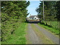
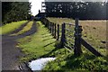
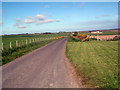
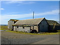
Nearby Images from Geograph Britain and Ireland:
©2007(licence)
©2017(licence)
©2008(licence)
©2016(licence)
©2016(licence)
The above images may not be of the site on this page, they are loaded from Geograph.
Please Submit an Image of this site or go out and take one for us!
Click here to see more info for this site
Nearby sites
Key: Red: member's photo, Blue: 3rd party photo, Yellow: other image, Green: no photo - please go there and take one, Grey: site destroyed
Download sites to:
KML (Google Earth)
GPX (GPS waypoints)
CSV (Garmin/Navman)
CSV (Excel)
To unlock full downloads you need to sign up as a Contributory Member. Otherwise downloads are limited to 50 sites.
Turn off the page maps and other distractions
Nearby sites listing. In the following links * = Image available
1.2km SSW 206° Coghill* Broch or Nuraghe (ND26705708)
2.0km SW 232° Scottag* Broch or Nuraghe (ND25665699)
3.0km SW 224° Tulach Gorm (Mains of Watten) Broch or Nuraghe (ND25105604)
3.7km SW 229° Loch Watten Crannog* Crannog (ND24435585)
3.9km N 9° Gunn's Hillock* Broch or Nuraghe (ND27926201)
4.5km WSW 248° Lynegar House, Grey Cairn* Broch or Nuraghe (ND23045662)
4.5km SSE 166° North Bilbster* Standing Stone (Menhir) (ND28295381)
4.5km NW 311° Halcro Manse* Broch or Nuraghe (ND23896119)
4.7km NNE 21° Hill of Works* Broch or Nuraghe (ND29036255)
4.7km WSW 252° Lynegar House, Oslie Cairn* Chambered Cairn (ND22715679)
4.7km SW 215° Watten Standing Stone* Standing Stone (Menhir) (ND24445436)
5.1km NNW 337° Murza Broch or Nuraghe (ND25386290)
5.3km SW 216° Nether Banks* Broch or Nuraghe (ND24105397)
5.3km ESE 107° Skitten Broch or Nuraghe (ND32345655)
5.5km SSW 211° Achingale Broch or Nuraghe (ND24345353)
5.7km NW 308° Mains of Bowertower Broch or Nuraghe (ND22796179)
6.1km WNW 304° The Stone Lud* Standing Stone (Menhir) (ND222617)
6.3km SSE 153° Thuster Broch or Nuraghe (ND30045254)
6.4km NNW 328° Ha' of Bowermadden* Broch or Nuraghe (ND23986369)
6.6km ESE 124° Norwall Broch* Broch or Nuraghe (ND32665445)
6.6km SW 224° Cairn of Achoy Broch or Nuraghe (ND22605348)
7.0km WSW 259° Lower Dunn (2) Broch or Nuraghe (ND2036356940)
7.0km WSW 254° Bridge of Dunn Standing Stone* Standing Stone (Menhir) (ND2045156374)
7.1km WSW 257° Lower Dunn* Broch or Nuraghe (ND2026656718)
7.1km WSW 252° Bridge of Dunn Broch Broch or Nuraghe (ND20415613)
View more nearby sites and additional images


 We would like to know more about this location. Please feel free to add a brief description and any relevant information in your own language.
 Wir möchten mehr über diese Stätte erfahren. Bitte zögern Sie nicht, eine kurze Beschreibung und relevante Informationen in Deutsch hinzuzufügen.
 Nous aimerions en savoir encore un peu sur les lieux. S'il vous plaît n'hesitez pas à ajouter une courte description et tous les renseignements pertinents dans votre propre langue.
 Quisieramos informarnos un poco más de las lugares. No dude en añadir una breve descripción y otros datos relevantes en su propio idioma.