


<< Our Photo Pages >> Bryntirion Well - Holy Well or Sacred Spring in Wales in Ceredigion
Submitted by coldrum on Monday, 01 February 2010 Page Views: 4389
Springs and Holy WellsSite Name: Bryntirion WellCountry: Wales County: Ceredigion Type: Holy Well or Sacred Spring
Map Ref: SN65158407
Latitude: 52.437916N Longitude: 3.985181W
Condition:
| 5 | Perfect |
| 4 | Almost Perfect |
| 3 | Reasonable but with some damage |
| 2 | Ruined but still recognisable as an ancient site |
| 1 | Pretty much destroyed, possibly visible as crop marks |
| 0 | No data. |
| -1 | Completely destroyed |
| 5 | Superb |
| 4 | Good |
| 3 | Ordinary |
| 2 | Not Good |
| 1 | Awful |
| 0 | No data. |
| 5 | Can be driven to, probably with disabled access |
| 4 | Short walk on a footpath |
| 3 | Requiring a bit more of a walk |
| 2 | A long walk |
| 1 | In the middle of nowhere, a nightmare to find |
| 0 | No data. |
| 5 | co-ordinates taken by GPS or official recorded co-ordinates |
| 4 | co-ordinates scaled from a detailed map |
| 3 | co-ordinates scaled from a bad map |
| 2 | co-ordinates of the nearest village |
| 1 | co-ordinates of the nearest town |
| 0 | no data |
Be the first person to rate this site - see the 'Contribute!' box in the right hand menu.
Internal Links:
External Links:
I have visited· I would like to visit
geoffstickland has visited here
")
"Well in underground chamber."
Source: Coflein.
You may be viewing yesterday's version of this page. To see the most up to date information please register for a free account.
")
")
")
Do not use the above information on other web sites or publications without permission of the contributor.
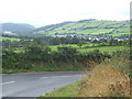
Nearby Images from Geograph Britain and Ireland:
©2009(licence)
©2011(licence)
©2009(licence)
©2007(licence)
©2008(licence)
The above images may not be of the site on this page, they are loaded from Geograph.
Please Submit an Image of this site or go out and take one for us!
Click here to see more info for this site
Nearby sites
Key: Red: member's photo, Blue: 3rd party photo, Yellow: other image, Green: no photo - please go there and take one, Grey: site destroyed
Download sites to:
KML (Google Earth)
GPX (GPS waypoints)
CSV (Garmin/Navman)
CSV (Excel)
To unlock full downloads you need to sign up as a Contributory Member. Otherwise downloads are limited to 50 sites.
Turn off the page maps and other distractions
Nearby sites listing. In the following links * = Image available
918m W 268° Penrhyncoch War Memorial Standing Stone (Menhir) (SN6422984058)
1.3km NW 318° Cwrt Enclosure Ancient Village or Settlement (SN64348503)
1.9km W 279° Hen Gaer Hillfort (SN633844)
2.2km NE 46° Banc Troed Rhiw Seiri* Ring Cairn (SN6679385583)
2.6km WSW 255° Plas Gogerddan Barrow* Round Barrow(s) (SN62658348)
2.6km WSW 256° Plas Gogerddan* Stone Row / Alignment (SN626835)
2.7km W 264° Gorgerddan Enclosure Ancient Village or Settlement (SN62418387)
2.8km W 262° Gorgerddan Round Barrow(s) (SN62328373)
2.9km W 273° Bow Street* Ancient Village or Settlement (SN6223584325)
2.9km ESE 110° Darren Camp Cairn II Cairn (SN6789183010)
2.9km ESE 109° Darren Camp* Hillfort (SN67908302)
2.9km ESE 110° Darren Camp Cairn I Cairn (SN6789382997)
3.1km ESE 102° Cwm-Y-Darren and Twyll-Y-Mwyn Copper Mines Ancient Mine, Quarry or other Industry (SN68148335)
3.4km E 86° Garn Wen Barrow Cairn (SN68518421)
3.4km E 95° Stones of the Lamb* Standing Stone (Menhir) (SN68568367)
3.6km E 84° Garn Wen (NE) Cairn (SN68788436)
3.6km WNW 299° Ruel Uchaf Ancient Village or Settlement (SN620859)
3.9km ENE 78° Pen-Y-Castell Hillfort Hillfort (SN68958480)
4.0km NW 313° St Michael's Church Well Holy Well or Sacred Spring (SN62328687)
4.0km ENE 77° Pen-Y-Castell* Standing Stone (Menhir) (SN69138487)
4.8km E 88° Pen-Y-Bryn-Mawr Cairn (SN70018412)
5.1km NE 45° Cwmere Farm Standing Stone* Standing Stone (Menhir) (SN689876)
5.2km E 95° Garrig Hir* Standing Stone (Menhir) (SN70378351)
6.0km ESE 102° Carn Dolgau Cairn (SN70978266)
6.0km WSW 237° Y Garreg Fawr* Chambered Tomb (SN59998093)
View more nearby sites and additional images


 We would like to know more about this location. Please feel free to add a brief description and any relevant information in your own language.
 Wir möchten mehr über diese Stätte erfahren. Bitte zögern Sie nicht, eine kurze Beschreibung und relevante Informationen in Deutsch hinzuzufügen.
 Nous aimerions en savoir encore un peu sur les lieux. S'il vous plaît n'hesitez pas à ajouter une courte description et tous les renseignements pertinents dans votre propre langue.
 Quisieramos informarnos un poco más de las lugares. No dude en añadir una breve descripción y otros datos relevantes en su propio idioma.