

<< Our Photo Pages >> Di Frissas Domus de Janas - Rock Cut Tomb in Italy in Sardinia (Sardegna)
Submitted by SolarMegalith on Sunday, 04 October 2009 Page Views: 4591
Multi-periodSite Name: Di Frissas Domus de Janas Alternative Name: FriscasCountry: Italy Region: Sardinia (Sardegna) Type: Rock Cut Tomb
Nearest Town: Isili Nearest Village: Nurri
Latitude: 39.755540N Longitude: 9.225000E
Condition:
| 5 | Perfect |
| 4 | Almost Perfect |
| 3 | Reasonable but with some damage |
| 2 | Ruined but still recognisable as an ancient site |
| 1 | Pretty much destroyed, possibly visible as crop marks |
| 0 | No data. |
| -1 | Completely destroyed |
| 5 | Superb |
| 4 | Good |
| 3 | Ordinary |
| 2 | Not Good |
| 1 | Awful |
| 0 | No data. |
| 5 | Can be driven to, probably with disabled access |
| 4 | Short walk on a footpath |
| 3 | Requiring a bit more of a walk |
| 2 | A long walk |
| 1 | In the middle of nowhere, a nightmare to find |
| 0 | No data. |
| 5 | co-ordinates taken by GPS or official recorded co-ordinates |
| 4 | co-ordinates scaled from a detailed map |
| 3 | co-ordinates scaled from a bad map |
| 2 | co-ordinates of the nearest village |
| 1 | co-ordinates of the nearest town |
| 0 | no data |
Internal Links:
External Links:
I have visited· I would like to visit
SolarMegalith visited on 12th Sep 2009 - their rating: Cond: 5 Amb: 4 Access: 3 Difficult to spot, ask the caretaker of Nuraghe Is Cangialis to show you the tomb.
")
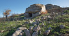
Single Domus de Janas located on the south-western slope of the hill, below Nuraghe Is Cangialis. It is reachable in the same was as a nuraghe - the guardsman who stays in the small sentrybox will show you the way to the site.
You may be viewing yesterday's version of this page. To see the most up to date information please register for a free account.
")
Do not use the above information on other web sites or publications without permission of the contributor.
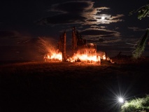
Nearby Images from Flickr
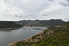
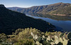
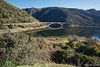

The above images may not be of the site on this page, but were taken nearby. They are loaded from Flickr so please click on them for image credits.
Click here to see more info for this site
Nearby sites
Click here to view sites on an interactive map of the areaKey: Red: member's photo, Blue: 3rd party photo, Yellow: other image, Green: no photo - please go there and take one, Grey: site destroyed
Download sites to:
KML (Google Earth)
GPX (GPS waypoints)
CSV (Garmin/Navman)
CSV (Excel)
To unlock full downloads you need to sign up as a Contributory Member. Otherwise downloads are limited to 50 sites.
Turn off the page maps and other distractions
Nearby sites listing. In the following links * = Image available
188m SE 141° Is Cangialis Nuraghe* Broch or Nuraghe
3.1km SW 230° San Accuzzadorgiu Nuraghe* Broch or Nuraghe
3.1km SW 223° Baracci Nuraghe* Broch or Nuraghe
3.5km SSW 211° Santu Perdu Nuraghe* Broch or Nuraghe
3.6km SSE 159° Sutta Corongiu Nuraghe* Broch or Nuraghe
3.8km SSE 168° Latt'e Pudda Nuraghe* Broch or Nuraghe
5.2km S 177° Sardajara Nuraghe* Broch or Nuraghe
5.3km SE 141° Corongiu Maria Protonuraghe* Broch or Nuraghe
5.4km SE 124° Sa Xea 'e Molas Tomba di Giganti Chambered Tomb
5.6km SE 125° Monte Is Abis Nuraghe Broch or Nuraghe
5.7km SSE 169° Comas de Pisu Nuraghe* Broch or Nuraghe
5.8km SSE 161° Pitziogu Nuraghe* Broch or Nuraghe
6.0km SSE 157° Corona Arrubia Nuraghe* Broch or Nuraghe
6.1km SSE 162° Salonis Nuraghe* Broch or Nuraghe
6.1km SSE 146° S'Arriu Pranemuru Nuraghe* Broch or Nuraghe
6.4km SSE 158° Su Motti Domus de Janas* Rock Cut Tomb
6.5km SSE 163° Perdu Foddis Nuraghe* Broch or Nuraghe
6.6km SE 137° Sedda Bintirissos Protonuraghe* Broch or Nuraghe
6.8km E 85° Recinto megalitico di Santa Vittoria* Ancient Village or Settlement
6.9km SSE 163° San Nicola Nuraghe* Broch or Nuraghe
7.1km S 189° Linnarbus Nuraghe* Broch or Nuraghe
7.3km SE 140° Perda 'e Putzu Nuraghe* Broch or Nuraghe
7.4km S 189° Perdas de Fogu Tomba di Giganti* Chambered Tomb
7.6km SE 135° Coremolla Nuraghe* Broch or Nuraghe
7.7km SSE 158° Taccu 'e Idda Nuraghe* Broch or Nuraghe
View more nearby sites and additional images


 We would like to know more about this location. Please feel free to add a brief description and any relevant information in your own language.
 Wir möchten mehr über diese Stätte erfahren. Bitte zögern Sie nicht, eine kurze Beschreibung und relevante Informationen in Deutsch hinzuzufügen.
 Nous aimerions en savoir encore un peu sur les lieux. S'il vous plaît n'hesitez pas à ajouter une courte description et tous les renseignements pertinents dans votre propre langue.
 Quisieramos informarnos un poco más de las lugares. No dude en añadir una breve descripción y otros datos relevantes en su propio idioma.