<< Our Photo Pages >> Steinkistengrab Oberzeuzheim - Chambered Tomb in Germany in Rhineland-Palatinate
Submitted by DrVenkman on Wednesday, 12 August 2009 Page Views: 14250
Neolithic and Bronze AgeSite Name: Steinkistengrab Oberzeuzheim Alternative Name: Steinkistengrab im Burggarten HachenburgCountry: Germany
NOTE: This site is 0.517 km away from the location you searched for.
Land: Rhineland-Palatinate Type: Chambered Tomb
Nearest Town: Hachenburg
Latitude: 50.662659N Longitude: 7.829710E
Condition:
| 5 | Perfect |
| 4 | Almost Perfect |
| 3 | Reasonable but with some damage |
| 2 | Ruined but still recognisable as an ancient site |
| 1 | Pretty much destroyed, possibly visible as crop marks |
| 0 | No data. |
| -1 | Completely destroyed |
| 5 | Superb |
| 4 | Good |
| 3 | Ordinary |
| 2 | Not Good |
| 1 | Awful |
| 0 | No data. |
| 5 | Can be driven to, probably with disabled access |
| 4 | Short walk on a footpath |
| 3 | Requiring a bit more of a walk |
| 2 | A long walk |
| 1 | In the middle of nowhere, a nightmare to find |
| 0 | No data. |
| 5 | co-ordinates taken by GPS or official recorded co-ordinates |
| 4 | co-ordinates scaled from a detailed map |
| 3 | co-ordinates scaled from a bad map |
| 2 | co-ordinates of the nearest village |
| 1 | co-ordinates of the nearest town |
| 0 | no data |
Internal Links:
External Links:
I have visited· I would like to visit
DrewParsons would like to visit
")
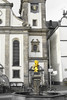
Reconstructed tomb originally from Hadamar-Oberzeuzheim (near Steinkistengrab Niederzeuzheim), open air museum nearby
Note: the reconstructed tomb has been removed from this place in November 2020. The stones were moved into an archaelogical depot to be probably transferred to Landesmuseum Mainz.
You may be viewing yesterday's version of this page. To see the most up to date information please register for a free account.
Do not use the above information on other web sites or publications without permission of the contributor.
Nearby Images from Flickr


The above images may not be of the site on this page, but were taken nearby. They are loaded from Flickr so please click on them for image credits.
Click here to see more info for this site
Nearby sites
Click here to view sites on an interactive map of the areaKey: Red: member's photo, Blue: 3rd party photo, Yellow: other image, Green: no photo - please go there and take one, Grey: site destroyed
Download sites to:
KML (Google Earth)
GPX (GPS waypoints)
CSV (Garmin/Navman)
CSV (Excel)
To unlock full downloads you need to sign up as a Contributory Member. Otherwise downloads are limited to 50 sites.
Turn off the page maps and other distractions
Nearby sites listing. In the following links * = Image available
9.7km NW 318° Altburg Stein-Wingert* Hillfort
13.8km NNE 16° Abschnittsbefestigung Alsdorf* Promontory Fort / Cliff Castle
15.5km NE 46° Wallburg Hohenseelenbachskopf Hillfort
15.8km NNE 21° Druidenstein Kirchen* Natural Stone / Erratic / Other Natural Feature
18.7km ENE 63° Burg von Burbach* Hillfort
19.2km NE 46° Zeppenfeld Iron Age Forge Ancient Mine, Quarry or other Industry
19.5km NW 324° Heilger Brunnen Halscheid Holy Well or Sacred Spring
19.7km E 84° Ketzersteine* Natural Stone / Erratic / Other Natural Feature
20.9km SE 138° Dornburg* Hillfort
24.0km NW 304° Heilbrunnen am Ohmbach* Holy Well or Sacred Spring
24.4km NNE 23° Siegen La Tène Ironworks Ancient Mine, Quarry or other Industry
24.7km SE 144° Niederzeuzheim* Chambered Tomb
25.0km ENE 79° Wildweiberhaus-Klippe Rock Outcrop
26.0km SSE 168° Bornkasten* Hillfort
26.1km SSE 155° Hundsangen Early Cross Ancient Cross
27.1km E 85° Steinkammer Hoehle Cave or Rock Shelter
27.5km NNE 31° Siegerlandmuseum* Museum
28.8km SW 225° Grabhügelfeld Heimbach-Weis* Barrow Cemetery
29.8km NE 51° Höllenrain Iron Age Forge Ancient Mine, Quarry or other Industry
30.0km ENE 78° Summstein Donsbach Modern Stone Circle etc
31.0km N 354° Dreiherrenstein am Kamp* Marker Stone
31.1km ESE 118° Ringwall Almerskopf Hillfort
31.9km SSW 199° Grabhügelfeld Simmern Barrow Cemetery
33.4km SE 140° Niedertiefenbach Galeriegrab Chambered Tomb
34.3km NW 324° Summstein Nümbrecht Modern Stone Circle etc
View more nearby sites and additional images


 We would like to know more about this location. Please feel free to add a brief description and any relevant information in your own language.
 Wir möchten mehr über diese Stätte erfahren. Bitte zögern Sie nicht, eine kurze Beschreibung und relevante Informationen in Deutsch hinzuzufügen.
 Nous aimerions en savoir encore un peu sur les lieux. S'il vous plaît n'hesitez pas à ajouter une courte description et tous les renseignements pertinents dans votre propre langue.
 Quisieramos informarnos un poco más de las lugares. No dude en añadir una breve descripción y otros datos relevantes en su propio idioma.