<< Our Photo Pages >> Mummer's Reive - Cairn in Scotland in Aberdeenshire
Submitted by cosmic on Monday, 04 August 2008 Page Views: 4629
Neolithic and Bronze AgeSite Name: Mummer's Reive Alternative Name: Braeside; Denovan; Hillbrae; Meikle TomCountry: Scotland County: Aberdeenshire Type: Cairn
Nearest Town: Huntly
Map Ref: NJ65723281
Latitude: 57.384422N Longitude: 2.571827W
Condition:
| 5 | Perfect |
| 4 | Almost Perfect |
| 3 | Reasonable but with some damage |
| 2 | Ruined but still recognisable as an ancient site |
| 1 | Pretty much destroyed, possibly visible as crop marks |
| 0 | No data. |
| -1 | Completely destroyed |
| 5 | Superb |
| 4 | Good |
| 3 | Ordinary |
| 2 | Not Good |
| 1 | Awful |
| 0 | No data. |
| 5 | Can be driven to, probably with disabled access |
| 4 | Short walk on a footpath |
| 3 | Requiring a bit more of a walk |
| 2 | A long walk |
| 1 | In the middle of nowhere, a nightmare to find |
| 0 | No data. |
| 5 | co-ordinates taken by GPS or official recorded co-ordinates |
| 4 | co-ordinates scaled from a detailed map |
| 3 | co-ordinates scaled from a bad map |
| 2 | co-ordinates of the nearest village |
| 1 | co-ordinates of the nearest town |
| 0 | no data |
Internal Links:
External Links:
I have visited· I would like to visit
megalithicmatt saw from a distance on 1st Jan 2008 - their rating: Amb: 3 Access: 3 One of those I never quite got round to visiting. Could see it from the road.
")
You may be viewing yesterday's version of this page. To see the most up to date information please register for a free account.
")
Do not use the above information on other web sites or publications without permission of the contributor.
coldrum has found this location on Google Street View:
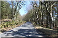
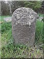
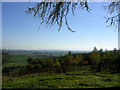
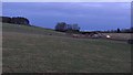
Nearby Images from Geograph Britain and Ireland:
©2021(licence)
©2019(licence)
©2007(licence)
©2011(licence)
©2014(licence)
The above images may not be of the site on this page, they are loaded from Geograph.
Please Submit an Image of this site or go out and take one for us!
Click here to see more info for this site
Nearby sites
Key: Red: member's photo, Blue: 3rd party photo, Yellow: other image, Green: no photo - please go there and take one, Grey: site destroyed
Download sites to:
KML (Google Earth)
GPX (GPS waypoints)
CSV (Garmin/Navman)
CSV (Excel)
To unlock full downloads you need to sign up as a Contributory Member. Otherwise downloads are limited to 50 sites.
Turn off the page maps and other distractions
Nearby sites listing. In the following links * = Image available
1.9km WSW 244° Culsalmond Stone Circle (NJ640320)
2.8km WSW 253° Colpy Stone Circle (NJ630320)
3.1km S 170° Newton House* Class I Pictish Symbol Stone (NJ6623929732)
3.2km ENE 75° Black Cairn, Hill of Rothmaise* Cairn (NJ68823362)
3.8km S 183° South Lediken* Cairn (NJ655290)
4.3km NNW 333° Hillhead (Forgue) Stone Circle (NJ638367)
4.9km SW 224° Inschfield* Stone Circle (NJ623293)
5.3km SSE 154° Old Rayne* Stone Circle (NJ67982798)
5.4km WSW 241° Picardy Stone* Class I Pictish Symbol Stone (NJ60993026)
5.7km NNE 23° West Haughs Stone Circle (NJ680380)
6.0km S 177° Hatton Of Ardoyne* Stone Circle (NJ65982676)
6.3km N 359° Logie Newton SW* Stone Circle (NJ65653915)
6.4km SW 223° Dunnideer Fort* Vitrified Fort (NJ613282)
6.4km N 359° Logie Newton NE* Stone Circle (NJ657392)
6.4km S 173° Westerton of Petmathen* Standing Stone (Menhir) (NJ664264)
6.4km WSW 243° Candle Hill* Stone Circle (NJ59912997)
6.5km SW 228° Dunnideer Circle* Stone Circle (NJ60862844)
6.7km SW 214° Wantonwells* Stone Circle (NJ619273)
6.9km NNE 17° Upper Third* Stone Circle (NJ6774839395)
6.9km SW 233° Stonehead* Stone Circle (NJ601287)
7.3km S 170° Archaeolink* Museum (NJ6691625613)
7.4km SSE 164° The Gowk Stane* Standing Stone (Menhir) (NJ67652570)
7.4km SSW 199° Broomend Stone Circle Stone Circle (NJ63302579)
7.5km S 172° Berry Hill Enclosure* Ancient Village or Settlement (NJ6672225370)
7.7km SW 225° Hill of Christ's Kirk* Hillfort (NJ60182742)
View more nearby sites and additional images


 We would like to know more about this location. Please feel free to add a brief description and any relevant information in your own language.
 Wir möchten mehr über diese Stätte erfahren. Bitte zögern Sie nicht, eine kurze Beschreibung und relevante Informationen in Deutsch hinzuzufügen.
 Nous aimerions en savoir encore un peu sur les lieux. S'il vous plaît n'hesitez pas à ajouter une courte description et tous les renseignements pertinents dans votre propre langue.
 Quisieramos informarnos un poco más de las lugares. No dude en añadir una breve descripción y otros datos relevantes en su propio idioma.