

<< Text Pages >> Dahme Langbett - Long Barrow in Germany in Schleswig-Holstein, Hamburg
Submitted by holger_rix on Sunday, 08 June 2008 Page Views: 2179
Neolithic and Bronze AgeSite Name: Dahme Langbett Alternative Name: Sprockhoff 282Country: Germany Land: Schleswig-Holstein, Hamburg Type: Long Barrow
Nearest Town: Neustadt in Holstein Nearest Village: Dahme
Latitude: 54.198375N Longitude: 11.077372E
Condition:
| 5 | Perfect |
| 4 | Almost Perfect |
| 3 | Reasonable but with some damage |
| 2 | Ruined but still recognisable as an ancient site |
| 1 | Pretty much destroyed, possibly visible as crop marks |
| 0 | No data. |
| -1 | Completely destroyed |
| 5 | Superb |
| 4 | Good |
| 3 | Ordinary |
| 2 | Not Good |
| 1 | Awful |
| 0 | No data. |
| 5 | Can be driven to, probably with disabled access |
| 4 | Short walk on a footpath |
| 3 | Requiring a bit more of a walk |
| 2 | A long walk |
| 1 | In the middle of nowhere, a nightmare to find |
| 0 | No data. |
| 5 | co-ordinates taken by GPS or official recorded co-ordinates |
| 4 | co-ordinates scaled from a detailed map |
| 3 | co-ordinates scaled from a bad map |
| 2 | co-ordinates of the nearest village |
| 1 | co-ordinates of the nearest town |
| 0 | no data |
Be the first person to rate this site - see the 'Contribute!' box in the right hand menu.
Internal Links:
External Links:
Long Barrow in Schleswig-Holstein, Hamburg
Hunebed with two chambers, described in Sprockhoff's Atlas.
Area near the Baltic Sea, called 'Dahmer Moor'.
You may be viewing yesterday's version of this page. To see the most up to date information please register for a free account.
")
")
Do not use the above information on other web sites or publications without permission of the contributor.
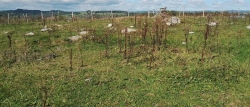
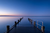
Nearby Images from Flickr

![[ CLOUD COVER ]](https://farm66.static.flickr.com/65535/53590134017_9402dea242_t.jpg)
The above images may not be of the site on this page, but were taken nearby. They are loaded from Flickr so please click on them for image credits.
Click here to see more info for this site
Nearby sites
Click here to view sites on an interactive map of the areaKey: Red: member's photo, Blue: 3rd party photo, Yellow: other image, Green: no photo - please go there and take one, Grey: site destroyed
Download sites to:
KML (Google Earth)
GPX (GPS waypoints)
CSV (Garmin/Navman)
CSV (Excel)
To unlock full downloads you need to sign up as a Contributory Member. Otherwise downloads are limited to 50 sites.
Turn off the page maps and other distractions
Nearby sites listing. In the following links * = Image available
331m S 179° Kellenhusen Steingrab 2 Burial Chamber or Dolmen
2.2km NW 304° Kellenhusen Steingrab 1* Passage Grave
8.6km W 266° Cismar Steingrab* Burial Chamber or Dolmen
9.2km N 357° Suessau Steingrab 1 Burial Chamber or Dolmen
9.2km N 358° Suessau Steingrab 2 Burial Chamber or Dolmen
9.6km N 359° Siggen Langbett Long Barrow
10.5km W 260° Sievershagen Huegelgrab* Round Barrow(s)
11.1km WNW 288° Lensahn Langbett* Long Barrow
16.4km NW 311° Oldenburger Burgwall* Hillfort
16.8km NW 311° Oldenburger Wallmuseum* Museum
17.6km WNW 295° Grammdorf Steingrab 2* Chambered Tomb
18.8km ESE 110° Blinkerwall Stone Row / Alignment
19.2km N 353° Luetjenbrode Steingrab 1 Burial Chamber or Dolmen
19.3km WNW 291° Grammdorf Steingrab 1* Burial Chamber or Dolmen
19.4km WNW 290° Meischenstorf Steingrab* Burial Chamber or Dolmen
19.5km N 358° Luetjenbrode Steingrab 3 Passage Grave
19.6km N 358° Luetjenbrode Steingrab 2 Burial Chamber or Dolmen
19.6km WSW 240° Museum der Stadt Neustadt in Holstein Museum
19.7km WSW 240° Luschendorfer Steinkiste* Cist
20.0km NNW 334° Heiligenhafen Struckberg Round Barrow(s)
20.0km NNW 334° Heiligenhafen Tweltenberge Round Barrow(s)
20.2km WSW 252° Sierhagen Steingrab 1* Burial Chamber or Dolmen
20.4km WSW 249° Sierhagen Eisberg* Round Barrow(s)
20.7km WNW 295° Farve Huegelgrab* Round Barrow(s)
20.8km WSW 250° Sierhagen Huegelgrab 2* Round Barrow(s)
View more nearby sites and additional images


 We would like to know more about this location. Please feel free to add a brief description and any relevant information in your own language.
 Wir möchten mehr über diese Stätte erfahren. Bitte zögern Sie nicht, eine kurze Beschreibung und relevante Informationen in Deutsch hinzuzufügen.
 Nous aimerions en savoir encore un peu sur les lieux. S'il vous plaît n'hesitez pas à ajouter une courte description et tous les renseignements pertinents dans votre propre langue.
 Quisieramos informarnos un poco más de las lugares. No dude en añadir una breve descripción y otros datos relevantes en su propio idioma.