<< Text Pages >> Tumulus de Bining - Round Barrow(s) in France in Alsace-Lorraine:Moselle (57)
Submitted by KaiHofmann on Wednesday, 23 January 2019 Page Views: 823
Neolithic and Bronze AgeSite Name: Tumulus de BiningCountry: France
NOTE: This site is 2.148 km away from the location you searched for.
Département: Alsace-Lorraine:Moselle (57) Type: Round Barrow(s)
Nearest Town: Bitche Nearest Village: Bining
Latitude: 49.023223N Longitude: 7.272059E
Condition:
| 5 | Perfect |
| 4 | Almost Perfect |
| 3 | Reasonable but with some damage |
| 2 | Ruined but still recognisable as an ancient site |
| 1 | Pretty much destroyed, possibly visible as crop marks |
| 0 | No data. |
| -1 | Completely destroyed |
| 5 | Superb |
| 4 | Good |
| 3 | Ordinary |
| 2 | Not Good |
| 1 | Awful |
| 0 | No data. |
| 5 | Can be driven to, probably with disabled access |
| 4 | Short walk on a footpath |
| 3 | Requiring a bit more of a walk |
| 2 | A long walk |
| 1 | In the middle of nowhere, a nightmare to find |
| 0 | No data. |
| 5 | co-ordinates taken by GPS or official recorded co-ordinates |
| 4 | co-ordinates scaled from a detailed map |
| 3 | co-ordinates scaled from a bad map |
| 2 | co-ordinates of the nearest village |
| 1 | co-ordinates of the nearest town |
| 0 | no data |
Internal Links:
External Links:
Round Barrow(s) in Alsace-Lorraine:Moselle (57)
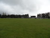
Celtic/iron age burial mound close to the Felsenhof farm, still around 1.6m tall.
You may be viewing yesterday's version of this page. To see the most up to date information please register for a free account.
Do not use the above information on other web sites or publications without permission of the contributor.
Nearby Images from Flickr
The above images may not be of the site on this page, but were taken nearby. They are loaded from Flickr so please click on them for image credits.
Click here to see more info for this site
Nearby sites
Click here to view sites on an interactive map of the areaKey: Red: member's photo, Blue: 3rd party photo, Yellow: other image, Green: no photo - please go there and take one, Grey: site destroyed
Download sites to:
KML (Google Earth)
GPX (GPS waypoints)
CSV (Garmin/Navman)
CSV (Excel)
To unlock full downloads you need to sign up as a Contributory Member. Otherwise downloads are limited to 50 sites.
Turn off the page maps and other distractions
Nearby sites listing. In the following links * = Image available
6.4km SSW 195° Tumulus de Ratzviller Round Barrow(s)
6.9km S 177° Heidenkirche Volksberg Ancient Temple
7.8km E 97° Source St. Hubert* Rock Art
8.0km S 185° Le Burg Hillfort
8.4km E 91° Rocher des trois figures* Rock Art
9.1km N 11° Tumulus de Rimling Round Barrow(s)
9.1km ESE 105° Bildmuehle* Rock Art
9.8km SE 142° Autel druidique de Meisenthal* Natural Stone / Erratic / Other Natural Feature
9.8km SE 142° Meisenthal Rochers Gravées Rock Art
10.0km NE 34° Nassenwald settlement Ancient Village or Settlement
10.4km SE 138° Pierre des XII Apôtres* Standing Stone (Menhir)
11.0km SSE 161° Pierre Pointue (Volksberg)* Standing Stone (Menhir)
11.3km NW 316° Hermeskappel* Ancient Trackway
11.9km NNW 335° Brueckerberg Grabhuegelgruppe* Barrow Cemetery
12.4km NNE 21° Tumuli de Ormesviller Barrow Cemetery
12.9km NW 310° Grosswald Villa* Ancient Palace
13.2km SSW 207° Colline des Morts du Totenberg Barrow Cemetery
13.3km NNW 334° Homerich* Natural Stone / Erratic / Other Natural Feature
13.5km E 101° Gruenberg Vestiges Hillfort
14.0km NNW 332° Europaeischer Kulturpark* Museum
14.1km NNW 337° Horres* Round Barrow(s)
14.6km NW 317° Kapellenwald Barrow Cemetery
15.2km NNE 14° Altheim Brenschelbach Grabhuegelfeld * Barrow Cemetery
15.4km NNW 330° Reinheimer Berg Grabhuegel* Barrow Cemetery
15.4km ENE 68° Le Ring Hillfort
View more nearby sites and additional images


 We would like to know more about this location. Please feel free to add a brief description and any relevant information in your own language.
 Wir möchten mehr über diese Stätte erfahren. Bitte zögern Sie nicht, eine kurze Beschreibung und relevante Informationen in Deutsch hinzuzufügen.
 Nous aimerions en savoir encore un peu sur les lieux. S'il vous plaît n'hesitez pas à ajouter une courte description et tous les renseignements pertinents dans votre propre langue.
 Quisieramos informarnos un poco más de las lugares. No dude en añadir una breve descripción y otros datos relevantes en su propio idioma.