<< Our Photo Pages >> Kvåle - Cist in Norway in Hordaland
Submitted by kenntha88 on Monday, 08 September 2014 Page Views: 1249
Neolithic and Bronze AgeSite Name: KvåleCountry: Norway
NOTE: This site is 3.459 km away from the location you searched for.
Fylke: Hordaland Type: Cist
Nearest Town: Voss
Latitude: 60.618902N Longitude: 6.369756E
Condition:
| 5 | Perfect |
| 4 | Almost Perfect |
| 3 | Reasonable but with some damage |
| 2 | Ruined but still recognisable as an ancient site |
| 1 | Pretty much destroyed, possibly visible as crop marks |
| 0 | No data. |
| -1 | Completely destroyed |
| 5 | Superb |
| 4 | Good |
| 3 | Ordinary |
| 2 | Not Good |
| 1 | Awful |
| 0 | No data. |
| 5 | Can be driven to, probably with disabled access |
| 4 | Short walk on a footpath |
| 3 | Requiring a bit more of a walk |
| 2 | A long walk |
| 1 | In the middle of nowhere, a nightmare to find |
| 0 | No data. |
| 5 | co-ordinates taken by GPS or official recorded co-ordinates |
| 4 | co-ordinates scaled from a detailed map |
| 3 | co-ordinates scaled from a bad map |
| 2 | co-ordinates of the nearest village |
| 1 | co-ordinates of the nearest town |
| 0 | no data |
Internal Links:
External Links:
")
I was told of a friend about this burial cist just next to his childhood home. The cist was discovered when they constructed the nearby road and the road was laid next to the cist instead of straight trough it which would have destroyed the burial chamber. He told me they used to play in it when they were children, but no artifacts have been discovered in it.
The cist is around 3 metres in length and around 1.5 metres wide. It is built of huge stone slabs, two made up the floor, four making the long walls and two the short walls. The cover slab have been lost. Right next to the cist is a modern made wall, and most of the cist is in a private garden.
You may be viewing yesterday's version of this page. To see the most up to date information please register for a free account.
")
")
")
")
Do not use the above information on other web sites or publications without permission of the contributor.
Nearby Images from Flickr
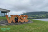
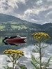

The above images may not be of the site on this page, but were taken nearby. They are loaded from Flickr so please click on them for image credits.
Click here to see more info for this site
Nearby sites
Click here to view sites on an interactive map of the areaKey: Red: member's photo, Blue: 3rd party photo, Yellow: other image, Green: no photo - please go there and take one, Grey: site destroyed
Download sites to:
KML (Google Earth)
GPX (GPS waypoints)
CSV (Garmin/Navman)
CSV (Excel)
To unlock full downloads you need to sign up as a Contributory Member. Otherwise downloads are limited to 50 sites.
Turn off the page maps and other distractions
Nearby sites listing. In the following links * = Image available
225m ESE 117° Ormshaugen* Round Barrow(s)
2.6km WNW 283° Byrkjehaugen* Round Barrow(s)
3.5km ENE 61° Rogne* Round Barrow(s)
7.2km ENE 67° Vetlehaugen* Round Barrow(s)
9.1km NE 51° Reppavegen* Round Barrow(s)
9.9km ENE 71° Sledasteinen* Rock Art
11.6km NNE 33° Grjotland* Barrow Cemetery
18.9km NNE 18° Runakollane* Cairn
20.6km NNE 22° Draugsvoll* Round Barrow(s)
20.6km ESE 108° Bårstesteinen* Standing Stone (Menhir)
20.7km ESE 108° Endrehaugen* Round Barrow(s)
22.1km ESE 116° Kjerland* Round Barrow(s)
23.6km SSE 156° Lothe (Utne)* Round Barrow(s)
25.0km SSW 193° Krakahaugen* Round Barrow(s)
25.6km S 190° Leirhaug* Round Barrow(s)
25.8km NE 36° Tinghaugane* Round Barrow(s)
26.5km NE 37° Lundahovden* Round Barrow(s)
26.7km S 191° Rykkje* Rock Art
26.8km S 191° Bjelkanes* Cairn
30.1km SSW 204° Grova* Round Barrow(s)
30.5km S 179° Bakke-Kalhagen Helleristning * Rock Art
31.0km S 179° Vik-Gamlenaustet* Ancient Village or Settlement
31.2km SSE 153° Håhaugsteinen Helleristninger* Rock Art
34.0km SSW 196° Salthammeren Stone Age Carvings* Rock Art
34.1km SSW 196° Salthammeren Bronze Age Carvings* Rock Art
View more nearby sites and additional images


 We would like to know more about this location. Please feel free to add a brief description and any relevant information in your own language.
 Wir möchten mehr über diese Stätte erfahren. Bitte zögern Sie nicht, eine kurze Beschreibung und relevante Informationen in Deutsch hinzuzufügen.
 Nous aimerions en savoir encore un peu sur les lieux. S'il vous plaît n'hesitez pas à ajouter une courte description et tous les renseignements pertinents dans votre propre langue.
 Quisieramos informarnos un poco más de las lugares. No dude en añadir una breve descripción y otros datos relevantes en su propio idioma.