

<< Our Photo Pages >> Rykkje - Rock Art in Norway in Hordaland
Submitted by kenntha88 on Wednesday, 26 October 2022 Page Views: 622
Rock ArtSite Name: RykkjeCountry: Norway Fylke: Hordaland Type: Rock Art
Nearest Village: Nordheimsund
Latitude: 60.383503N Longitude: 6.277461E
Condition:
| 5 | Perfect |
| 4 | Almost Perfect |
| 3 | Reasonable but with some damage |
| 2 | Ruined but still recognisable as an ancient site |
| 1 | Pretty much destroyed, possibly visible as crop marks |
| 0 | No data. |
| -1 | Completely destroyed |
| 5 | Superb |
| 4 | Good |
| 3 | Ordinary |
| 2 | Not Good |
| 1 | Awful |
| 0 | No data. |
| 5 | Can be driven to, probably with disabled access |
| 4 | Short walk on a footpath |
| 3 | Requiring a bit more of a walk |
| 2 | A long walk |
| 1 | In the middle of nowhere, a nightmare to find |
| 0 | No data. |
| 5 | co-ordinates taken by GPS or official recorded co-ordinates |
| 4 | co-ordinates scaled from a detailed map |
| 3 | co-ordinates scaled from a bad map |
| 2 | co-ordinates of the nearest village |
| 1 | co-ordinates of the nearest town |
| 0 | no data |
Internal Links:
External Links:
")
At a vertical rock surface just 2 metres to the north of the main road is a carving of a deer, it is of the typical hunter-gatherer type of rock carvings that mainly picture large to almost life sized pictures of animals. Typically dated to older to middle stone age. The deer figure is very easy to see from the road as the carved lines are clear. There is water running down the rock side and according to kulturminnesøk there are steps beeing taken to prevent further water erosion on the caving. The deer figure is around 1 1,5 metre in lenght and around 80 cm in height.
You may be viewing yesterday's version of this page. To see the most up to date information please register for a free account.
")
")
")
Do not use the above information on other web sites or publications without permission of the contributor.
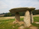
Nearby Images from Flickr
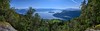
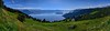


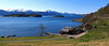

The above images may not be of the site on this page, but were taken nearby. They are loaded from Flickr so please click on them for image credits.
Click here to see more info for this site
Nearby sites
Click here to view sites on an interactive map of the areaKey: Red: member's photo, Blue: 3rd party photo, Yellow: other image, Green: no photo - please go there and take one, Grey: site destroyed
Download sites to:
KML (Google Earth)
GPX (GPS waypoints)
CSV (Garmin/Navman)
CSV (Excel)
To unlock full downloads you need to sign up as a Contributory Member. Otherwise downloads are limited to 50 sites.
Turn off the page maps and other distractions
Nearby sites listing. In the following links * = Image available
142m S 174° Bjelkanes* Cairn
1.1km NNE 27° Leirhaug* Round Barrow(s)
1.9km NNW 345° Krakahaugen* Round Barrow(s)
7.1km SE 127° Bakke-Kalhagen Helleristning * Rock Art
7.2km SE 132° Vik-Gamlenaustet* Ancient Village or Settlement
7.4km W 260° Grova* Round Barrow(s)
7.8km SSW 214° Salthammeren Stone Age Carvings* Rock Art
7.9km SSW 214° Salthammeren Bronze Age Carvings* Rock Art
11.4km SSW 212° Augastad standing stone* Standing Stone (Menhir)
15.3km ENE 73° Lothe (Utne)* Round Barrow(s)
17.1km SSW 204° Vikingnes* Cairn
19.5km E 94° Håhaugsteinen Helleristninger* Rock Art
26.6km NNE 11° Ormshaugen* Round Barrow(s)
26.7km N 11° Kvåle* Cist
26.9km N 5° Byrkjehaugen* Round Barrow(s)
29.1km NNE 16° Rogne* Round Barrow(s)
29.8km ENE 57° Kjerland* Round Barrow(s)
31.2km NNE 22° Vetlehaugen* Round Barrow(s)
31.5km NE 51° Bårstesteinen* Standing Stone (Menhir)
31.6km NE 51° Endrehaugen* Round Barrow(s)
32.8km NNE 26° Sledasteinen* Rock Art
34.2km NNE 21° Reppavegen* Round Barrow(s)
37.6km NNE 18° Grjotland* Barrow Cemetery
44.3km SSE 160° Sandvin Standing Stone* Standing Stone (Menhir)
44.4km ENE 78° Lægreid Liksteinen* Carving
View more nearby sites and additional images


 We would like to know more about this location. Please feel free to add a brief description and any relevant information in your own language.
 Wir möchten mehr über diese Stätte erfahren. Bitte zögern Sie nicht, eine kurze Beschreibung und relevante Informationen in Deutsch hinzuzufügen.
 Nous aimerions en savoir encore un peu sur les lieux. S'il vous plaît n'hesitez pas à ajouter une courte description et tous les renseignements pertinents dans votre propre langue.
 Quisieramos informarnos un poco más de las lugares. No dude en añadir una breve descripción y otros datos relevantes en su propio idioma.