


<< Text Pages >> Willibrordusput (Geijsteren) - Holy Well or Sacred Spring in Netherlands in Limburg
Submitted by Hunengrab77 on Thursday, 03 August 2023 Page Views: 157
Springs and Holy WellsSite Name: Willibrordusput (Geijsteren)Country: Netherlands
NOTE: This site is 5.663 km away from the location you searched for.
Province: Limburg Type: Holy Well or Sacred Spring
Nearest Town: Venray Nearest Village: Geijsteren
Latitude: 51.552330N Longitude: 6.031670E
Condition:
| 5 | Perfect |
| 4 | Almost Perfect |
| 3 | Reasonable but with some damage |
| 2 | Ruined but still recognisable as an ancient site |
| 1 | Pretty much destroyed, possibly visible as crop marks |
| 0 | No data. |
| -1 | Completely destroyed |
| 5 | Superb |
| 4 | Good |
| 3 | Ordinary |
| 2 | Not Good |
| 1 | Awful |
| 0 | No data. |
| 5 | Can be driven to, probably with disabled access |
| 4 | Short walk on a footpath |
| 3 | Requiring a bit more of a walk |
| 2 | A long walk |
| 1 | In the middle of nowhere, a nightmare to find |
| 0 | No data. |
| 5 | co-ordinates taken by GPS or official recorded co-ordinates |
| 4 | co-ordinates scaled from a detailed map |
| 3 | co-ordinates scaled from a bad map |
| 2 | co-ordinates of the nearest village |
| 1 | co-ordinates of the nearest town |
| 0 | no data |
Be the first person to rate this site - see the 'Contribute!' box in the right hand menu.
Internal Links:
External Links:
Holy Well or Sacred Spring in Limburg
Mediaeval sacred well, dedicated to Saint Willibrord.
Article from the Dutch Meertensinstituut.
You may be viewing yesterday's version of this page. To see the most up to date information please register for a free account.
Do not use the above information on other web sites or publications without permission of the contributor.
Nearby Images from Flickr


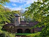


The above images may not be of the site on this page, but were taken nearby. They are loaded from Flickr so please click on them for image credits.
Click here to see more info for this site
Nearby sites
Click here to view sites on an interactive map of the areaKey: Red: member's photo, Blue: 3rd party photo, Yellow: other image, Green: no photo - please go there and take one, Grey: site destroyed
Download sites to:
KML (Google Earth)
GPX (GPS waypoints)
CSV (Garmin/Navman)
CSV (Excel)
To unlock full downloads you need to sign up as a Contributory Member. Otherwise downloads are limited to 50 sites.
Turn off the page maps and other distractions
Nearby sites listing. In the following links * = Image available
10.6km ESE 113° Grafheuvel Wellerlooi (45084)* Round Barrow(s)
15.2km ENE 77° Niederrheinisches Museum Kevelaer* Museum
18.7km NE 44° Grabhügelfeld Kalbeck* Barrow Cemetery
19.9km SSE 165° Boekend (532449) Ancient Village or Settlement
22.1km W 278° Heilig Putje (Handel) Holy Well or Sacred Spring
22.8km SSE 155° Limburgs Museum* Museum
24.7km SSW 206° Willibrordusput (Meijel) Holy Well or Sacred Spring
25.2km SSE 156° Generaalsheuvel (46123)* Round Barrow(s)
25.6km SSE 148° Grabhügel Poelvenn* Round Barrow(s)
25.7km SE 146° Grabhügelfeld Plankenheide Barrow Cemetery
26.6km S 174° Maasbree (45733) Ancient Village or Settlement
26.7km W 277° Grafheuvel Erp (45333) Round Barrow(s)
27.5km NNE 13° Grabhügelfeld Donsbrüggen Barrow Cemetery
27.9km NE 56° Grabhügelfeld Marienbaum* Barrow Cemetery
28.4km S 185° Helden (45566) Ancient Village or Settlement
28.7km SE 144° Amandusbrunnen Holy Well or Sacred Spring
29.8km NNE 13° Mars-Camulus-Stein* Early Christian Sculptured Stone
30.1km E 90° Grabhügelgruppe Bönninghardt* Barrow Cemetery
30.7km NNW 328° Heumen Burial Mounds* Barrow Cemetery
30.7km NNW 341° Museumpark Orientalis* Museum
30.9km ENE 66° LVR Archaeologischer Park Xanten* Museum
31.0km W 272° Grafheuvel Erp (45332) Round Barrow(s)
31.1km ENE 66° Matronenheiligtum Colonia Ulpia Traiana* Ancient Temple
31.5km ENE 67° SiegfriedMuseum Xanten Museum
31.6km ENE 67° Batimodus Stein* Early Christian Sculptured Stone
View more nearby sites and additional images


 We would like to know more about this location. Please feel free to add a brief description and any relevant information in your own language.
 Wir möchten mehr über diese Stätte erfahren. Bitte zögern Sie nicht, eine kurze Beschreibung und relevante Informationen in Deutsch hinzuzufügen.
 Nous aimerions en savoir encore un peu sur les lieux. S'il vous plaît n'hesitez pas à ajouter une courte description et tous les renseignements pertinents dans votre propre langue.
 Quisieramos informarnos un poco más de las lugares. No dude en añadir una breve descripción y otros datos relevantes en su propio idioma.