<< Text Pages >> Pierre dit l'Autel de Malpas - Standing Stone (Menhir) in France in Languedoc:Hérault (34)
Submitted by TheCaptain on Thursday, 10 February 2005 Page Views: 2484
Neolithic and Bronze AgeSite Name: Pierre dit l'Autel de MalpasCountry: France
NOTE: This site is 1.187 km away from the location you searched for.
Département: Languedoc:Hérault (34) Type: Standing Stone (Menhir)
Nearest Town: Béziers Nearest Village: Colombiers
Latitude: 43.307290N Longitude: 3.126310E
Condition:
| 5 | Perfect |
| 4 | Almost Perfect |
| 3 | Reasonable but with some damage |
| 2 | Ruined but still recognisable as an ancient site |
| 1 | Pretty much destroyed, possibly visible as crop marks |
| 0 | No data. |
| -1 | Completely destroyed |
| 5 | Superb |
| 4 | Good |
| 3 | Ordinary |
| 2 | Not Good |
| 1 | Awful |
| 0 | No data. |
| 5 | Can be driven to, probably with disabled access |
| 4 | Short walk on a footpath |
| 3 | Requiring a bit more of a walk |
| 2 | A long walk |
| 1 | In the middle of nowhere, a nightmare to find |
| 0 | No data. |
| 5 | co-ordinates taken by GPS or official recorded co-ordinates |
| 4 | co-ordinates scaled from a detailed map |
| 3 | co-ordinates scaled from a bad map |
| 2 | co-ordinates of the nearest village |
| 1 | co-ordinates of the nearest town |
| 0 | no data |
Be the first person to rate this site - see the 'Contribute!' box in the right hand menu.
Internal Links:
External Links:
Menhir in Hérault
Location Source: T4T35
You may be viewing yesterday's version of this page. To see the most up to date information please register for a free account.
Do not use the above information on other web sites or publications without permission of the contributor.
Nearby Images from Flickr
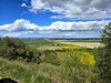
The above images may not be of the site on this page, but were taken nearby. They are loaded from Flickr so please click on them for image credits.
Click here to see more info for this site
Nearby sites
Click here to view sites on an interactive map of the areaKey: Red: member's photo, Blue: 3rd party photo, Yellow: other image, Green: no photo - please go there and take one, Grey: site destroyed
Download sites to:
KML (Google Earth)
GPX (GPS waypoints)
CSV (Garmin/Navman)
CSV (Excel)
To unlock full downloads you need to sign up as a Contributory Member. Otherwise downloads are limited to 50 sites.
Turn off the page maps and other distractions
Nearby sites listing. In the following links * = Image available
962m WNW 291° Oppidum d' Ensérune* Ancient Village or Settlement
8.0km ENE 64° Musée du Biterrois* Museum
12.7km NNW 334° Pierre Blanche (Cazouls)* Standing Stone (Menhir)
13.1km WNW 301° Dolmen de Pech Ménel* Burial Chamber or Dolmen
15.1km SW 230° Oppidum de Montlaures Ancient Village or Settlement
16.9km NW 307° Dolmen de Montmajou 2* Burial Chamber or Dolmen
16.9km SW 216° Musée Archéologique de Narbonne* Museum
17.1km WNW 290° Dolmens de la Serre des Balmes Burial Chamber or Dolmen
17.4km NW 304° Dolmen de Montmajou 1* Burial Chamber or Dolmen
17.7km WNW 288° Dolmen de Roquefourcade Burial Chamber or Dolmen
17.8km WNW 293° Dolmen de la Serre Pascale Burial Chamber or Dolmen
18.0km W 280° Montouliers* Cave or Rock Shelter
19.2km WNW 292° Dolmen de Camporland Burial Chamber or Dolmen
19.8km S 188° Grotte de la Crouzade* Cave or Rock Shelter
20.2km NNW 334° Dolmen de Lugné* Burial Chamber or Dolmen
20.3km W 279° Grotte du Moulin (Bize-Minervois)* Cave or Rock Shelter
20.4km W 279° Grotte de Las Fons Cave or Rock Shelter
20.5km NNE 24° Magalas Oppidum Ancient Village or Settlement
22.1km WNW 286° Dolmen dit la Pierre des Couteaux Burial Chamber or Dolmen
22.1km WNW 288° Dolmen du Roc Gris Burial Chamber or Dolmen
22.3km WNW 287° Dolmen des Caves-de-Roueyre Burial Chamber or Dolmen
22.5km WNW 297° Bois de Monsieur allee couverte* Burial Chamber or Dolmen
22.6km WNW 292° Dolmen du Gour du Boeuf Burial Chamber or Dolmen
23.1km WNW 294° Mounio Oppidum Ancient Village or Settlement
23.6km N 3° Lenthéric menhir Standing Stone (Menhir)
View more nearby sites and additional images


 We would like to know more about this location. Please feel free to add a brief description and any relevant information in your own language.
 Wir möchten mehr über diese Stätte erfahren. Bitte zögern Sie nicht, eine kurze Beschreibung und relevante Informationen in Deutsch hinzuzufügen.
 Nous aimerions en savoir encore un peu sur les lieux. S'il vous plaît n'hesitez pas à ajouter une courte description et tous les renseignements pertinents dans votre propre langue.
 Quisieramos informarnos un poco más de las lugares. No dude en añadir una breve descripción y otros datos relevantes en su propio idioma.