<< Image Pages >> Vahakyro - Barrow Cemetery in Finland
Submitted by durhamnature on Monday, 07 January 2013 Page Views: 3008
Neolithic and Bronze AgeSite Name: Vahakyro Alternative Name: LillkyroCountry: Finland
NOTE: This site is 124.189 km away from the location you searched for.
Type: Barrow Cemetery
Latitude: 63.050833N Longitude: 22.109722E
Condition:
| 5 | Perfect |
| 4 | Almost Perfect |
| 3 | Reasonable but with some damage |
| 2 | Ruined but still recognisable as an ancient site |
| 1 | Pretty much destroyed, possibly visible as crop marks |
| 0 | No data. |
| -1 | Completely destroyed |
| 5 | Superb |
| 4 | Good |
| 3 | Ordinary |
| 2 | Not Good |
| 1 | Awful |
| 0 | No data. |
| 5 | Can be driven to, probably with disabled access |
| 4 | Short walk on a footpath |
| 3 | Requiring a bit more of a walk |
| 2 | A long walk |
| 1 | In the middle of nowhere, a nightmare to find |
| 0 | No data. |
| 5 | co-ordinates taken by GPS or official recorded co-ordinates |
| 4 | co-ordinates scaled from a detailed map |
| 3 | co-ordinates scaled from a bad map |
| 2 | co-ordinates of the nearest village |
| 1 | co-ordinates of the nearest town |
| 0 | no data |
Be the first person to rate this site - see the 'Contribute!' box in the right hand menu.
Internal Links:
External Links:
")
Barrow cemetery. Lillkyro is the Swedish name, Vahakyro in Finnish.
You may be viewing yesterday's version of this page. To see the most up to date information please register for a free account.
Do not use the above information on other web sites or publications without permission of the contributor.
Nearby Images from Flickr

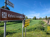
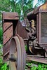
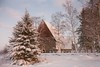
The above images may not be of the site on this page, but were taken nearby. They are loaded from Flickr so please click on them for image credits.
Click here to see more info for this site
Nearby sites
Click here to view sites on an interactive map of the areaKey: Red: member's photo, Blue: 3rd party photo, Yellow: other image, Green: no photo - please go there and take one, Grey: site destroyed
Download sites to:
KML (Google Earth)
GPX (GPS waypoints)
CSV (Garmin/Navman)
CSV (Excel)
To unlock full downloads you need to sign up as a Contributory Member. Otherwise downloads are limited to 50 sites.
Turn off the page maps and other distractions
Nearby sites listing. In the following links * = Image available
2.7km SE 140° Tervajoki* Barrow Cemetery
17.8km ENE 67° Höjsalträsk Giant's Church Stone Fort or Dun
19.0km SE 127° Levänluhta Holy Well or Sacred Spring
21.2km NE 56° Tavoma 1 Giant's Church Stone Fort or Dun
38.7km SSE 168° Hiivanaanen* Artificial Mound
38.7km SSE 168° Hiivanaasenkivi* Artificial Mound
49.4km ENE 63° Korkeamäki Giant's Church* Stone Fort or Dun
63.0km NE 47° Kejsmolandsbacken Giant's Church Stone Fort or Dun
68.8km NE 46° Purmo-Jäknabacken Giant's Church Stone Fort or Dun
73.0km NE 45° Esse-Svedjebacken Giant's Church Stone Fort or Dun
76.4km NE 51° Storbacken Giant's Church Stone Fort or Dun
77.4km NE 49° Esse-Hembacken Giant's Church Stone Fort or Dun
78.2km NE 46° Esse-Tallbackharju Giant's Church Stone Fort or Dun
78.4km NE 46° Esse-Tallbackharju N Giant's Church Stone Fort or Dun
82.8km SSE 151° The Devil's Nest (Pirunpesä)* Natural Stone / Erratic / Other Natural Feature
86.1km SSW 195° Susiluola* Cave or Rock Shelter
87.5km NE 47° Terjärv-Snårbacken Giant's Church Stone Fort or Dun
89.1km NE 41° Högryggen Giant's Church Stone Fort or Dun
95.3km NE 42° Nedervetil Kåtabacken Giant's Church Stone Fort or Dun
106.1km NE 44° Tressunharju Giant's Church Stone Fort or Dun
106.2km NE 40° Rahkalampinkangas 2 Giant's Church Stone Fort or Dun
106.4km NE 40° Rahkalampinkangas 1 Giant's Church Stone Fort or Dun
106.7km NE 40° Kämppäkangas Giant's Church 1 Stone Fort or Dun
106.8km NE 40° Kämppäkangas Giant's Church 2 Stone Fort or Dun
107.6km NE 45° Kiimanevan Hautakangas Giant's Church Stone Fort or Dun
View more nearby sites and additional images


 We would like to know more about this location. Please feel free to add a brief description and any relevant information in your own language.
 Wir möchten mehr über diese Stätte erfahren. Bitte zögern Sie nicht, eine kurze Beschreibung und relevante Informationen in Deutsch hinzuzufügen.
 Nous aimerions en savoir encore un peu sur les lieux. S'il vous plaît n'hesitez pas à ajouter une courte description et tous les renseignements pertinents dans votre propre langue.
 Quisieramos informarnos un poco más de las lugares. No dude en añadir una breve descripción y otros datos relevantes en su propio idioma.