


<< Our Photo Pages >> Narona Museum - Museum in Croatia
Submitted by AlexHunger on Tuesday, 17 May 2005 Page Views: 4030
MuseumsSite Name: Narona MuseumCountry: Croatia
NOTE: This site is 13.05 km away from the location you searched for.
Type: Museum
Nearest Town: Metkovic Nearest Village: Vid
Latitude: 43.079930N Longitude: 17.623670E
Condition:
| 5 | Perfect |
| 4 | Almost Perfect |
| 3 | Reasonable but with some damage |
| 2 | Ruined but still recognisable as an ancient site |
| 1 | Pretty much destroyed, possibly visible as crop marks |
| 0 | No data. |
| -1 | Completely destroyed |
| 5 | Superb |
| 4 | Good |
| 3 | Ordinary |
| 2 | Not Good |
| 1 | Awful |
| 0 | No data. |
| 5 | Can be driven to, probably with disabled access |
| 4 | Short walk on a footpath |
| 3 | Requiring a bit more of a walk |
| 2 | A long walk |
| 1 | In the middle of nowhere, a nightmare to find |
| 0 | No data. |
| 5 | co-ordinates taken by GPS or official recorded co-ordinates |
| 4 | co-ordinates scaled from a detailed map |
| 3 | co-ordinates scaled from a bad map |
| 2 | co-ordinates of the nearest village |
| 1 | co-ordinates of the nearest town |
| 0 | no data |
Internal Links:
External Links:
")
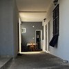
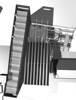
Small museum beneath local school. Some statues remain, the rest being relocated to Ashmolean Museum in Oxford.
You may be viewing yesterday's version of this page. To see the most up to date information please register for a free account.
Do not use the above information on other web sites or publications without permission of the contributor.
Nearby Images from Flickr
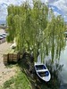
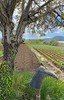
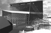

The above images may not be of the site on this page, but were taken nearby. They are loaded from Flickr so please click on them for image credits.
Click here to see more info for this site
Nearby sites
Click here to view sites on an interactive map of the areaKey: Red: member's photo, Blue: 3rd party photo, Yellow: other image, Green: no photo - please go there and take one, Grey: site destroyed
Download sites to:
KML (Google Earth)
GPX (GPS waypoints)
CSV (Garmin/Navman)
CSV (Excel)
To unlock full downloads you need to sign up as a Contributory Member. Otherwise downloads are limited to 50 sites.
Turn off the page maps and other distractions
Nearby sites listing. In the following links * = Image available
96m ENE 76° Narona Town Wall* Hillfort
8.2km ENE 75° Klepci tumuli 1* Round Barrow(s)
8.3km ENE 76° Klepci tumuli 2* Round Barrow(s)
18.8km NNE 17° Citluk-Greda-Illyrian observatory* Carving
24.8km E 84° Osanici Hillfort* Hillfort
32.4km NNE 14° Polog.* Hillfort
33.7km N 9° Zvonigrad - fortification wall* Hillfort
33.8km N 9° Zvonigrad* Hillfort
44.5km WSW 259° Nakovana Cave* Cave or Rock Shelter
75.6km W 276° Tor Hillfort (Croatia)* Hillfort
78.2km W 277° Hvar Island* Ancient Village or Settlement
80.3km ESE 115° Crvena Stjena Cave or Rock Shelter
83.5km W 277° Purkin Kuk Hillfort* Hillfort
84.0km W 278° Pharos Town wall* Hillfort
84.1km W 278° Stari Grad Museum* Museum
86.3km WNW 284° Zmajeva Spilja* Cave or Rock Shelter
91.8km WNW 288° Brac Island* Ancient Village or Settlement
96.2km W 277° Hvar Castle Museum* Museum
96.5km W 277° Fortica* Hillfort
96.6km W 277° Hvar Museum* Museum
97.6km W 278° Vira (Hvar)* Barrow Cemetery
97.8km WNW 288° Gradina Rat Hillfort
98.3km NW 312° Cetina Valley Ancient Village or Settlement
103.8km WNW 301° Klis Hillfort* Hillfort
105.5km WNW 299° Solin Town Gate* Ancient Village or Settlement
View more nearby sites and additional images


 We would like to know more about this location. Please feel free to add a brief description and any relevant information in your own language.
 Wir möchten mehr über diese Stätte erfahren. Bitte zögern Sie nicht, eine kurze Beschreibung und relevante Informationen in Deutsch hinzuzufügen.
 Nous aimerions en savoir encore un peu sur les lieux. S'il vous plaît n'hesitez pas à ajouter une courte description et tous les renseignements pertinents dans votre propre langue.
 Quisieramos informarnos un poco más de las lugares. No dude en añadir una breve descripción y otros datos relevantes en su propio idioma.