<< Our Photo Pages >> Pizuge Hillfort - Hillfort in Croatia
Submitted by AlexHunger on Tuesday, 17 May 2005 Page Views: 4317
Iron Age and Later PrehistorySite Name: Pizuge HillfortCountry: Croatia
NOTE: This site is 20.585 km away from the location you searched for.
Type: Hillfort
Nearest Town: Porec Nearest Village: Porec
Latitude: 45.213110N Longitude: 13.639630E
Condition:
| 5 | Perfect |
| 4 | Almost Perfect |
| 3 | Reasonable but with some damage |
| 2 | Ruined but still recognisable as an ancient site |
| 1 | Pretty much destroyed, possibly visible as crop marks |
| 0 | No data. |
| -1 | Completely destroyed |
| 5 | Superb |
| 4 | Good |
| 3 | Ordinary |
| 2 | Not Good |
| 1 | Awful |
| 0 | No data. |
| 5 | Can be driven to, probably with disabled access |
| 4 | Short walk on a footpath |
| 3 | Requiring a bit more of a walk |
| 2 | A long walk |
| 1 | In the middle of nowhere, a nightmare to find |
| 0 | No data. |
| 5 | co-ordinates taken by GPS or official recorded co-ordinates |
| 4 | co-ordinates scaled from a detailed map |
| 3 | co-ordinates scaled from a bad map |
| 2 | co-ordinates of the nearest village |
| 1 | co-ordinates of the nearest town |
| 0 | no data |
Internal Links:
External Links:
")
Unexcavated Bronze Age Hillfort.
You may be viewing yesterday's version of this page. To see the most up to date information please register for a free account.
Do not use the above information on other web sites or publications without permission of the contributor.
Nearby Images from Flickr
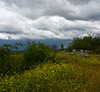
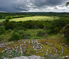
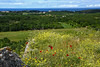
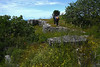
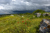
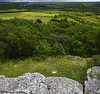
The above images may not be of the site on this page, but were taken nearby. They are loaded from Flickr so please click on them for image credits.
Click here to see more info for this site
Nearby sites
Click here to view sites on an interactive map of the areaKey: Red: member's photo, Blue: 3rd party photo, Yellow: other image, Green: no photo - please go there and take one, Grey: site destroyed
Download sites to:
KML (Google Earth)
GPX (GPS waypoints)
CSV (Garmin/Navman)
CSV (Excel)
To unlock full downloads you need to sign up as a Contributory Member. Otherwise downloads are limited to 50 sites.
Turn off the page maps and other distractions
Nearby sites listing. In the following links * = Image available
983m WSW 255° Veliki Sveti Andeo* Hillfort
984m W 270° Mali Sveti Andeo* Stone Circle
1.0km NW 304° Mordele Hillfort* Hillfort
13.7km SSE 146° Karastac Hilfort* Hillfort
14.6km SE 143° Maklavun Tholos* Cairn
16.5km SSE 164° Monkodonja* Hillfort
26.3km SSE 161° Barbarija Tumulus 3* Round Barrow(s)
26.4km SSE 161° Barbarija Tumulus 2* Round Barrow(s)
26.5km SSE 161° Barbarija Tumulus 1* Round Barrow(s)
27.3km SSE 158° Uvala Maric 1* Artificial Mound
27.3km SSE 158° Uvala Maric 2 Tumulus* Round Barrow(s)
27.4km SSE 158° Uvala Maric 3 Zigurat* Artificial Mound
34.5km SSE 163° Brijuni Museum* Museum
35.0km SSE 163° Brijuni Hillfort* Hillfort
39.1km SE 136° Mutvoran Hillfort* Hillfort
40.5km ESE 110° Labin Museum* Museum
41.1km ESE 108° Kunci Hillfort* Hillfort
41.5km SSE 157° Pula Museum* Museum
41.9km SE 142° Nesactium Hillfort* Hillfort
56.4km ESE 102° Tramuntana Portal Tomb* Portal Tomb
56.4km ESE 102° Tramuntana Well* Holy Well or Sacred Spring
56.8km E 101° Tramuntana Dolmen 1* Burial Chamber or Dolmen
56.8km ESE 101° Tramuntana Dolmen 2* Burial Chamber or Dolmen
57.2km E 101° Beli wall petroglyph* Rock Art
66.2km N 7° Debela Griža Hillfort
View more nearby sites and additional images


 We would like to know more about this location. Please feel free to add a brief description and any relevant information in your own language.
 Wir möchten mehr über diese Stätte erfahren. Bitte zögern Sie nicht, eine kurze Beschreibung und relevante Informationen in Deutsch hinzuzufügen.
 Nous aimerions en savoir encore un peu sur les lieux. S'il vous plaît n'hesitez pas à ajouter une courte description et tous les renseignements pertinents dans votre propre langue.
 Quisieramos informarnos un poco más de las lugares. No dude en añadir una breve descripción y otros datos relevantes en su propio idioma.